Drum Wood

Wood, Forest in Stirlingshire

Scotland

Drum Wood

Roughcastle Wood Part of the Central Scotland Forest project.
Roughcastle Wood Credit: Richard Webb

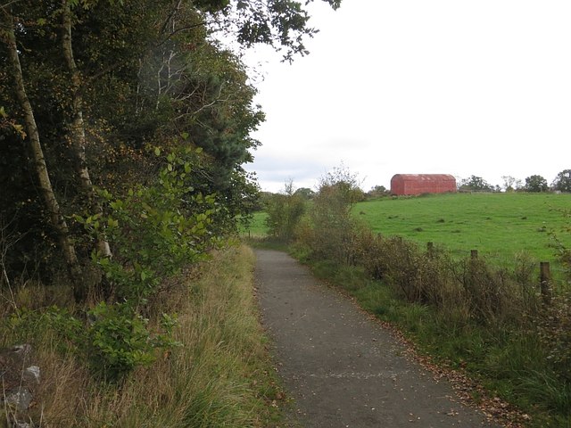
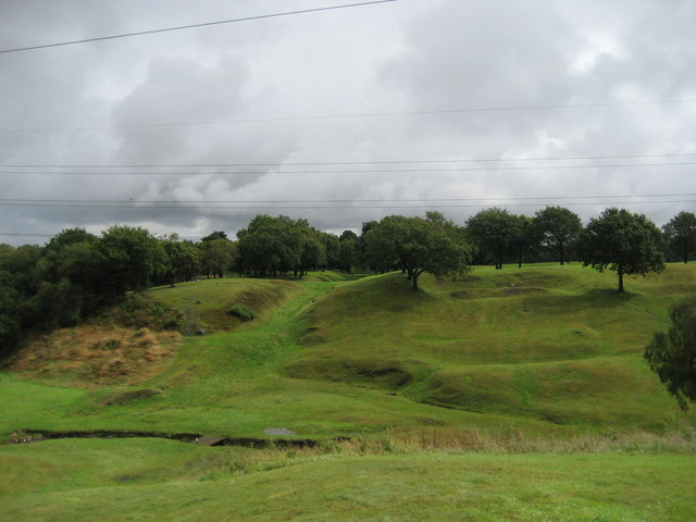
Drum Wood is a picturesque forest located in the region of Stirlingshire in central Scotland. Covering an area of approximately 300 acres, this enchanting woodland is a popular destination for nature enthusiasts and those seeking a peaceful retreat.

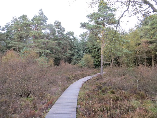
The forest is characterized by its dense canopy of mature trees, predominantly consisting of oak, beech, and birch. These towering giants provide a sense of tranquility as visitors wander along the well-maintained trails that wind through the woodland. The forest floor is blanketed by a lush carpet of ferns, mosses, and wildflowers, creating a vibrant tapestry of colors throughout the seasons.

Drum Wood is not only aesthetically pleasing but also serves as an important habitat for a diverse range of flora and fauna. Birdsong can be heard echoing through the trees, with species such as woodpeckers, owls, and thrushes making their homes here. Deer, squirrels, and other woodland creatures can also be spotted foraging amongst the undergrowth.

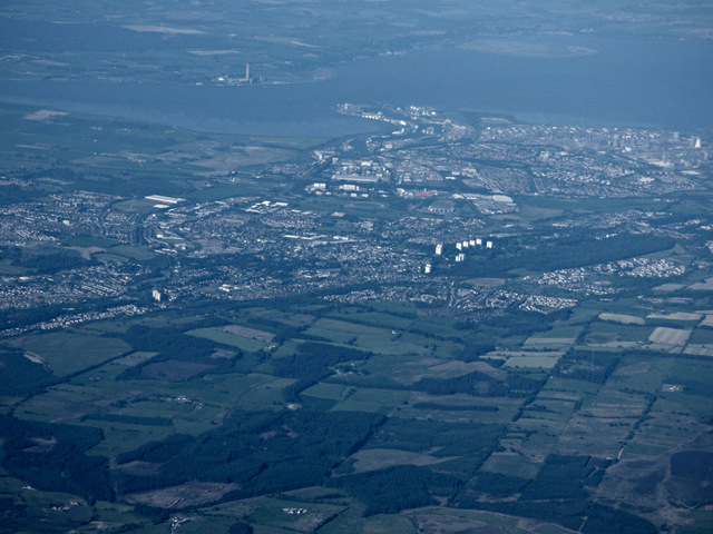
The forest is managed by the local authorities, who have taken great care to preserve its natural beauty while ensuring that it remains accessible to the public. There are designated picnic areas and viewpoints where visitors can take in the stunning views of the surrounding countryside.

Drum Wood is a true gem in Stirlingshire, offering a haven of peace and tranquility for those seeking solace in nature. Whether it is a leisurely stroll, a picnic with loved ones, or simply a moment of reflection, this woodland provides a perfect escape from the hustle and bustle of everyday life.

If you have any feedback on the listing, please let us know in the comments section below.

Drum Wood Images

Images are sourced within 2km of 55.981466/-3.8640552 or Grid Reference NS8378. Thanks to Geograph Open Source API. All images are credited.

Roughcastle Wood Part of the Central Scotland Forest project.
Roughcastle Wood
Part of the Central Scotland Forest project.
Howierig A path on the edge of typical industrial reclamation woodland.
Howierig
A path on the edge of typical industrial reclamation woodland.
Mountain bike track, Greenrig Some easy northshore in woodland at Greenrig.
Mountain bike track, Greenrig
Some easy northshore in woodland at Greenrig.
Greenhill, view north-east
Birchwood Farm A 'high end' type of Traveller's community has set up here. Very smart looking.
Birchwood Farm
A 'high end' type of Traveller's community has set up here. Very smart looking.
Drum, view north-east
Falkirk and Grangemouth from the air Looking over Drum Wood, near Bonnybridge, the towerblocks at Seaton Place in Falkirk can be seen. Grangemouth docks and petro-chemical works are also visible, as is the chimney at Longannet power station across the River Forth.
Falkirk and Grangemouth from the air
Looking over Drum Wood, near Bonnybridge, the towerblocks at Seaton Place in Falkirk can be seen. Grangemouth docks and petro-chemical works are also visible, as is the chimney at Longannet power station across the River Forth.
View from a Glasgow-Stirling train - High Bonnybridge View north at the village and in the distance, the newly erected gantries on the Edinburgh-Glasgow main line. They also mark the site (far left of picture) of the former Bonnybridge High railway station.
View from a Glasgow-Stirling train - High Bonnybridge
View north at the village and in the distance, the newly erected gantries on the Edinburgh-Glasgow main line. They also mark the site (far left of picture) of the former Bonnybridge High railway station.
St Helen's Loch Viewed from a Glasgow bound train.
St Helen's Loch
Viewed from a Glasgow bound train.
St Joseph's Catholic Church, Bonnybridge
The Broomhill Inn, Bonnybridge On Broomhill Road.
The Broomhill Inn, Bonnybridge
On Broomhill Road.
The Broomhill Inn, Bonnybridge On Broomhill Road.
The Broomhill Inn, Bonnybridge
On Broomhill Road.
Sign for the Broomhill Inn, Bonnybridge
Railway bridge over Broomhill Road (B816), Bonnybridge Looking south east.
Railway bridge over Broomhill Road (B816), Bonnybridge
Looking south east.
High Bonnybridge Baptist Church
Railway bridge over Church Street, High Bonnybridge
Grazing, High Bonnybridge
Heading south from High Bonnybridge
Show me another place!

Drum Wood is located at Grid Ref: NS8378 (Lat: 55.981466, Lng: -3.8640552)

Unitary Authority: Falkirk

Police Authority: Forth Valley

What 3 Words

///workroom.adapt.bump. Near Greenhill, Falkirk

Nearby Locations

Drum Wood

Related Wikis

Bonnybridge High railway station

Bonnybridge High railway station was a railway station serving the village of Bonnybridge. The station was originally part of the Edinburgh and Glasgow...

High Bonnybridge

High Bonnybridge is a small village which lies in the Falkirk council area of Scotland. The village is located 0.5 miles (0.8 km) south-east of Bonnybridge...

Greenhill Lower railway station

Greenhill Lower railway station served the village of Greenhill, Falkirk, Scotland from 1848 to 1966 on the Scottish Central Railway. == History == The...

Rough Castle Fort

Rough Castle Fort is a Roman fort on the Antonine Wall roughly 2 kilometres south east of Bonnybridge near Tamfourhill in the Falkirk council area, Scotland...

Nearby Amenities

Located within 500m of 55.981466,-3.8640552
Power: tower
Lat/Long: 55.9783371/-3.8648188
Power: tower
Lat/Long: 55.9798512/-3.8618086
Barrier: cycle_barrier
Bicycle: yes
Foot: yes
Horse: yes
Lat/Long: 55.9785631/-3.8670635
Crossing: informal
Lat/Long: 55.9785346/-3.8670624
Barrier: cycle_barrier
Bicycle: yes
Foot: yes
Horse: yes
Lat/Long: 55.9785165/-3.8670519
Power: tower
Lat/Long: 55.9817868/-3.8580178
Bicycle: yes
Hiking: yes
Information: guidepost
Tourism: information
Lat/Long: 55.9785118/-3.8670123
Bicycle: yes
Hiking: yes
Information: guidepost
Tourism: information
Lat/Long: 55.9786083/-3.8670406
Bicycle: yes
Hiking: yes
Information: guidepost
Tourism: information
Lat/Long: 55.9792244/-3.8676047
Bench
Material: wood
Seats: 4
Lat/Long: 55.980145/-3.865511
Bench
Material: wood
Seats: 4
Lat/Long: 55.9819513/-3.8616022
Bench
Material: wood
Seats: 4
Lat/Long: 55.9852028/-3.8598596
Power: pole
Lat/Long: 55.9835409/-3.8706466
The data included in this document is from www.openstreetmap.org. The data is made available under ODbL.

Have you been to Drum Wood?

Leave your review of Drum Wood below (or comments, questions and feedback).