Aird Wood

Wood, Forest in Dumfriesshire

Scotland

Aird Wood

Craigturra Felled woodland and a rather crumbly crag near Tynron.
Craigturra Credit: Richard Webb

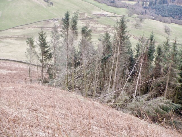
Aird Wood is a charming and picturesque forest located in Dumfriesshire, Scotland. Covering an area of approximately 1,500 acres, it is a popular destination for nature enthusiasts and outdoor adventurers alike.

The wood is home to a diverse range of plant and animal species, making it a haven for wildlife lovers. Ancient oak trees dominate the landscape, providing a majestic and peaceful atmosphere. The forest floor is carpeted with a rich variety of wildflowers, creating a vibrant and colorful display during the spring and summer months.

Several well-maintained walking trails wind their way through the wood, offering visitors the opportunity to explore its beauty at their own pace. These paths lead to hidden glens, babbling brooks, and tranquil ponds, providing ample opportunities for peaceful reflection or wildlife spotting.

Aird Wood is also a birdwatcher's paradise, with a wide array of avian species calling it home. From the melodious calls of songbirds to the majestic soarings of birds of prey, the forest offers a symphony of birdsong throughout the year.

For those seeking a more active experience, the wood offers excellent opportunities for outdoor activities. Mountain biking trails crisscross the forest, providing exhilarating rides through the woodland. Additionally, there are designated areas for picnicking and barbecuing, making it an ideal spot for families to relax and enjoy a day out in nature.

Whether it is a peaceful stroll, birdwatching, or thrilling bike ride, Aird Wood offers something for everyone seeking to connect with nature in the heart of Dumfriesshire.

If you have any feedback on the listing, please let us know in the comments section below.

Aird Wood Images

Images are sourced within 2km of 55.223184/-3.8431104 or Grid Reference NX8293. Thanks to Geograph Open Source API. All images are credited.

Craigturra Felled woodland and a rather crumbly crag near Tynron.
Craigturra
Felled woodland and a rather crumbly crag near Tynron.
Road beneath Craigturra Tynron Doon in the background.
Road beneath Craigturra
Tynron Doon in the background.
View towards Clonrae From beneath Craigturra.
View towards Clonrae
From beneath Craigturra.
Decaying trailer, Craigtrurra Tynron Doon in the background.
Decaying trailer, Craigtrurra
Tynron Doon in the background.
Ruined dyke, Mid Hill An electric fence continues along the line of the dyke from the right.
Ruined dyke, Mid Hill
An electric fence continues along the line of the dyke from the right.
Gate and electric fence, Auchengibbert Hill
Rough grazing, Auchengibbert Hill
Mid Hill, Tynron
Mid Hill, Tynron
Tynron Doon The hill fort seen from Mid Hill.
Tynron Doon
The hill fort seen from Mid Hill.
Path under Mid Hill Now little used, but an obvious path from the past.
Path under Mid Hill
Now little used, but an obvious path from the past.
Above Craignee A view from between Mid Hill and Tynron Doon down into the Scaur Water.
Above Craignee
A view from between Mid Hill and Tynron Doon down into the Scaur Water.
Mid Hill, Tynron
Mid Hill, Tynron
Lower ramparts, Tynron Doon A ditch below the first of the big earthwalls on the hill fort.
Lower ramparts, Tynron Doon
A ditch below the first of the big earthwalls on the hill fort.
Rampart, Tynron Doon
Summit, Tynron Doon The small area within the ramparts and steep southern slopes.
Summit, Tynron Doon
The small area within the ramparts and steep southern slopes.
Windthrow, Tynron Doon Woodland on the very steep southeast slopes of Tynron Doon.
Windthrow, Tynron Doon
Woodland on the very steep southeast slopes of Tynron Doon.
East ridge of Tynron Doon Very steep slopes beneath the hill fort.
East ridge of Tynron Doon
Very steep slopes beneath the hill fort.
Southern slopes, Tynron Doon
Show me another place!

Aird Wood is located at Grid Ref: NX8293 (Lat: 55.223184, Lng: -3.8431104)

Unitary Authority: Dumfries and Galloway

Police Authority: Dumfries and Galloway

What 3 Words

///commutes.rectangular.unstable. Near Thornhill, Dumfries & Galloway

Related Wikis

Tynron Doon

Tynron Doon is a multivallate Iron Age hill fort outside the village of Tynron in Dumfries and Galloway, Scotland. It was occupied on and off from the...

Shinnel Water

Shinnel Water, also spelt Shinnell, is a river in the region of Dumfries and Galloway, Scotland. It rises in the Scaur hills of Tynron Parish in the Southern...

Grennan Hill

Grennan Hill is the site of an Iron Age hill fort outside Penpont in Dumfries and Galloway, Scotland. == References == Schedule "Grennan Hill, NMRS Number...

Penpont

Penpont is a village about 2 miles (3 km) west of Thornhill in Dumfriesshire, in the Dumfries and Galloway region of Scotland. It is near the confluence...

Nearby Amenities

Located within 500m of 55.223184,-3.8431104
Power: pole
Lat/Long: 55.2235036/-3.8502753
Power: pole
Lat/Long: 55.2236319/-3.8493312
Power: pole
Lat/Long: 55.2237129/-3.8479035
Power: pole
Lat/Long: 55.2240687/-3.8463739
Power: pole
Lat/Long: 55.2243615/-3.8452114
Power: pole
Lat/Long: 55.2246434/-3.8440191
Power: pole
Lat/Long: 55.2249288/-3.8428395
Power: pole
Lat/Long: 55.2252218/-3.8416283
Power: pole
Lat/Long: 55.225413/-3.8408454
Power: pole
Lat/Long: 55.2256973/-3.839685
Power: pole
Lat/Long: 55.2259841/-3.8385012
Power: pole
Lat/Long: 55.2244922/-3.842218
Power: pole
Lat/Long: 55.2239997/-3.8415498
Power: pole
Lat/Long: 55.2236415/-3.8410597
Power: pole
Lat/Long: 55.2231382/-3.8409748
Power: pole
Lat/Long: 55.222089/-3.8407457
Power: pole
Lat/Long: 55.2215663/-3.8408327
Power: pole
Lat/Long: 55.2208051/-3.8409027
Power: pole
Lat/Long: 55.2255654/-3.8378245
Power: pole
Lat/Long: 55.2251528/-3.8371711
Power: pole
Lat/Long: 55.2245623/-3.8371244
Power: pole
Lat/Long: 55.2238872/-3.8370629
Power: pole
Lat/Long: 55.2231079/-3.8370374
Power: pole
Lat/Long: 55.2225331/-3.8369717
The data included in this document is from www.openstreetmap.org. The data is made available under ODbL.

Have you been to Aird Wood?

Leave your review of Aird Wood below (or comments, questions and feedback).