Barsoles Wood
Wood, Forest in Kirkcudbrightshire
Scotland
Barsoles Wood
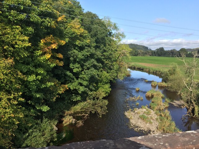
Barsoles Wood, located in Kirkcudbrightshire, is a captivating forest known for its natural beauty and diverse ecosystem. The wood spans an impressive area, offering visitors a serene and peaceful environment to explore. With its enchanting woodland trails and towering trees, Barsoles Wood is a haven for nature enthusiasts and hikers alike.
The forest is home to a variety of tree species, including oak, beech, and pine, which dominate the landscape and create a stunning canopy overhead. The rich undergrowth supports a thriving population of flora, including bluebells, wild garlic, and various ferns. These vibrant plants add an extra layer of beauty to the woodland, especially during the spring and summer months.
Barsoles Wood provides a habitat for a wide array of wildlife, making it a must-visit destination for animal lovers. Visitors may have the chance to spot red squirrels, badgers, and a variety of bird species, including woodpeckers and owls. The forest is also home to a diverse range of insects, amphibians, and small mammals.
The wood offers a network of well-maintained walking trails, allowing visitors to explore its beauty at their own pace. These paths wind through the forest, leading visitors to picturesque viewpoints, tranquil ponds, and hidden groves. The peaceful atmosphere and stunning scenery make Barsoles Wood an ideal location for a leisurely stroll or a more challenging hike.
Overall, Barsoles Wood in Kirkcudbrightshire is a captivating destination for nature enthusiasts, offering a diverse ecosystem, stunning scenery, and an abundance of wildlife. Whether it's a quiet walk or an exploration of the woodland trails, visitors are sure to be enchanted by the natural beauty of this idyllic forest.
If you have any feedback on the listing, please let us know in the comments section below.
Barsoles Wood Images
Images are sourced within 2km of 54.944141/-3.8451034 or Grid Reference NX8162. Thanks to Geograph Open Source API. All images are credited.


Barsoles Wood is located at Grid Ref: NX8162 (Lat: 54.944141, Lng: -3.8451034)
Unitary Authority: Dumfries and Galloway
Police Authority: Dumfries and Galloway
What 3 Words
///decorate.trinkets.expel. Near Dalbeattie, Dumfries & Galloway
Nearby Locations
Related Wikis

Buittle Castle
Buittle Castle, also known historically as Botle or Botel Castle, is a Motte and Bailey site in Galloway, south-west Scotland with significant early and...

Buittle
Buittle is an ecclesiastical and civil parish in Dumfries and Galloway, southwest Scotland, in the traditional county of Kirkcudbrightshire. It lies to...

Dalbeattie railway station
Dalbeattie railway station served the town of Dalbeattie, Dumfries and Galloway, Scotland from 1859 to 1965 on the Castle Douglas and Dumfries Railway...

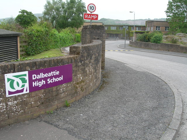
Dalbeattie High School
Dalbeattie High School is a small rural secondary school on the edge of Dalbeattie in the historical county of Kirkcudbrightshire in the local council...
Nearby Amenities
Located within 500m of 54.944141,-3.8451034Have you been to Barsoles Wood?
Leave your review of Barsoles Wood below (or comments, questions and feedback).