Carnguwch Bach

Settlement in Caernarfonshire

Wales

Carnguwch Bach

Toposcope above Mount Pleasant on Yr Eifl A little redundant in terms of its full use today but informative anyway. I do like a good toposcope.
Toposcope above Mount Pleasant on Yr Eifl Credit: Jeremy Bolwell

Carnguwch Bach is a small village located in the historical county of Caernarfonshire, Wales. Situated in the scenic countryside, it is nestled between the towns of Pwllheli and Caernarfon, offering residents and visitors a tranquil and picturesque setting.

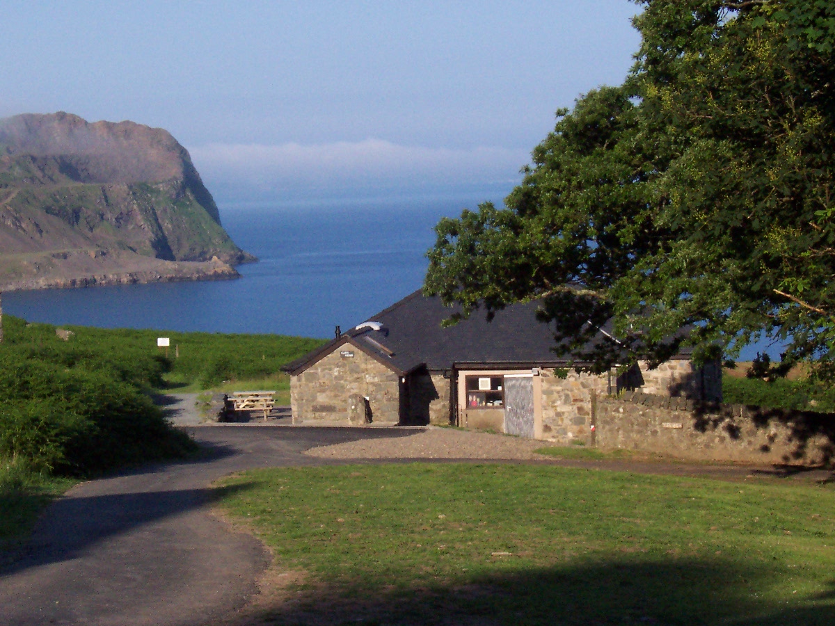
The village is characterized by its charming rural atmosphere, with traditional stone houses and lush green fields dominating the landscape. The surrounding area is rich in natural beauty, with rolling hills and stunning coastal views. The nearby Llŷn Peninsula is renowned for its rugged coastline, sandy beaches, and diverse wildlife, attracting nature enthusiasts and beach lovers alike.

Although Carnguwch Bach is a small village, it has a strong sense of community. The residents are friendly and welcoming, and there are often local events and activities organized to bring people together. The village also has a small primary school, providing education for local children.

For amenities and services, residents typically rely on the nearby towns of Pwllheli and Caernarfon. These towns offer a wider range of facilities, including shops, supermarkets, restaurants, and healthcare centers.

Carnguwch Bach is an ideal location for those seeking a peaceful and idyllic lifestyle away from the hustle and bustle of city living. With its stunning natural surroundings and close-knit community, it offers a perfect retreat for those looking to embrace the beauty of the Welsh countryside.

If you have any feedback on the listing, please let us know in the comments section below.

Carnguwch Bach Images

Images are sourced within 2km of 52.952336/-4.431965 or Grid Reference SH3642. Thanks to Geograph Open Source API. All images are credited.

Toposcope above Mount Pleasant on Yr Eifl A little redundant in terms of its full use today but informative anyway. I do like a good toposcope.
Toposcope above Mount Pleasant on Yr Eifl
A little redundant in terms of its full use today but informative anyway. I do like a good toposcope.
Fingerpost on Yr Eifl Always useful in poor weather, even when backed up with good map reading and navigational skills.
Fingerpost on Yr Eifl
Always useful in poor weather, even when backed up with good map reading and navigational skills.
View of B4417 towards Gyrn Ddu View from the lay-by on B4417, looking north-east. The field visible to the right of the road is upland grazing for sheep, continuing to the summit of Mynydd Carnguwch. The photo looks down on an expanse of lowland pasture, used for sheep, cattle and horses. The village of Llanaelhaearn is hidden by the terrain, although some indications of habitation are visible.
View of B4417 towards Gyrn Ddu
View from the lay-by on B4417, looking north-east. The field visible to the right of the road is upland grazing for sheep, continuing to the summit of Mynydd Carnguwch. The photo looks down on an expanse of lowland pasture, used for sheep, cattle and horses. The village of Llanaelhaearn is hidden by the terrain, although some indications of habitation are visible.
Approaching Llithfaen
Approaching Caergribin The rocky outcrop of Caergribin seen across heather moorland. The summit of Yr Eifl is visible to the left.
Approaching Caergribin
The rocky outcrop of Caergribin seen across heather moorland. The summit of Yr Eifl is visible to the left.
Llithfaen chapel Up for sale as so many old chapels are these days. What a large, imposing and impressive building. Dated 1905 - I wonder what the deacons of that day would say and do if they could see it today?
Llithfaen chapel
Up for sale as so many old chapels are these days. What a large, imposing and impressive building. Dated 1905 - I wonder what the deacons of that day would say and do if they could see it today?
Mynydd Carnguwch Parking space to the NNW, then follow fence to fence junction to avoid prickly vegetation. The follow fence line plus over wall to find large summit cairn with hollowed out centre.

Name: Mynydd Carnguwch
Hill number: 5144
Height: 359m / 1178ft
Area: 30A: Anglesey and the Lleyn Peninsula
Class: Hu
Grid ref: SH 37464 42925
Summit feature: large cairn
Drop: 104m
Col: 255m  SH368434
Mynydd Carnguwch
Parking space to the NNW, then follow fence to fence junction to avoid prickly vegetation. The follow fence line plus over wall to find large summit cairn with hollowed out centre. Name: Mynydd Carnguwch Hill number: 5144 Height: 359m / 1178ft Area: 30A: Anglesey and the Lleyn Peninsula Class: Hu Grid ref: SH 37464 42925 Summit feature: large cairn Drop: 104m Col: 255m SH368434
Capel Isaf and Mynydd Carnguwch Seen from the 'beer garden' of Tafarn y Fic.
Capel Isaf and Mynydd Carnguwch
Seen from the 'beer garden' of Tafarn y Fic.
Llithfaen children's play area Adjacent to the 'beer garden' of Tafarn y Fic.
Llithfaen children's play area
Adjacent to the 'beer garden' of Tafarn y Fic.
View across Llithfaen Looking over Llithfaen village with a view right across the peninsula.
View across Llithfaen
Looking over Llithfaen village with a view right across the peninsula.
Approaching Llithfaen The B4417 approaching Llithfaen.
Approaching Llithfaen
The B4417 approaching Llithfaen.
View east from near Cae-garw View east from near Cae Garw, in the centre in the distance is Moel Hebog
View east from near Cae-garw
View east from near Cae Garw, in the centre in the distance is Moel Hebog
Road to Hafod Farm road and byway to Hafod, out of picture just to the left is a cattle grid.
Road to Hafod
Farm road and byway to Hafod, out of picture just to the left is a cattle grid.
The B4417 near Cae-garw
Llithfaen and Mynydd Garnguwch View of Llithfaen and the B4417 passing through it, Mynydd Garnguwch can be seen in the background.
Llithfaen and Mynydd Garnguwch
View of Llithfaen and the B4417 passing through it, Mynydd Garnguwch can be seen in the background.
Capel a Thŷ Capel Llwyndyrys Chapel and Chapel House
Capel Llwyndyrys
Capel Llwyndyrys
Giatiau Capel Llwyndyrys Gates
Show me another place!

Carnguwch Bach is located at Grid Ref: SH3642 (Lat: 52.952336, Lng: -4.431965)

Unitary Authority: Gwynedd

Police Authority: North Wales

What 3 Words

///invite.petulant.evolving. Near Nefyn, Gwynedd

Related Wikis

Carnguwch

Carnguwch is a former civil parish in the Welsh county of Gwynedd. It was abolished in 1934, and incorporated into Pistyll. The parish included 1,179...
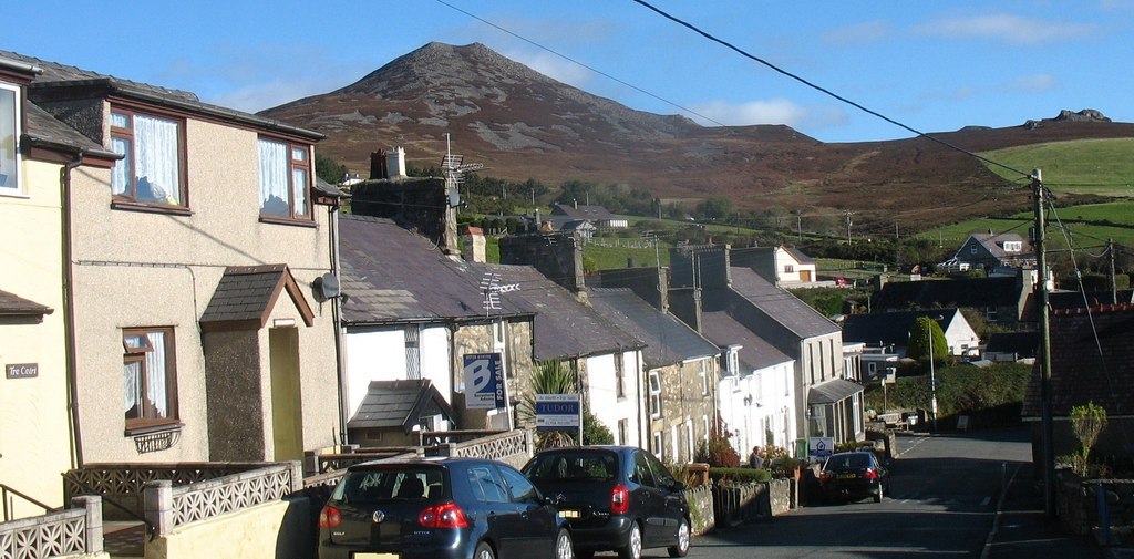
Llithfaen

Llithfaen is a village on the northern coast of the Llŷn Peninsula in Gwynedd, Wales, in the historic county of Caernarfonshire. It is within the community...
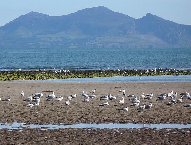
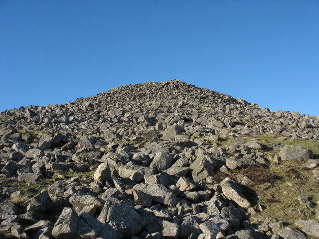
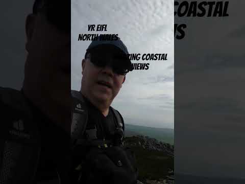
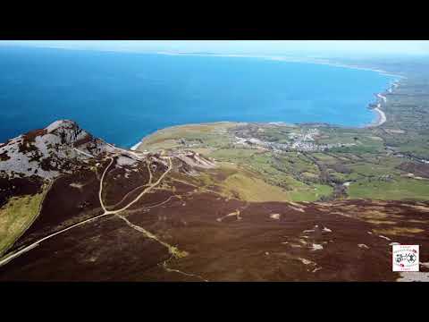
Yr Eifl

Yr Eifl, sometimes called the Rivals in English, is a group of hills on the north coast of the Llŷn Peninsula in Gwynedd, Wales. On a clear day, the views...
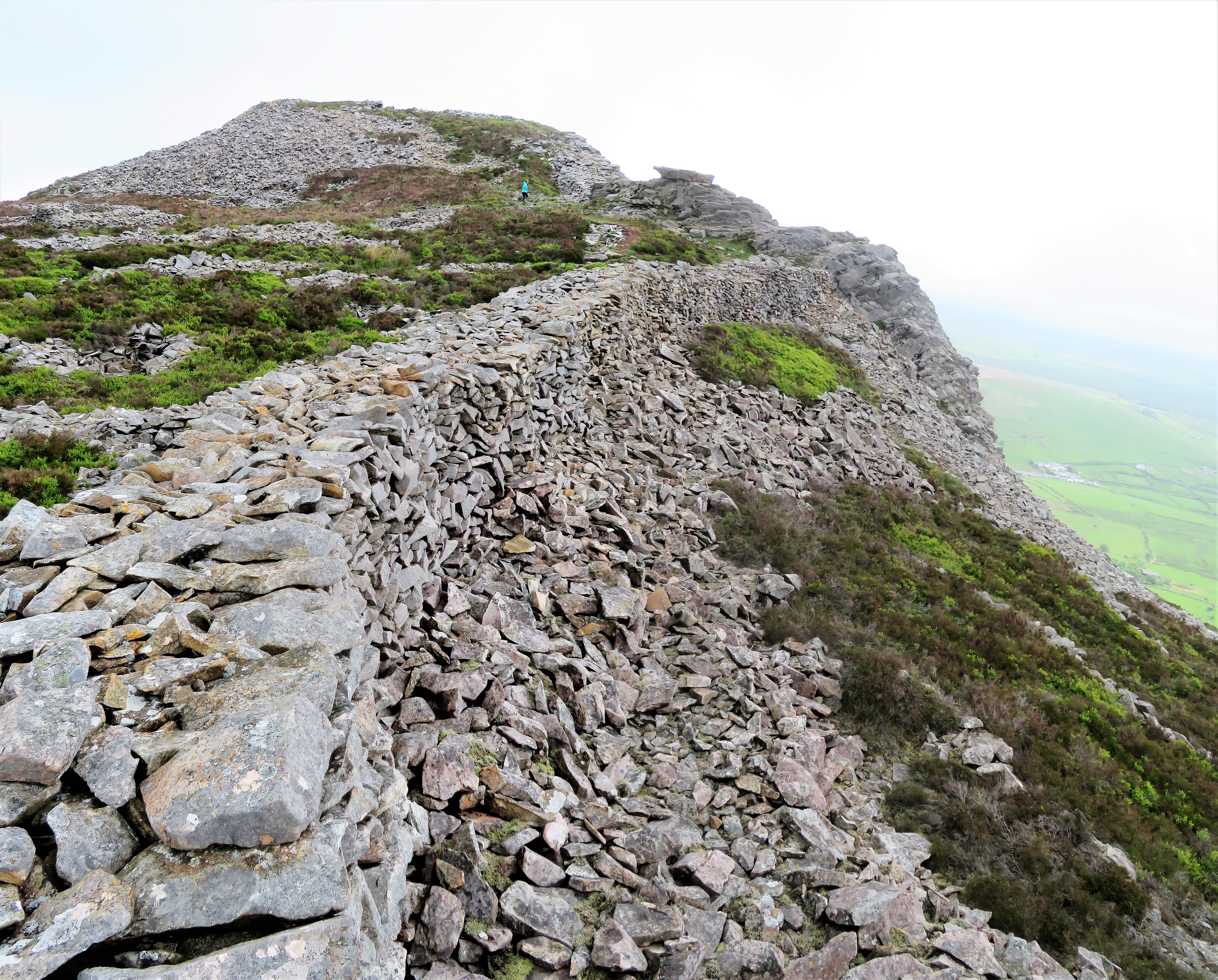
Tre'r Ceiri

Tre'r Ceiri ([treːr ˈkɛiri] ) is a hillfort dating back to the Iron Age. The name means 'town of the giants', from cewri, plural of cawr, 'giant'. The...

Cantref Llŷn

Llŷn was an ancient Welsh cantref in north-west Wales. It was part of the kingdom of Gwynedd for much of its history until it was included in the new county...

A499 road

The A499 road is the major road of the Llŷn peninsula in North Wales. Its northern terminus is a roundabout with the A487 trunk road between Llanwnda and...

Llanaelhaearn

Llanaelhaearn is a village and community on the Llŷn Peninsula in the county of Gwynedd, Wales. The community includes the larger village of Trefor and...

Nant Gwrtheyrn

Nant Gwrtheyrn is a Welsh Language and Heritage Centre, located near the village of Llithfaen on the northern coast of the Llŷn Peninsula, Gwynedd, in...

Related Videos

Welsh Paradise

This is a short video of Nant Gwrtheyrn, the National Welsh Language and Heritage Centre, and a former quarrying village ...

Mountain on the doorstep!

Video compilation of views from the landscape behind Arallt Holiday Cottage . Situated on the slopes of Yr Eifl there are some ...

Trer Ceiri - 1:04 Sarah Woodbury's Medieval Britain

With over a million books sold to date, Sarah Woodbury is the author of more than forty novels, all set in medieval Wales. For more ...

Nearby Amenities

Located within 500m of 52.952336,-4.431965
Organig Parc
Addr Postcode: LL53 6NH
Note: www.organigparc.co.uk
Phone: +44 1758750000
Tourism: chalet
Lat/Long: 52.9519564/-4.4310346
The data included in this document is from www.openstreetmap.org. The data is made available under ODbL.

Have you been to Carnguwch Bach?

Leave your review of Carnguwch Bach below (or comments, questions and feedback).