Blackbellie Plantation

Wood, Forest in Kirkcudbrightshire

Scotland

Blackbellie Plantation

Road entrance, Doach Plantation
Road entrance, Doach Plantation Credit: Richard Webb

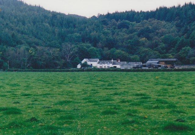
Blackbellie Plantation, located in Kirkcudbrightshire, is a scenic woodland area renowned for its natural beauty and diverse flora and fauna. Encompassing an area of approximately 500 acres, the plantation is nestled within the picturesque landscape of southwest Scotland.

The woodland of Blackbellie Plantation consists predominantly of native broadleaf trees such as oak, beech, and birch, which create a dense canopy, providing a haven for various wildlife species. The forest floor is adorned with a vibrant carpet of bluebells and other wildflowers during the spring season, offering a breathtaking sight to visitors.

The plantation is a popular destination for nature enthusiasts, hikers, and photographers due to its extensive network of well-marked trails, which provide stunning views of the surrounding countryside. There are paths suitable for different levels of fitness and accessibility, ensuring that everyone can enjoy the plantation's unique charm.

Aside from its natural beauty, Blackbellie Plantation also plays a vital role in local conservation efforts. The woodland provides a habitat for a wide range of wildlife, including red squirrels, roe deer, and a variety of bird species. Conservation initiatives are in place to protect and preserve the delicate ecosystem, ensuring the sustainability of the plantation's biodiversity.

In conclusion, Blackbellie Plantation in Kirkcudbrightshire is a captivating woodland area that offers visitors a chance to immerse themselves in nature. With its enchanting trails, diverse flora and fauna, and commitment to conservation, this haven of tranquility is a must-visit destination for anyone seeking solace in the beauty of the Scottish countryside.

If you have any feedback on the listing, please let us know in the comments section below.

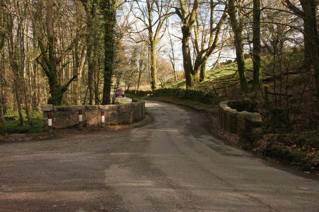
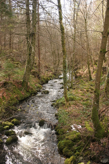
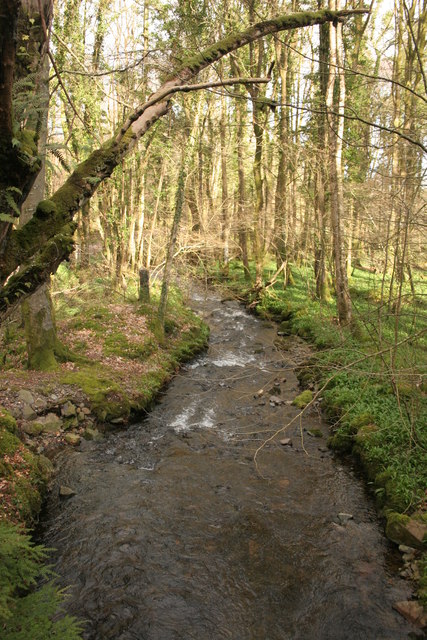
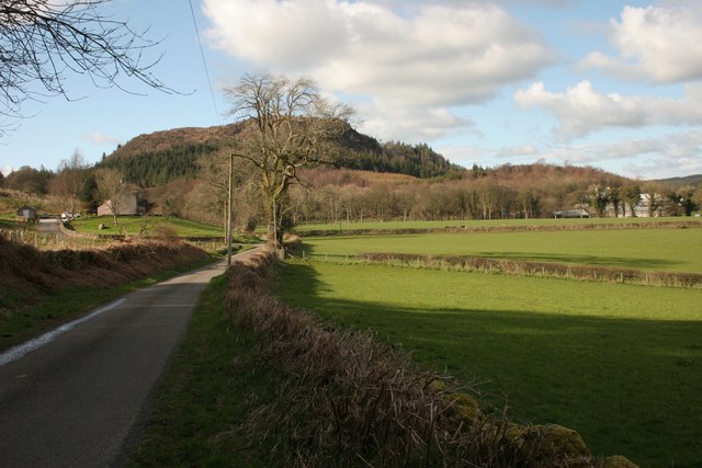
Blackbellie Plantation Images

Images are sourced within 2km of 54.887559/-3.865965 or Grid Reference NX8056. Thanks to Geograph Open Source API. All images are credited.

Road entrance, Doach Plantation
B736, Doach
B736, Doach
Doach Burn
Doach Burn
Gelston Lodge The stables and paddock are fairly recent additions.
Gelston Lodge
The stables and paddock are fairly recent additions.
Minor road near Gelston Lodge
Potterland Bridge The road crosses the Potterland Burn.
Potterland Bridge
The road crosses the Potterland Burn.
Potterland Burn Viewed from Potterland Bridge.
Potterland Burn
Viewed from Potterland Bridge.
Potterland Burn Viewed from Potterland Bridge.
Potterland Burn
Viewed from Potterland Bridge.
Road beside Kirkmirran Kirkmirran is on the left. Potterland is amongst the trees on the right.
Road beside Kirkmirran
Kirkmirran is on the left. Potterland is amongst the trees on the right.
Glenyerrock Farm A farmhouse and associated outbuildings, photographed from the B736.
Glenyerrock Farm
A farmhouse and associated outbuildings, photographed from the B736.
B736 at Doach
B736 at Doach
B736 at Doach Wood Cars are parked in the Forestry Commission Scotland car park.
B736 at Doach Wood
Cars are parked in the Forestry Commission Scotland car park.
Doach Wood The wood contains some of the tallest trees in south-west Scotland, growing up to 40 metres high.
Doach Wood
The wood contains some of the tallest trees in south-west Scotland, growing up to 40 metres high.
Tin-roofed building A shed of some kind.
Tin-roofed building
A shed of some kind.
Cheeky Red Squirrel Carved out of a tree trunk beside the forestry path.
Cheeky Red Squirrel
Carved out of a tree trunk beside the forestry path.
The edge of Doach Wood
Sheep grazing beside the Doach Burn
Tall trees, Doach Wood The wood contains some of the tallest trees in south-west Scotland, growing up to 40 metres high.
Tall trees, Doach Wood
The wood contains some of the tallest trees in south-west Scotland, growing up to 40 metres high.
Show me another place!

Blackbellie Plantation is located at Grid Ref: NX8056 (Lat: 54.887559, Lng: -3.865965)

Unitary Authority: Dumfries and Galloway

Police Authority: Dumfries and Galloway

What 3 Words

///pouch.refrained.migrate. Near Dalbeattie, Dumfries & Galloway

Nearby Locations

Blackbellie Plantation

Related Wikis

Palnackie

Palnackie is a village in the parish of Buittle in the historical county of Kirkcudbrightshire in Dumfries and Galloway, Scotland. It has a population...

Orchardton Castle

Orchardton Castle overlooks the Solway Coast. Built in the 1880s, this is a Grade B listed property formerly known as Orchardton House. Built around a...

Gelston Castle

Gelston Castle, located near Castle Douglas in Kirkcudbrightshire in Dumfries and Galloway, Scotland, was built by Sir William Douglas of Castle Douglas...

Rockcliffe, Dumfries and Galloway

Rockcliffe is a small, coastal village in Kirkcudbrightshire, Dumfries and Galloway in Scotland, with a view of Rough Island, Hestan Island, the Solway...

Nearby Amenities

Located within 500m of 54.887559,-3.865965
Douganhill
Naptan AtcoCode: 680000998333
Naptan Bearing: SW
Naptan BusStopType: CUS
Naptan CommonName: Douganhill
Naptan Indicator: opp Farm
Naptan Landmark: B736
Naptan NaptanCode: 34236373
Naptan Notes: none
Naptan Street: A711
Naptan Verified: no
Source: naptan_import
Lat/Long: 54.8847736/-3.8619758
Douganhill
Naptan AtcoCode: 680000998444
Naptan Bearing: NE
Naptan BusStopType: CUS
Naptan CommonName: Douganhill
Naptan Indicator: Farm
Naptan Landmark: B736
Naptan NaptanCode: 34236374
Naptan Notes: none
Naptan Street: A711
Naptan Verified: no
Source: naptan_import
Lat/Long: 54.8847424/-3.862255
Power: pole
Lat/Long: 54.884319/-3.8618149
Power: pole
Lat/Long: 54.8844656/-3.8627157
Power: pole
Lat/Long: 54.8844229/-3.8609014
Power: pole
Lat/Long: 54.8846832/-3.8639606
Power: pole
Lat/Long: 54.8848775/-3.865093
Power: pole
Lat/Long: 54.8850522/-3.8625373
Power: pole
Lat/Long: 54.8850779/-3.8662274
Power: pole
Lat/Long: 54.8852673/-3.8673577
Power: pole
Lat/Long: 54.8854921/-3.8686366
Power: pole
Lat/Long: 54.8857145/-3.8699367
Power: pole
Lat/Long: 54.8859247/-3.8711838
Power: pole
Lat/Long: 54.8861374/-3.8724585
Power: pole
Lat/Long: 54.8868632/-3.8727623
Power: pole
Lat/Long: 54.8875829/-3.8730661
Power: pole
Lat/Long: 54.8883247/-3.8733677
The data included in this document is from www.openstreetmap.org. The data is made available under ODbL.

Have you been to Blackbellie Plantation?

Leave your review of Blackbellie Plantation below (or comments, questions and feedback).