Barfraggan Wood

Wood, Forest in Kirkcudbrightshire

Scotland

Barfraggan Wood

Church Road, Auchencairn
Church Road, Auchencairn Credit: Billy McCrorie

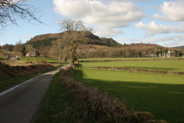
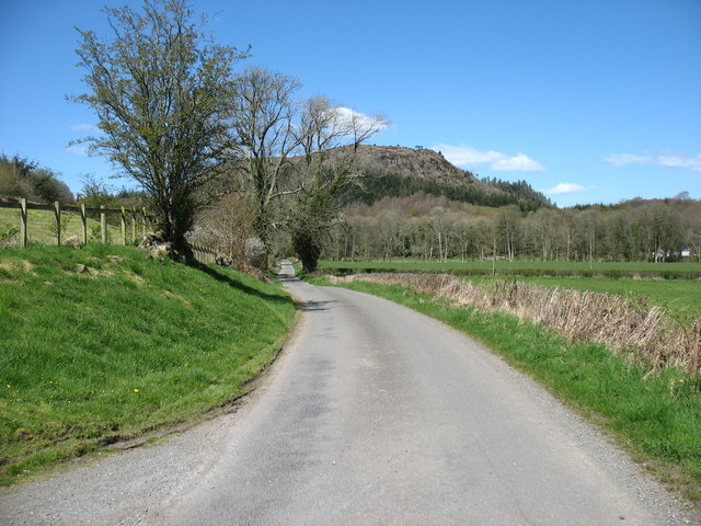
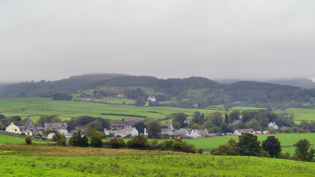
Barfraggan Wood is a picturesque woodland located in Kirkcudbrightshire, Scotland. Spread over an area of approximately 100 acres, it is known for its natural beauty and diverse range of flora and fauna. The wood is situated on the eastern banks of the River Dee, near the small village of Crossmichael.

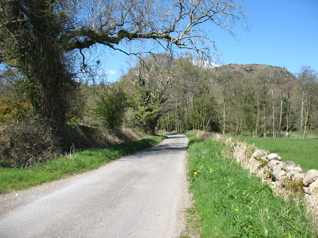
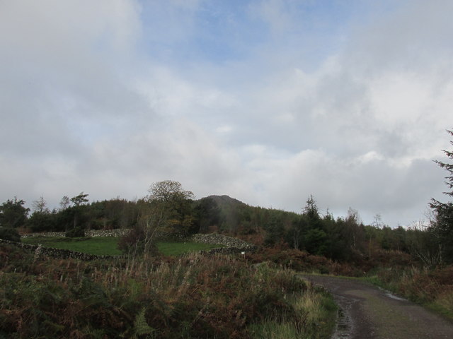
The wood consists mainly of deciduous trees, including oak, beech, and birch, which provide a stunning display of colors during the autumn months. The dense canopy of the trees creates a peaceful and tranquil atmosphere, making it an ideal place for nature lovers and hikers to explore.

Numerous walking trails crisscross the wood, allowing visitors to fully immerse themselves in its enchanting surroundings. These trails offer breathtaking views of the surrounding countryside, with opportunities to spot wildlife such as red squirrels, roe deer, and a variety of bird species.

The wood is also home to a variety of plant species, including bluebells, wild garlic, and ferns, which carpet the forest floor during the spring and summer months. This creates a vibrant and magical environment, perfect for photographers and nature enthusiasts.

Barfraggan Wood is a popular destination for both locals and tourists alike, offering a peaceful retreat from the hustle and bustle of everyday life. Whether you're looking to embark on a leisurely stroll, admire the beauty of nature, or simply relax in a serene setting, Barfraggan Wood is a must-visit destination in Kirkcudbrightshire.

If you have any feedback on the listing, please let us know in the comments section below.

Barfraggan Wood Images

Images are sourced within 2km of 54.859935/-3.870298 or Grid Reference NX8053. Thanks to Geograph Open Source API. All images are credited.

Church Road, Auchencairn
Farmland at Auchencairn With view over to Torr Point.
Farmland at Auchencairn
With view over to Torr Point.
Road beside Kirkmirran Kirkmirran is on the left. Potterland is amongst the trees on the right.
Road beside Kirkmirran
Kirkmirran is on the left. Potterland is amongst the trees on the right.
In the centre of Auchencairn The "Jubilee Lamp" was erected by public subscription in 1897 to mark the sixtieth year of Queen Victoria's long reign.
In the centre of Auchencairn
The "Jubilee Lamp" was erected by public subscription in 1897 to mark the sixtieth year of Queen Victoria's long reign.
Junction of A711 and Shore Road, Auchencairn The bridge on the left carries the A711 across the Auchencairn Burn, which enters Auchencairn Bay less than half a mile from this point. This is the section of the A711 from Dalbeattie to Kirkcudbright.
The War Memorial on the right is a simple stone Maltese Cross located at the corner of the A711 and Shore Road, a 'no-through road' branching off to the right.
Junction of A711 and Shore Road, Auchencairn
The bridge on the left carries the A711 across the Auchencairn Burn, which enters Auchencairn Bay less than half a mile from this point. This is the section of the A711 from Dalbeattie to Kirkcudbright. The War Memorial on the right is a simple stone Maltese Cross located at the corner of the A711 and Shore Road, a 'no-through road' branching off to the right.
Minor road to Gelston Potterland Hill ahead.
Minor road to Gelston
Potterland Hill ahead.
Minor road to Gelston
Track on the lower slopes of Screel hill.
Auchencairn under low cloud Auchencairn from fields to the South
Auchencairn under low cloud
Auchencairn from fields to the South
Farmland at Torr With view out to Hestan Island as seen from the A711.
Farmland at Torr
With view out to Hestan Island as seen from the A711.
Farmland at Torr With view out to Hestan Island as seen from the A711.
Farmland at Torr
With view out to Hestan Island as seen from the A711.
Houston's Bus Near Auchencairn on the A711 heading for Dalbeattie.
Houston's Bus
Near Auchencairn on the A711 heading for Dalbeattie.
Torr Farm From the A711.
Torr Farm
From the A711.
The A711 to Dalbeattie Near to Barfraggan Wood.
The A711 to Dalbeattie
Near to Barfraggan Wood.
The A711 to Kirkcudbright Passing Torr Farm.
The A711 to Kirkcudbright
Passing Torr Farm.
Road into Little Forest From the A711 near Auchencairn.
Road into Little Forest
From the A711 near Auchencairn.
Gates into Farmland at Torr With a view out to Hestan Island, as seen from the A711.
Gates into Farmland at Torr
With a view out to Hestan Island, as seen from the A711.
Show me another place!

Barfraggan Wood is located at Grid Ref: NX8053 (Lat: 54.859935, Lng: -3.870298)

Unitary Authority: Dumfries and Galloway

Police Authority: Dumfries and Galloway

What 3 Words

///audit.howler.scrambles. Near Dalbeattie, Dumfries & Galloway

Nearby Locations

Loch Ling Barfraggan Wood

Related Wikis

Orchardton Castle

Orchardton Castle overlooks the Solway Coast. Built in the 1880s, this is a Grade B listed property formerly known as Orchardton House. Built around a...

Auchencairn

Auchencairn ([ɔxən'kʰɛ:(r)n]) is a village in the historical county of Kirkcudbrightshire in the Dumfries and Galloway region of Scotland. It is located...

Rough Firth

Rough Firth is an inlet on the northern coast of the Solway Firth in the Stewartry area of Dumfries and Galloway, Scotland. The firth lies between Almorness...

Urr Water

Urr Water or River Urr (arc. River Orr) is a river in which flows through the counties of Dumfriesshire and Kirkcudbrightshire in southwest Scotland....

Rockcliffe, Dumfries and Galloway

Rockcliffe is a small, coastal village in Kirkcudbrightshire, Dumfries and Galloway in Scotland, with a view of Rough Island, Hestan Island, the Solway...

Kippford

Kippford (/ˈkɪpfəd/; otherwise Scaur) is a small village along the Solway coast, in the historic county of Kirkcudbrightshire in Dumfries and Galloway...

Palnackie

Palnackie is a village in the parish of Buittle in the historical county of Kirkcudbrightshire in Dumfries and Galloway, Scotland. It has a population...

Rough Island, Scotland

"Rough Island" is also used as a translation of "Garbh Eilean", a common Scottish name for islandsRough Island is a 20-acre (8 ha) uninhabited tidal island...

Nearby Amenities

Located within 500m of 54.859935,-3.870298
Post Box
Ref: DG7 33
Source: survey
Lat/Long: 54.8631669/-3.8684277
Rigg of Torr
Place: locality
Lat/Long: 54.8568998/-3.8664563
Thornglass
Place: locality
Lat/Long: 54.8559222/-3.8684272
Power: pole
Lat/Long: 54.8558003/-3.8677347
Power: pole
Lat/Long: 54.8563323/-3.8674671
Power: pole
Lat/Long: 54.8568483/-3.8672036
Power: pole
Lat/Long: 54.8576579/-3.866613
Power: pole
Lat/Long: 54.8584796/-3.8660054
Power: pole
Lat/Long: 54.8592793/-3.8654
Power: pole
Lat/Long: 54.8600448/-3.8648349
Power: pole
Lat/Long: 54.8606562/-3.864393
Power: pole
Lat/Long: 54.861237/-3.8639745
Power: pole
Lat/Long: 54.8617114/-3.8640212
Power: pole
Lat/Long: 54.8625049/-3.8639802
Power: pole
Lat/Long: 54.8557257/-3.8686313
Power: pole
Lat/Long: 54.8556658/-3.8694088
Power: pole
Lat/Long: 54.8625771/-3.8650537
Power: pole
Lat/Long: 54.8626566/-3.8661372
The data included in this document is from www.openstreetmap.org. The data is made available under ODbL.

Have you been to Barfraggan Wood?

Leave your review of Barfraggan Wood below (or comments, questions and feedback).