Mawkins Brae

Wood, Forest in Perthshire

Scotland

Mawkins Brae

A9, northbound The A9 is a strategic link between the Highlands of Scotland and the Central Belt. It runs 279 miles from junction 5 of the M9 at Polmont to Scrabster. Originally it ran from Edinburgh.
<span class="nowrap"><a title="https://www.sabre-roads.org.uk/wiki/index.php?title=A9" rel="nofollow ugc noopener" href="https://www.sabre-roads.org.uk/wiki/index.php?title=A9">Link</a><img style="margin-left:2px;" alt="External link" title="External link - shift click to open in new window" src="https://s1.geograph.org.uk/img/external.png" width="10" height="10"/></span>
A9, northbound Credit: N Chadwick

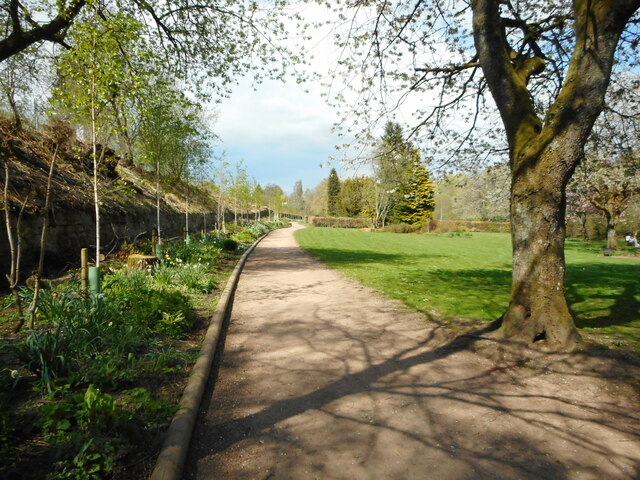
Mawkins Brae is a picturesque wood located in Perthshire, Scotland. Nestled amidst the rolling hills and lush greenery, this enchanting forest covers an area of approximately 100 acres and is a popular destination for nature enthusiasts and hikers alike.

The forest boasts a diverse range of flora and fauna, including towering oak and beech trees, carpeted forest floors with wildflowers, and a variety of bird species that fill the air with their melodious songs. The dense foliage provides a sense of tranquility and seclusion, making it an ideal spot for those seeking solace in nature.

Mawkins Brae offers an extensive network of well-maintained trails, providing ample opportunities for walking, jogging, and cycling. The paths wind through the woods, offering breathtaking views of the surrounding countryside and occasional glimpses of wildlife such as deer and squirrels.

In addition to its natural beauty, Mawkins Brae also possesses historical significance. The wood was once part of a larger estate and has remnants of an ancient settlement, including stone ruins and old boundary walls. These historic features add a touch of intrigue and a sense of connection to the past for visitors.

With its stunning landscapes, diverse wildlife, and rich history, Mawkins Brae is a hidden gem in Perthshire. Whether it's a leisurely stroll or an adventurous hike, this forest offers an unforgettable experience for nature lovers, providing an escape from the hustle and bustle of everyday life.

If you have any feedback on the listing, please let us know in the comments section below.

Mawkins Brae Images

Images are sourced within 2km of 56.203164/-3.9476525 or Grid Reference NN7902. Thanks to Geograph Open Source API. All images are credited.

A9, northbound The A9 is a strategic link between the Highlands of Scotland and the Central Belt. It runs 279 miles from junction 5 of the M9 at Polmont to Scrabster. Originally it ran from Edinburgh.
<span class="nowrap"><a title="https://www.sabre-roads.org.uk/wiki/index.php?title=A9" rel="nofollow ugc noopener" href="https://www.sabre-roads.org.uk/wiki/index.php?title=A9">Link</a><img style="margin-left:2px;" alt="External link" title="External link - shift click to open in new window" src="https://s1.geograph.org.uk/img/external.png" width="10" height="10"/></span>
A9, northbound
The A9 is a strategic link between the Highlands of Scotland and the Central Belt. It runs 279 miles from junction 5 of the M9 at Polmont to Scrabster. Originally it ran from Edinburgh. LinkExternal link
A9 crossing Allan Water The A9 is a strategic link between the Highlands of Scotland and the Central Belt. It runs 279 miles from junction 5 of the M9 at Polmont to Scrabster. Originally it ran from Edinburgh.
<span class="nowrap"><a title="https://www.sabre-roads.org.uk/wiki/index.php?title=A9" rel="nofollow ugc noopener" href="https://www.sabre-roads.org.uk/wiki/index.php?title=A9">Link</a><img style="margin-left:2px;" alt="External link" title="External link - shift click to open in new window" src="https://s1.geograph.org.uk/img/external.png" width="10" height="10"/></span>
A9 crossing Allan Water
The A9 is a strategic link between the Highlands of Scotland and the Central Belt. It runs 279 miles from junction 5 of the M9 at Polmont to Scrabster. Originally it ran from Edinburgh. LinkExternal link
B8033 bridge, A9 The A9 is a strategic link between the Highlands of Scotland and the Central Belt. It runs 279 miles from junction 5 of the M9 at Polmont to Scrabster. Originally it ran from Edinburgh.
<span class="nowrap"><a title="https://www.sabre-roads.org.uk/wiki/index.php?title=A9" rel="nofollow ugc noopener" href="https://www.sabre-roads.org.uk/wiki/index.php?title=A9">Link</a><img style="margin-left:2px;" alt="External link" title="External link - shift click to open in new window" src="https://s1.geograph.org.uk/img/external.png" width="10" height="10"/></span>
B8033 bridge, A9
The A9 is a strategic link between the Highlands of Scotland and the Central Belt. It runs 279 miles from junction 5 of the M9 at Polmont to Scrabster. Originally it ran from Edinburgh. LinkExternal link
A9, northbound The A9 is a strategic link between the Highlands of Scotland and the Central Belt. It runs 279 miles from junction 5 of the M9 at Polmont to Scrabster. Originally it ran from Edinburgh.
<span class="nowrap"><a title="https://www.sabre-roads.org.uk/wiki/index.php?title=A9" rel="nofollow ugc noopener" href="https://www.sabre-roads.org.uk/wiki/index.php?title=A9">Link</a><img style="margin-left:2px;" alt="External link" title="External link - shift click to open in new window" src="https://s1.geograph.org.uk/img/external.png" width="10" height="10"/></span>
A9, northbound
The A9 is a strategic link between the Highlands of Scotland and the Central Belt. It runs 279 miles from junction 5 of the M9 at Polmont to Scrabster. Originally it ran from Edinburgh. LinkExternal link
A9, Strathallan The A9 is a strategic link between the Highlands of Scotland and the Central Belt. It runs 279 miles from junction 5 of the M9 at Polmont to Scrabster. Originally it ran from Edinburgh.
<span class="nowrap"><a title="https://www.sabre-roads.org.uk/wiki/index.php?title=A9" rel="nofollow ugc noopener" href="https://www.sabre-roads.org.uk/wiki/index.php?title=A9">Link</a><img style="margin-left:2px;" alt="External link" title="External link - shift click to open in new window" src="https://s1.geograph.org.uk/img/external.png" width="10" height="10"/></span>
A9, Strathallan
The A9 is a strategic link between the Highlands of Scotland and the Central Belt. It runs 279 miles from junction 5 of the M9 at Polmont to Scrabster. Originally it ran from Edinburgh. LinkExternal link
Cathedral Church of St Blaan and St Laurence, Dunblane Dunblane Cathedral dates back to the 12th century, most of what stands being constructed during the bishopric of Clement in the 13th century.
Cathedral Church of St Blaan and St Laurence, Dunblane
Dunblane Cathedral dates back to the 12th century, most of what stands being constructed during the bishopric of Clement in the 13th century.
Dunblane Cathedral Western end of the cathedral, with three stained glass windows
Dunblane Cathedral
Western end of the cathedral, with three stained glass windows
Door on southern side of Dunblane Cathedral There is believed to have been a 9th century church on this site, and the present cathedral of St Blaan and St Laurence erected in its place dates largely from the 12th-13th centuries, restored in 1889 by Sir Robert Rowand Anderson. Along with its surrounding close it is listed category A (LB26361) and a Scheduled Monument (SM90109).
Door on southern side of Dunblane Cathedral
There is believed to have been a 9th century church on this site, and the present cathedral of St Blaan and St Laurence erected in its place dates largely from the 12th-13th centuries, restored in 1889 by Sir Robert Rowand Anderson. Along with its surrounding close it is listed category A (LB26361) and a Scheduled Monument (SM90109).
OS Cutmark, Dunblane Cathedral At the foot of the tower
OS Cutmark, Dunblane Cathedral
At the foot of the tower
Dunblane Cathedral Seen from the west bank of the Allan Water. The cathedral is Category A listed <span class="nowrap"><a title="http://portal.historicenvironment.scot/designation/LB26361" rel="nofollow ugc noopener" href="http://portal.historicenvironment.scot/designation/LB26361">Link</a><img style="margin-left:2px;" alt="External link" title="External link - shift click to open in new window" src="https://s1.geograph.org.uk/img/external.png" width="10" height="10"/></span> and it and the precinct around it are a Scheduled Monument <span class="nowrap"><a title="http://portal.historicenvironment.scot/designation/SM90109" rel="nofollow ugc noopener" href="http://portal.historicenvironment.scot/designation/SM90109">Link</a><img style="margin-left:2px;" alt="External link" title="External link - shift click to open in new window" src="https://s1.geograph.org.uk/img/external.png" width="10" height="10"/></span>.
Dunblane Cathedral
Seen from the west bank of the Allan Water. The cathedral is Category A listed LinkExternal link and it and the precinct around it are a Scheduled Monument LinkExternal link.
Footpath, The Haugh The embankment on the left is for the railway.
Footpath, The Haugh
The embankment on the left is for the railway.
Dunblane Cathedral Seen from the west bank of the Allan Water. The cathedral is Category A listed <span class="nowrap"><a title="http://portal.historicenvironment.scot/designation/LB26361" rel="nofollow ugc noopener" href="http://portal.historicenvironment.scot/designation/LB26361">Link</a><img style="margin-left:2px;" alt="External link" title="External link - shift click to open in new window" src="https://s1.geograph.org.uk/img/external.png" width="10" height="10"/></span> and it and the precinct around it are a Scheduled Monument <span class="nowrap"><a title="http://portal.historicenvironment.scot/designation/SM90109" rel="nofollow ugc noopener" href="http://portal.historicenvironment.scot/designation/SM90109">Link</a><img style="margin-left:2px;" alt="External link" title="External link - shift click to open in new window" src="https://s1.geograph.org.uk/img/external.png" width="10" height="10"/></span>.
Dunblane Cathedral
Seen from the west bank of the Allan Water. The cathedral is Category A listed LinkExternal link and it and the precinct around it are a Scheduled Monument LinkExternal link.
War memorial, Dunblane The war memorial was originally located opposite St Mary's Church at the junction of Perth Road and Glen Road. It was unveiled in October 1921. It was moved to its present location to allow for road improvements. The memorial was dismantled, cleaned and re-assembled in 1959. It was restored again in 2010. It is Category C listed <span class="nowrap"><a title="http://portal.historicenvironment.scot/designation/LB48950" rel="nofollow ugc noopener" href="http://portal.historicenvironment.scot/designation/LB48950">Link</a><img style="margin-left:2px;" alt="External link" title="External link - shift click to open in new window" src="https://s1.geograph.org.uk/img/external.png" width="10" height="10"/></span>.
War memorial, Dunblane
The war memorial was originally located opposite St Mary's Church at the junction of Perth Road and Glen Road. It was unveiled in October 1921. It was moved to its present location to allow for road improvements. The memorial was dismantled, cleaned and re-assembled in 1959. It was restored again in 2010. It is Category C listed LinkExternal link.
Path under the railway viaduct The viaduct over the Allan Water dates from 1846-8 and was built for the Scottish Central Railway. It is Category B listed <span class="nowrap"><a title="http://portal.historicenvironment.scot/designation/LB26425" rel="nofollow ugc noopener" href="http://portal.historicenvironment.scot/designation/LB26425">Link</a><img style="margin-left:2px;" alt="External link" title="External link - shift click to open in new window" src="https://s1.geograph.org.uk/img/external.png" width="10" height="10"/></span>.
Path under the railway viaduct
The viaduct over the Allan Water dates from 1846-8 and was built for the Scottish Central Railway. It is Category B listed LinkExternal link.
Viaduct over the Allan Water Officially it's Bridge SCM4 133/001, according to a small sign attached to one of the supports <a href="https://www.geograph.org.uk/photo/7163481">NN7701 : Bridge sign</a>. It dates from 1846-8 and was built for the Scottish Central Railway. It is Category B listed <span class="nowrap"><a title="http://portal.historicenvironment.scot/designation/LB26425" rel="nofollow ugc noopener" href="http://portal.historicenvironment.scot/designation/LB26425">Link</a><img style="margin-left:2px;" alt="External link" title="External link - shift click to open in new window" src="https://s1.geograph.org.uk/img/external.png" width="10" height="10"/></span>.
Viaduct over the Allan Water
Officially it's Bridge SCM4 133/001, according to a small sign attached to one of the supports NN7701 : Bridge sign. It dates from 1846-8 and was built for the Scottish Central Railway. It is Category B listed LinkExternal link.
Show me another place!

Mawkins Brae is located at Grid Ref: NN7902 (Lat: 56.203164, Lng: -3.9476525)

Unitary Authority: Stirling

Police Authority: Forth Valley

What 3 Words

///scoring.earlobe.regarding. Near Dunblane, Stirling

Related Wikis

Ashfield, Stirling

Ashfield (Scottish Gaelic: Achadh an Uinnsinn) is a small village in the Registration county of Perth and the local government district of Stirling, Scotland...

Diocese of Dunblane

The Diocese of Dunblane or Diocese of Strathearn was one of the thirteen historical dioceses of Scotland, before the abolition of episcopacy in the Scottish...

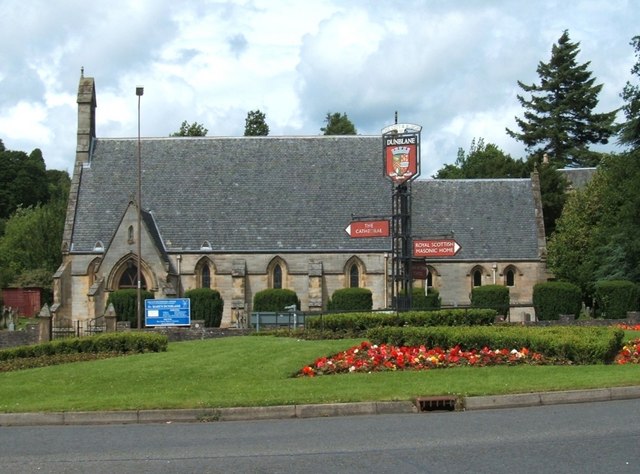
St Mary's Episcopal Church, Dunblane

St Mary's Episcopal Church is a medium-sized church of the Scottish Episcopal Church in Dunblane, Scotland. It is situated by the Fourways roundabout....

St Blane's Church, Dunblane

St Blane's is a Church of Scotland church located in Dunblane, Scotland. The evangelical congregation is within the Church of Scotland's Presbytery of...

Dunblane Museum

Dunblane Museum is a historic building in the Scottish town of Dunblane, Stirling. Located in The Cross, immediately to the south of Dunblane Cathedral...
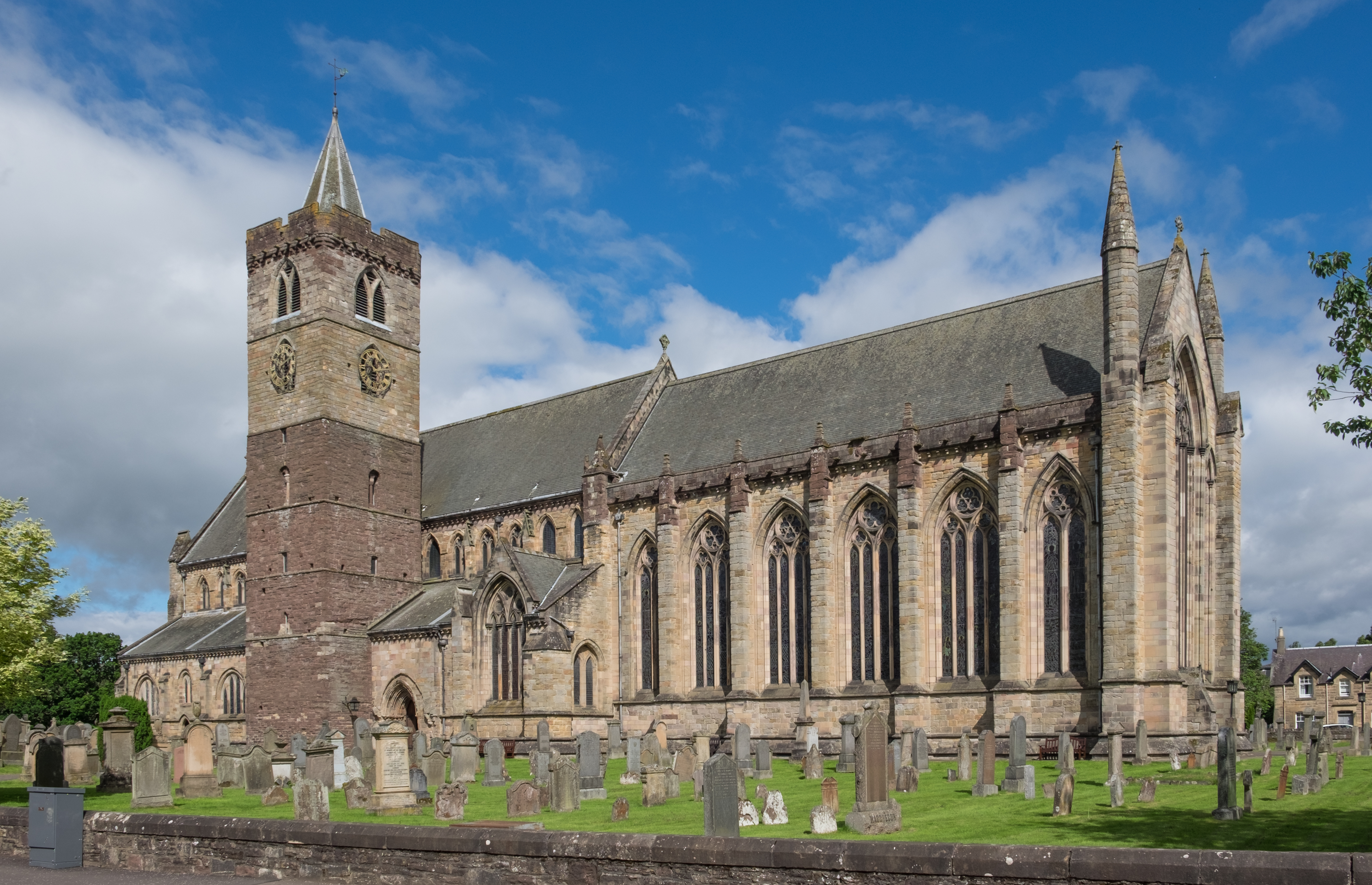
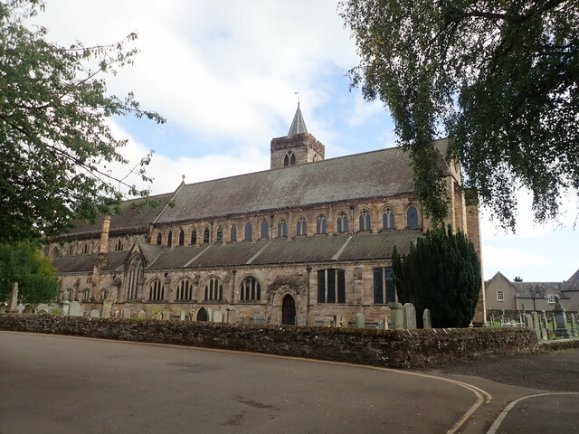
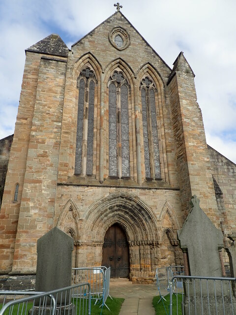
Dunblane Cathedral

Dunblane Cathedral is the larger of the two Church of Scotland parish churches serving Dunblane, near the city of Stirling, in central Scotland. The lower...

Leighton Library

The Leighton Library, or Bibliotheca Leightoniana, in The Cross, Dunblane, is the oldest purpose built library in Scotland and also has a well-documented...

St Clement's Cottage

St Clement's Cottage is a building in the Scottish town of Dunblane, Stirling. Located in The Cross, immediately to the south of Dunblane Cathedral, it...

Nearby Amenities

Located within 500m of 56.203164,-3.9476525
Motorway Junction
Lat/Long: 56.2039477/-3.9554417
Motorway Junction
Lat/Long: 56.2048981/-3.9512479
Generator Method: photovoltaic
Generator Output Electricity: yes
Generator Source: solar
Generator Type: solar_photovoltaic_panel
Power: generator
Lat/Long: 56.1992253/-3.950747
Generator Method: photovoltaic
Generator Output Electricity: yes
Generator Source: solar
Generator Type: solar_photovoltaic_panel
Power: generator
Lat/Long: 56.1992373/-3.9506518
Generator Method: photovoltaic
Generator Output Electricity: yes
Generator Source: solar
Generator Type: solar_photovoltaic_panel
Power: generator
Lat/Long: 56.1992544/-3.9505297
Generator Method: photovoltaic
Generator Output Electricity: yes
Generator Source: solar
Generator Type: solar_photovoltaic_panel
Power: generator
Lat/Long: 56.1992783/-3.9504211
Generator Method: photovoltaic
Generator Output Electricity: yes
Generator Source: solar
Generator Type: solar_photovoltaic_panel
Power: generator
Lat/Long: 56.1990821/-3.950747
Generator Method: photovoltaic
Generator Output Electricity: yes
Generator Source: solar
Generator Type: solar_photovoltaic_panel
Power: generator
Lat/Long: 56.199194/-3.9500831
Power: pole
Lat/Long: 56.1993007/-3.9439455
Power: pole
Lat/Long: 56.1991681/-3.944891
Power: pole
Lat/Long: 56.1990401/-3.9458365
Power: pole
Lat/Long: 56.1989051/-3.9467401
Power: pole
Lat/Long: 56.1987515/-3.9478613
Power: pole
Lat/Long: 56.1992472/-3.9477943
Power: pole
Lat/Long: 56.1998092/-3.9470727
Power: pole
Lat/Long: 56.2003433/-3.9463657
Power: pole
Lat/Long: 56.2008763/-3.9456754
Power: pole
Lat/Long: 56.2014057/-3.9449914
Power: pole
Lat/Long: 56.201927/-3.9442865
Power: pole
Lat/Long: 56.2025541/-3.9434602
Power: pole
Lat/Long: 56.2032092/-3.9432929
Power: pole
Lat/Long: 56.2038678/-3.9431193
Power: pole
Lat/Long: 56.2045042/-3.9429582
Power: pole
Lat/Long: 56.2054385/-3.9431026
Power: pole
Lat/Long: 56.2059865/-3.9431841
Power: pole
Lat/Long: 56.206581/-3.9432594
Power: pole
Lat/Long: 56.2060702/-3.9421132
The data included in this document is from www.openstreetmap.org. The data is made available under ODbL.

Have you been to Mawkins Brae?

Leave your review of Mawkins Brae below (or comments, questions and feedback).