Fiveyates Wood

Wood, Forest in Stirlingshire

Scotland

Fiveyates Wood

Nearing the end of the M80 The M80 joins Glasgow to Stirling. It runs 25 miles from Glasgow to Bannockburn.
<span class="nowrap"><a title="https://www.sabre-roads.org.uk/wiki/index.php?title=M80" rel="nofollow ugc noopener" href="https://www.sabre-roads.org.uk/wiki/index.php?title=M80">Link</a><img style="margin-left:2px;" alt="External link" title="External link - shift click to open in new window" src="https://s1.geograph.org.uk/img/external.png" width="10" height="10"/></span>
Nearing the end of the M80 Credit: N Chadwick

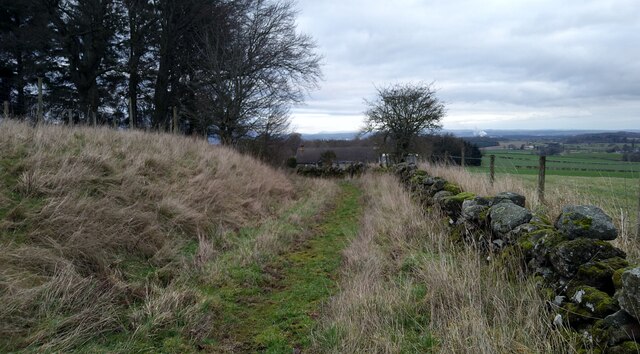
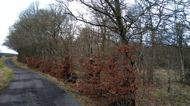
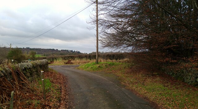
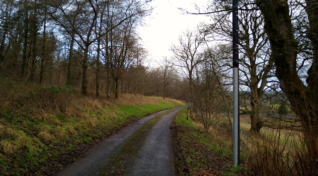
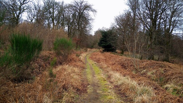
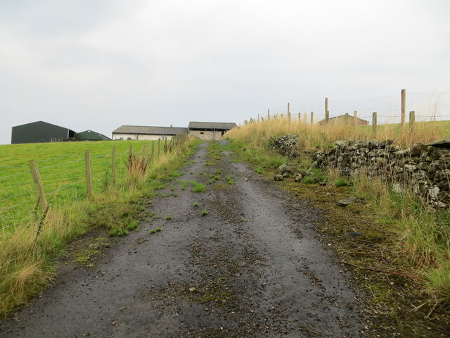
Fiveyates Wood is a picturesque woodland located in Stirlingshire, Scotland. Covering an area of approximately 20 hectares, this ancient forest is home to a diverse range of flora and fauna.

The woodland is characterized by a mix of broadleaf and coniferous trees, including oak, beech, birch, and pine. The canopy of the forest provides a habitat for a variety of bird species, such as woodpeckers, owls, and thrushes. Additionally, the forest floor is carpeted with a rich assortment of wildflowers, ferns, and mosses.

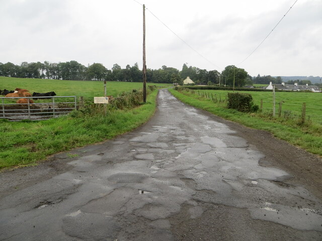
Visitors to Fiveyates Wood can enjoy a network of well-maintained walking trails that wind through the forest, offering opportunities for peaceful strolls and wildlife observation. The wood is popular among nature enthusiasts, photographers, and families looking to escape the hustle and bustle of everyday life.

Fiveyates Wood is managed by local conservation authorities to ensure the preservation of its natural beauty and ecological importance. It serves as a vital green space for the community, providing a tranquil retreat for those seeking to connect with nature.

If you have any feedback on the listing, please let us know in the comments section below.

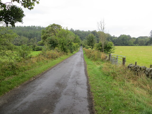
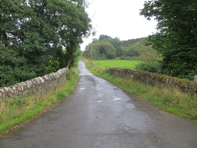
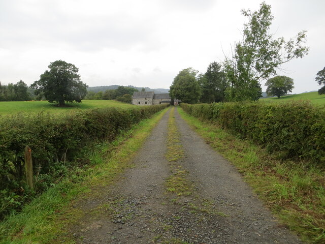
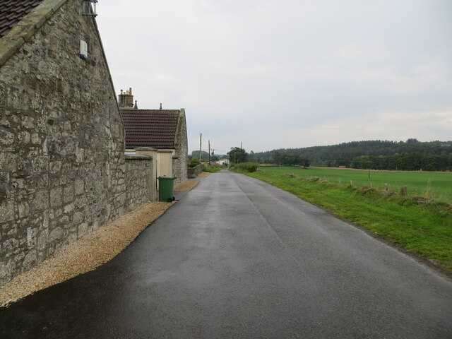
Fiveyates Wood Images

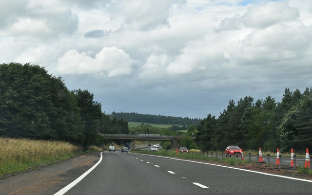
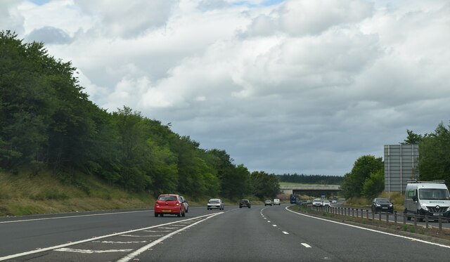
Images are sourced within 2km of 56.076367/-3.9441095 or Grid Reference NS7988. Thanks to Geograph Open Source API. All images are credited.

Nearing the end of the M80 The M80 joins Glasgow to Stirling. It runs 25 miles from Glasgow to Bannockburn.
<span class="nowrap"><a title="https://www.sabre-roads.org.uk/wiki/index.php?title=M80" rel="nofollow ugc noopener" href="https://www.sabre-roads.org.uk/wiki/index.php?title=M80">Link</a><img style="margin-left:2px;" alt="External link" title="External link - shift click to open in new window" src="https://s1.geograph.org.uk/img/external.png" width="10" height="10"/></span>
Nearing the end of the M80
The M80 joins Glasgow to Stirling. It runs 25 miles from Glasgow to Bannockburn. LinkExternal link
M80 merges with M9 (end of M80) The M80 joins Glasgow to Stirling. It runs 25 miles from Glasgow to Bannockburn.
<span class="nowrap"><a title="https://www.sabre-roads.org.uk/wiki/index.php?title=M80" rel="nofollow ugc noopener" href="https://www.sabre-roads.org.uk/wiki/index.php?title=M80">Link</a><img style="margin-left:2px;" alt="External link" title="External link - shift click to open in new window" src="https://s1.geograph.org.uk/img/external.png" width="10" height="10"/></span>
M80 merges with M9 (end of M80)
The M80 joins Glasgow to Stirling. It runs 25 miles from Glasgow to Bannockburn. LinkExternal link
The track to Old Sauchie This OS marked track varies between a decent track and a boggy faint path as it moves from the single track road in the west and Old Sauchie.
The track to Old Sauchie
This OS marked track varies between a decent track and a boggy faint path as it moves from the single track road in the west and Old Sauchie.
The track from Old Sauchie
Track junction near Old Sauchie
The approach to Old Sauchie
The Great Hall at Old Sauchie "Great Hall" is how the OS describes this fine building.
The Great Hall at Old Sauchie
"Great Hall" is how the OS describes this fine building.
The path from Old Sauchie to Lewis Hill At time of visit the gates on the track at NS7780 8849 were locked by the landowner, complicating access to this route.
The path from Old Sauchie to Lewis Hill
At time of visit the gates on the track at NS7780 8849 were locked by the landowner, complicating access to this route.
Minor road between Kingsburgh and Craigend Looking south-westward.
Minor road between Kingsburgh and Craigend
Looking south-westward.
Minor road and bridge crossing a small burn near to Milnholm Looking south-eastward.
Minor road and bridge crossing a small burn near to Milnholm
Looking south-eastward.
Hedge-lined track giving access to Old Sauchie Mill and Cottages Looking north-westward.
Hedge-lined track giving access to Old Sauchie Mill and Cottages
Looking north-westward.
Minor road at Cauldbarns Looking south-eastward.
Minor road at Cauldbarns
Looking south-eastward.
The back way into Foot o' Green Looking south-westward.
The back way into Foot o' Green
Looking south-westward.
Track giving access to Howlands and Swanswater Fisheries Looking south-westward.
Track giving access to Howlands and Swanswater Fisheries
Looking south-westward.
Ordnance Survey Cut Mark with Rivet This mark can be found on top of the parapet wall of a road bridge near Auchenbowie.
The recorded details give a height of 79.35 metres above sea level.
For more detail see : <span class="nowrap"><a title="https://www.bench-marks.org.uk/bm179739" rel="nofollow ugc noopener" href="https://www.bench-marks.org.uk/bm179739">Link</a><img style="margin-left:2px;" alt="External link" title="External link - shift click to open in new window" src="https://s1.geograph.org.uk/img/external.png" width="10" height="10"/></span>
Ordnance Survey Cut Mark with Rivet
This mark can be found on top of the parapet wall of a road bridge near Auchenbowie. The recorded details give a height of 79.35 metres above sea level. For more detail see : LinkExternal link
Ordnance Survey Flush Bracket S8923 This bracket can be found on the wall of West Byre at Cauldbarns.
The recorded details give a height of 90.7886 metres above sea level.
For more detail see : <span class="nowrap"><a title="https://www.bench-marks.org.uk/bm21295" rel="nofollow ugc noopener" href="https://www.bench-marks.org.uk/bm21295">Link</a><img style="margin-left:2px;" alt="External link" title="External link - shift click to open in new window" src="https://s1.geograph.org.uk/img/external.png" width="10" height="10"/></span>
Ordnance Survey Flush Bracket S8923
This bracket can be found on the wall of West Byre at Cauldbarns. The recorded details give a height of 90.7886 metres above sea level. For more detail see : LinkExternal link
Stirling : The M9 The M9 Motorway heading through Stirling.
Stirling : The M9
The M9 Motorway heading through Stirling.
M80 and M9 (at M9 Junction 9) Looking in the direction of Glasgow at the point where the M9 becomes the M80. The M9 itself branches off on the slip road to the left. The long queue of traffic was due to an accident further down the M80.
M80 and M9 (at M9 Junction 9)
Looking in the direction of Glasgow at the point where the M9 becomes the M80. The M9 itself branches off on the slip road to the left. The long queue of traffic was due to an accident further down the M80.
Show me another place!

Fiveyates Wood is located at Grid Ref: NS7988 (Lat: 56.076367, Lng: -3.9441095)

Unitary Authority: Stirling

Police Authority: Forth Valley

What 3 Words

///dabbling.reclining.thudding. Near Bannockburn, Stirling

Nearby Locations

Fiveyates Wood

Related Wikis

Howietoun Fishery

Howietoun Fishery was created by Sir James Ramsay Gibson Maitland; it is a Victorian fish farm that specialised in the study of trout and salmon farming...

Stirling services

Stirling services is a motorway service station near Stirling, Scotland. The service station is located where the M9 motorway and M80 motorway join. It...
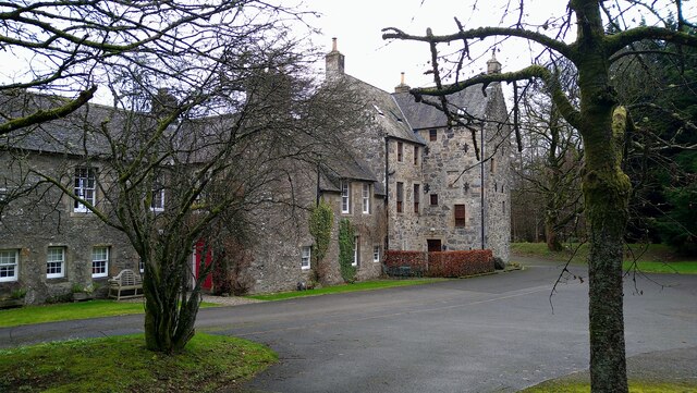
Auchenbowie House

Auchenbowie House is a laird's house (mansion) in Stirling, Scotland. The location is about 3.5 miles (5.6 km) south of Stirling, on minor road west of...

Broomridge

Broomridge is a district in the south of the city of Stirling, Scotland, located north of Bannockburn and east of St. Ninians. It is home to Bannockburn...

Nearby Amenities

Located within 500m of 56.076367,-3.9441095
Power: pole
Lat/Long: 56.0732217/-3.9401868
Power: pole
Lat/Long: 56.0739351/-3.9405934
Power: pole
Lat/Long: 56.072272/-3.9419386
Power: pole
Lat/Long: 56.0728381/-3.9416893
Power: pole
Lat/Long: 56.073438/-3.9414441
Power: pole
Lat/Long: 56.0767096/-3.9365325
Power: pole
Lat/Long: 56.0763143/-3.9371548
Power: pole
Lat/Long: 56.0758594/-3.9378651
Power: pole
Lat/Long: 56.0753905/-3.9386132
Power: pole
Lat/Long: 56.0749777/-3.9392753
Power: pole
Lat/Long: 56.0744988/-3.9396902
Power: pole
Lat/Long: 56.0770061/-3.9372732
Power: pole
Lat/Long: 56.0772703/-3.9381973
Power: pole
Lat/Long: 56.077537/-3.9391486
Power: pole
Lat/Long: 56.0777077/-3.9397751
Power: pole
Lat/Long: 56.0780643/-3.941068
Power: pole
Lat/Long: 56.0784187/-3.9423189
Power: pole
Lat/Long: 56.0780562/-3.9441042
Power: pole
Lat/Long: 56.0766634/-3.9363931
The data included in this document is from www.openstreetmap.org. The data is made available under ODbL.

Have you been to Fiveyates Wood?

Leave your review of Fiveyates Wood below (or comments, questions and feedback).