Bad an Aodainn
Wood, Forest in Perthshire
Scotland
Bad an Aodainn

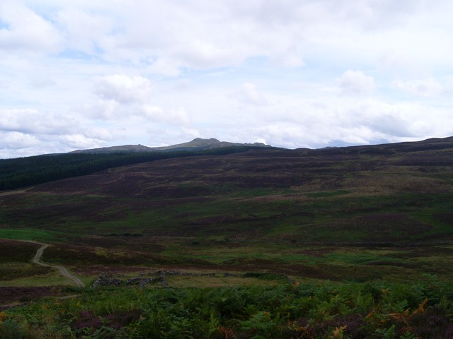
Bad an Aodainn, located in Perthshire, Scotland, is a picturesque wood or forest area that showcases the natural beauty of the region. Spanning over a considerable area, this woodland is replete with abundant flora and fauna, making it an ideal destination for nature enthusiasts and hikers.
The forest of Bad an Aodainn boasts a diverse range of tree species, including Scots pine, oak, birch, and rowan. These trees create a dense canopy overhead, providing shade and shelter to the various animals that call this woodland their home. The forest floor is adorned with a vibrant tapestry of mosses, ferns, and wildflowers, adding to the enchanting atmosphere of the area.
Visitors to Bad an Aodainn can explore a network of well-maintained trails that wind their way through the forest. These trails offer an opportunity to fully immerse oneself in the tranquility of nature while providing a chance to observe the local wildlife. Red squirrels, roe deer, and a multitude of bird species can often be spotted amidst the trees.
In addition to its natural beauty, Bad an Aodainn also has historical significance. The remains of an ancient settlement, believed to be over a thousand years old, can be found within the forest. These archaeological remains, including stone structures and artifacts, offer a glimpse into the lives of the people who once inhabited this area.
Overall, Bad an Aodainn in Perthshire is a captivating woodland that enthralls visitors with its stunning scenery, diverse ecosystem, and historical remnants. It serves as a testament to the rich natural and cultural heritage of the region.
If you have any feedback on the listing, please let us know in the comments section below.
Bad an Aodainn Images
Images are sourced within 2km of 56.67422/-4.0227142 or Grid Reference NN7655. Thanks to Geograph Open Source API. All images are credited.


Bad an Aodainn is located at Grid Ref: NN7655 (Lat: 56.67422, Lng: -4.0227142)
Unitary Authority: Perth and Kinross
Police Authority: Tayside
What 3 Words
///skinning.believer.protests. Near Aberfeldy, Perth & Kinross
Nearby Locations
Related Wikis

Tummel Bridge
Tummel Bridge is a double arched hump-backed former military bridge crossing the River Tummel at Tummel Bridge, Perth & Kinross, Scotland. A Category A...

Creag Odhar
Creag Odhar is a rocky mountain peak in the southern Highlands of Scotland, in Perthshire north of Aberfeldy. The name is Gaelic, from creag, meaning...

Schiehallion experiment
The Schiehallion experiment was an 18th-century experiment to determine the mean density of the Earth. Funded by a grant from the Royal Society, it was...
Meall Tàirneachan
Meall Tairneachan (787 m) is a mountain in the Grampian Mountains of Scotland, located northwest of Aberfeldy in Perthshire. The peak lies in an area of...
Schiehallion
Schiehallion (; Scottish Gaelic: Sìth Chailleann, IPA: [ʃiˈxaʎən̪ˠ]) is a prominent cone-shaped mountain in the Breadalbane region of the Scottish Highlands...
Garth Castle
Garth Castle (Scottish Gaelic: Caisteal a' Chuilein Churta, transl. Castle of the fierce wolf) is a 14th-century castle in the form of a tower house and...
Bohespic
Bohespic (Gaelic: Both Easbaig 'bishop's house') is a place near Blair Atholl in the Perth and Kinross area of Scotland. The name also appears in older...

Dunalastair
Dunalastair (Scottish Gaelic: Dùn Alastair, meaning "fort of Alexander") is an estate in the southern part of the Highlands, in Perthshire, Scotland....
Nearby Amenities
Located within 500m of 56.67422,-4.0227142Have you been to Bad an Aodainn?
Leave your review of Bad an Aodainn below (or comments, questions and feedback).