Carmel

Settlement in Caernarfonshire

Wales

Carmel

Hen gronfa ddwr / A former reservoir I'm not sure whether the reservoir provided water for the Bryngwyn branch of the Welsh Highland Railway, or was purely domestic.
Hen gronfa ddwr / A former reservoir Credit: Ceri Thomas

Carmel is a small village located in Caernarfonshire, Wales. Situated in the picturesque countryside of the Snowdonia National Park, it offers stunning natural beauty and a peaceful, rural atmosphere.

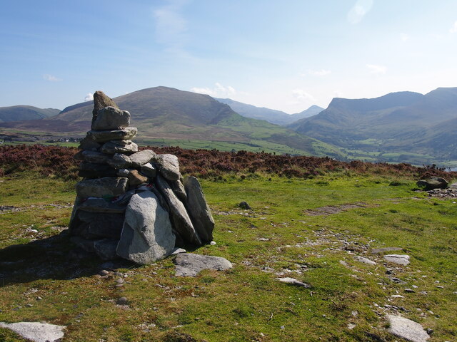
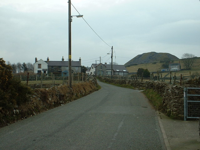
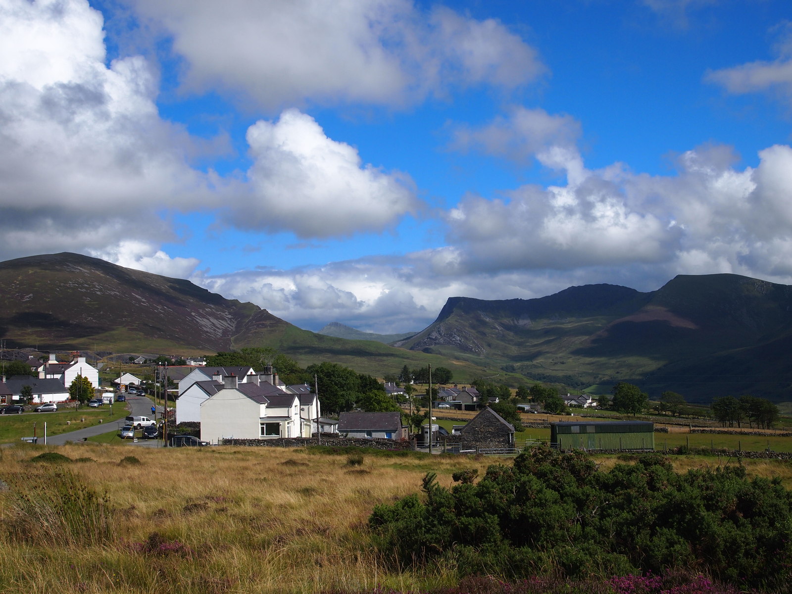
The village is nestled amidst rolling hills and lush green fields, with breathtaking views of the nearby mountains. It is renowned for its idyllic charm and traditional Welsh character, attracting visitors looking to escape the hustle and bustle of city life.

Carmel is a close-knit community with a population of around 500 residents. The village is centered around a small square, which is adorned with quaint stone cottages and a charming church. The church, St. John's, is a notable historical landmark and serves as a focal point for religious and community gatherings.

While Carmel may be small in size, it boasts several amenities to cater to both locals and visitors. These include a village hall, a primary school, a post office, and a pub. The village hall regularly hosts events and activities, fostering a sense of community spirit among the residents.

For outdoor enthusiasts, Carmel offers plenty of opportunities for exploring the surrounding countryside. The nearby Snowdonia National Park is a haven for hikers, with its diverse trails catering to all levels of experience. Additionally, the village is within close proximity to the picturesque coastline, allowing visitors to enjoy scenic walks along the sandy beaches.

In conclusion, Carmel is a charming village in Caernarfonshire, Wales, known for its natural beauty, close-knit community, and tranquil ambiance. It is a perfect destination for those seeking a peaceful retreat in the heart of the Welsh countryside.

If you have any feedback on the listing, please let us know in the comments section below.

Carmel Images

Images are sourced within 2km of 53.073422/-4.250824 or Grid Reference SH4955. Thanks to Geograph Open Source API. All images are credited.

Hen gronfa ddwr / A former reservoir I'm not sure whether the reservoir provided water for the Bryngwyn branch of the Welsh Highland Railway, or was purely domestic.
Hen gronfa ddwr / A former reservoir
I'm not sure whether the reservoir provided water for the Bryngwyn branch of the Welsh Highland Railway, or was purely domestic.
Cairn, Pen y Cilgwyn
Cairn on Mynydd Cilgwyn
Caernarvon Fundamental Benchmark FBM easily found after longish walk in from the north with Alex Cameron. It was harder to find and follow the footpaths than find the FBM.
Caernarvon Fundamental Benchmark
FBM easily found after longish walk in from the north with Alex Cameron. It was harder to find and follow the footpaths than find the FBM.
Footpath Starts Well Our footpath started well on our route from the north towards the Caernarvon Fundamental Benchmark however we were soon in trouble when it became badly overgrown and a detour was required. It all looked so easy on the map.
Footpath Starts Well
Our footpath started well on our route from the north towards the Caernarvon Fundamental Benchmark however we were soon in trouble when it became badly overgrown and a detour was required. It all looked so easy on the map.
Bryngwyn tramway Part of the tramway linking the Cilgwyn Quarries to the Bryngwyn branch of the North Wales Narrow Gauge Railway, now a popular path leading onto and across the common. Some idea of the extent and proximity of the workings of Cilgwyn and Pen yr Orsedd quarries can be gained. There is a heritage explanation board at the entry to this patch of enclosed plots at the foot of the common.
Bryngwyn tramway
Part of the tramway linking the Cilgwyn Quarries to the Bryngwyn branch of the North Wales Narrow Gauge Railway, now a popular path leading onto and across the common. Some idea of the extent and proximity of the workings of Cilgwyn and Pen yr Orsedd quarries can be gained. There is a heritage explanation board at the entry to this patch of enclosed plots at the foot of the common.
The Remains of St Thomas's Church, Groeslon Built in the mid nineteenth century and now demolished.
The Remains of St Thomas's Church, Groeslon
Built in the mid nineteenth century and now demolished.
Footpath South Of Cefnen
Hillside at Cilgwyn Almost a pleasant rural scene looking into the Nantlle valley, but there's also a glimpse of old quarry workings further down the hillside.
Hillside at Cilgwyn
Almost a pleasant rural scene looking into the Nantlle valley, but there's also a glimpse of old quarry workings further down the hillside.
The TCB needs some TLC A rather shabby looking telephone call box at Cilgwyn. Photographed by another contributor some 9 years previously and most likely not seen paint since.
The TCB needs some TLC
A rather shabby looking telephone call box at Cilgwyn. Photographed by another contributor some 9 years previously and most likely not seen paint since.
Tin roofed shack, Cilgwyn The chimney at the left hand end would suggest that this might once have been a quarryman's cottage.
Tin roofed shack, Cilgwyn
The chimney at the left hand end would suggest that this might once have been a quarryman's cottage.
Hazy afternoon at Cilgwyn Looking downhill from the lower slopes of Mynydd y Cligwyn towards the distant coast where two of the Yr Eifl group can be seen.
Hazy afternoon at Cilgwyn
Looking downhill from the lower slopes of Mynydd y Cligwyn towards the distant coast where two of the Yr Eifl group can be seen.
Capel Gosen - for sale The former chapel, built in 1899, is for sale to be refurbished or knocked down and redeveloped.
Capel Gosen - for sale
The former chapel, built in 1899, is for sale to be refurbished or knocked down and redeveloped.
House of John Gwilym Jones, dramatist This house next to Gosen Chapel in Groeslon, is the former house of John Gwilym Jones, (1904–1988) celebrated Welsh dramatist and lecturer. There is a slate plaque on the front of the house.
House of John Gwilym Jones, dramatist
This house next to Gosen Chapel in Groeslon, is the former house of John Gwilym Jones, (1904–1988) celebrated Welsh dramatist and lecturer. There is a slate plaque on the front of the house.
Brynrhos Chapel and Schoolroom Brynrhos was a Congregational chapel which has now been converted into a house.
Brynrhos Chapel and Schoolroom
Brynrhos was a Congregational chapel which has now been converted into a house.
View north from Groeslon Looking north, the Menai Straits are seen clearly, and Anglesey beyond
View north from Groeslon
Looking north, the Menai Straits are seen clearly, and Anglesey beyond
Former primary school at Groeslon Converted into housing, the children now go to Ysgol Bro Llifon, a new school nearer the centre of the village
Former primary school at Groeslon
Converted into housing, the children now go to Ysgol Bro Llifon, a new school nearer the centre of the village
Groeslon Penfforddhelen Water Pumping Station
Show me another place!

Carmel is located at Grid Ref: SH4955 (Lat: 53.073422, Lng: -4.250824)

Unitary Authority: Gwynedd

Police Authority: North Wales

What 3 Words

///jogging.noticing.decently. Near Talysarn, Gwynedd

Nearby Locations

Carmel

Related Wikis

Carmel, Gwynedd

Carmel is a small village near Y Fron in Gwynedd, north-west Wales. The village is built up mainly of Victorian homes, with a more modern area. The village...

Bryngwyn railway station

Bryngwyn railway station is a former station which was the terminus for passengers on the Bryngwyn Branch of the North Wales Narrow Gauge Railways, and...

Y Fron

Y Fron, also known locally as Cesarea, after the chapel, is a country village on the south-west side of Moel Tryfan, overlooking the Nantlle Valley, in...

Ysgol Bronyfoel

Ysgol Bronyfoel was a Welsh daily co-educational primary school. The school was situated in the centre of the village Y Fron, Gwynedd, North Wales. It...

Nearby Amenities

Located within 500m of 53.073422,-4.250824
Traffic Calming: yes
Lat/Long: 53.0719805/-4.2490195
Power: tower
Source: Bing
Lat/Long: 53.0761544/-4.2508084
Power: tower
Source: Bing
Lat/Long: 53.0712526/-4.2550997
Power: tower
Source: Bing
Lat/Long: 53.0739117/-4.2527876
Power: pole
Lat/Long: 53.0756391/-4.2493942
Power: pole
Lat/Long: 53.0760677/-4.2487076
Power: pole
Lat/Long: 53.0768109/-4.2482245
Power: pole
Lat/Long: 53.0747431/-4.2501534
Power: pole
Lat/Long: 53.0738729/-4.2507274
Power: pole
Lat/Long: 53.0730221/-4.2513282
Power: pole
Lat/Long: 53.0770312/-4.2469723
Power: pole
Lat/Long: 53.0765575/-4.2477608
Power: pole
Lat/Long: 53.0760161/-4.2486513
Power: pole
Lat/Long: 53.0717651/-4.2508239
Power: pole
Lat/Long: 53.0706061/-4.2502953
Power: pole
Lat/Long: 53.0713203/-4.2505986
Power: pole
Lat/Long: 53.0698669/-4.2499764
Power: pole
Lat/Long: 53.0761611/-4.2494454
Traffic Calming: yes
Lat/Long: 53.070319/-4.2502614
Traffic Calming: yes
Lat/Long: 53.0709033/-4.2497752
Traffic Calming: yes
Lat/Long: 53.0692811/-4.2513516
Power: pole
Lat/Long: 53.0774211/-4.248866
Power: pole
Lat/Long: 53.0749927/-4.2486998
Power: pole
Lat/Long: 53.0749218/-4.2472139
Power: pole
Lat/Long: 53.074954/-4.2464494
Power: pole
Lat/Long: 53.073471/-4.2434865
Power: pole
Lat/Long: 53.0736416/-4.2439837
Power: pole
Lat/Long: 53.0739323/-4.2448515
Power: pole
Lat/Long: 53.0741009/-4.2460275
Power: pole
Lat/Long: 53.0742105/-4.246803
Power: pole
Lat/Long: 53.074582/-4.24771
Power: pole
Lat/Long: 53.0755324/-4.2494257
Direction: 215
Generator Method: photovoltaic
Generator Output Electricity: yes
Generator Solar Modules: 15
Generator Source: solar
Generator Type: solar_photovoltaic_panel
Location: roof
Power: generator
Lat/Long: 53.0728417/-4.2484313
Direction: 125
Generator Method: photovoltaic
Generator Output Electricity: yes
Generator Solar Modules: 16
Generator Source: solar
Generator Type: solar_photovoltaic_panel
Location: roof
Power: generator
Lat/Long: 53.070924/-4.2511638
Entrance: yes
Lat/Long: 53.0731652/-4.24819
Defibrillator
Defibrillator Location: outside Carmel Village Hall
Emergency: defibrillator
Indoor: no
Lat/Long: 53.0731451/-4.2482111
Give Way
Direction: backward
Lat/Long: 53.0735298/-4.2474332
Give Way
Direction: backward
Lat/Long: 53.0735721/-4.2475253
The data included in this document is from www.openstreetmap.org. The data is made available under ODbL.

Have you been to Carmel?

Leave your review of Carmel below (or comments, questions and feedback).