Barhill Wood

Wood, Forest in Kirkcudbrightshire

Scotland

Barhill Wood

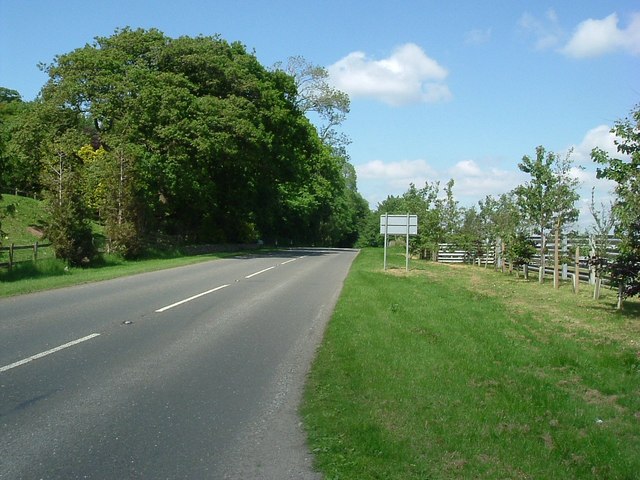
The back road to Tongland This road runs parallel to the River Dee, but maintains some distance from it.
The back road to Tongland Credit: Gordon Hatton

The requested URL returned error: 429 Too Many Requests

If you have any feedback on the listing, please let us know in the comments section below.

Barhill Wood Images

Images are sourced within 2km of 54.882671/-3.9985795 or Grid Reference NX7156. Thanks to Geograph Open Source API. All images are credited.

The back road to Tongland This road runs parallel to the River Dee, but maintains some distance from it.
The back road to Tongland
This road runs parallel to the River Dee, but maintains some distance from it.
Cattle near Netherthird Occupying a field in the NW corner of the grid square.
Cattle near Netherthird
Occupying a field in the NW corner of the grid square.
The road to Castle Douglas This is the minor road linking Tongland and Castle Douglas. Anyone in a hurry would be well advised to use the A711 on the other side of the Dee.
The road to Castle Douglas
This is the minor road linking Tongland and Castle Douglas. Anyone in a hurry would be well advised to use the A711 on the other side of the Dee.
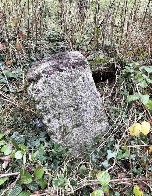
Old Milestone, Kirkcudbright parish Square-shaped granite stone by the A711, in the parish of Kirkcudbright (Stewartry District). It may have been set up by the Tongland Trust.

Inscription reads:-
3

Milestone Society National ID: DG_DFKK24
Old Milestone, Kirkcudbright parish
Square-shaped granite stone by the A711, in the parish of Kirkcudbright (Stewartry District). It may have been set up by the Tongland Trust. Inscription reads:- 3 Milestone Society National ID: DG_DFKK24
Old Milestone, Kirkcudbright parish Square-shaped granite stone by the A711, in the parish of Kirkcudbright (Stewartry District). It may have been set up by the Tongland Trust. 

Inscription reads:-
3

Milestone Society National ID: DG_DFKK24
Old Milestone, Kirkcudbright parish
Square-shaped granite stone by the A711, in the parish of Kirkcudbright (Stewartry District). It may have been set up by the Tongland Trust. Inscription reads:- 3 Milestone Society National ID: DG_DFKK24
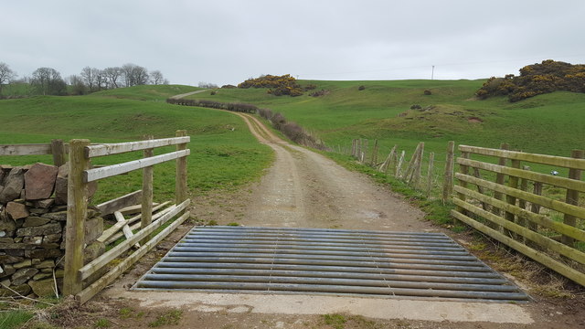
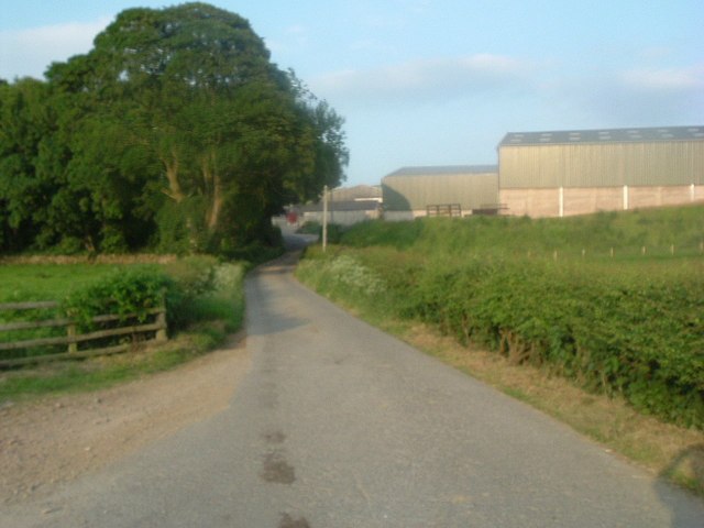
Track to Netherthird Farm The beginning of the long drive to Netherthird Farm.
Track to Netherthird Farm
The beginning of the long drive to Netherthird Farm.
Above Tongland Loch The open countryside to the east of Tongland Loch.
Above Tongland Loch
The open countryside to the east of Tongland Loch.
Netherthird Farm A track leads to open farmland at Netherthird Farm.
Netherthird Farm
A track leads to open farmland at Netherthird Farm.
Farmland near to Mayfield The track marks the edge of the field boundary and continues to the River Dee.
Farmland near to Mayfield
The track marks the edge of the field boundary and continues to the River Dee.
From Billies Bridge to Billies Farm The beginning of the track to Billies Farm.
From Billies Bridge to Billies Farm
The beginning of the track to Billies Farm.
The road at Mayfield The entrance to Mayfield farm is to the right from the main road.
The road at Mayfield
The entrance to Mayfield farm is to the right from the main road.
Near to Barstibly A lay-by on the A711 south of Barstibly.
Near to Barstibly
A lay-by on the A711 south of Barstibly.
Road to Barstibly
Road to Barstibly
A shady spot Off the A711.
A shady spot
Off the A711.
A711 northbound Looking northeast.
A711 northbound
Looking northeast.
Cattle pen
Cattle pen
Looking southwest at Billies farm
Billies farm
Billies farm
Show me another place!

Barhill Wood is located at Grid Ref: NX7156 (Lat: 54.882671, Lng: -3.9985795)

Unitary Authority: Dumfries and Galloway

Police Authority: Dumfries and Galloway

What 3 Words

///apron.focal.chucked. Near Kirkcudbright, Dumfries & Galloway

Nearby Locations

Barhill Wood

Related Wikis

Tongland

Tongland is a small village about 2 miles (3 km) north of Kirkcudbright, in the historic county of Kirkcudbrightshire in Dumfries and Galloway, Scotland...

Tongland Abbey

Tungland or Tongland Abbey was a Premonstratensian monastic community located in Tongland in the historical county of Kirkcudbrightshire in Dumfries and...

Tarff railway station

Tarff railway station served the village of Ringford, Dumfries and Galloway, Scotland from 1864 to 1965 on the Kirkcudbright Railway. == History == The...

Ringford

Ringford is a village in the historical county of Kirkcudbrightshire in Dumfries and Galloway located at grid reference NX689578 beside the Tarff Water...

Nearby Amenities

Located within 500m of 54.882671,-3.9985795
Power: pole
Lat/Long: 54.8866003/-3.9967874
Power: pole
Lat/Long: 54.8858304/-3.9973801
Power: pole
Lat/Long: 54.8851407/-3.9980668
Power: pole
Lat/Long: 54.8844696/-3.9987239
Power: pole
Lat/Long: 54.8837846/-3.9994588
Power: pole
Lat/Long: 54.8831365/-4.0001482
Power: pole
Lat/Long: 54.8824869/-4.0008563
Power: pole
Lat/Long: 54.8818281/-4.0015563
Power: pole
Lat/Long: 54.8811831/-4.0022161
Power: pole
Lat/Long: 54.880542/-4.0029189
Power: pole
Lat/Long: 54.8799186/-4.0035894
The data included in this document is from www.openstreetmap.org. The data is made available under ODbL.

Have you been to Barhill Wood?

Leave your review of Barhill Wood below (or comments, questions and feedback).