Black Wood
Wood, Forest in Kirkcudbrightshire
Scotland
Black Wood
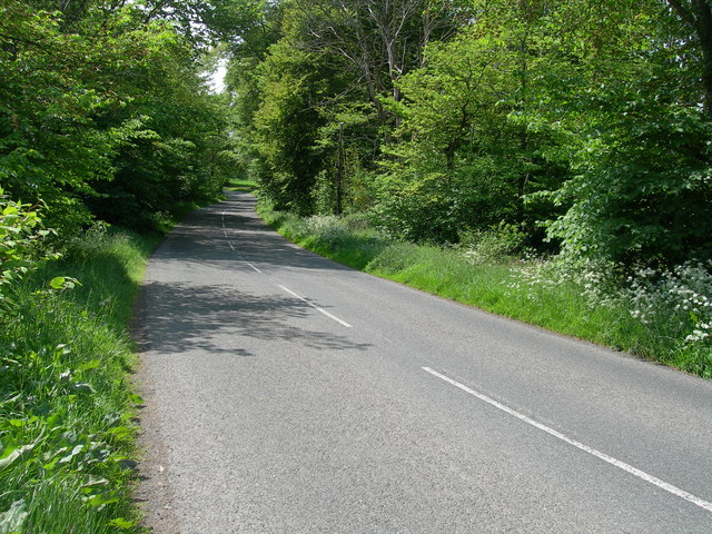
Black Wood is a picturesque forest located in the region of Kirkcudbrightshire, Scotland. Stretching over an area of approximately 200 acres, this woodland is a popular destination for nature enthusiasts and outdoor adventurers alike.
The forest is characterized by its dense vegetation, dominated by tall, majestic trees such as oak, beech, and pine. These towering giants create a canopy that provides shade and shelter for a diverse array of flora and fauna. Moss-covered boulders and fallen logs further enhance the natural beauty of the wood.
Black Wood is home to a variety of wildlife, including red squirrels, roe deer, and numerous species of birds. Birdwatchers flock to this woodland to catch a glimpse of the elusive woodpeckers, owls, and buzzards that inhabit the area. The forest is also known for its vibrant display of wildflowers during the spring and summer months.
Visitors can explore the forest by following the well-maintained walking trails that wind through the woodland. These paths offer breathtaking views of the surrounding countryside and allow visitors to immerse themselves in the tranquility of nature. Additionally, there are designated areas for picnicking and camping, making it an ideal spot for a family outing or a weekend getaway.
Black Wood, with its stunning natural beauty and abundant wildlife, provides a peaceful and rejuvenating experience for all who venture into its depths. Whether hiking, birdwatching, or simply enjoying a leisurely stroll, this woodland offers a unique opportunity to connect with nature in the heart of Kirkcudbrightshire.
If you have any feedback on the listing, please let us know in the comments section below.
Black Wood Images
Images are sourced within 2km of 54.946367/-4.0064241 or Grid Reference NX7163. Thanks to Geograph Open Source API. All images are credited.
Black Wood is located at Grid Ref: NX7163 (Lat: 54.946367, Lng: -4.0064241)
Unitary Authority: Dumfries and Galloway
Police Authority: Dumfries and Galloway
What 3 Words
///hears.threading.flops. Near Castle Douglas, Dumfries & Galloway
Nearby Locations
Related Wikis
Glenlochar
Glenlochar (Gd: Gleann Lochair) is a hamlet on the western bank of the River Dee in the parish of Balmaghie in the historical county of Kirkcudbrightshire...
Abbey Yard
Abbey Yard is a location in Dumfries and Galloway, Scotland. Abbey Yard is near Glenlochar in the historical county of Kirkcudbrightshire in the Dumfries...
Threave Castle
Threave Castle is situated on an island in the River Dee, 2.5 kilometres (1.6 mi) west of Castle Douglas in the historical county of Kirkcudbrightshire...
Balmaghie
Balmaghie ( bal-mə-GEE), from the Scottish Gaelic Baile Mhic Aoidh, is an ecclesiastical and civil parish in the historical county of Kirkcudbrightshire...
Nearby Amenities
Located within 500m of 54.946367,-4.0064241Have you been to Black Wood?
Leave your review of Black Wood below (or comments, questions and feedback).


