Burnbank Wood

Wood, Forest in Perthshire

Scotland

Burnbank Wood

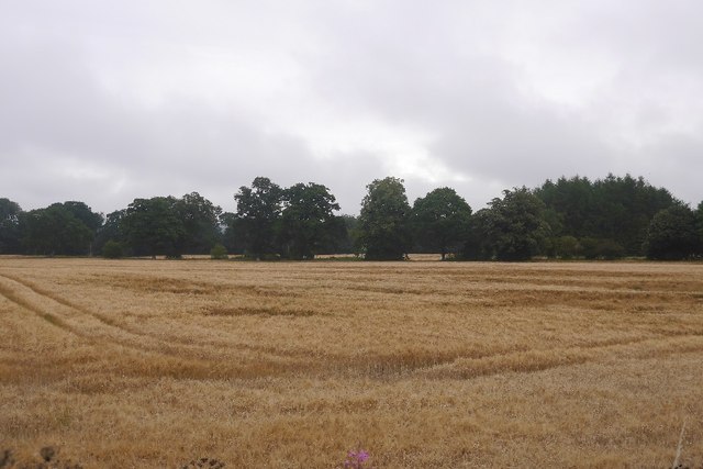
A ploughed field, Upper Spittleton
A ploughed field, Upper Spittleton Credit: Richard Webb

The requested URL returned error: 429 Too Many Requests

If you have any feedback on the listing, please let us know in the comments section below.

Burnbank Wood Images

Images are sourced within 2km of 56.163743/-4.0712939 or Grid Reference NS7198. Thanks to Geograph Open Source API. All images are credited.
A ploughed field, Upper Spittleton
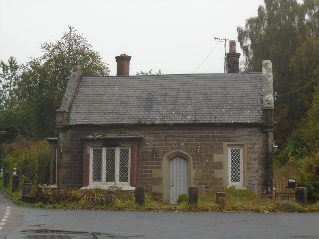
Former tollhouse On the A84 south of Doune at the B826 junction is this former tollhouse known as Loch-Hills Wood which may date from about 1825.  On the OS 1st Edition it is noted that there is a 'weighing machine'.  In 2009 it was lived in and well-cared for.   By 2021 it was empty and deteriorating.   However it is to be renovated, hopefully, in 2022.   It is B Listed LB8412 and its Canmore reference is 363352.
Former tollhouse
On the A84 south of Doune at the B826 junction is this former tollhouse known as Loch-Hills Wood which may date from about 1825. On the OS 1st Edition it is noted that there is a 'weighing machine'. In 2009 it was lived in and well-cared for. By 2021 it was empty and deteriorating. However it is to be renovated, hopefully, in 2022. It is B Listed LB8412 and its Canmore reference is 363352.
A84 towards Doune
A84 towards Doune
Farmland, Upper Spittalton Looking north from the A873.
Farmland, Upper Spittalton
Looking north from the A873.
Upper Spittalton Set in the rolling countryside that separates the Forth and Teith valleys.
Upper Spittalton
Set in the rolling countryside that separates the Forth and Teith valleys.
Coldoch Broch For full details see <span class="nowrap"><a title="http://www.megalithic.co.uk/article.php?sid=13348" rel="nofollow ugc noopener" href="http://www.megalithic.co.uk/article.php?sid=13348">Link</a><img style="margin-left:2px;" alt="External link" title="External link - shift click to open in new window" src="https://s1.geograph.org.uk/img/external.png" width="10" height="10"/></span>.
Coldoch Broch
For full details see LinkExternal link.
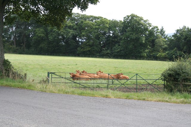
Cows sit in a field close by an ancient Broch Undisturbed by the ancient Broch, the cows lie together awaiting whatever cows wait patiently for. The field shown is south of the road and the Broch, if it were visible, would be in the trees on the far left of the picture behind the field.
Cows sit in a field close by an ancient Broch
Undisturbed by the ancient Broch, the cows lie together awaiting whatever cows wait patiently for. The field shown is south of the road and the Broch, if it were visible, would be in the trees on the far left of the picture behind the field.
View over Coldoch Broch looking South
Kilmadock Cemetery
Kilmadock Cemetery
Loch Watston White water-lilies at the southern end of the loch.
Loch Watston
White water-lilies at the southern end of the loch.
Yellow iris Growing in a damp field/woodland margin west of Loch Watston.
Yellow iris
Growing in a damp field/woodland margin west of Loch Watston.
Rosebay Willow Herb Fields off the A84 just before Doune
Rosebay Willow Herb
Fields off the A84 just before Doune
Beech stripwood A line of mature beeches beside a grass field above the Forth's carselands.
Beech stripwood
A line of mature beeches beside a grass field above the Forth's carselands.
Kilmadock Cemetery Well kept.
Kilmadock Cemetery
Well kept.
Flat field of stubble On Meldrum Farm.
Flat field of stubble
On Meldrum Farm.
Arable land, Meldrum Near Doune.
Arable land, Meldrum
Near Doune.
Former tollhouse Surveyed by the Milestone Society.  On Meldrum Road, Doune at the junction with the B8026 is this property named The Lodge.  Although it may have been a lodge for an estate it is in the prime position to be used as a tollhouse especially with the side bay facing on to the main road.
Former tollhouse
Surveyed by the Milestone Society. On Meldrum Road, Doune at the junction with the B8026 is this property named The Lodge. Although it may have been a lodge for an estate it is in the prime position to be used as a tollhouse especially with the side bay facing on to the main road.
Old Milestone, A84, Meldrum Located on the East side of road. Cast iron post, Stirling GM design. 

Lost since last survey. 

Milestone Society National ID: ST_STCA07
Old Milestone, A84, Meldrum
Located on the East side of road. Cast iron post, Stirling GM design. Lost since last survey. Milestone Society National ID: ST_STCA07
Show me another place!

Burnbank Wood is located at Grid Ref: NS7198 (Lat: 56.163743, Lng: -4.0712939)

Unitary Authority: Stirling

Police Authority: Forth Valley

What 3 Words

///trails.overruns.delved. Near Doune, Stirling

Nearby Locations

Burnbank Wood

Related Wikis

Menteith

Menteith or Monteith (Scottish Gaelic: Mòine Tèadhaich), a district of south Perthshire, Scotland, roughly comprises the territory between the Teith and...

Stirling torcs

The Stirling torcs make up a hoard of four gold Iron Age torcs, a type of necklace, all of which date to between 300 and 100 BC and which were buried deliberately...

Kincardine-in-Menteith

Kincardine is a civil parish in the Scottish council area of Stirling and the former county of Perthshire in the historic district of Menteith. It lies...

Blair Drummond

Blair Drummond is a small rural community 5 miles (8 kilometres) northwest of Stirling in the Stirling district of Scotland, predominantly located along...

Nearby Amenities

Located within 500m of 56.163743,-4.0712939
Bus Stop
Bus: yes
Public Transport: platform
Shelter: yes
Source: survey
Lat/Long: 56.1661609/-4.064791
Kincardine-in-Menteith
Name Gd: Cinn Chàrdainn
Place: locality
Lat/Long: 56.1647807/-4.0643868
Power: pole
Lat/Long: 56.1609003/-4.0651567
Power: pole
Lat/Long: 56.1608468/-4.066282
Power: pole
Lat/Long: 56.1607862/-4.0673425
The data included in this document is from www.openstreetmap.org. The data is made available under ODbL.

Have you been to Burnbank Wood?

Leave your review of Burnbank Wood below (or comments, questions and feedback).