Carlops

Settlement in Peeblesshire

Scotland

Carlops

Carlops Drinking Fountain A fine example of a mid 19th century well and drinking fountain, notable for its well-detailed carving with distinctive curved alcove flanked by swept, coped walls surmounted by finials. Prominently located beside the road, the structure adds considerably to the interest of the village streetscape. The structure was donated by the Browns of nearby Newhall House which is located nearby in Penicuik Parish.
Carlops Drinking Fountain Credit: Colin Kinnear

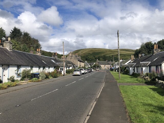
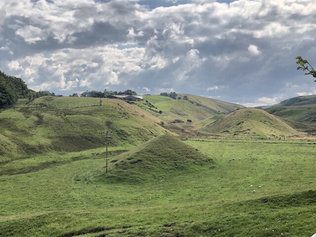
Carlops is a small village located in the Peeblesshire region of Scotland. Situated approximately 15 miles southwest of Edinburgh, it lies within the picturesque Pentland Hills, offering stunning views and a tranquil setting. With a population of around 500 residents, Carlops boasts a close-knit community and a peaceful rural atmosphere.

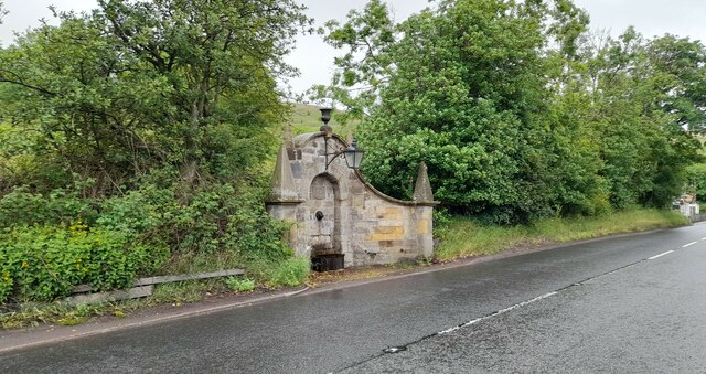
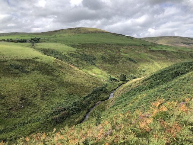
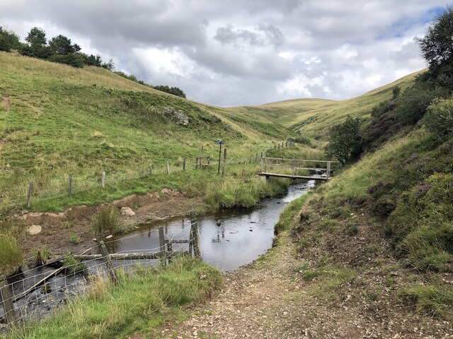
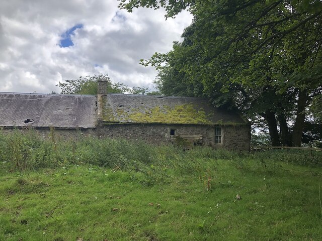
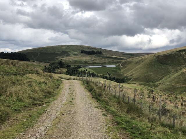
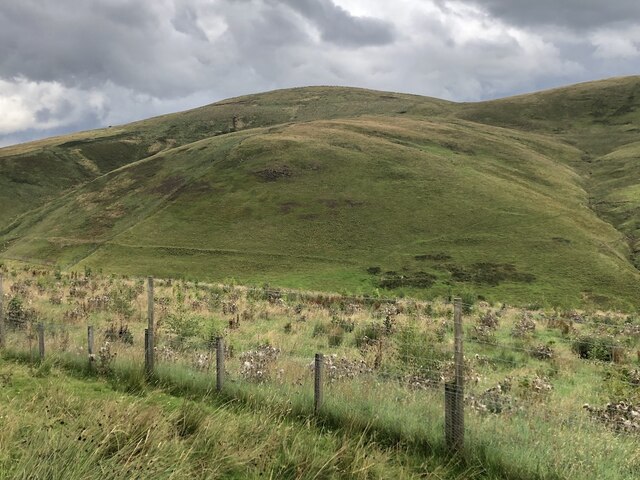
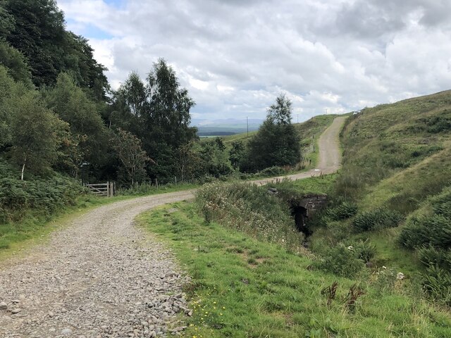
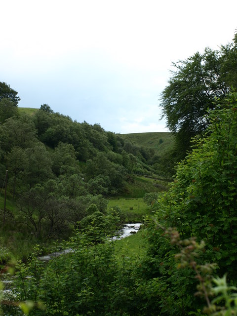
The village is known for its charming stone-built cottages and traditional architecture, providing visitors with a glimpse into Scotland's rich cultural heritage. Surrounded by rolling hills and lush green landscapes, Carlops is a haven for nature lovers and outdoor enthusiasts. The nearby Pentland Hills Regional Park offers numerous walking trails, cycling routes, and opportunities for wildlife spotting, making it a popular destination for hikers and nature enthusiasts.

Despite its small size, Carlops has a vibrant community spirit. The village hosts various events throughout the year, including a summer fair and a Christmas market, bringing residents and visitors together in celebration. The community also has a local pub, The Allan Ramsay, named after the acclaimed Scottish poet who was born in the nearby village of Leadhills.

Although Carlops is predominantly a residential area, it is conveniently located within easy reach of larger towns and cities. The city of Edinburgh is just a short drive away, offering a wide range of amenities, cultural attractions, and employment opportunities. Overall, Carlops offers a peaceful and idyllic retreat for those seeking a quieter way of life amidst the beautiful Scottish countryside.

If you have any feedback on the listing, please let us know in the comments section below.
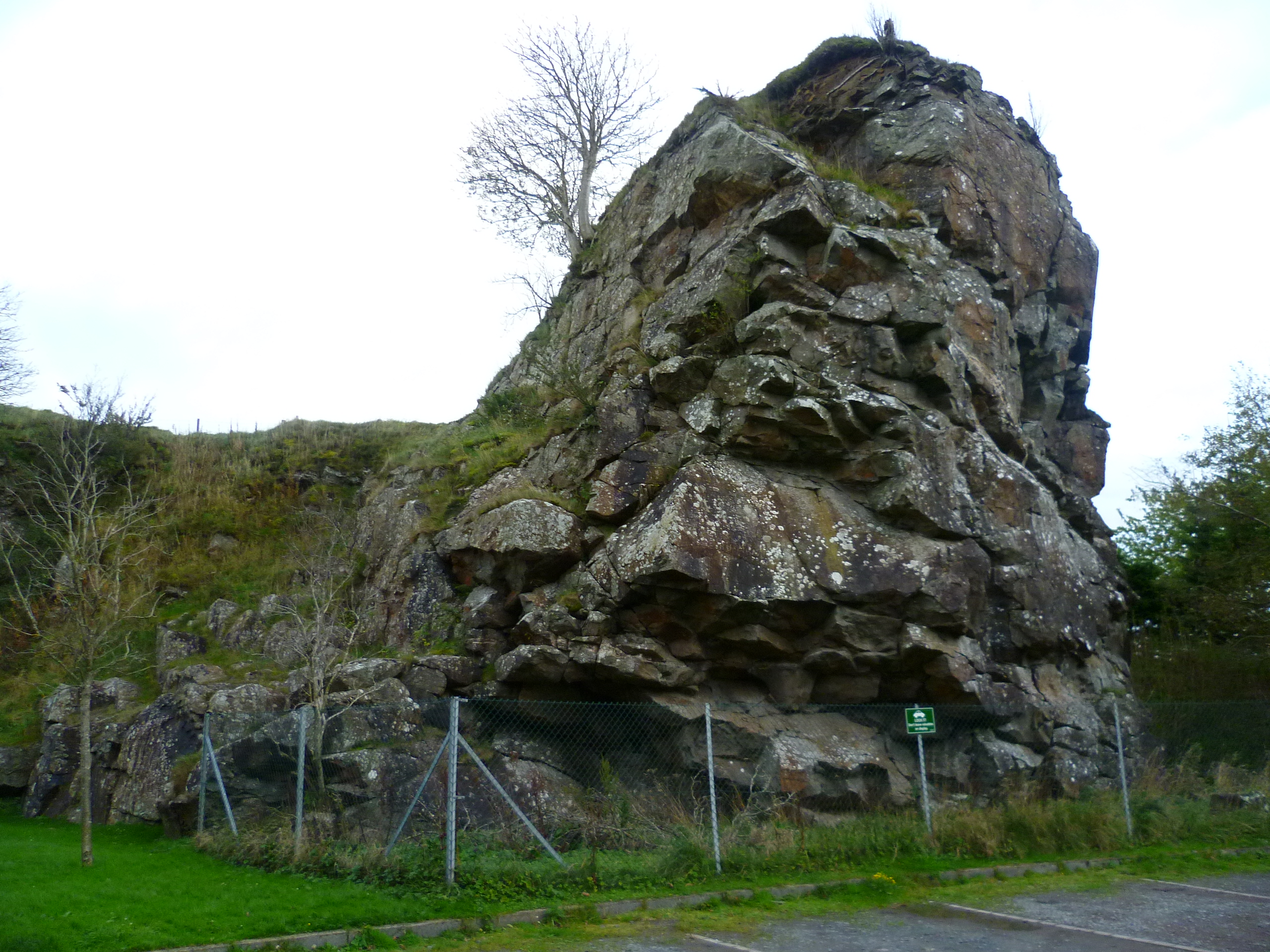
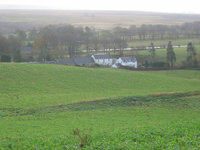
Carlops Images

Images are sourced within 2km of 55.787806/-3.3374725 or Grid Reference NT1655. Thanks to Geograph Open Source API. All images are credited.

Carlops Drinking Fountain A fine example of a mid 19th century well and drinking fountain, notable for its well-detailed carving with distinctive curved alcove flanked by swept, coped walls surmounted by finials. Prominently located beside the road, the structure adds considerably to the interest of the village streetscape. The structure was donated by the Browns of nearby Newhall House which is located nearby in Penicuik Parish.
Carlops Drinking Fountain
A fine example of a mid 19th century well and drinking fountain, notable for its well-detailed carving with distinctive curved alcove flanked by swept, coped walls surmounted by finials. Prominently located beside the road, the structure adds considerably to the interest of the village streetscape. The structure was donated by the Browns of nearby Newhall House which is located nearby in Penicuik Parish.
A702, Carlops View through the village to the now closed Alan Ramsay.
A702, Carlops
View through the village to the now closed Alan Ramsay.
North Esk, upstream of Carlops Deep cut glen leaving the Pentland Hills.
North Esk, upstream of Carlops
Deep cut glen leaving the Pentland Hills.
Bridge below Fairliehope Connects a path from the road to the North Esk Reservoir with paths on the Midlothian side of the burn. Cattle drink in the foreground.
Bridge below Fairliehope
Connects a path from the road to the North Esk Reservoir with paths on the Midlothian side of the burn. Cattle drink in the foreground.
Steadings, Fairliehope
Red Angus cattle, Fairliehope
Road to the North Esk Reservoir Rounding Fairliehope Hill
Road to the North Esk Reservoir
Rounding Fairliehope Hill
Young trees,  Fairleehope Hill There are numerous small young plantations in the upper North Esk catchment.
Young trees, Fairleehope Hill
There are numerous small young plantations in the upper North Esk catchment.
Bridge over the Fairliehope Burn A path for the north end of Carlops leaves here while an easier route on the road comes out at the southern end of the village by the carpark.
Bridge over the Fairliehope Burn
A path for the north end of Carlops leaves here while an easier route on the road comes out at the southern end of the village by the carpark.
Windy Gowl A spectacular sub glacial meltwater valley.  The water was probably routed by the nearby Pentland fault and high ground. Similar features are found near the Southern Upland Boundary fault at Lothian Edge <a href="https://www.geograph.org.uk/photo/163436">NT6471 : Below Lothian Edge</a>.
Windy Gowl
A spectacular sub glacial meltwater valley. The water was probably routed by the nearby Pentland fault and high ground. Similar features are found near the Southern Upland Boundary fault at Lothian Edge NT6471 : Below Lothian Edge.
Old milestone Spotted in the ditch on the north west side of the A702 is this mostly hidden and defaced sandstone milestone.  It is 100m southwest of the B&B sign for Peggyslea.   It is 12 miles from Edinburgh.   There is a benchmark and pin on the top.
Old milestone
Spotted in the ditch on the north west side of the A702 is this mostly hidden and defaced sandstone milestone. It is 100m southwest of the B&B sign for Peggyslea. It is 12 miles from Edinburgh. There is a benchmark and pin on the top.
Old milestone The milestone on the northwest side of the A702 near Peggyslea, slightly dug out.   The 2 of the 12 (miles from Edinburgh) is defaced or eroded away.
Old milestone
The milestone on the northwest side of the A702 near Peggyslea, slightly dug out. The 2 of the 12 (miles from Edinburgh) is defaced or eroded away.
Old milestone A view of the back of the milestone in the ditch on the A702 near Peggyslea.    This shows the shape of the edges and the vertical broaching.   The sides have horizontal broaching.
Old milestone
A view of the back of the milestone in the ditch on the A702 near Peggyslea. This shows the shape of the edges and the vertical broaching. The sides have horizontal broaching.
Old milestone This shows the well-cut benchmark and metal pin in the top of the milestone on the A702 near Peggyslea.  It also shows the overall shape of the stone.
Old milestone
This shows the well-cut benchmark and metal pin in the top of the milestone on the A702 near Peggyslea. It also shows the overall shape of the stone.
Al look up the valley View along the river valley.
Al look up the valley
View along the river valley.
A big rock, Carlops
A big rock, Carlops
The Carlins Lowp at Carlops So called because local folklore tells of witches jumping (carlines loupin') from this rock to a rockface opposite to keep themselves amused; hence the name of the village.
The Carlins Lowp at Carlops
So called because local folklore tells of witches jumping (carlines loupin') from this rock to a rockface opposite to keep themselves amused; hence the name of the village.
The Carlins Lowp at Carlops
Show me another place!

Carlops is located at Grid Ref: NT1655 (Lat: 55.787806, Lng: -3.3374725)

Unitary Authority: The Scottish Borders

Police Authority: The Lothians and Scottish Borders

What 3 Words

///nudge.garden.dawn. Near West Linton, Scottish Borders

Nearby Locations

Carlops

Related Wikis

Carlops

Carlops (Scottish Gaelic: Leum na Caillich) is a small village in the Pentland Hills, within the Scottish Borders area of Scotland, close to the boundary...

Nine Mile Burn

Nine Mile Burn is a hamlet in Midlothian, Scotland, the last in Midlothian when heading south on the A702 road. It is located at the foot of the Pentland...

Pentland Hills

The Pentland Hills are a range of hills southwest of Edinburgh, Scotland. The range is around twenty miles (thirty kilometres) in length, and runs southwest...

Baddinsgill Reservoir

Baddinsgill Reservoir is a small reservoir in the Scottish Borders area of Scotland close to Carlops, West Linton, and the boundary with Midlothian. It...

Nearby Amenities

Located within 500m of 55.787806,-3.3374725
Carlops
Is In: Scotland, UK
Name Gd: Leum na Caillich
Name Sco: Carlin’s Lowp
Place: village
Population: 92
Start Date: 1784
Wikidata: Q5041644
Wikipedia: en:Carlops
Lat/Long: 55.790192/-3.339839
Bus Stop
Allan Ramsey Square
Bus: yes
Naptan AtcoCode: 6900182
Naptan Bearing: S
Naptan CommonName: Allan Ramsey Sq
Naptan Indicator: opp
Naptan Landmark: Allan Ramsey
Naptan NaptanCode: 72724963
Naptan Street: A702
Note: this seems to be a library rather than a bus stop
Public Transport: platform
Ref: 6900182
Shelter: yes
Source: NaPTAN
Lat/Long: 55.7904083/-3.3396125
Bus Stop
Allan Ramsey Square
Bench: yes
Bus: yes
Naptan AtcoCode: 6900934
Naptan Bearing: N
Naptan CommonName: Allan Ramsey Sq
Naptan Indicator: adj
Naptan Landmark: Allan Ramsey
Naptan NaptanCode: 72726942
Naptan Street: A702
Public Transport: platform
Ref: 6900934
Shelter: yes
Source: NaPTAN
Lat/Long: 55.7901788/-3.3399142
Booth: K6
Covered: booth
Disused Amenity: telephone
Man Made: telephone_box
Note: phone has been removed
Source: survey
Lat/Long: 55.7904813/-3.3395801
Pub
Allan Ramsay Hotel
Addr Postcode: EH26 9NF
Addr Street: Allan Ramsay Square
Fhrs Id: 706573
Source: local_knowledge;Bing
Source Addr: FHRS Open Data
Tourism: hotel
Wikidata: Q17842322
Lat/Long: 55.7905665/-3.3399746
Post Box
Brand: Royal Mail
Brand Wikidata: Q638098
Collection Times: Mo-Fr 16:00; Sa 10:30
Operator: Royal Mail
Operator Wikidata: Q638098
Post Box Mounting: wooden_post
Post Box Type: lamp
Ref: EH26 166
Royal Cypher: scottish_crown
Source: survey
Lat/Long: 55.7904445/-3.3395991
Carlops Drinking Fountain
Drinking Water: yes
Natural: spring
Lat/Long: 55.7909982/-3.3394476
Barrier: stile
Foot: yes
Material: wood
Stile: stepover
Lat/Long: 55.791788/-3.3352634
Bench
Backrest: yes
Lat/Long: 55.7891449/-3.3387112
Recycling
Recycling Clothes: yes
Recycling Type: container
Lat/Long: 55.7888066/-3.3389997
Recycling
Recycling Glass: yes
Recycling Type: container
Lat/Long: 55.7888375/-3.3389768
Leisure: picnic_table
Lat/Long: 55.7884615/-3.3386745
Leisure: playground
Lat/Long: 55.7884701/-3.338531
Power: pole
Lat/Long: 55.7885908/-3.3306561
Power: pole
Lat/Long: 55.7885624/-3.331886
Power: pole
Lat/Long: 55.7885258/-3.3334712
Power: pole
Lat/Long: 55.7884921/-3.3350679
Power: pole
Lat/Long: 55.7884626/-3.3365375
Power: pole
Lat/Long: 55.7884164/-3.3378599
Power: pole
Lat/Long: 55.7884176/-3.3388712
Power: pole
Lat/Long: 55.7886026/-3.3319585
Power: pole
Lat/Long: 55.7890642/-3.332728
Power: pole
Lat/Long: 55.7895524/-3.333571
Power: pole
Lat/Long: 55.7900642/-3.3344414
Power: pole
Lat/Long: 55.7905607/-3.3353434
Power: pole
Lat/Long: 55.7904661/-3.3364765
Power: pole
Lat/Long: 55.7906339/-3.3369769
Power: pole
Lat/Long: 55.7910086/-3.3380975
Power: pole
Lat/Long: 55.7881942/-3.3437466
Power: pole
Lat/Long: 55.7874542/-3.3448651
Power: pole
Lat/Long: 55.7848937/-3.3380512
Power: pole
Lat/Long: 55.7852602/-3.3397184
Power: pole
Lat/Long: 55.7855877/-3.3412258
Power: pole
Lat/Long: 55.7854647/-3.3420184
Power: pole
Lat/Long: 55.7861184/-3.3420657
Power: pole
Lat/Long: 55.7870813/-3.3420825
Power: pole
Lat/Long: 55.7876717/-3.3433955
Power: pole
Lat/Long: 55.7886871/-3.3440872
Power: pole
Lat/Long: 55.7894401/-3.3446296
Location Transition: yes
Phases: 3
Power: pole
Transformer: distribution
Lat/Long: 55.7885444/-3.3394857
Entrance: main
Lat/Long: 55.789176/-3.3396007
Give Way
Direction: backward
Lat/Long: 55.7903386/-3.3398632
Give Way
Direction: backward
Lat/Long: 55.787075/-3.339609
Defibrillator
Defibrillator Location: outside Carlops Village Hall
Emergency: defibrillator
Indoor: no
Ref GB The Circuit: C1BE02DC-FC9E-4786-8A6A-AADA00EFCD7A
Lat/Long: 55.7888955/-3.3395486
The data included in this document is from www.openstreetmap.org. The data is made available under ODbL.

Have you been to Carlops?

Leave your review of Carlops below (or comments, questions and feedback).