Barhill Wood

Wood, Forest in Kirkcudbrightshire

Scotland

Barhill Wood

The A711 leaving Kirkcudbright
The A711 leaving Kirkcudbright Credit: habiloid

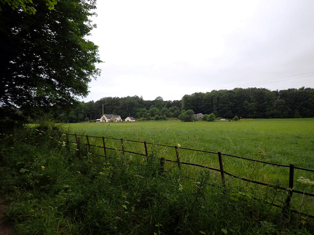
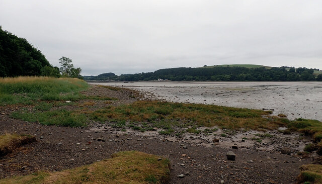
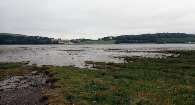
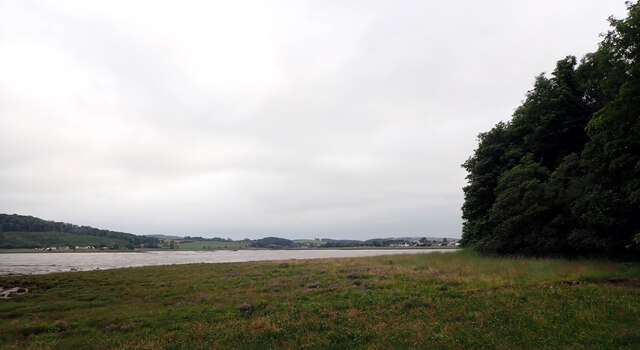
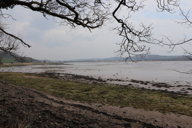
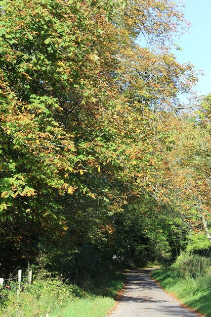
Barhill Wood is a charming woodland located in the county of Kirkcudbrightshire, Scotland. Nestled amidst the picturesque countryside, this forest covers an expansive area of land, offering visitors a tranquil and serene environment to explore and enjoy nature at its best.

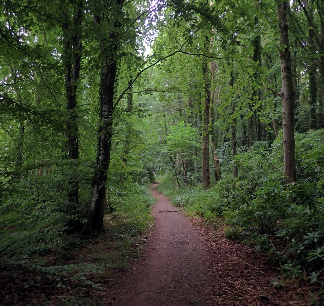
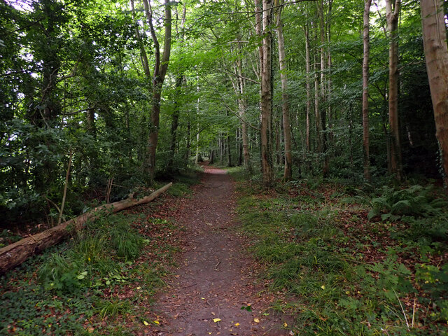
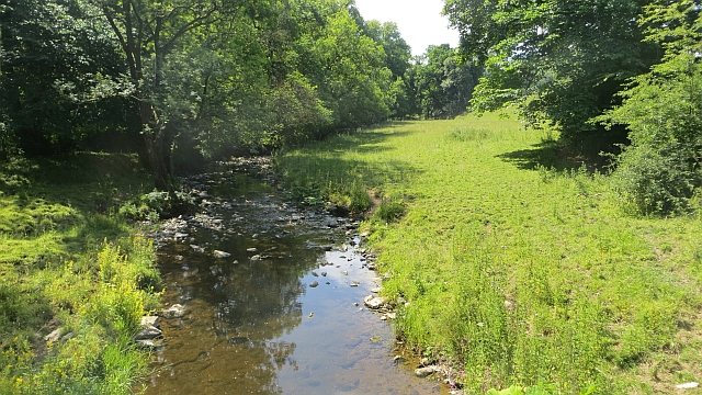
The wood is predominantly composed of native tree species, including oak, birch, and Scots pine, which create a diverse and vibrant ecosystem. The towering trees provide a canopy of shade, while the forest floor is carpeted with a rich layer of moss, ferns, and wildflowers, adding to the woodland's enchanting atmosphere.

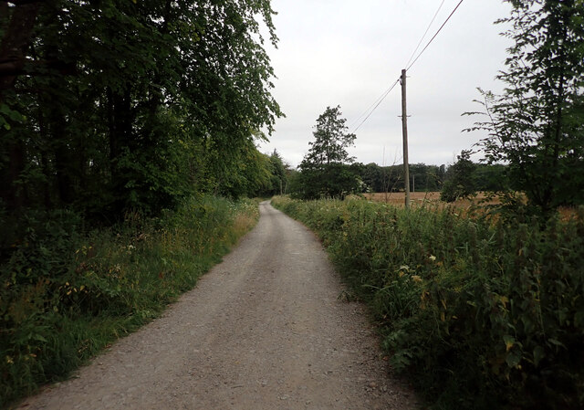
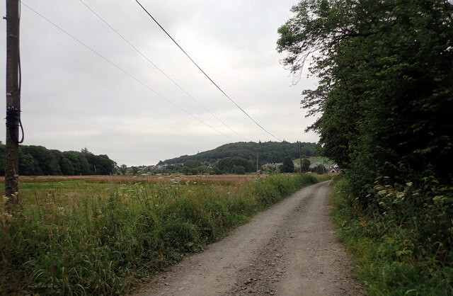
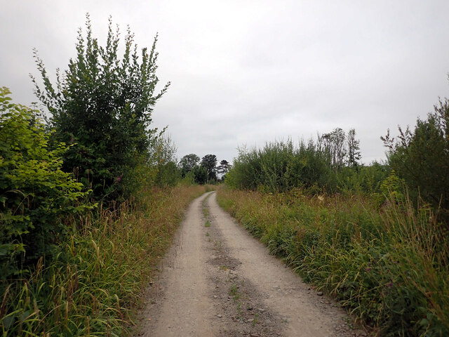
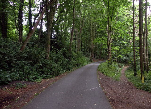
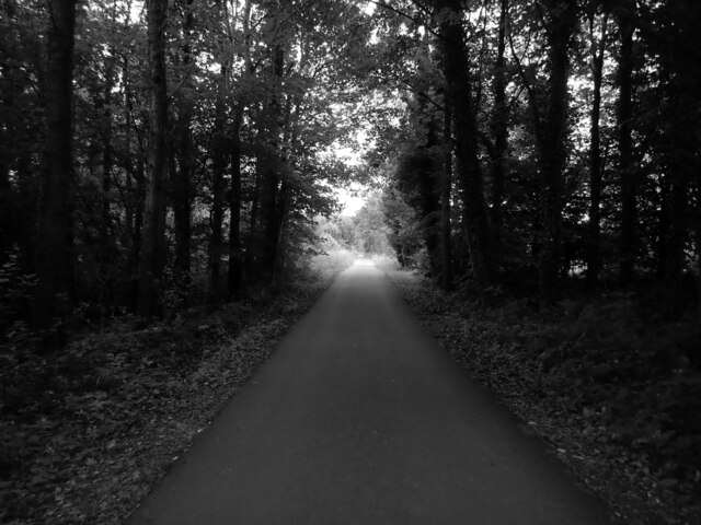
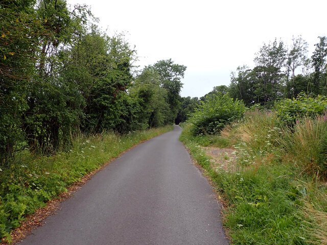
A network of well-maintained trails winds through the wood, allowing visitors to immerse themselves in its beauty. These paths range in difficulty, catering to both casual strollers and avid hikers alike. Along the way, visitors may encounter various wildlife species, such as red squirrels, deer, and a myriad of bird species, making Barhill Wood an excellent spot for wildlife enthusiasts and birdwatchers.

Barhill Wood is also home to a diverse range of flora, including rare and endangered species. The wood's management ensures the preservation of these plants, creating a haven for botanists and nature lovers interested in studying and appreciating the unique plant life.

The wood is easily accessible, with parking facilities available nearby. Whether you are seeking a peaceful walk in nature, a spot for a picnic, or a place to explore the rich biodiversity of Scotland, Barhill Wood is a destination that promises to captivate and leave a lasting impression on all who visit.

If you have any feedback on the listing, please let us know in the comments section below.
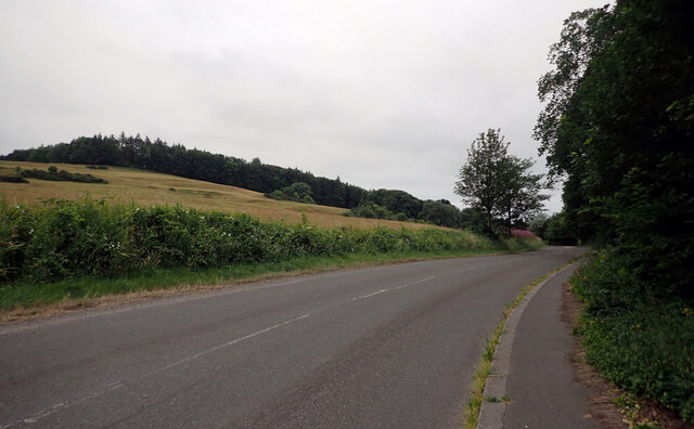
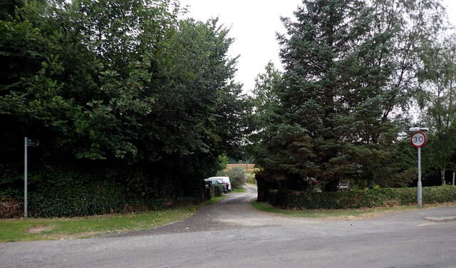
Barhill Wood Images

Images are sourced within 2km of 54.83226/-4.044792 or Grid Reference NX6850. Thanks to Geograph Open Source API. All images are credited.

The A711 leaving Kirkcudbright
A track to St. Mary's Isle leaving the A711, Kirkcudbright
Track, St. Mary's Isle, Kirkcudbright St Mary's Isle in a peninsula in the estuary of the River Dee to the south of Kirkcudbright. It lies between Manxman's Lake and Goat Well Bay. At low tide it is about 1.75km long and 550m wide at its widest. The tidal island of Inch lies to its south off Point of the Isle. There was an Augustinian Priory on the Isle between the 12th and 16th centuries; all traces of it were removed when the Earls of Selkirk landscaped the Isle in the 17th and 18th centuries.
Track, St. Mary's Isle, Kirkcudbright
St Mary's Isle in a peninsula in the estuary of the River Dee to the south of Kirkcudbright. It lies between Manxman's Lake and Goat Well Bay. At low tide it is about 1.75km long and 550m wide at its widest. The tidal island of Inch lies to its south off Point of the Isle. There was an Augustinian Priory on the Isle between the 12th and 16th centuries; all traces of it were removed when the Earls of Selkirk landscaped the Isle in the 17th and 18th centuries.
Cow Green, St. Mary's Isle, Kirkcudbright St Mary's Isle in a peninsula in the estuary of the River Dee to the south of Kirkcudbright. It lies between Manxman's Lake and Goat Well Bay. At low tide it is about 1.75km long and 550m wide at its widest. The tidal island of Inch lies to its south off Point of the Isle. There was an Augustinian Priory on the Isle between the 12th and 16th centuries; all traces of it were removed when the Earls of Selkirk landscaped the Isle in the 17th and 18th centuries.
Cow Green, St. Mary's Isle, Kirkcudbright
St Mary's Isle in a peninsula in the estuary of the River Dee to the south of Kirkcudbright. It lies between Manxman's Lake and Goat Well Bay. At low tide it is about 1.75km long and 550m wide at its widest. The tidal island of Inch lies to its south off Point of the Isle. There was an Augustinian Priory on the Isle between the 12th and 16th centuries; all traces of it were removed when the Earls of Selkirk landscaped the Isle in the 17th and 18th centuries.
Track, St. Mary's Isle, Kirkcudbright St Mary's Isle in a peninsula in the estuary of the River Dee to the south of Kirkcudbright. It lies between Manxman's Lake and Goat Well Bay. At low tide it is about 1.75km long and 550m wide at its widest. The tidal island of Inch lies to its south off Point of the Isle. There was an Augustinian Priory on the Isle between the 12th and 16th centuries; all traces of it were removed when the Earls of Selkirk landscaped the Isle in the 17th and 18th centuries.
Track, St. Mary's Isle, Kirkcudbright
St Mary's Isle in a peninsula in the estuary of the River Dee to the south of Kirkcudbright. It lies between Manxman's Lake and Goat Well Bay. At low tide it is about 1.75km long and 550m wide at its widest. The tidal island of Inch lies to its south off Point of the Isle. There was an Augustinian Priory on the Isle between the 12th and 16th centuries; all traces of it were removed when the Earls of Selkirk landscaped the Isle in the 17th and 18th centuries.
Manxman's Lake seen from St. Mary's Isle, Kirkcudbright St Mary's Isle in a peninsula in the estuary of the River Dee to the south of Kirkcudbright. It lies between Manxman's Lake and Goat Well Bay. At low tide it is about 1.75km long and 550m wide at its widest. The tidal island of Inch lies to its south off Point of the Isle. There was an Augustinian Priory on the Isle between the 12th and 16th centuries; all traces of it were removed when the Earls of Selkirk landscaped the Isle in the 17th and 18th centuries.
Manxman's Lake seen from St. Mary's Isle, Kirkcudbright
St Mary's Isle in a peninsula in the estuary of the River Dee to the south of Kirkcudbright. It lies between Manxman's Lake and Goat Well Bay. At low tide it is about 1.75km long and 550m wide at its widest. The tidal island of Inch lies to its south off Point of the Isle. There was an Augustinian Priory on the Isle between the 12th and 16th centuries; all traces of it were removed when the Earls of Selkirk landscaped the Isle in the 17th and 18th centuries.
Woodland path, St. Mary's Isle, Kirkcudbright St Mary's Isle in a peninsula in the estuary of the River Dee to the south of Kirkcudbright. It lies between Manxman's Lake and Goat Well Bay. At low tide it is about 1.75km long and 550m wide at its widest. The tidal island of Inch lies to its south off Point of the Isle. There was an Augustinian Priory on the Isle between the 12th and 16th centuries; all traces of it were removed when the Earls of Selkirk landscaped the Isle in the 17th and 18th centuries.
Woodland path, St. Mary's Isle, Kirkcudbright
St Mary's Isle in a peninsula in the estuary of the River Dee to the south of Kirkcudbright. It lies between Manxman's Lake and Goat Well Bay. At low tide it is about 1.75km long and 550m wide at its widest. The tidal island of Inch lies to its south off Point of the Isle. There was an Augustinian Priory on the Isle between the 12th and 16th centuries; all traces of it were removed when the Earls of Selkirk landscaped the Isle in the 17th and 18th centuries.
The Dee estuary seen from St. Mary's Isle, Kirkcudbright The River Dee, in south-west Scotland, flows from Loch Dee in the Galloway Hills. It passes through Clatteringshaws Loch and Loch Ken towards to Kirkcudbright, where there is a harbour on its banks. It ends at Kirkcudbright Bay where it flows into the Solway Firth. It is approximately 61km long.
The Dee estuary seen from St. Mary's Isle, Kirkcudbright
The River Dee, in south-west Scotland, flows from Loch Dee in the Galloway Hills. It passes through Clatteringshaws Loch and Loch Ken towards to Kirkcudbright, where there is a harbour on its banks. It ends at Kirkcudbright Bay where it flows into the Solway Firth. It is approximately 61km long.
Track, St. Mary's Isle, Kirkcudbright St Mary's Isle in a peninsula in the estuary of the River Dee to the south of Kirkcudbright. It lies between Manxman's Lake and Goat Well Bay. At low tide it is about 1.75km long and 550m wide at its widest. The tidal island of Inch lies to its south off Point of the Isle. There was an Augustinian Priory on the Isle between the 12th and 16th centuries; all traces of it were removed when the Earls of Selkirk landscaped the Isle in the 17th and 18th centuries.
Track, St. Mary's Isle, Kirkcudbright
St Mary's Isle in a peninsula in the estuary of the River Dee to the south of Kirkcudbright. It lies between Manxman's Lake and Goat Well Bay. At low tide it is about 1.75km long and 550m wide at its widest. The tidal island of Inch lies to its south off Point of the Isle. There was an Augustinian Priory on the Isle between the 12th and 16th centuries; all traces of it were removed when the Earls of Selkirk landscaped the Isle in the 17th and 18th centuries.
Track, St. Mary's Isle, Kirkcudbright
Track, St. Mary's Isle, Kirkcudbright St Mary's Isle in a peninsula in the estuary of the River Dee to the south of Kirkcudbright. It lies between Manxman's Lake and Goat Well Bay. At low tide it is about 1.75km long and 550m wide at its widest. The tidal island of Inch lies to its south off Point of the Isle. There was an Augustinian Priory on the Isle between the 12th and 16th centuries; all traces of it were removed when the Earls of Selkirk landscaped the Isle in the 17th and 18th centuries.
Track, St. Mary's Isle, Kirkcudbright
St Mary's Isle in a peninsula in the estuary of the River Dee to the south of Kirkcudbright. It lies between Manxman's Lake and Goat Well Bay. At low tide it is about 1.75km long and 550m wide at its widest. The tidal island of Inch lies to its south off Point of the Isle. There was an Augustinian Priory on the Isle between the 12th and 16th centuries; all traces of it were removed when the Earls of Selkirk landscaped the Isle in the 17th and 18th centuries.
The River Dee Looking back towards Kirkcudbright. Viewed from the B727 near Fish House Wood.
The River Dee
Looking back towards Kirkcudbright. Viewed from the B727 near Fish House Wood.
Buckland Burn Downstream from Buckland Bridge.
Buckland Burn
Downstream from Buckland Bridge.
Minor Road SW of Buckland Bridge
Show me another place!

Barhill Wood is located at Grid Ref: NX6850 (Lat: 54.83226, Lng: -4.044792)

Unitary Authority: Dumfries and Galloway

Police Authority: Dumfries and Galloway

What 3 Words

///lends.invoices.releases. Near Kirkcudbright, Dumfries & Galloway

Related Wikis

Kirkcudbright

Kirkcudbright ( kur-KOO-bree; Scots: Kirkcoubrie; Scottish Gaelic: Cille Chùithbeirt) is a town, parish and a Royal Burgh from 1455 in Kirkcudbrightshire...

Kirkcudbright Hospital

Kirkcudbright Hospital is a health facility in Barrhill Road, Kirkcudbright, Dumfries and Galloway, Scotland. It is managed by NHS Dumfries and Galloway...

Kirkcudbright Town Hall

Kirkcudbright Town Hall, currently operating as Kirkcudbright Galleries, is a municipal building in St Mary's Street, Kirkcudbright, Scotland. The building...

Stewartry Museum

The Stewartry Museum is a local museum in Kirkcudbright, Scotland, which covers the history of this part of Galloway. == History == The museum was originally...

Nearby Amenities

Located within 500m of 54.83226,-4.044792
Bus Stop
Woodlands Avenue
Naptan AtcoCode: 680000710503
Naptan Bearing: SW
Naptan BusStopType: CUS
Naptan CommonName: Woodlands Avenue
Naptan Indicator: Mid
Naptan Landmark: Rossway Road
Naptan NaptanCode: 34236769
Naptan Notes: none
Naptan Street: Woodlands Avenue
Naptan Verified: no
Source: naptan_import
Lat/Long: 54.8335486/-4.0481372
Bus Stop
Selkirk Road
Naptan AtcoCode: 680000992333
Naptan Bearing: N
Naptan CommonName: Selkirk Road
Naptan Indicator: opp no 1
Naptan Landmark: Selkirk Road
Naptan NaptanCode: 34236436
Naptan Notes: none
Naptan Street: St Mary Street
Naptan Verified: no
Source: naptan_import
Lat/Long: 54.8315494/-4.0518212
Bus Stop
Selkirk Road
Naptan AtcoCode: 680000992444
Naptan Bearing: S
Naptan CommonName: Selkirk Road
Naptan Indicator: no 1
Naptan Landmark: Selkirk Road
Naptan NaptanCode: 34236437
Naptan Notes: none
Naptan Street: St Mary Street
Naptan Verified: no
Source: naptan_import
Lat/Long: 54.831588/-4.0516675
Bus Stop
Health Centre
Naptan AtcoCode: 680003001501
Naptan Bearing: SW
Naptan BusStopType: CUS
Naptan CommonName: Health Centre
Naptan Indicator: at Centre
Naptan NaptanCode: 34238683
Naptan Street: Barrhill Road
Naptan Verified: no
Source: naptan_import
Lat/Long: 54.8344453/-4.0506757
Leisure: playground
Lat/Long: 54.836183/-4.044983
Post Box
Ref: DG6 55
Lat/Long: 54.8344277/-4.0508328
Post Box
Ref: DG6 13
Lat/Long: 54.8321512/-4.0489279
Parking
Lat/Long: 54.8355504/-4.0411273
Barrier: lift_gate
Lift Gate Type: single
Lat/Long: 54.834893/-4.0474012
Power: pole
Lat/Long: 54.8284708/-4.0409647
Power: pole
Lat/Long: 54.8288379/-4.0425835
Power: pole
Lat/Long: 54.8292656/-4.0444881
Power: pole
Lat/Long: 54.829585/-4.0458796
Power: pole
Lat/Long: 54.8292265/-4.0474624
Power: pole
Lat/Long: 54.8289744/-4.0485118
Power: pole
Lat/Long: 54.8288006/-4.0493404
Power: pole
Lat/Long: 54.8293672/-4.0438189
Power: pole
Lat/Long: 54.8294749/-4.0430307
Power: pole
Lat/Long: 54.829771/-4.0426398
Power: pole
Lat/Long: 54.8302654/-4.0419983
The data included in this document is from www.openstreetmap.org. The data is made available under ODbL.

Have you been to Barhill Wood?

Leave your review of Barhill Wood below (or comments, questions and feedback).