Carleton St Peter

Settlement in Norfolk South Norfolk

England

Carleton St Peter

Carleton St Peter, St Peter
Carleton St Peter, St Peter Credit: Dave Kelly

Carleton St Peter is a small village located in the South Norfolk district of Norfolk, England. Situated approximately 10 miles south of Norwich, the village is nestled amidst picturesque countryside and offers a tranquil and idyllic setting.

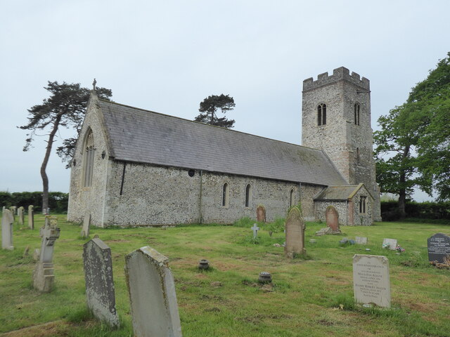
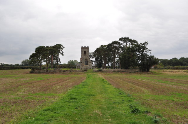
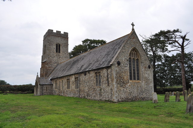
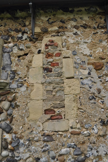
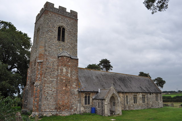
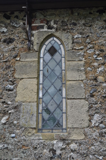
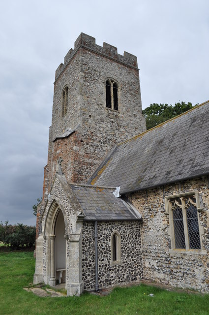
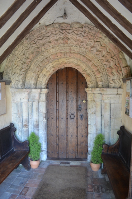
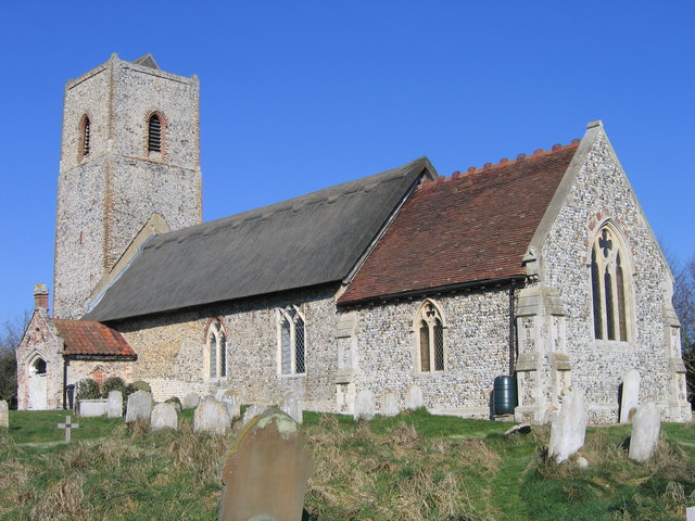
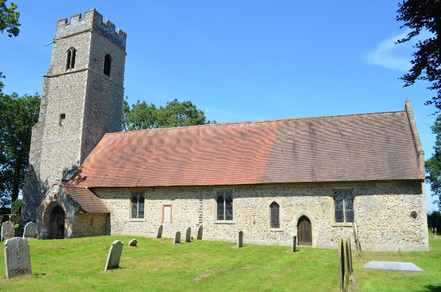
The village is notable for its charming architecture, with many of its buildings showcasing traditional Norfolk flint construction. The St Peter's Church, dating back to the 14th century, stands as an architectural gem and a prominent landmark in the area. The church features an impressive tower and beautiful stained glass windows, attracting visitors interested in history and architecture.

Carleton St Peter is surrounded by lush green fields and woodlands, providing ample opportunities for outdoor activities such as hiking, cycling, and birdwatching. The nearby River Chet offers fishing enthusiasts a chance to indulge in their hobby, while also providing scenic views and peaceful walks along its banks.

Despite its small size, the village boasts a strong sense of community, with various social events and gatherings taking place throughout the year. The village hall serves as a hub for these activities, hosting regular events like fairs, dances, and community meetings.

Although Carleton St Peter is a predominantly residential area, it benefits from its proximity to larger towns and cities. Norwich, with its vibrant cultural scene, shopping centers, and historical attractions, is easily accessible, ensuring residents have access to a wide range of amenities.

In summary, Carleton St Peter is a charming and peaceful village, offering a rural escape while still being within reach of larger urban centers. Its rich history, natural beauty, and tight-knit community make it an attractive place to live or visit for those seeking a slower pace of life.

If you have any feedback on the listing, please let us know in the comments section below.

Carleton St Peter Images

Images are sourced within 2km of 52.570205/1.454733 or Grid Reference TG3402. Thanks to Geograph Open Source API. All images are credited.

Carleton St Peter, St Peter
Langley Abbey - Cellarium The impressive restored Cellarium, inside are lights to highlight the room. Nothing like it would have been like but I quite liked the feel. See also <a href="https://www.geograph.org.uk/photo/1950682">TM4599 : St Olaves Priory 13th Century Undercroft</a>
 <a href="https://www.geograph.org.uk/photo/2373394">TG3602 : Langley Abbey</a>
Langley Abbey - Cellarium
The impressive restored Cellarium, inside are lights to highlight the room. Nothing like it would have been like but I quite liked the feel. See also TM4599 : St Olaves Priory 13th Century Undercroft TG3602 : Langley Abbey
The path to St Peter's church See <a href="https://www.geograph.org.uk/photo/1331932">TG3402 : The path to St Peter's church</a>
The path to St Peter's church
St Peter's church This church is mentioned in the 1086 Domesday book. The body is Norman in origin with two slit windows (north and south). The tower was extended in height in the 1600s. Now isolated in a field and kept open.
St Peter's church
This church is mentioned in the 1086 Domesday book. The body is Norman in origin with two slit windows (north and south). The tower was extended in height in the 1600s. Now isolated in a field and kept open.
St Peter's church - Norman Window A blocked up window on the southern side of the building. 
This church is mentioned in the 1086 Domesday book. The body is Norman in origin with two slit windows (north and south). The tower was extended in height in the 1600s. Now isolated in a field and kept open.

<a href="https://www.geograph.org.uk/photo/2585077">TG3302 : St Peter's church</a>
St Peter's church - Norman Window
A blocked up window on the southern side of the building. This church is mentioned in the 1086 Domesday book. The body is Norman in origin with two slit windows (north and south). The tower was extended in height in the 1600s. Now isolated in a field and kept open. TG3302 : St Peter's church
St Peter's church - Norman Window
St Peter's church See <a href="https://www.geograph.org.uk/photo/148315">TG3302 : Carleton St. Peter</a> also
St Peter's church
Path through Hazelmere Hole This public footpath forms a section of the Wherryman's Way long distance footpath, leading from New Road > <a title="https://www.geograph.org.uk/photo/1411099" href="https://www.geograph.org.uk/photo/1411099">Link</a> through Hazelmere Hole and from there onwards to Langley Green > <a title="https://www.geograph.org.uk/photo/1411314" href="https://www.geograph.org.uk/photo/1411314">Link</a> further to the north.

The Wherryman's Way > <a title="https://www.geograph.org.uk/photo/1340030" href="https://www.geograph.org.uk/photo/1340030">Link</a> is a 35-mile long distance footpath following the route of the Broads trading wherries between Norwich and Great Yarmouth. The route takes its name from the wherry – a large cargo-carrying barge whose black sails used to be a common sight on these waters. Ten circular village walks branch off this path along the way.
Path through Hazelmere Hole
This public footpath forms a section of the Wherryman's Way long distance footpath, leading from New Road > Link through Hazelmere Hole and from there onwards to Langley Green > Link further to the north. The Wherryman's Way > Link is a 35-mile long distance footpath following the route of the Broads trading wherries between Norwich and Great Yarmouth. The route takes its name from the wherry – a large cargo-carrying barge whose black sails used to be a common sight on these waters. Ten circular village walks branch off this path along the way.
Dry drainage ditch in Hazelmere Hole
On the edge of Hazelmere Hole
Hazelmere Hole in spring
Remains of old farm cart in Hazelmere Hole I believe this is part of the axle. For a wider view of this location see > <a title="https://www.geograph.org.uk/photo/2870757" href="https://www.geograph.org.uk/photo/2870757">Link</a>.
Remains of old farm cart in Hazelmere Hole
I believe this is part of the axle. For a wider view of this location see > Link.
Track to Langley Street This public footpath forms a section of the Wherryman's Way long distance footpath, leading from New Road > <a title="https://www.geograph.org.uk/photo/1411099" href="https://www.geograph.org.uk/photo/1411099">Link</a> through Hazelmere Hole > <a title="https://www.geograph.org.uk/photo/2870757" href="https://www.geograph.org.uk/photo/2870757">Link</a> and from there onwards to Langley Green > <a title="https://www.geograph.org.uk/photo/1411314" href="https://www.geograph.org.uk/photo/1411314">Link</a> further to the north.

The Wherryman's Way > <a title="https://www.geograph.org.uk/photo/1340030" href="https://www.geograph.org.uk/photo/1340030">Link</a> is a 35-mile long distance footpath following the route of the Broads trading wherries between Norwich and Great Yarmouth. The route takes its name from the wherry – a large cargo-carrying barge whose black sails used to be a common sight on these waters. Ten circular village walks branch off this path along the way.
Track to Langley Street
This public footpath forms a section of the Wherryman's Way long distance footpath, leading from New Road > Link through Hazelmere Hole > Link and from there onwards to Langley Green > Link further to the north. The Wherryman's Way > Link is a 35-mile long distance footpath following the route of the Broads trading wherries between Norwich and Great Yarmouth. The route takes its name from the wherry – a large cargo-carrying barge whose black sails used to be a common sight on these waters. Ten circular village walks branch off this path along the way.
Crop near Langley Green It appears to be some sort of cabbage.
Crop near Langley Green
It appears to be some sort of cabbage.
Cabbage crop near Langley Green
Norman Doorway - Ashby St Mary The church was possibly the site of a Roman station, later a Saxon church then a Norman. The Norman nave can be seen with this magnificent doorway carved from French limestone. The porch is Tudor in age.
Norman Doorway - Ashby St Mary
The church was possibly the site of a Roman station, later a Saxon church then a Norman. The Norman nave can be seen with this magnificent doorway carved from French limestone. The porch is Tudor in age.
Show me another place!

Carleton St Peter is located at Grid Ref: TG3402 (Lat: 52.570205, Lng: 1.454733)

Administrative County: Norfolk

District: South Norfolk

Police Authority: Norfolk

What 3 Words

///monk.suppers.prominent. Near Loddon, Norfolk

Related Wikis

Ducan's Marsh

Ducan's Marsh is a 3.6-hectare (8.9-acre) biological Site of Special Scientific Interest north-east of Loddon in Norfolk. It is part of the Broadland Ramsar...

Carleton St Peter

Carleton St Peter is a hamlet and civil parish in South Norfolk approximately 8+1⁄2 miles (13.7 km) south-east of Norwich. There is no village centre but...

Claxton, Norfolk

Claxton is a small village 8.5 miles (13.7 km) south-east of Norwich, and south of the River Yare, between Rockland St. Mary and Loddon in South Norfolk...

Ashby St Mary

Ashby St Mary, historically Ascebei, is a small village and civil parish in the English county of Norfolk. The civil parish has an area of 2.03 square...

Claxton Castle

Claxton Castle in the village of Claxton, Norfolk, is a ruined brick castle some 13 km southeast of Norwich. == Details == Sir William de Kerdeston and...

Thurton

Thurton is a village in South Norfolk lying 8½ miles (13½ km) south-east of Norwich on the A146 Norwich to Lowestoft road between Framingham Pigot and...

Langley Abbey

Langley Abbey was an abbey of Premonstratensian Canons in Langley Green, now in the civil parish of Langley with Hardley, Norfolk, England. The monastery...

Norwich High School for Boys

Norwich High School for Boys was an independent school in Norwich, England. Founded in 1910, it became the Langley School shortly after World War II....

Nearby Amenities

Located within 500m of 52.570205,1.454733
Power: tower
Ref: PPA 43
Lat/Long: 52.571328/1.449423
Power: tower
Ref: PPA 46
Lat/Long: 52.568991/1.460441
Power: tower
Ref: PPA 44
Lat/Long: 52.570339/1.454093
Power: tower
Ref: PPA 45
Lat/Long: 52.569631/1.457421
Entrance: main
Lat/Long: 52.5680216/1.4509675
Give Way
Lat/Long: 52.5667735/1.4518809
Give Way
Lat/Long: 52.5667716/1.4519801
Barrier: stile
Bicycle: no
Foot: yes
Material: wood
Note: Broken step.
Stile: stepover
Lat/Long: 52.5713318/1.4540577
Barrier: stile
Bicycle: no
Foot: yes
Material: wood
Note: Not very steady and a single high step.
Stile: stepover
Lat/Long: 52.5696609/1.4516572
The data included in this document is from www.openstreetmap.org. The data is made available under ODbL.

Have you been to Carleton St Peter?

Leave your review of Carleton St Peter below (or comments, questions and feedback).