Bay Wood

Wood, Forest in Ross-shire

Scotland

Bay Wood

Munlochy Bay A deep inlet on the south of the Black Isle
Munlochy Bay Credit: Anne Burgess

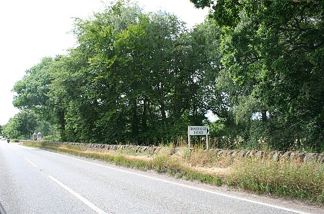
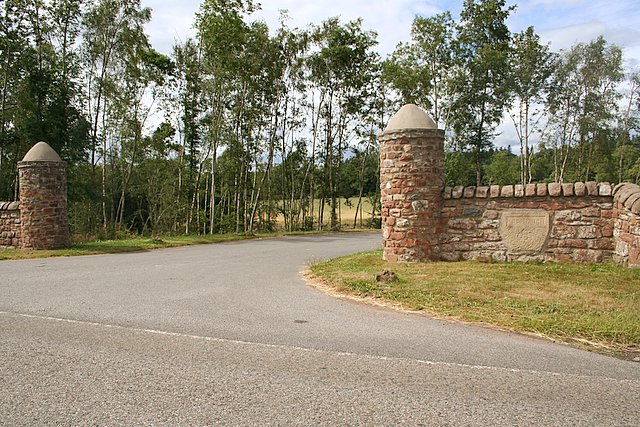
Bay Wood is a charming forest located in Ross-shire, Scotland. Spread across a vast area, it is known for its breathtaking beauty and diverse flora and fauna. The wood is situated near the picturesque Bay of Nigg, adding to its allure.

The wood boasts a rich history, with evidence of human habitation dating back thousands of years. Archaeological findings suggest that the area was once inhabited by prehistoric communities. Today, Bay Wood is a popular destination for nature enthusiasts and those seeking tranquility.

The forest is predominantly composed of native tree species, including oak, birch, and pine. These trees create a dense canopy, providing shade and shelter for numerous animal species. Visitors can spot a wide variety of wildlife, including red squirrels, roe deer, and a myriad of bird species.

Bay Wood offers an extensive network of walking trails, allowing visitors to explore its beauty at their own pace. These well-maintained paths wind through the forest, offering glimpses of stunning vistas and secluded spots for picnics or quiet contemplation. The wood is also home to a small lake, where visitors can enjoy fishing or simply soak in the serenity of the surroundings.

With its picturesque location and diverse natural offerings, Bay Wood is a must-visit destination for anyone seeking a peaceful retreat in the heart of nature. Whether it be for a leisurely stroll, birdwatching, or simply immersing oneself in the tranquil ambiance, Bay Wood promises an unforgettable experience for all.

If you have any feedback on the listing, please let us know in the comments section below.

Bay Wood Images

Images are sourced within 2km of 57.551131/-4.2172397 or Grid Reference NH6753. Thanks to Geograph Open Source API. All images are credited.

Munlochy Bay A deep inlet on the south of the Black Isle
Munlochy Bay
A deep inlet on the south of the Black Isle
Ruined farm building overlooking Munlochy Bay.
Approaching the entrance to Rosehaugh Mains.
Beautiful stonework welcomes you to Rosehaugh Mains.
Lochala Seen from near Easter Bennetsfield.
Lochala
Seen from near Easter Bennetsfield.
Stubble Field Looking towards Ord Hill.
Stubble Field
Looking towards Ord Hill.
Told you the trig was in there! Pal Mike proudly shows off our combined handywork to free Wood Hill's trigpoint from its suffocating blanket of gorse.
Told you the trig was in there!
Pal Mike proudly shows off our combined handywork to free Wood Hill's trigpoint from its suffocating blanket of gorse.
Bay Farm inlet - Munlochy Bay It seems as if this inlet is man made to provide a dock for the large sandstone quarry that existed in this locality.
Bay Farm inlet - Munlochy Bay
It seems as if this inlet is man made to provide a dock for the large sandstone quarry that existed in this locality.
Mouth of Munlochy Bay Looking across to Craigiehowe across the mouth of Munlochy Bay. The walking in this area is unfrequented and provides some wonderful scenery.
Mouth of Munlochy Bay
Looking across to Craigiehowe across the mouth of Munlochy Bay. The walking in this area is unfrequented and provides some wonderful scenery.
Munlochy Bay north headland Looking across the mouth of Munlochy Bay towards Craigiehowe.
Munlochy Bay north headland
Looking across the mouth of Munlochy Bay towards Craigiehowe.
Ballone Farm Ballone Farm between Avoch and Munlochy.
Ballone Farm
Ballone Farm between Avoch and Munlochy.
Munlochy Bay and beyond One of my favourite areas on the Black Isle.
Munlochy Bay and beyond
One of my favourite areas on the Black Isle.
Clootie Well This is an ancient clootie well similar to the Munlochy well close by at <a href="https://www.geograph.org.uk/gridref/NH6453">NH6453</a>. People have believed in the magical healing properties of these wells since before Christianity.
Clootie Well
This is an ancient clootie well similar to the Munlochy well close by at NH6453. People have believed in the magical healing properties of these wells since before Christianity.
Estate track through an avenue of trees In Rosehaugh Estate
Estate track through an avenue of trees
In Rosehaugh Estate
Track in Rosehaugh Estate
Junction of estate roads and bridge over Killen Burn in Rosehaugh Estate
Main estate road into Rosehaugh Estate
Fields in Rosehaugh Estate
Show me another place!

Bay Wood is located at Grid Ref: NH6753 (Lat: 57.551131, Lng: -4.2172397)

Unitary Authority: Highland

Police Authority: Highlands and Islands

What 3 Words

///tastes.rifled.mountain. Near Fortrose, Highland

Nearby Locations

Bay Wood

Related Wikis

Ormond Castle

Ormond Castle, also known as Avoch Castle, was a powerful stronghold, overlooking the village of Avoch, on the Black Isle, in the former county of Ross...

Munlochy

Munlochy ( mən-LOKH-ee; Scottish Gaelic: Poll Lochaidh) is a small village, lying at the head of Munlochy Bay (Ob Poll Lochaidh), in the Black Isle in...

Munlochy railway station

Munlochy railway station served the village of Munlochy, Ross and Cromarty, Scotland, from 1894 to 1951 on the Fortrose Branch. == History == The station...

Avoch railway station

Avoch railway station was a station on the single track branch of the Highland Railway, in north east Scotland. The line connected villages in The Black...

Avoch

Avoch ( OKH; from the Scottish Gaelic: Abhach – meaning mouth of the stream) is a harbour-village located on the south-east coast of the Black Isle, on...

Knockbain

Knockbain is a parish on the Black Isle, in the county of Ross and Cromarty in Highland council area, Scotland. It includes the villages of North Kessock...

Kilmuir, Black Isle

Kilmuir (from the Scottish Gaelic Cille Mhoire, meaning Mary's Church) is a former fishing village, located on the north coast of the Moray Firth in the...

Black Isle

The Black Isle (Scottish Gaelic: an t-Eilean Dubh, pronounced [ən̪ˠ ˈtʲʰelan ˈt̪uh]) is a peninsula within Ross and Cromarty, in the Scottish Highlands...

Nearby Amenities

Located within 500m of 57.551131,-4.2172397
Source: PGS
Lat/Long: 57.5512092/-4.2247279
Source: PGS
Lat/Long: 57.5510215/-4.2237106
Source: PGS
Lat/Long: 57.5508777/-4.2232935
Source: PGS
Lat/Long: 57.5504773/-4.2221879
Source: PGS
Lat/Long: 57.5504542/-4.2212414
Source: PGS
Lat/Long: 57.5504955/-4.2206407
Source: PGS
Lat/Long: 57.5504794/-4.2200588
Source: PGS
Lat/Long: 57.5503286/-4.2193275
Source: PGS
Lat/Long: 57.5500965/-4.2185106
Source: PGS
Lat/Long: 57.5499267/-4.2180456
Source: PGS
Lat/Long: 57.5497385/-4.2174221
Source: PGS
Lat/Long: 57.5495387/-4.2169342
Source: PGS
Lat/Long: 57.5491386/-4.2164488
Source: PGS
Lat/Long: 57.5493631/-4.2155949
Source: PGS
Lat/Long: 57.5495573/-4.2148052
Source: PGS
Lat/Long: 57.5496032/-4.2136669
Source: PGS
Lat/Long: 57.5493878/-4.2125285
Source: PGS
Lat/Long: 57.5492708/-4.2115168
Source: PGS
Lat/Long: 57.5490136/-4.2106993
Source: PGS
Lat/Long: 57.549438/-4.2099175
Power: pole
Lat/Long: 57.5511481/-4.2095962
The data included in this document is from www.openstreetmap.org. The data is made available under ODbL.

Have you been to Bay Wood?

Leave your review of Bay Wood below (or comments, questions and feedback).