Arvie Wood

Wood, Forest in Kirkcudbrightshire

Scotland

Arvie Wood

A713 towards New Galloway
A713 towards New Galloway Credit: Steven Brown

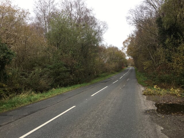
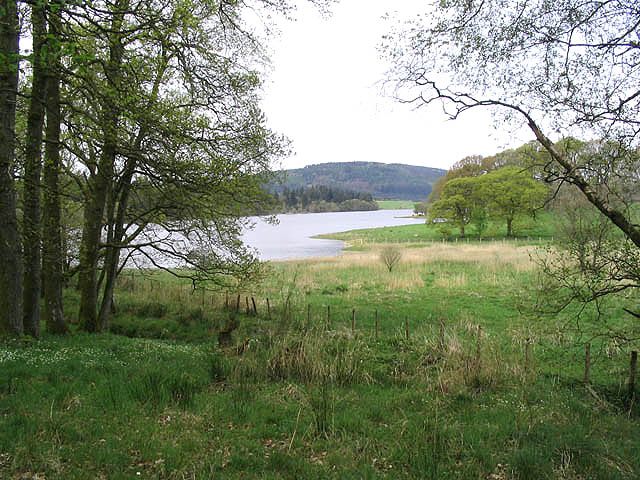
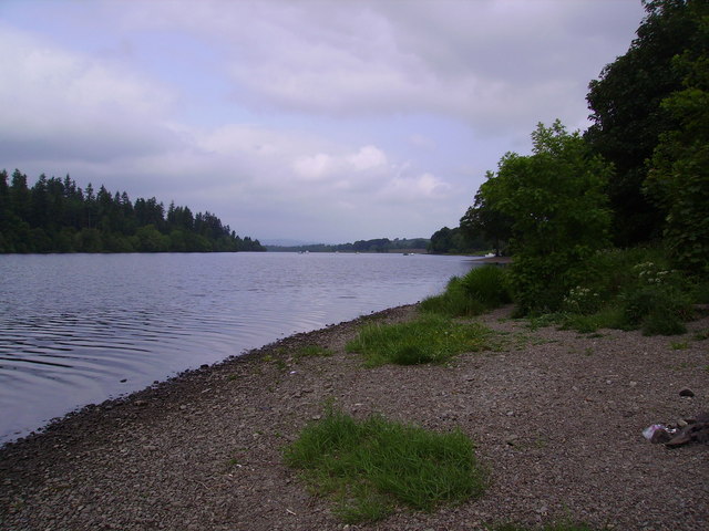
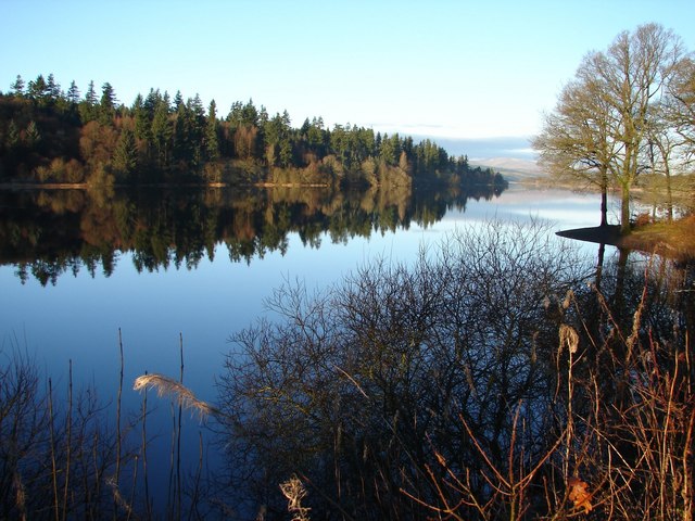
Arvie Wood is a picturesque forest located in Kirkcudbrightshire, Scotland. Covering an area of approximately 100 hectares, this woodland is a popular destination for nature enthusiasts and outdoor adventurers.

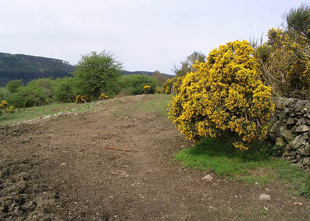
The wood is characterized by its diverse and dense vegetation, consisting mainly of native tree species such as oak, beech, and birch. The canopy of these towering trees provides shelter for a wide range of wildlife, including birds, mammals, and insects. Visitors can expect to encounter species such as red squirrels, roe deer, and various bird species as they explore the woodland.

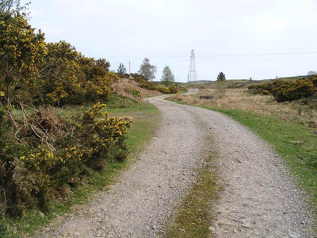
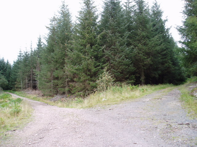
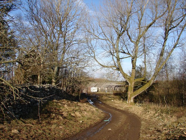
Arvie Wood is crisscrossed by a network of well-maintained footpaths and trails, making it an ideal location for walking, hiking, and cycling. These paths wind their way through the forest, offering visitors the opportunity to immerse themselves in the serene beauty of the natural surroundings. The varied terrain of the wood provides a challenge for outdoor enthusiasts of all abilities, with some areas offering gentle slopes while others have steeper inclines.

In addition to its natural beauty, Arvie Wood also boasts historical significance. The woodland is home to remnants of ancient settlements, with archaeological evidence suggesting human occupation dating back thousands of years. The presence of stone circles and burial mounds adds to the sense of mystery and intrigue surrounding the area.

Overall, Arvie Wood in Kirkcudbrightshire is a captivating destination that offers a blend of natural beauty, recreational opportunities, and historical intrigue. It is a must-visit location for anyone seeking to connect with nature and explore the rich heritage of the region.

If you have any feedback on the listing, please let us know in the comments section below.

Arvie Wood Images

Images are sourced within 2km of 55.029801/-4.0761854 or Grid Reference NX6772. Thanks to Geograph Open Source API. All images are credited.

A713 towards New Galloway
A group of kayakers paddling north on the Loch
Farm road The road to Ken Ervie Farm, taken near Shirmers Bridge.
Farm road
The road to Ken Ervie Farm, taken near Shirmers Bridge.
Livestock field
Livestock field
Loch Ken Viewed from the edge of a small wood near Drumrash.
Loch Ken
Viewed from the edge of a small wood near Drumrash.
Glenlaggan Buildings on Glenlaggan Park where there are lodges to buy or rent and caravan berths with spectacular views to Loch Ken and Galloway Forest Park.
Glenlaggan
Buildings on Glenlaggan Park where there are lodges to buy or rent and caravan berths with spectacular views to Loch Ken and Galloway Forest Park.
Loch Ken Looking northwest up the Loch from the shore near Glenlaggan
Loch Ken
Looking northwest up the Loch from the shore near Glenlaggan
Little Drumrash, Parton.
Track junctions in Rabbit Warren Forest, Mossdale
Loch Ken shore line at Ringferson Wood
Glenlaggan - Loch Ken View NW up Loch Ken with Rhinns of Kells in distance. Photographer standing on W side of A713 at Glenlaggan.
Glenlaggan - Loch Ken
View NW up Loch Ken with Rhinns of Kells in distance. Photographer standing on W side of A713 at Glenlaggan.
Upper Drumrash View NE from Upper Drumrash craig (crag) in hill farming area toward Barend and Cairny Woods. The Arvie Burn flows W down to Loch Ken in a depression beyond the dew pond.
Upper Drumrash
View NE from Upper Drumrash craig (crag) in hill farming area toward Barend and Cairny Woods. The Arvie Burn flows W down to Loch Ken in a depression beyond the dew pond.
Drumrash Wood The track meanders W to the A713 through a sleeping wood on a sunny February day.
Drumrash Wood
The track meanders W to the A713 through a sleeping wood on a sunny February day.
Upper Drumrash Track Walking (and photographing) S into the February sun and down the track to Drumrash. Drumrash Burn follows on the left but equal water seems to flows down the track as well!
Upper Drumrash Track
Walking (and photographing) S into the February sun and down the track to Drumrash. Drumrash Burn follows on the left but equal water seems to flows down the track as well!
Ken Ervie 1 mile stone and mud track from Shirmers Bridge (A713) peters out in the farmyard of Ken Ervie on Barnshalloch Moor
Ken Ervie
1 mile stone and mud track from Shirmers Bridge (A713) peters out in the farmyard of Ken Ervie on Barnshalloch Moor
Downies Knowles Hillocks of rough grazing to the E of Loch Ken near Ken Ervie.
Downies Knowles
Hillocks of rough grazing to the E of Loch Ken near Ken Ervie.
Galloway Sailing Centre Galloway Sailing Centre and activity centre situated on the E side of Loch Ken. Across the water is Bennan Hill.
Galloway Sailing Centre
Galloway Sailing Centre and activity centre situated on the E side of Loch Ken. Across the water is Bennan Hill.
Galloway Sailing Centre from Cadger's Loop Loch Ken is a wonderful place to sail. <span class="nowrap"><a title="http://www.lochken.co.uk" rel="nofollow ugc noopener" href="http://www.lochken.co.uk">Link</a><img style="margin-left:2px;" alt="External link" title="External link - shift click to open in new window" src="https://s1.geograph.org.uk/img/external.png" width="10" height="10"/></span>  Wonder if the Sailing Centre still makes these delicious moist, mouthwatering home-made cakes?
Galloway Sailing Centre from Cadger's Loop
Loch Ken is a wonderful place to sail. LinkExternal link Wonder if the Sailing Centre still makes these delicious moist, mouthwatering home-made cakes?
Show me another place!

Arvie Wood is located at Grid Ref: NX6772 (Lat: 55.029801, Lng: -4.0761854)

Unitary Authority: Dumfries and Galloway

Police Authority: Dumfries and Galloway

What 3 Words

///marker.sand.buggy. Near Castle Douglas, Dumfries & Galloway

Related Wikis

Airds of Kells

Airds of Kells is a farm and small estate in the historical county of Kirkcudbrightshire in the parish of Kells, Dumfries and Galloway, Scotland. The...

New Galloway railway station

New Galloway railway station served the town of New Galloway in Dumfries and Galloway, Scotland, from 1861 to 1965 on the Portpatrick and Wigtownshire...

Loch Ken

Loch Ken is a 9 miles (14 km) long freshwater loch in the historic county of Kirkcudbrightshire in Dumfries and Galloway, Scotland. It lies in the Glenkens...

Ironmacannie Mill

Ironmacannie Mill is a historic watermill near Balmaclellan in Dumfries and Galloway, Scotland. Built in the 18th and 19th centuries, on the site of an...

Parton railway station (Portpatrick and Wigtownshire Joint Railway)

Parton railway station served the hamlet of Parton, Dumfries and Galloway, Scotland, from 1861 to 1965 on the Portpatrick and Wigtownshire Joint Railway...

Parton, Dumfries and Galloway

Parton is a hamlet situated on the banks of the River Dee in the historical county of Kirkcudbrightshire, Dumfries and Galloway, Scotland. == Notable... ==

Galloway

Galloway (Scottish Gaelic: Gall-Ghàidhealaibh [ˈkal̪ˠaɣəl̪ˠu]; Scots: Gallowa; Latin: Gallovidia) is a region in southwestern Scotland comprising the historic...

Kenmure Castle

Kenmure Castle is a fortified house or castle in The Glenkens, 1 mile (1.6 km) south of the town of New Galloway in Kirkcudbrightshire, Galloway, south...

Nearby Amenities

Located within 500m of 55.029801,-4.0761854
White Hill
Ele: 70
Natural: peak
Lat/Long: 55.0290063/-4.0774962
Power: pole
Lat/Long: 55.032763/-4.0818944
Power: pole
Lat/Long: 55.0323323/-4.0808506
Power: pole
Lat/Long: 55.0319274/-4.0798644
Power: pole
Lat/Long: 55.0314821/-4.0787992
Power: pole
Lat/Long: 55.0312818/-4.0778947
Power: pole
Lat/Long: 55.0311734/-4.0772816
Power: pole
Lat/Long: 55.0309065/-4.0759476
Power: pole
Lat/Long: 55.0304822/-4.0746288
Power: pole
Lat/Long: 55.0300046/-4.07318
Power: pole
Lat/Long: 55.0296625/-4.072139
Power: pole
Lat/Long: 55.0293276/-4.0711384
Power: pole
Lat/Long: 55.0288832/-4.0700146
Power: pole
Lat/Long: 55.0285093/-4.0688992
Power: pole
Lat/Long: 55.0263917/-4.0719701
Power: pole
Lat/Long: 55.0279407/-4.0698085
Power: pole
Lat/Long: 55.0273148/-4.0707857
Power: pole
Lat/Long: 55.0266767/-4.071797
Power: pole
Lat/Long: 55.0314511/-4.0770667
Barrier: cattle_grid
Lat/Long: 55.0290347/-4.0802604
Ford: yes
Lat/Long: 55.0295986/-4.0803271
The data included in this document is from www.openstreetmap.org. The data is made available under ODbL.

Have you been to Arvie Wood?

Leave your review of Arvie Wood below (or comments, questions and feedback).