Bollochlinn Strip

Wood, Forest in Stirlingshire

Scotland

Bollochlinn Strip

Old Military Road Once the road between Dumbarton and Stirling, now a no through road lane.
Old Military Road Credit: Richard Webb

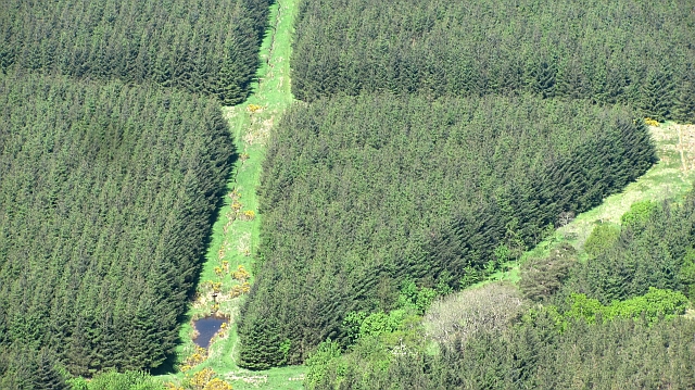
Bollochlinn Strip is a wood located in Stirlingshire, a county in central Scotland. Situated near the village of Balfron, it covers an area of approximately 100 hectares (247 acres) and is part of the wider Stirling Council area. The wood is predominantly composed of a diverse range of tree species, including native deciduous trees such as oak, birch, and beech.

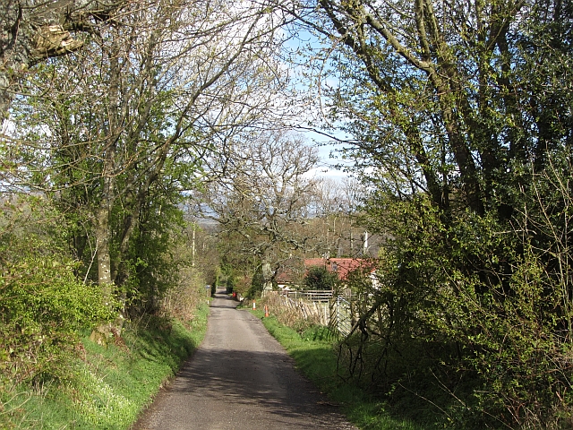
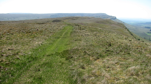
This forested area is well-known for its picturesque landscapes and scenic beauty. Bollochlinn Strip offers a tranquil environment, attracting visitors who seek solace and relaxation amidst nature. The wood is crisscrossed by a network of walking trails, allowing visitors to explore its natural wonders at their own pace.

Due to its location, Bollochlinn Strip also serves as an important habitat for various wildlife species. It provides a suitable environment for a range of woodland birds, including woodpeckers, thrushes, and owls. Mammals such as red squirrels, badgers, and deer can also be spotted within the wood.

Managed by the local authorities, Bollochlinn Strip is carefully maintained to preserve its ecological balance and promote sustainable forestry practices. Periodic tree thinning and selective felling are carried out to maintain a healthy woodland ecosystem. The management also ensures the safety and accessibility of the walking trails for visitors.

Overall, Bollochlinn Strip in Stirlingshire offers a captivating natural environment with its diverse flora and fauna, providing a delightful experience for nature enthusiasts and those seeking a peaceful retreat.

If you have any feedback on the listing, please let us know in the comments section below.

Bollochlinn Strip Images

Images are sourced within 2km of 56.107494/-4.1599876 or Grid Reference NS6592. Thanks to Geograph Open Source API. All images are credited.

Old Military Road Once the road between Dumbarton and Stirling, now a no through road lane.
Old Military Road
Once the road between Dumbarton and Stirling, now a no through road lane.
Cattle by the Boquhan Burn The burn runs through a wooded ravine below this field.
Cattle by the Boquhan Burn
The burn runs through a wooded ravine below this field.
Whins, Ballochleam The slopes below the Gargunnock escarpment.
Whins, Ballochleam
The slopes below the Gargunnock escarpment.
On the Gargunnock Hills Above the scarp with a tin of grouse grit in the foreground. The view is towards Carleatheran.
On the Gargunnock Hills
Above the scarp with a tin of grouse grit in the foreground. The view is towards Carleatheran.
Blair Moss Wood Conifer plantation beneath the Gargunnock Hills escarpment.
Blair Moss Wood
Conifer plantation beneath the Gargunnock Hills escarpment.
Field above the Boquhan Burn The burn flows through a deep ravine which looks like it might repay exploration. A long focus brings in the Perthshire Highlands in the background.
Field above the Boquhan Burn
The burn flows through a deep ravine which looks like it might repay exploration. A long focus brings in the Perthshire Highlands in the background.
Larches, Slackgun Old and weatherbeaten trees on a very steep slope on the Gargunnock Hills scarp. The view is from a good path which is not marked on maps.
Larches, Slackgun
Old and weatherbeaten trees on a very steep slope on the Gargunnock Hills scarp. The view is from a good path which is not marked on maps.
Ruined dyke, Lees Hill The dyke runs parallel to the dangerous escarpment. Now a stock proof fence is used and it runs nearer the crags.
Ruined dyke, Lees Hill
The dyke runs parallel to the dangerous escarpment. Now a stock proof fence is used and it runs nearer the crags.
Path above Standmilane Crags Exaggerated somewhat to road status by the Ordnance Survey, this is a quad bike track of flattened grass with some deep boggy bits which runs the length of the escarpment. The view is towards Stronend above Fintry. Progress off the path is liable to be slow and frustrating, this is rough country.
Path above Standmilane Crags
Exaggerated somewhat to road status by the Ordnance Survey, this is a quad bike track of flattened grass with some deep boggy bits which runs the length of the escarpment. The view is towards Stronend above Fintry. Progress off the path is liable to be slow and frustrating, this is rough country.
Bog pool, Lees Hill Peat deposits on the Gargunnock Hill plateau.
Bog pool, Lees Hill
Peat deposits on the Gargunnock Hill plateau.
Moorland, Lees Hill Grassy moorland looking over towards Earlsburn wind farm.
Moorland, Lees Hill
Grassy moorland looking over towards Earlsburn wind farm.
Bog pool, Lees Hill A small pool on the Gargunnock Hills plateau.
Bog pool, Lees Hill
A small pool on the Gargunnock Hills plateau.
On Lees Hill View along the Gargunnock escarpment towards Stronend.
On Lees Hill
View along the Gargunnock escarpment towards Stronend.
Moorland near the Spout of Ballochleam Grassy moorland with a faint path made by the passage of quad bikes. The map's road symbol is an exaggeration.
Moorland near the Spout of Ballochleam
Grassy moorland with a faint path made by the passage of quad bikes. The map's road symbol is an exaggeration.
Metal hut, Ballochleam One of at least two Anderson shelter like huts along the road. Probably the work of a water board.
Metal hut, Ballochleam
One of at least two Anderson shelter like huts along the road. Probably the work of a water board.
Wood, Ballochleam A few trees remain in this roundel wood at Ballochleam.
Wood, Ballochleam
A few trees remain in this roundel wood at Ballochleam.
Road, Ballochleam The road runs up to the Gargunnock Hills plateau by the Spout of Ballochleam.
Road, Ballochleam
The road runs up to the Gargunnock Hills plateau by the Spout of Ballochleam.
Road, Ballochleam The road runs up to the Gargunnock Hills plateau by a gap in the crags near Spout of Ballochleam.
Road, Ballochleam
The road runs up to the Gargunnock Hills plateau by a gap in the crags near Spout of Ballochleam.
Show me another place!

Bollochlinn Strip is located at Grid Ref: NS6592 (Lat: 56.107494, Lng: -4.1599876)

Unitary Authority: Stirling

Police Authority: Forth Valley

What 3 Words

///joyously.paraded.inferior. Near Kippen, Stirling

Related Wikis

Kippen

Kippen is a village in west Stirlingshire, Scotland. It lies between the Gargunnock Hills and the Fintry Hills and overlooks the Carse of Forth to the...

Kippen railway station

Kippen railway station co-served the village of Kippen, Stirling, Scotland, from 1856 to 1934 on the Forth and Clyde Junction Railway. == History == The...

Gargunnock Hills

The Gargunnock Hills are a range of hills west of the city of Stirling, Scotland. They culminate in the peak of Carleatheran, whose 485-metre (1,591 ft...

Leckie Broch

Leckie Broch is an iron-age broch located in Stirlingshire, Scotland. == Location == Just above the confluence of two streams with deep gulleys on the...

Nearby Amenities

Located within 500m of 56.107494,-4.1599876
Barrier: cattle_grid
Lat/Long: 56.1056536/-4.160162
Power: pole
Lat/Long: 56.1095427/-4.1530955
Power: pole
Lat/Long: 56.1090143/-4.1534616
Power: pole
Lat/Long: 56.1082877/-4.1539176
Power: pole
Lat/Long: 56.107624/-4.1543422
Power: pole
Lat/Long: 56.1069194/-4.1548066
Power: pole
Lat/Long: 56.1065252/-4.156001
Power: pole
Lat/Long: 56.1061344/-4.1572163
Power: pole
Lat/Long: 56.1057098/-4.1580195
Power: pole
Lat/Long: 56.1052642/-4.1588185
Power: pole
Lat/Long: 56.1048244/-4.1595506
Power: pole
Lat/Long: 56.104394/-4.160379
Power: pole
Lat/Long: 56.1039647/-4.1611864
Power: pole
Lat/Long: 56.1035179/-4.1619896
The data included in this document is from www.openstreetmap.org. The data is made available under ODbL.

Have you been to Bollochlinn Strip?

Leave your review of Bollochlinn Strip below (or comments, questions and feedback).