Carloway

Settlement in Ross-shire

Scotland

Carloway

View towards Loch Chàrlabhaigh
View towards Loch Chàrlabhaigh Credit: David Dixon

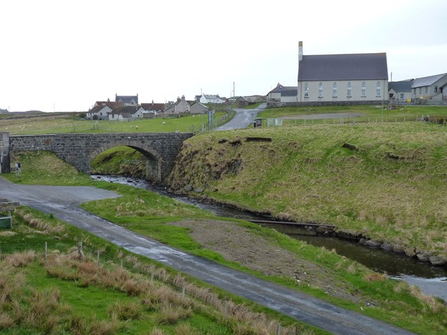
Carloway is a small village located in the Ross-shire region of Scotland. Situated on the Isle of Lewis, it is part of the Western Isles council area. With a population of around 500 people, Carloway offers a peaceful and picturesque setting for residents and visitors alike.

The village is renowned for its rich history, particularly its connection to the ancient Callanish Standing Stones, which are located just a few miles away. These Neolithic stone circles attract tourists from around the world, offering a glimpse into the island's prehistoric past.

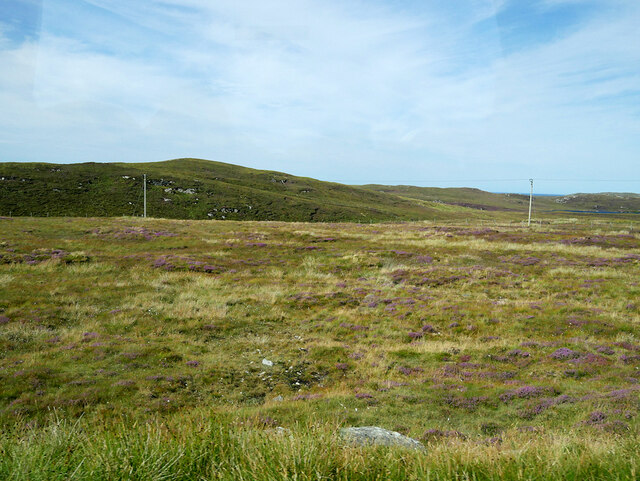
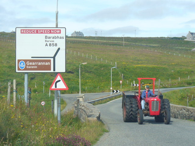
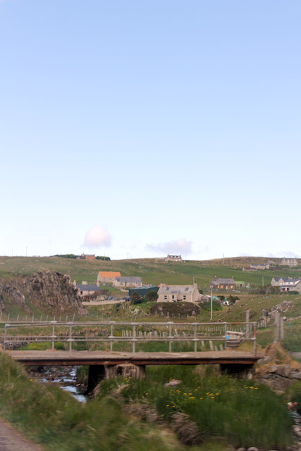
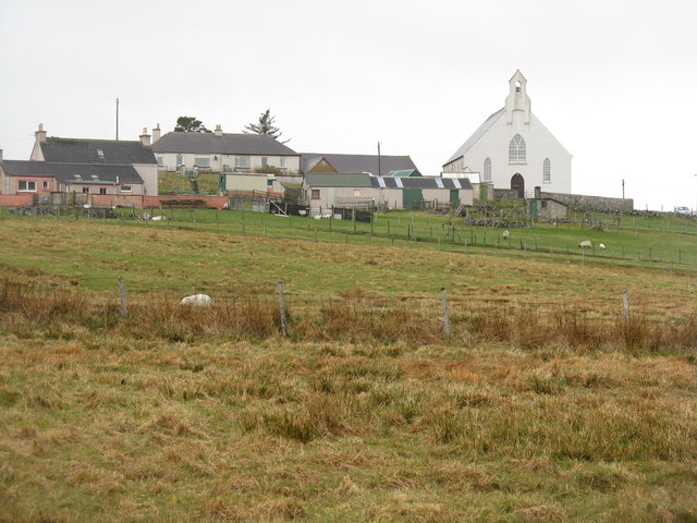
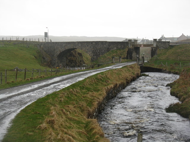
Carloway is also known for its stunning natural beauty. The surrounding landscape is dominated by rugged hills, expansive moorland, and breathtaking coastlines. The village itself is nestled between the sea and the rolling hills, providing a tranquil atmosphere and breathtaking views.

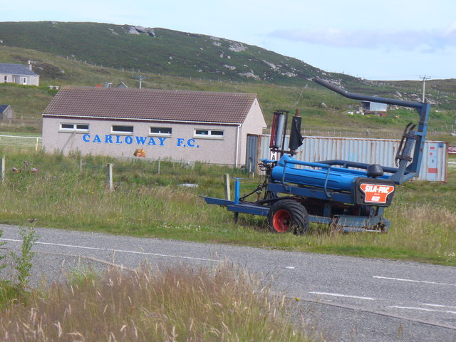
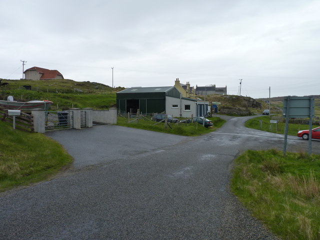
Despite its small size, Carloway offers a range of amenities for residents. There is a primary school, a post office, a few local shops, and a pub where locals and visitors can enjoy traditional Scottish hospitality. The village is also home to a thriving arts and crafts community, with several local artists and artisans showcasing their work in galleries and studios.

Carloway is an ideal destination for outdoor enthusiasts, with opportunities for hiking, fishing, and birdwatching in the surrounding area. Its close proximity to other attractions on the Isle of Lewis, such as the stunning beaches of Dalmore and Dalbeg, makes it a popular base for exploring the island.

Overall, Carloway is a charming village that offers a unique blend of history, natural beauty, and community spirit, making it a must-visit destination for those seeking an authentic Scottish experience.

If you have any feedback on the listing, please let us know in the comments section below.

Carloway Images

Images are sourced within 2km of 58.286623/-6.7630386 or Grid Reference NB2042. Thanks to Geograph Open Source API. All images are credited.

View towards Loch Chàrlabhaigh
Moorland west of Carloway
Bungalow, Upper Carloway
Abhainn Chàrlabhaigh
Carloway, Isle of Lewis
Byre, Carloway
Byre, Carloway
Hill near Carloway
Hill near Carloway
Bridge carrying A858 over Abhainn Charlabhaigh, Carloway
Bus shelter near the Tweed Mill
The road to Gearrannan Blackhouse Village
Carloway Bridge Busy scene for Lewis with a bright red tractor on the A858, crossing the River Carloway / Abhainn Charlabhaigh. Note the Gaelic / English language road sign.
Carloway Bridge
Busy scene for Lewis with a bright red tractor on the A858, crossing the River Carloway / Abhainn Charlabhaigh. Note the Gaelic / English language road sign.
Carloway F.C. Amateur football is popular in Lewis and Carloway is one of its more prominent clubs. The ground sits in an attractive location, surrounded by low hills. Note the silage machine in the foreground.
<span class="nowrap"><a title="www.carlowayfc.co.uk" rel="nofollow ugc noopener" href="http://www.carlowayfc.co.uk">Link</a><img style="margin-left:2px;" alt="External link" title="External link - shift click to open in new window" src="https://s1.geograph.org.uk/img/external.png" width="10" height="10"/></span>
Carloway F.C.
Amateur football is popular in Lewis and Carloway is one of its more prominent clubs. The ground sits in an attractive location, surrounded by low hills. Note the silage machine in the foreground. LinkExternal link
The Bridge at Carloway Substantial stone arched road bridge spanning the Abhainn Charlabhaigh / Carloway River.
The Bridge at Carloway
Substantial stone arched road bridge spanning the Abhainn Charlabhaigh / Carloway River.
Sunnybrae Carloway Shown on the map, I don't know if Sunnybrae is the name of the house or a farm or just an area.
Sunnybrae Carloway
Shown on the map, I don't know if Sunnybrae is the name of the house or a farm or just an area.
Càrlabhagh/Carloway Church and houses above Abhainn Chàrlabhaigh.
Càrlabhagh/Carloway
Church and houses above Abhainn Chàrlabhaigh.
Abhainn Chàrlabhaigh and Pentland Road Both passing under the A858 at Càrlabhagh.
Abhainn Chàrlabhaigh and Pentland Road
Both passing under the A858 at Càrlabhagh.
Road to Borghastan A cul-de-sac back road near Càrlabhagh.
Road to Borghastan
A cul-de-sac back road near Càrlabhagh.
Bridge over Abhainn Chàrlabhaigh With Càrlabhagh village and church in the background.
Bridge over Abhainn Chàrlabhaigh
With Càrlabhagh village and church in the background.
Show me another place!

Carloway is located at Grid Ref: NB2042 (Lat: 58.286623, Lng: -6.7630386)

Unitary Authority: Na h-Eileanan an Iar

Police Authority: Highlands and Islands

Also known as: Carlabhagh

What 3 Words

///stung.strikers.supported. Near Carloway, Na h-Eileanan Siar

Related Wikis

Carloway

Carloway (Scottish Gaelic: Càrlabhagh [ˈkʰaːɾɫ̪ə.ɤː]) is a crofting township and a district on the west coast of the Isle of Lewis, in the Outer Hebrides...

Borrowston, Lewis

Borrowston (Scottish Gaelic: Borghastan), with a population of about 50, is a crofting township situated on the Isle of Lewis, on the Outer Hebrides of...

Garenin

Garenin (Scottish Gaelic: Na Gearrannan) is a crofting township on the west coast of the Isle of Lewis in the Outer Hebrides of Scotland. Garenin is in...

Dun Carloway

Dun Carloway (Scottish Gaelic: Dùn Chàrlabhaigh) is a broch situated in the district of Carloway, on the west coast of the Isle of Lewis, Scotland (grid...

Nearby Amenities

Located within 500m of 58.286623,-6.7630386
Passing Place
Lat/Long: 58.2865358/-6.7684162
Passing Place
Lat/Long: 58.2845899/-6.7628347
Passing Place
Lat/Long: 58.2856281/-6.7631551
Mullach Chàrlabhaigh
Name En: Upper Carloway
Name Gd: Mullach Chàrlabhaigh
Place: neighbourhood
Lat/Long: 58.2867569/-6.7693182
Pàirc Chàrlabhaigh
Name En: Park Carloway
Name Gd: Pàirc Chàrlabhaigh
Place: neighbourhood
Lat/Long: 58.2832581/-6.7613409
Barrier: cattle_grid
Lat/Long: 58.2868441/-6.7649741
Barrier: cattle_grid
Lat/Long: 58.2870931/-6.7654876
Barrier: cattle_grid
Lat/Long: 58.2868142/-6.7639164
Barrier: cattle_grid
Lat/Long: 58.2844544/-6.75609
Barrier: cattle_grid
Lat/Long: 58.2843492/-6.7565811
Access: private
Entrance: yes
Lat/Long: 58.2838413/-6.7575101
Barrier: cattle_grid
Lat/Long: 58.2835528/-6.7588846
Barrier: cattle_grid
Lat/Long: 58.2837499/-6.7581998
Barrier: cattle_grid
Lat/Long: 58.2832564/-6.7596133
Barrier: cattle_grid
Lat/Long: 58.2837245/-6.7591077
Access: private
Entrance: yes
Lat/Long: 58.2834705/-6.7600312
Barrier: cattle_grid
Lat/Long: 58.2822286/-6.7616079
Power: pole
Lat/Long: 58.2827318/-6.7587966
Power: pole
Lat/Long: 58.2822967/-6.7630375
Power: pole
Lat/Long: 58.2830243/-6.7631604
Power: pole
Lat/Long: 58.2834754/-6.7632974
Power: pole
Lat/Long: 58.2839658/-6.763415
Power: pole
Lat/Long: 58.2844309/-6.7635358
Power: pole
Lat/Long: 58.2848769/-6.7636231
Power: pole
Lat/Long: 58.2855599/-6.7637701
Power: pole
Lat/Long: 58.2859534/-6.7638545
Power: pole
Lat/Long: 58.2835839/-6.7628644
Power: pole
Lat/Long: 58.2830963/-6.7625167
Power: pole
Lat/Long: 58.2831949/-6.7619767
Power: pole
Lat/Long: 58.2834385/-6.7610196
Power: pole
Lat/Long: 58.2835311/-6.7603231
Power: pole
Lat/Long: 58.2838954/-6.7588659
Power: pole
Lat/Long: 58.2840734/-6.758171
Material: wood
Power: pole
Lat/Long: 58.2843182/-6.7574068
Power: pole
Lat/Long: 58.2850029/-6.7630802
Power: pole
Lat/Long: 58.2852259/-6.7621376
Power: pole
Lat/Long: 58.2855593/-6.7608372
Power: pole
Lat/Long: 58.2858495/-6.7592715
Power: pole
Lat/Long: 58.2860269/-6.7632545
Power: pole
Lat/Long: 58.2860676/-6.7628698
Power: pole
Lat/Long: 58.2856737/-6.7628159
Power: pole
Lat/Long: 58.2865119/-6.7629321
Power: pole
Lat/Long: 58.286246/-6.7645085
Power: pole
Lat/Long: 58.2864454/-6.7649932
Power: pole
Lat/Long: 58.2867032/-6.7655695
Power: pole
Lat/Long: 58.2870021/-6.7662625
Power: pole
Lat/Long: 58.2866998/-6.7677299
Power: pole
Lat/Long: 58.2865205/-6.768598
Power: pole
Lat/Long: 58.2867697/-6.7691454
Power: pole
Lat/Long: 58.2870091/-6.7700542
Power: pole
Lat/Long: 58.2872515/-6.7705319
Power: pole
Lat/Long: 58.2874801/-6.7711257
Power: pole
Lat/Long: 58.2861766/-6.7686777
Power: pole
Lat/Long: 58.2867185/-6.7704345
Barrier: cattle_grid
Lat/Long: 58.2875882/-6.7710603
Barrier: cattle_grid
Lat/Long: 58.2834658/-6.7620373
Barrier: cattle_grid
Lat/Long: 58.2831359/-6.7613598
Power: pole
Lat/Long: 58.2848408/-6.7650941
Passing Place
Lat/Long: 58.2823164/-6.7648418
Passing Place
Lat/Long: 58.2859428/-6.7597303
Passing Place
Lat/Long: 58.2863013/-6.7614464
Passing Place
Lat/Long: 58.2856428/-6.7575503
Power: pole
Lat/Long: 58.2838025/-6.7577998
Generator Method: photovoltaic
Generator Output Electricity: small_installation
Generator Source: solar
Generator Type: solar_photovoltaic_panel
Power: generator
Lat/Long: 58.2832411/-6.7580505
Charging Station
Access: yes
Capacity: 2
Fee: yes
Operator: ChargePlace Scotland
Operator Wikidata: Q105359316
Ref: 53508
Socket Type2 Output: 22 kW
Website: https://chargeplacescotland.org/cpmap/chargepoint/1446368/
Lat/Long: 58.2836791/-6.758396
The data included in this document is from www.openstreetmap.org. The data is made available under ODbL.

Have you been to Carloway?

Leave your review of Carloway below (or comments, questions and feedback).