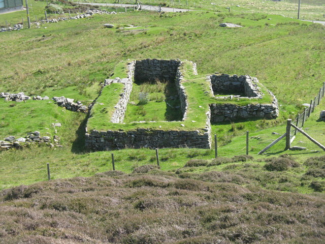
Cnoc Eirshader

Hill, Mountain in Ross-shire

Scotland

Cnoc Eirshader
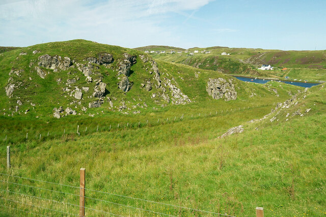
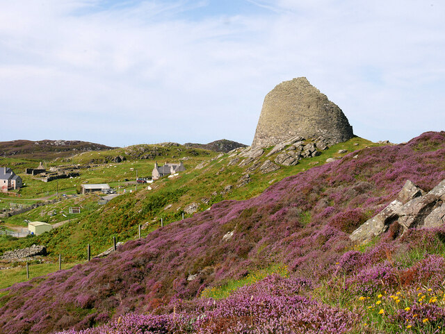
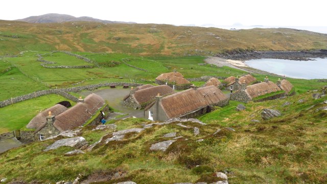
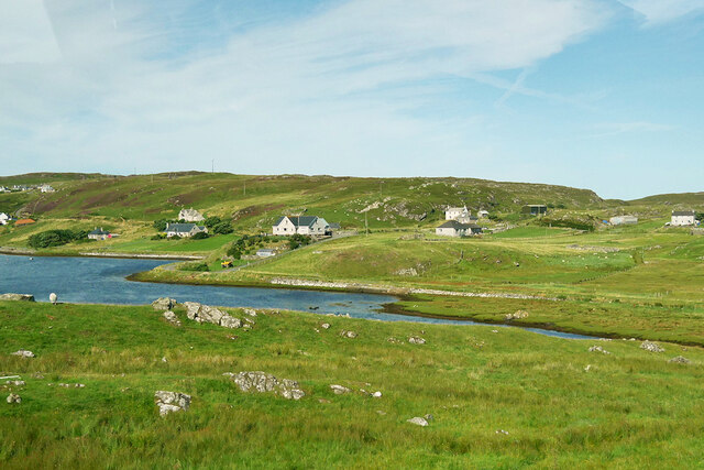
View towards Loch Chàrlabhaigh
View towards Loch Chàrlabhaigh Credit: David Dixon

Cnoc Eirshader, located in Ross-shire, Scotland, is a prominent hill that offers breathtaking views and a tranquil atmosphere. Rising to an elevation of approximately 126 meters (413 feet), it is considered a small mountain or a large hill, depending on one's perspective.

Situated near the village of Eirshader, Cnoc Eirshader is a popular destination for hikers and nature enthusiasts. The hill is characterized by its gentle slopes, covered with lush green vegetation during the warmer months. Heather, grasses, and wildflowers create a vibrant tapestry of colors, attracting a variety of wildlife such as birds, rabbits, and deer.

At the summit of Cnoc Eirshader, visitors are rewarded with panoramic views of the surrounding landscape. On clear days, the vista encompasses the surrounding countryside, with rolling hills, scattered lochs, and the distant peaks of the Scottish Highlands. The awe-inspiring scenery offers ample opportunities for photography and provides a peaceful retreat from the busyness of everyday life.

The hill is easily accessible, with well-maintained trails leading to the summit. Visitors can enjoy a leisurely walk or a more challenging hike, depending on their preferences and fitness levels. The route is suitable for all ages and is often enjoyed by families seeking outdoor adventures.

In conclusion, Cnoc Eirshader is a picturesque hill in Ross-shire, Scotland, offering stunning views and a serene environment. Whether one seeks a peaceful walk, a challenging hike, or simply a chance to connect with nature, this hill is a place of beauty and tranquility.

If you have any feedback on the listing, please let us know in the comments section below.

Cnoc Eirshader Images

Images are sourced within 2km of 58.282523/-6.7728704 or Grid Reference NB2042. Thanks to Geograph Open Source API. All images are credited.
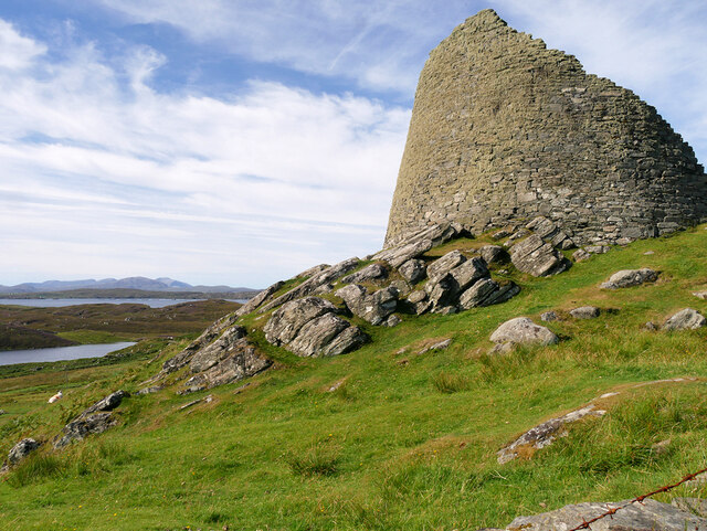
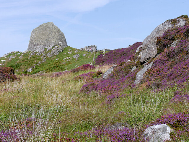
View towards Loch Chàrlabhaigh
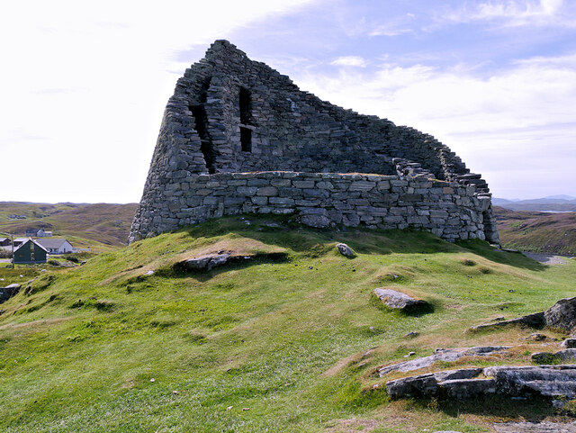
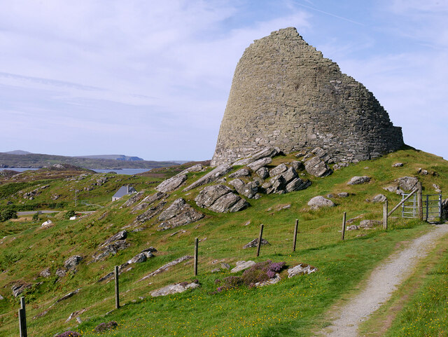
Dun Carloway Broch A Broch is an Iron Age, drystone structure found almost exclusively in Scotland and the Isles. Designed to impress and defend, they were probably the homes of tribal leaders and important members of the community. They are built with two concentric walls of stone, with a stairway or gallery within the walls to the upper floors. 

Dun Carloway (Dùn Chàrlabhaigh) broch is located above Loch an Dùin on a rocky knoll in a good defensive position. It is one of the best preserved in the Hebrides and some sections of the outer wall stand approximately 9 metres tall so they have survived almost intact. It dates back more than 2000 years; it is thought to have been constructed about 200 BC. Broch-building ceased around AD 100, but they may have continued in use. Evidence from excavations suggests Dun Carloway may have been used until about AD 1000. In the 17th century the broch is said to have been used as a stronghold by members of the Morison Clan when it was besieged by the Macaulays of Uig, with whom they were feuding. The implication is that the wall of the broch were relatively complete until this date.

The broch is a scheduled monument (SM90110 <span class="nowrap"><a title="https://portal.historicenvironment.scot/designation/SM90110" rel="nofollow ugc noopener" href="https://portal.historicenvironment.scot/designation/SM90110">Link</a><img style="margin-left:2px;" alt="External link" title="External link - shift click to open in new window" src="https://s1.geograph.org.uk/img/external.png" width="10" height="10"/></span> Historic Environment Scotland). More information can be found in the statement of significance <span class="nowrap"><a title="https://app-hes-pubs-prod-neu-01.azurewebsites.net/api/file/185e6bb3-1b4d-4c6d-8497-acaf009e3ef6" rel="nofollow ugc noopener" href="https://app-hes-pubs-prod-neu-01.azurewebsites.net/api/file/185e6bb3-1b4d-4c6d-8497-acaf009e3ef6">Link</a><img style="margin-left:2px;" alt="External link" title="External link - shift click to open in new window" src="https://s1.geograph.org.uk/img/external.png" width="10" height="10"/></span>  (pdf file on the HES website).
Dun Carloway Broch
A Broch is an Iron Age, drystone structure found almost exclusively in Scotland and the Isles. Designed to impress and defend, they were probably the homes of tribal leaders and important members of the community. They are built with two concentric walls of stone, with a stairway or gallery within the walls to the upper floors. Dun Carloway (Dùn Chàrlabhaigh) broch is located above Loch an Dùin on a rocky knoll in a good defensive position. It is one of the best preserved in the Hebrides and some sections of the outer wall stand approximately 9 metres tall so they have survived almost intact. It dates back more than 2000 years; it is thought to have been constructed about 200 BC. Broch-building ceased around AD 100, but they may have continued in use. Evidence from excavations suggests Dun Carloway may have been used until about AD 1000. In the 17th century the broch is said to have been used as a stronghold by members of the Morison Clan when it was besieged by the Macaulays of Uig, with whom they were feuding. The implication is that the wall of the broch were relatively complete until this date. The broch is a scheduled monument (SM90110 LinkExternal link Historic Environment Scotland). More information can be found in the statement of significance LinkExternal link (pdf file on the HES website).
Dun Carloway (Dùn Chàrlabhaigh) A Broch is an Iron Age, drystone structure found almost exclusively in Scotland and the Isles. Designed to impress and defend, they were probably the homes of tribal leaders and important members of the community. They are built with two concentric walls of stone, with a stairway or gallery within the walls to the upper floors. 

Dun Carloway (Dùn Chàrlabhaigh) broch is located above Loch an Dùin on a rocky knoll in a good defensive position. It is one of the best preserved in the Hebrides and some sections of the outer wall stand approximately 9 metres tall so they have survived almost intact. It dates back more than 2000 years; it is thought to have been constructed about 200 BC. Broch-building ceased around AD 100, but they may have continued in use. Evidence from excavations suggests Dun Carloway may have been used until about AD 1000. In the 17th century the broch is said to have been used as a stronghold by members of the Morison Clan when it was besieged by the Macaulays of Uig, with whom they were feuding. The implication is that the wall of the broch were relatively complete until this date.

The broch is a scheduled monument (SM90110 <span class="nowrap"><a title="https://portal.historicenvironment.scot/designation/SM90110" rel="nofollow ugc noopener" href="https://portal.historicenvironment.scot/designation/SM90110">Link</a><img style="margin-left:2px;" alt="External link" title="External link - shift click to open in new window" src="https://s1.geograph.org.uk/img/external.png" width="10" height="10"/></span> Historic Environment Scotland). More information can be found in the statement of significance <span class="nowrap"><a title="https://app-hes-pubs-prod-neu-01.azurewebsites.net/api/file/185e6bb3-1b4d-4c6d-8497-acaf009e3ef6" rel="nofollow ugc noopener" href="https://app-hes-pubs-prod-neu-01.azurewebsites.net/api/file/185e6bb3-1b4d-4c6d-8497-acaf009e3ef6">Link</a><img style="margin-left:2px;" alt="External link" title="External link - shift click to open in new window" src="https://s1.geograph.org.uk/img/external.png" width="10" height="10"/></span>  (pdf file on the HES website).
Dun Carloway (Dùn Chàrlabhaigh)
A Broch is an Iron Age, drystone structure found almost exclusively in Scotland and the Isles. Designed to impress and defend, they were probably the homes of tribal leaders and important members of the community. They are built with two concentric walls of stone, with a stairway or gallery within the walls to the upper floors. Dun Carloway (Dùn Chàrlabhaigh) broch is located above Loch an Dùin on a rocky knoll in a good defensive position. It is one of the best preserved in the Hebrides and some sections of the outer wall stand approximately 9 metres tall so they have survived almost intact. It dates back more than 2000 years; it is thought to have been constructed about 200 BC. Broch-building ceased around AD 100, but they may have continued in use. Evidence from excavations suggests Dun Carloway may have been used until about AD 1000. In the 17th century the broch is said to have been used as a stronghold by members of the Morison Clan when it was besieged by the Macaulays of Uig, with whom they were feuding. The implication is that the wall of the broch were relatively complete until this date. The broch is a scheduled monument (SM90110 LinkExternal link Historic Environment Scotland). More information can be found in the statement of significance LinkExternal link (pdf file on the HES website).
Dùn Chàrlabhaigh Broch A Broch is an Iron Age, drystone structure found almost exclusively in Scotland and the Isles. Designed to impress and defend, they were probably the homes of tribal leaders and important members of the community. They are built with two concentric walls of stone, with a stairway or gallery within the walls to the upper floors. 

Dun Carloway (Dùn Chàrlabhaigh) broch is located above Loch an Dùin on a rocky knoll in a good defensive position. It is one of the best preserved in the Hebrides and some sections of the outer wall stand approximately 9 metres tall so they have survived almost intact. It dates back more than 2000 years; it is thought to have been constructed about 200 BC. Broch-building ceased around AD 100, but they may have continued in use. Evidence from excavations suggests Dun Carloway may have been used until about AD 1000. In the 17th century the broch is said to have been used as a stronghold by members of the Morison Clan when it was besieged by the Macaulays of Uig, with whom they were feuding. The implication is that the wall of the broch were relatively complete until this date.

The broch is a scheduled monument (SM90110 <span class="nowrap"><a title="https://portal.historicenvironment.scot/designation/SM90110" rel="nofollow ugc noopener" href="https://portal.historicenvironment.scot/designation/SM90110">Link</a><img style="margin-left:2px;" alt="External link" title="External link - shift click to open in new window" src="https://s1.geograph.org.uk/img/external.png" width="10" height="10"/></span> Historic Environment Scotland). More information can be found in the statement of significance <span class="nowrap"><a title="https://app-hes-pubs-prod-neu-01.azurewebsites.net/api/file/185e6bb3-1b4d-4c6d-8497-acaf009e3ef6" rel="nofollow ugc noopener" href="https://app-hes-pubs-prod-neu-01.azurewebsites.net/api/file/185e6bb3-1b4d-4c6d-8497-acaf009e3ef6">Link</a><img style="margin-left:2px;" alt="External link" title="External link - shift click to open in new window" src="https://s1.geograph.org.uk/img/external.png" width="10" height="10"/></span>  (pdf file on the HES website).
Dùn Chàrlabhaigh Broch
A Broch is an Iron Age, drystone structure found almost exclusively in Scotland and the Isles. Designed to impress and defend, they were probably the homes of tribal leaders and important members of the community. They are built with two concentric walls of stone, with a stairway or gallery within the walls to the upper floors. Dun Carloway (Dùn Chàrlabhaigh) broch is located above Loch an Dùin on a rocky knoll in a good defensive position. It is one of the best preserved in the Hebrides and some sections of the outer wall stand approximately 9 metres tall so they have survived almost intact. It dates back more than 2000 years; it is thought to have been constructed about 200 BC. Broch-building ceased around AD 100, but they may have continued in use. Evidence from excavations suggests Dun Carloway may have been used until about AD 1000. In the 17th century the broch is said to have been used as a stronghold by members of the Morison Clan when it was besieged by the Macaulays of Uig, with whom they were feuding. The implication is that the wall of the broch were relatively complete until this date. The broch is a scheduled monument (SM90110 LinkExternal link Historic Environment Scotland). More information can be found in the statement of significance LinkExternal link (pdf file on the HES website).
Broch at Doune Carloway A Broch is an Iron Age, drystone structure found almost exclusively in Scotland and the Isles. Designed to impress and defend, they were probably the homes of tribal leaders and important members of the community. They are built with two concentric walls of stone, with a stairway or gallery within the walls to the upper floors. 

Dun Carloway (Dùn Chàrlabhaigh) broch is located above Loch an Dùin on a rocky knoll in a good defensive position. It is one of the best preserved in the Hebrides and some sections of the outer wall stand approximately 9 metres tall so they have survived almost intact. It dates back more than 2000 years; it is thought to have been constructed about 200 BC. Broch-building ceased around AD 100, but they may have continued in use. Evidence from excavations suggests Dun Carloway may have been used until about AD 1000. In the 17th century the broch is said to have been used as a stronghold by members of the Morison Clan when it was besieged by the Macaulays of Uig, with whom they were feuding. The implication is that the wall of the broch were relatively complete until this date.

The broch is a scheduled monument (SM90110 <span class="nowrap"><a title="https://portal.historicenvironment.scot/designation/SM90110" rel="nofollow ugc noopener" href="https://portal.historicenvironment.scot/designation/SM90110">Link</a><img style="margin-left:2px;" alt="External link" title="External link - shift click to open in new window" src="https://s1.geograph.org.uk/img/external.png" width="10" height="10"/></span> Historic Environment Scotland). More information can be found in the statement of significance <span class="nowrap"><a title="https://app-hes-pubs-prod-neu-01.azurewebsites.net/api/file/185e6bb3-1b4d-4c6d-8497-acaf009e3ef6" rel="nofollow ugc noopener" href="https://app-hes-pubs-prod-neu-01.azurewebsites.net/api/file/185e6bb3-1b4d-4c6d-8497-acaf009e3ef6">Link</a><img style="margin-left:2px;" alt="External link" title="External link - shift click to open in new window" src="https://s1.geograph.org.uk/img/external.png" width="10" height="10"/></span>  (pdf file on the HES website).
Broch at Doune Carloway
A Broch is an Iron Age, drystone structure found almost exclusively in Scotland and the Isles. Designed to impress and defend, they were probably the homes of tribal leaders and important members of the community. They are built with two concentric walls of stone, with a stairway or gallery within the walls to the upper floors. Dun Carloway (Dùn Chàrlabhaigh) broch is located above Loch an Dùin on a rocky knoll in a good defensive position. It is one of the best preserved in the Hebrides and some sections of the outer wall stand approximately 9 metres tall so they have survived almost intact. It dates back more than 2000 years; it is thought to have been constructed about 200 BC. Broch-building ceased around AD 100, but they may have continued in use. Evidence from excavations suggests Dun Carloway may have been used until about AD 1000. In the 17th century the broch is said to have been used as a stronghold by members of the Morison Clan when it was besieged by the Macaulays of Uig, with whom they were feuding. The implication is that the wall of the broch were relatively complete until this date. The broch is a scheduled monument (SM90110 LinkExternal link Historic Environment Scotland). More information can be found in the statement of significance LinkExternal link (pdf file on the HES website).
Dun Carloway A Broch is an Iron Age, drystone structure found almost exclusively in Scotland and the Isles. Designed to impress and defend, they were probably the homes of tribal leaders and important members of the community. They are built with two concentric walls of stone, with a stairway or gallery within the walls to the upper floors. 

Dun Carloway (Dùn Chàrlabhaigh) broch is located above Loch an Dùin on a rocky knoll in a good defensive position. It is one of the best preserved in the Hebrides and some sections of the outer wall stand approximately 9 metres tall so they have survived almost intact. It dates back more than 2000 years; it is thought to have been constructed about 200 BC. Broch-building ceased around AD 100, but they may have continued in use. Evidence from excavations suggests Dun Carloway may have been used until about AD 1000. In the 17th century the broch is said to have been used as a stronghold by members of the Morison Clan when it was besieged by the Macaulays of Uig, with whom they were feuding. The implication is that the wall of the broch were relatively complete until this date.

The broch is a scheduled monument (SM90110 <span class="nowrap"><a title="https://portal.historicenvironment.scot/designation/SM90110" rel="nofollow ugc noopener" href="https://portal.historicenvironment.scot/designation/SM90110">Link</a><img style="margin-left:2px;" alt="External link" title="External link - shift click to open in new window" src="https://s1.geograph.org.uk/img/external.png" width="10" height="10"/></span> Historic Environment Scotland). More information can be found in the statement of significance <span class="nowrap"><a title="https://app-hes-pubs-prod-neu-01.azurewebsites.net/api/file/185e6bb3-1b4d-4c6d-8497-acaf009e3ef6" rel="nofollow ugc noopener" href="https://app-hes-pubs-prod-neu-01.azurewebsites.net/api/file/185e6bb3-1b4d-4c6d-8497-acaf009e3ef6">Link</a><img style="margin-left:2px;" alt="External link" title="External link - shift click to open in new window" src="https://s1.geograph.org.uk/img/external.png" width="10" height="10"/></span>  (pdf file on the HES website).
Dun Carloway
A Broch is an Iron Age, drystone structure found almost exclusively in Scotland and the Isles. Designed to impress and defend, they were probably the homes of tribal leaders and important members of the community. They are built with two concentric walls of stone, with a stairway or gallery within the walls to the upper floors. Dun Carloway (Dùn Chàrlabhaigh) broch is located above Loch an Dùin on a rocky knoll in a good defensive position. It is one of the best preserved in the Hebrides and some sections of the outer wall stand approximately 9 metres tall so they have survived almost intact. It dates back more than 2000 years; it is thought to have been constructed about 200 BC. Broch-building ceased around AD 100, but they may have continued in use. Evidence from excavations suggests Dun Carloway may have been used until about AD 1000. In the 17th century the broch is said to have been used as a stronghold by members of the Morison Clan when it was besieged by the Macaulays of Uig, with whom they were feuding. The implication is that the wall of the broch were relatively complete until this date. The broch is a scheduled monument (SM90110 LinkExternal link Historic Environment Scotland). More information can be found in the statement of significance LinkExternal link (pdf file on the HES website).
Doune Carloway
Doune Carloway
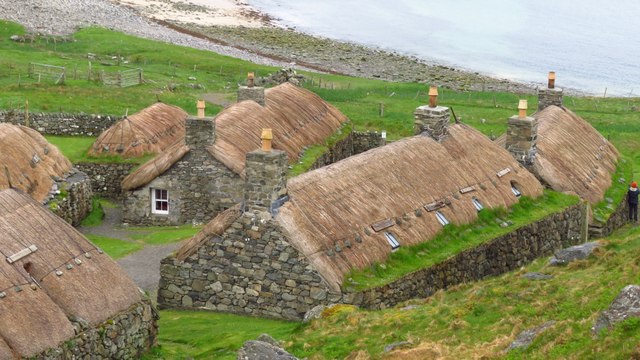
Blackhouse Village at Garenin
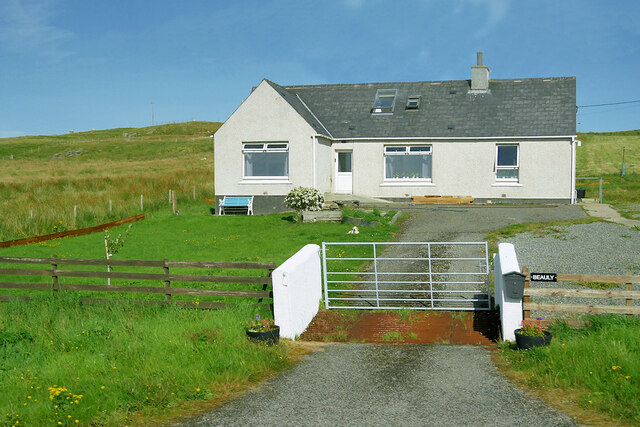
Bungalow, Upper Carloway
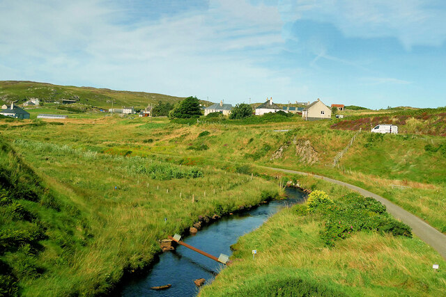
Abhainn Chàrlabhaigh
Carloway, Isle of Lewis
Byre, Carloway
Byre, Carloway
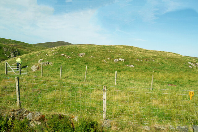
Hill near Carloway
Hill near Carloway
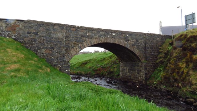
Bridge carrying A858 over Abhainn Charlabhaigh, Carloway
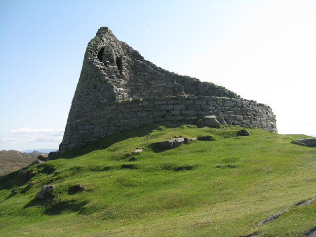
Dùn Chàrlabhaigh The broch at Carloway.
Dùn Chàrlabhaigh
The broch at Carloway.
Blackhouse base at Carloway Seen from the path that leads to the broch.
Blackhouse base at Carloway
Seen from the path that leads to the broch.
Welcome to Dùn Chàrlabhaigh Historic Scotland information panel about the broch.
Welcome to Dùn Chàrlabhaigh
Historic Scotland information panel about the broch.
Show me another place!

Cnoc Eirshader is located at Grid Ref: NB2042 (Lat: 58.282523, Lng: -6.7728704)

Unitary Authority: Na h-Eileanan an Iar

Police Authority: Highlands and Islands

What 3 Words

///souk.forwarded.zones. Near Carloway, Na h-Eileanan Siar

Related Wikis

Carloway

Carloway (Scottish Gaelic: Càrlabhagh [ˈkʰaːɾɫ̪ə.ɤː]) is a crofting township and a district on the west coast of the Isle of Lewis, in the Outer Hebrides...

Borrowston, Lewis

Borrowston (Scottish Gaelic: Borghastan), with a population of about 50, is a crofting township situated on the Isle of Lewis, on the Outer Hebrides of...

Garenin

Garenin (Scottish Gaelic: Na Gearrannan) is a crofting township on the west coast of the Isle of Lewis in the Outer Hebrides of Scotland. Garenin is in...

Dun Carloway

Dun Carloway (Scottish Gaelic: Dùn Chàrlabhaigh) is a broch situated in the district of Carloway, on the west coast of the Isle of Lewis, Scotland (grid...

Nearby Amenities

Located within 500m of 58.282523,-6.7728704
Passing Place
Lat/Long: 58.2845001/-6.7757309
Càrlabhagh
Name En: Carloway
Name Gd: Càrlabhagh
Name Sco: Carlawa
Place: village
Population: 500
Wikidata: Q1043339
Wikipedia: en:Carloway
Lat/Long: 58.2827578/-6.7684901
Passing Place
Lat/Long: 58.2827038/-6.7719265
Source: survey
Tourism: picnic_site
Lat/Long: 58.2831343/-6.7687285
Bus Stop
Carloway
Bus: yes
Naptan AtcoCode: 6010731588
Naptan Bearing: NE
Naptan CommonName: Carloway
Naptan Indicator: Bridge
Naptan Landmark: Bus shelter
Naptan NaptanCode: 94723962
Naptan Street: Bridge
Naptan Verified: no
Public Transport: platform
Shelter: yes
Source: naptan_import
Lat/Long: 58.2824614/-6.7687372
Carloway War Memorial
Historic: memorial
Memorial: war_memorial
Lat/Long: 58.2821342/-6.768981
Post Box
Collection Times: Mo-Fr 10:45; Sa 10:45
Operator: Royal Mail
Post Box Type: lamp
Ref: HS2 53
Royal Cypher: scottish_crown
Source: survey
Lat/Long: 58.2851607/-6.7768981
Cnoc Càrlabhaigh
Alt Name Gd: An Cnoc
Name En: Knock Carloway
Name Gd: Cnoc Càrlabhaigh
Place: neighbourhood
Lat/Long: 58.2813705/-6.7703482
Passing Place
Lat/Long: 58.2825083/-6.7666932
Barrier: cattle_grid
Lat/Long: 58.2847818/-6.7758809
Barrier: cattle_grid
Lat/Long: 58.2833316/-6.7730973
Barrier: cattle_grid
Lat/Long: 58.2830342/-6.77979
Barrier: cattle_grid
Lat/Long: 58.2821173/-6.7780458
Power: pole
Lat/Long: 58.2796514/-6.7666951
Power: pole
Lat/Long: 58.2794907/-6.7679963
Power: pole
Lat/Long: 58.2793028/-6.7694479
Power: pole
Lat/Long: 58.2787249/-6.7705026
Power: pole
Lat/Long: 58.2781833/-6.7715056
Power: pole
Lat/Long: 58.2842987/-6.7765168
Power: pole
Lat/Long: 58.2841503/-6.7778369
Power: pole
Lat/Long: 58.2837042/-6.778918
Power: pole
Lat/Long: 58.2832865/-6.7799488
Power: pole
Lat/Long: 58.2827788/-6.7810995
Power: pole
Lat/Long: 58.2831943/-6.7787251
Power: pole
Lat/Long: 58.2827694/-6.7781842
Power: pole
Lat/Long: 58.2823742/-6.7776937
Power: pole
Lat/Long: 58.2819421/-6.7775779
Power: pole
Lat/Long: 58.2858422/-6.7775826
Power: pole
Lat/Long: 58.2854303/-6.77754
Power: pole
Lat/Long: 58.2847692/-6.7766481
Power: pole
Lat/Long: 58.283794/-6.7758736
Power: pole
Lat/Long: 58.2839863/-6.7742443
Power: pole
Lat/Long: 58.2836441/-6.7735235
Power: pole
Lat/Long: 58.2841327/-6.7745141
Power: pole
Lat/Long: 58.2861766/-6.7686777
Power: pole
Lat/Long: 58.2867185/-6.7704345
Power: pole
Lat/Long: 58.2848598/-6.7761902
Power: pole
Lat/Long: 58.2853853/-6.775473
Power: pole
Lat/Long: 58.2858448/-6.774639
Power: pole
Lat/Long: 58.2861297/-6.7741272
Power: pole
Lat/Long: 58.2865718/-6.7733397
Power: pole
Lat/Long: 58.2868048/-6.7729125
Power: pole
Lat/Long: 58.2815534/-6.7685434
Power: pole
Lat/Long: 58.281362/-6.7683704
Power: pole
Lat/Long: 58.2816376/-6.7677721
Power: pole
Lat/Long: 58.2808544/-6.7682957
Power: pole
Lat/Long: 58.280397/-6.768212
Power: pole
Lat/Long: 58.2798775/-6.7680813
Clach An Tursa
Alt Name: Stone of Sadness;Carloway Row;Clach an Trushal
Archaeological Site: megalith
Historic: archaeological_site
Historic Civilization: prehistoric
Historic Era: neolithic
Historic Period: stone-age;bronze-age
Megalith Type: alignment
Lat/Long: 58.285938/-6.771948
Material: wood
Power: pole
Lat/Long: 58.2805492/-6.7720459
Passing Place
Lat/Long: 58.2841395/-6.7753604
Passing Place
Lat/Long: 58.2835574/-6.7746943
Passing Place
Lat/Long: 58.2854272/-6.7770586
Barrier: cattle_grid
Lat/Long: 58.2853187/-6.776661
Passing Place
Lat/Long: 58.2832474/-6.7736071
Passing Place
Lat/Long: 58.2823164/-6.7648418
Passing Place
Lat/Long: 58.2820269/-6.7734149
Passing Place
Lat/Long: 58.2838699/-6.7792556
Police
Lat/Long: 58.2814063/-6.7702285
Barrier: cattle_grid
Lat/Long: 58.2819158/-6.7692179
Addr Housenumber: 1
Addr Street: Lois Na Glibe
Lat/Long: 58.2814918/-6.7667398
Addr Housenumber: 2
Addr Street: Lois Na Glibe
Lat/Long: 58.2814495/-6.766485
Addr Housenumber: 3
Addr Street: Lois Na Glibe
Lat/Long: 58.2814213/-6.7663804
Addr Housenumber: 4
Addr Street: Lois Na Glibe
Lat/Long: 58.2813212/-6.7662248
Addr Housenumber: 5
Addr Street: Lois Na Glibe
Lat/Long: 58.281262/-6.7662758
Addr Housenumber: 6
Addr Street: Lois Na Glibe
Lat/Long: 58.281183/-6.7664609
Addr Housenumber: 7
Addr Street: Lois Na Glibe
Lat/Long: 58.2811463/-6.7665386
Man Made: mast
Tower Type: communication
Lat/Long: 58.2794771/-6.7727854
The data included in this document is from www.openstreetmap.org. The data is made available under ODbL.

Have you been to Cnoc Eirshader?

Leave your review of Cnoc Eirshader below (or comments, questions and feedback).