Duke's Wood

Wood, Forest in Stirlingshire

Scotland

Duke's Wood

Dungoil Clearfelled Dungoil, seen from the road across the north side of Lecket Hill
Dungoil Credit: Richard Webb

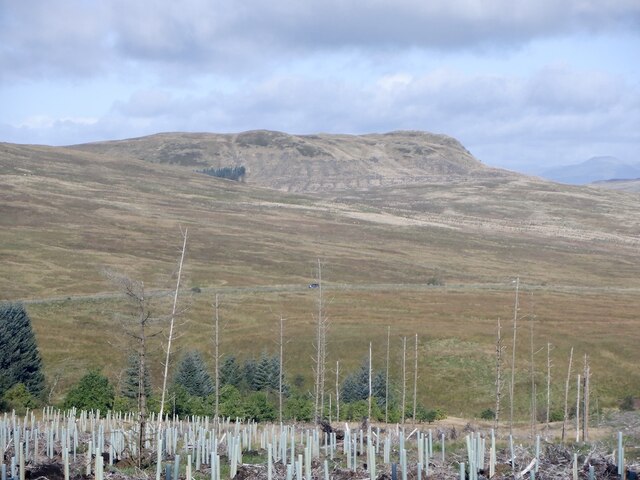
Duke's Wood is a picturesque woodland located in Stirlingshire, Scotland. Nestled within the stunning landscape of the Scottish Highlands, it spans over a vast area of approximately 200 acres. The wood is named after the Duke of Montrose, who owned the land during the 18th and 19th centuries.

The forest boasts a diverse range of tree species, including oak, birch, beech, and pine, creating a lush and vibrant ecosystem. The dense canopy provides a haven for numerous bird species, such as woodpeckers, owls, and various songbirds, making it a popular spot among birdwatchers.

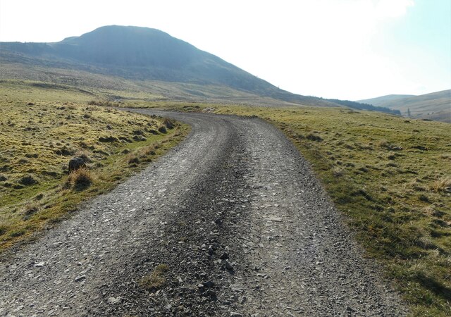
Duke's Wood offers an array of recreational activities for visitors to enjoy. There are several well-maintained trails that meander through the wood, allowing hikers and walkers to explore its natural beauty. These trails offer breathtaking views of the surrounding countryside, with the option of longer or shorter routes to suit all abilities.

The woodland also features picnic areas and benches, providing the perfect opportunity for visitors to relax and immerse themselves in the tranquil ambience of the forest. Wildlife enthusiasts can often spot red squirrels, rabbits, and deer roaming freely in their natural habitat.

Duke's Wood is managed by a dedicated team of conservationists who work tirelessly to preserve its natural heritage. They regularly organize educational events and guided tours, offering visitors the chance to learn about the flora and fauna that call the wood their home.

Overall, Duke's Wood is a captivating destination for nature lovers and those seeking solace in the embrace of Scotland's natural wonders. Its scenic beauty, diverse ecosystem, and range of recreational activities make it a must-visit location in Stirlingshire.

If you have any feedback on the listing, please let us know in the comments section below.

Duke's Wood Images

Images are sourced within 2km of 56.049515/-4.1831607 or Grid Reference NS6486. Thanks to Geograph Open Source API. All images are credited.

Dungoil Clearfelled Dungoil, seen from the road across the north side of Lecket Hill
Dungoil
Clearfelled Dungoil, seen from the road across the north side of Lecket Hill
Fintry Youth Hostel by Endrick Water, Stirling North of the Campsie Fells, this was one of Scotland's earliest hostels, opening in 1935. It was popular with weekenders from Glasgow. The hostel closed in 1981 being by then structurally unsound, and was demolished. (Details from John Martin)

Scanned from an Agfa colour slide, circa mid 1970s in August. It may not be 1975.
Fintry Youth Hostel by Endrick Water, Stirling
North of the Campsie Fells, this was one of Scotland's earliest hostels, opening in 1935. It was popular with weekenders from Glasgow. The hostel closed in 1981 being by then structurally unsound, and was demolished. (Details from John Martin) Scanned from an Agfa colour slide, circa mid 1970s in August. It may not be 1975.
Townhead Farm The Fintry Hills are behind.
Townhead Farm
The Fintry Hills are behind.
Double Craigs Impressive scarps on the southwest side of the Fintry Hills. Townhead Farm is on the right.
Double Craigs
Impressive scarps on the southwest side of the Fintry Hills. Townhead Farm is on the right.
Looking down the B822
Forestry road gate Giving access to the forestry around Dungoil (slopes rising on the left).
Forestry road gate
Giving access to the forestry around Dungoil (slopes rising on the left).
Forestry track With Dungoil in the distance.
Forestry track
With Dungoil in the distance.
Double Craigs Impressive scarps on the southwest side of the Fintry Hills.
Double Craigs
Impressive scarps on the southwest side of the Fintry Hills.
Dungoil A 424 metres summit in the Campsie Fells.
Dungoil
A 424 metres summit in the Campsie Fells.
Slopes below Dungoil The 424 metres high summit seen from about 315 metres.
Slopes below Dungoil
The 424 metres high summit seen from about 315 metres.
Hamlet in the Endrick Valley The settlement is located around the bridge carrying the B818 over the Endrick Water.
Hamlet in the Endrick Valley
The settlement is located around the bridge carrying the B818 over the Endrick Water.
Townhead Farm
Townhead Farm
Quadbike track, Fintry Hills
Fintry Hills View across the plateau towards Stronend.
Fintry Hills
View across the plateau towards Stronend.
Fintry Hills The plateau east of Stronend.
Fintry Hills
The plateau east of Stronend.
Moorland south of Stronend Fintry Hills
Moorland south of Stronend
Fintry Hills
Plateau, Fintry Hills
Tussocks, Fintry Hills Rough going south of Stronend.
Tussocks, Fintry Hills
Rough going south of Stronend.
Show me another place!

Duke's Wood is located at Grid Ref: NS6486 (Lat: 56.049515, Lng: -4.1831607)

Unitary Authority: Stirling

Police Authority: Forth Valley

What 3 Words

///diverts.shipyards.recapture. Near Lennoxtown, East Dunbartonshire

Nearby Locations

Duke's Wood

Related Wikis

Fintry Castle, Stirling

Fintry Castle, was a 15th-century castle near Fintry, Stirling, Scotland. The castle was built on the northern slopes of the valley of the Endrick Water...
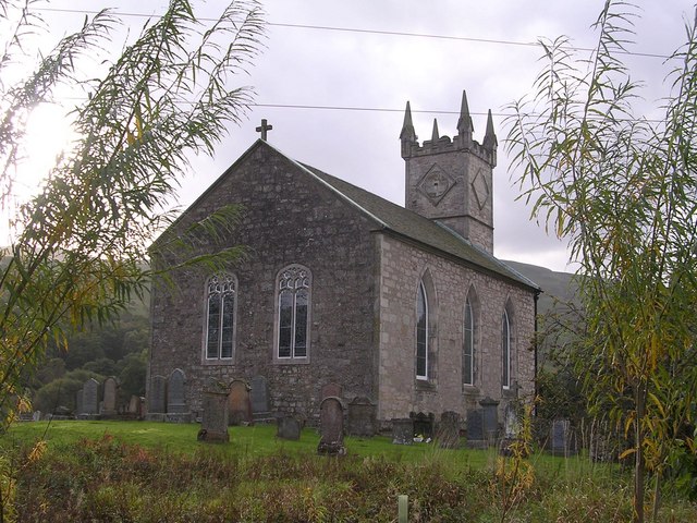
Fintry Kirk

Fintry Kirk is in the village of Fintry in Stirlingshire, Scotland. Fintry is a Church of Scotland Parish in the Presbytery of Stirling. The kirk is located...

Loup of Fintry

Loup of Fintry is a notable waterfall on the River Endrick around 2 miles to the east of Fintry in Scotland and 17 miles from Stirling, 10 miles from Denny...

Fintry

Fintry is a small riverside village in Stirlingshire, central Scotland. It is located 16 miles (26 km) south-west of Stirling and around 19 miles (31 km...

Nearby Amenities

Located within 500m of 56.049515,-4.1831607
Power: pole
Lat/Long: 56.0473323/-4.1763526
Power: pole
Lat/Long: 56.0469304/-4.1783899
Power: pole
Lat/Long: 56.0470648/-4.1794902
Power: pole
Lat/Long: 56.0471944/-4.1805904
Power: pole
Lat/Long: 56.047344/-4.1817974
Power: pole
Lat/Long: 56.047476/-4.1829227
Power: pole
Lat/Long: 56.047601/-4.1839937
Power: pole
Lat/Long: 56.0475367/-4.1853972
Power: pole
Lat/Long: 56.0475461/-4.186303
Power: pole
Lat/Long: 56.0475554/-4.186987
Power: pole
Lat/Long: 56.0478393/-4.1881625
Power: pole
Lat/Long: 56.0481197/-4.1893757
Power: pole
Lat/Long: 56.0483931/-4.190568
Power: pole
Lat/Long: 56.0470683/-4.1864055
Power: pole
Lat/Long: 56.0463708/-4.1865791
Power: pole
Lat/Long: 56.0457306/-4.1868133
The data included in this document is from www.openstreetmap.org. The data is made available under ODbL.

Have you been to Duke's Wood?

Leave your review of Duke's Wood below (or comments, questions and feedback).