Carey Park

Settlement in Cornwall

England

Carey Park

Polperro - The Crumplehorn The Crumplehorn was formerly a mill, but is now partly a public house and partly holiday accommodation. It is the first significant building one encounters having parked in the large car park above the village of Polperro.
EH Grade II listing: <span class="nowrap"><a title="https://historicengland.org.uk/listing/the-list/list-entry/1140795" rel="nofollow ugc noopener" href="https://historicengland.org.uk/listing/the-list/list-entry/1140795">Link</a><img style="margin-left:2px;" alt="External link" title="External link - shift click to open in new window" src="https://s1.geograph.org.uk/img/external.png" width="10" height="10"/></span>
Polperro - The Crumplehorn Credit: Rob Farrow

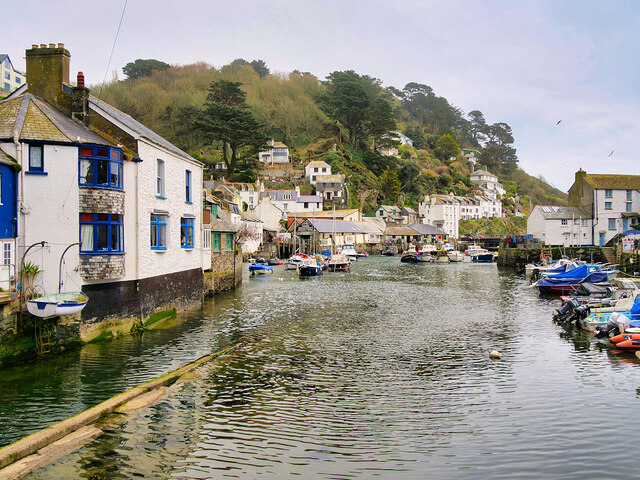
Carey Park is a charming village located in the county of Cornwall, England. Situated on the southern coast, it is surrounded by picturesque landscapes and stunning views of the Atlantic Ocean. With a population of around 1,000 residents, it offers a tight-knit community atmosphere that is characteristic of small English villages.

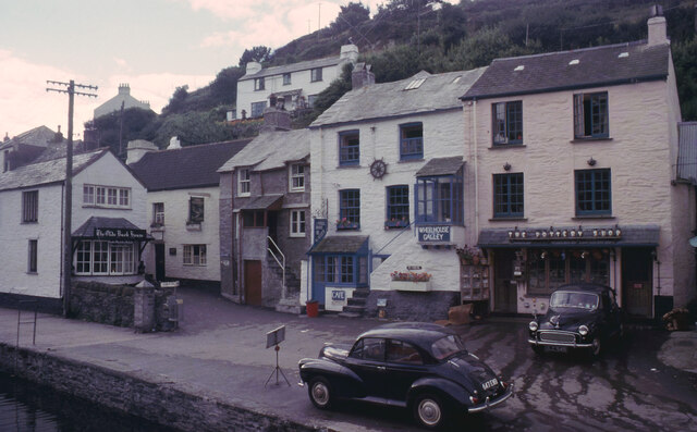
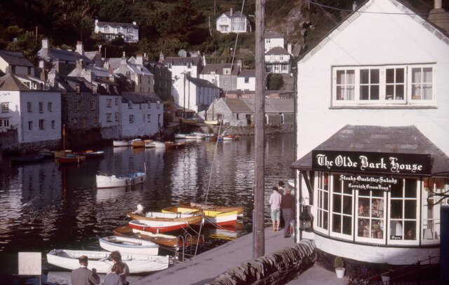
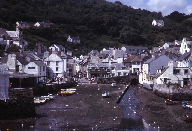
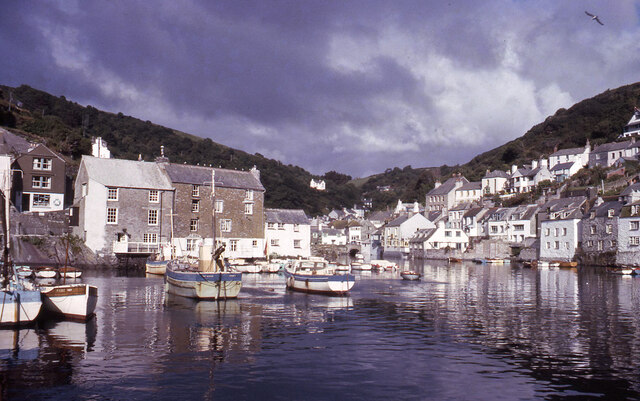
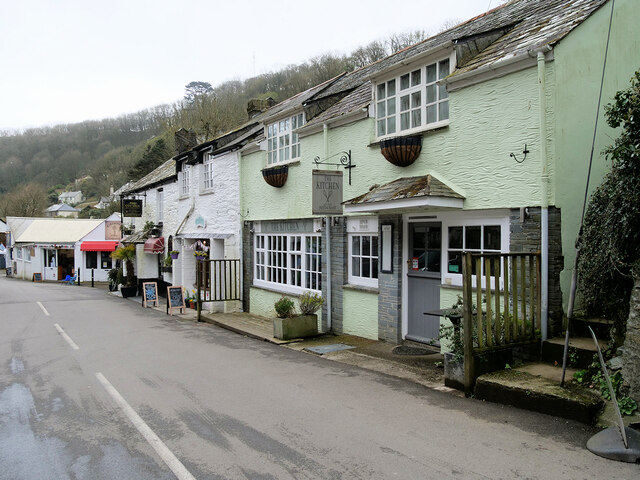
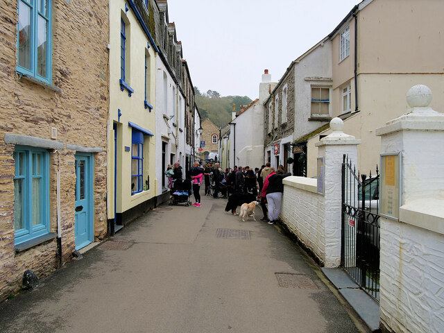
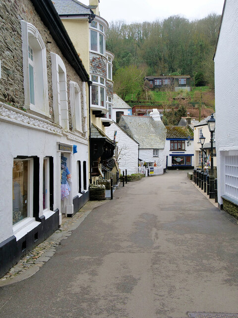
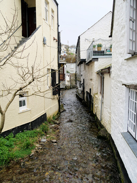
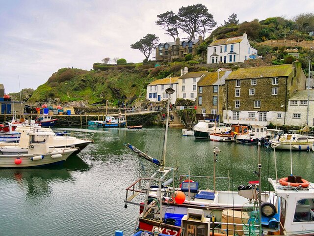
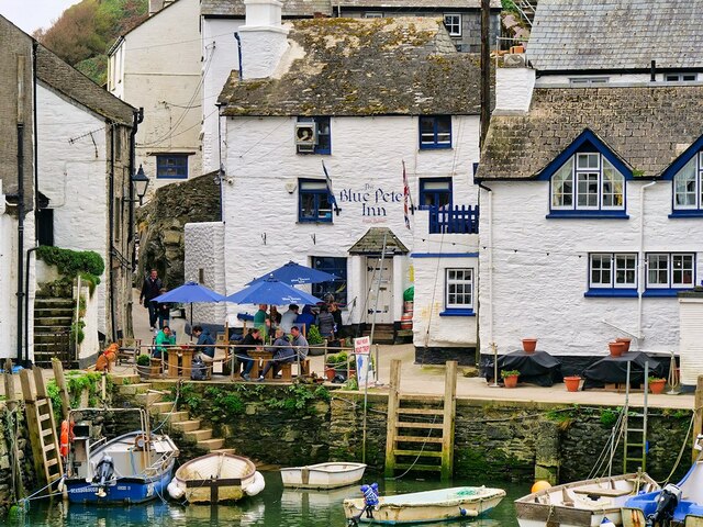
The village is known for its quaint cottages, many of which date back to the 18th century. Its narrow streets are lined with colorful gardens and small shops, creating a delightful ambiance for residents and visitors alike. The local church, St. Mary's, is a prominent landmark in the village and adds to its historic charm.

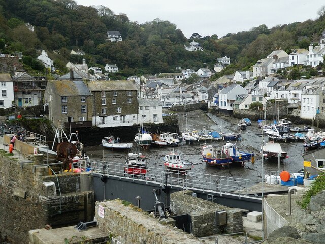
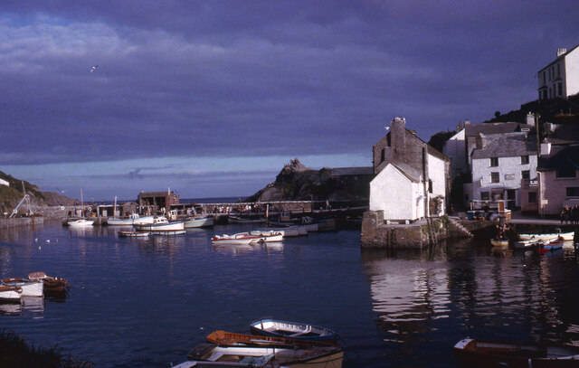
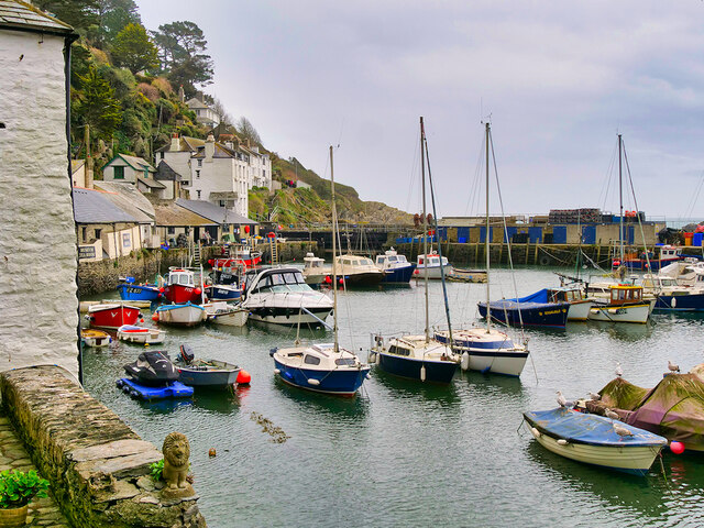
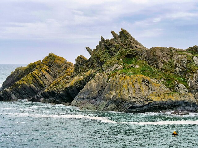
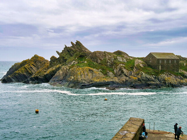
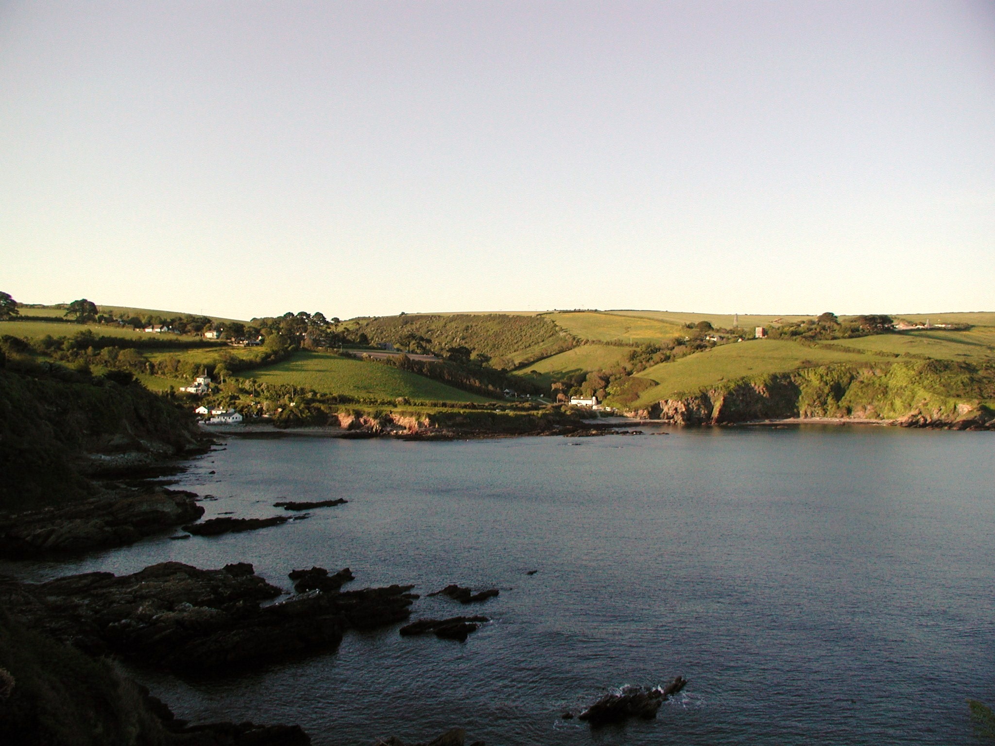
Nature enthusiasts will be delighted by the proximity of Carey Park to several natural attractions. The nearby coastal path provides breathtaking walks along the cliffs, offering panoramic views of the ocean. Additionally, the village is surrounded by lush green fields and rolling hills, making it an ideal location for outdoor activities such as hiking and cycling.

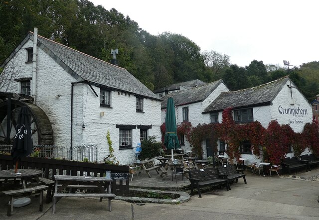
For those seeking more leisurely pursuits, Carey Park offers a range of amenities. The village boasts a cozy pub, where locals gather for a pint and friendly conversation. There are also several quaint tearooms and cafes, perfect for enjoying a cup of tea and scones. The village hall hosts regular community events, including art exhibitions and local produce markets.

Overall, Carey Park is a charming and idyllic village that offers a peaceful retreat from the hustle and bustle of city life. Its natural beauty, charming architecture, and close-knit community make it an attractive destination for both residents and visitors seeking a quintessential English village experience.

If you have any feedback on the listing, please let us know in the comments section below.

Carey Park Images

Images are sourced within 2km of 50.338707/-4.510652 or Grid Reference SX2151. Thanks to Geograph Open Source API. All images are credited.

Polperro - The Crumplehorn The Crumplehorn was formerly a mill, but is now partly a public house and partly holiday accommodation. It is the first significant building one encounters having parked in the large car park above the village of Polperro.
EH Grade II listing: <span class="nowrap"><a title="https://historicengland.org.uk/listing/the-list/list-entry/1140795" rel="nofollow ugc noopener" href="https://historicengland.org.uk/listing/the-list/list-entry/1140795">Link</a><img style="margin-left:2px;" alt="External link" title="External link - shift click to open in new window" src="https://s1.geograph.org.uk/img/external.png" width="10" height="10"/></span>
Polperro - The Crumplehorn
The Crumplehorn was formerly a mill, but is now partly a public house and partly holiday accommodation. It is the first significant building one encounters having parked in the large car park above the village of Polperro. EH Grade II listing: LinkExternal link
Polperro - Breakwaters and storm gate protecting the harbour Polperro's harbour has always been naturally protected to a large extent by 'Peak Rock' but adverse conditions could inundate the little port so breakwaters were built and a massive steel storm gate keep the sea at bay.
Polperro - Breakwaters and storm gate protecting the harbour
Polperro's harbour has always been naturally protected to a large extent by 'Peak Rock' but adverse conditions could inundate the little port so breakwaters were built and a massive steel storm gate keep the sea at bay.
Polperro - Steps up from The Warren Apparently the founder of Methodism, John Wesley, preached from these steps which rise to the north of The Warren in Polperro.
Polperro - Steps up from The Warren
Apparently the founder of Methodism, John Wesley, preached from these steps which rise to the north of The Warren in Polperro.
Wheelhouse Gallery, Polperro Photo of the quayside showing (left to right) The Olde Bark House, the Three Pilchards pub, Wheelhouse Gallery and cafe (Wheelhouse Family Restaurant in 2021), and The Pottery Shop.
Wheelhouse Gallery, Polperro
Photo of the quayside showing (left to right) The Olde Bark House, the Three Pilchards pub, Wheelhouse Gallery and cafe (Wheelhouse Family Restaurant in 2021), and The Pottery Shop.
Looking across Polperro Harbour from Quay Road With The Olde Bark House in the foreground. The four houses on the far side of the water are named (in 2021): The Old Watch, Harbour View, Sea Walls and Slipway Cottage.
Looking across Polperro Harbour from Quay Road
With The Olde Bark House in the foreground. The four houses on the far side of the water are named (in 2021): The Old Watch, Harbour View, Sea Walls and Slipway Cottage.
Looking across Polperro harbour from The Warren Showing the pier guarding the entrance to the harbour. The white house to its right was named Studio Cottage in 2021.
Looking across Polperro harbour from The Warren
Showing the pier guarding the entrance to the harbour. The white house to its right was named Studio Cottage in 2021.
Western end of Polperro harbour
Western end of Polperro harbour Probably seen from end of the entrance pier. The three houses in foreground were, in 2021, named Moorings Pierinn, Mariners and Studio Cottage.
Western end of Polperro harbour
Probably seen from end of the entrance pier. The three houses in foreground were, in 2021, named Moorings Pierinn, Mariners and Studio Cottage.
Polperro, The Coombes Polperro is a small fishing village and harbour about 4 miles west of Looe in Cornwall. The village is a major tourist attraction. Cars are not allowed in the village, with the car park being located in Crumplehorn, a northern extension of the village.
Polperro, The Coombes
Polperro is a small fishing village and harbour about 4 miles west of Looe in Cornwall. The village is a major tourist attraction. Cars are not allowed in the village, with the car park being located in Crumplehorn, a northern extension of the village.
Polperro, Fore Street Polperro is a small fishing village and harbour about 4 miles west of Looe in Cornwall. The village is a major tourist attraction. Cars are not allowed in the village, with the car park being located in Crumplehorn, a northern extension of the village.
Polperro, Fore Street
Polperro is a small fishing village and harbour about 4 miles west of Looe in Cornwall. The village is a major tourist attraction. Cars are not allowed in the village, with the car park being located in Crumplehorn, a northern extension of the village.
Big Green, Polperro Polperro is a small fishing village and harbour about 4 miles west of Looe in Cornwall. The village is a major tourist attraction. Cars are not allowed in the village, with the car park being located in Crumplehorn, a northern extension of the village.
Big Green, Polperro
Polperro is a small fishing village and harbour about 4 miles west of Looe in Cornwall. The village is a major tourist attraction. Cars are not allowed in the village, with the car park being located in Crumplehorn, a northern extension of the village.
River Pol, Polperro The small stream-like River Pol runs through the village into the tidal harbour.
River Pol, Polperro
The small stream-like River Pol runs through the village into the tidal harbour.
Polperro Harbour Polperro is a small fishing village and harbour about 4 miles west of Looe in Cornwall. The village is a major tourist attraction. Cars are not allowed in the village, with the car park being located in Crumplehorn, a northern extension of the village.
Polperro Harbour
Polperro is a small fishing village and harbour about 4 miles west of Looe in Cornwall. The village is a major tourist attraction. Cars are not allowed in the village, with the car park being located in Crumplehorn, a northern extension of the village.
The Harbour, Polperro Polperro is a small fishing village and harbour about 4 miles west of Looe in Cornwall. The village is a major tourist attraction. Cars are not allowed in the village, with the car park being located in Crumplehorn, a northern extension of the village.
The Harbour, Polperro
Polperro is a small fishing village and harbour about 4 miles west of Looe in Cornwall. The village is a major tourist attraction. Cars are not allowed in the village, with the car park being located in Crumplehorn, a northern extension of the village.
Polperro, Chapel Cliff Polperro is a small fishing village and harbour about 4 miles west of Looe in Cornwall. The village is a major tourist attraction. Cars are not allowed in the village, with the car park being located in Crumplehorn, a northern extension of the village.
Polperro, Chapel Cliff
Polperro is a small fishing village and harbour about 4 miles west of Looe in Cornwall. The village is a major tourist attraction. Cars are not allowed in the village, with the car park being located in Crumplehorn, a northern extension of the village.
The Blue Peter Inn, Polperro Early-nineteenth century public house. Grade II listed building (list entry number 1140779 <span class="nowrap"><a title="https://historicengland.org.uk/listing/the-list/list-entry/1140779?section=official-list-entry" rel="nofollow ugc noopener" href="https://historicengland.org.uk/listing/the-list/list-entry/1140779?section=official-list-entry">Link</a><img style="margin-left:2px;" alt="External link" title="External link - shift click to open in new window" src="https://s1.geograph.org.uk/img/external.png" width="10" height="10"/></span> Historic England).
The Blue Peter Inn, Polperro
Early-nineteenth century public house. Grade II listed building (list entry number 1140779 LinkExternal link Historic England).
Chapel Cliff, Polperro Polperro is a small fishing village and harbour about 4 miles west of Looe in Cornwall. The village is a major tourist attraction. Cars are not allowed in the village, with the car park being located in Crumplehorn, a northern extension of the village.
Chapel Cliff, Polperro
Polperro is a small fishing village and harbour about 4 miles west of Looe in Cornwall. The village is a major tourist attraction. Cars are not allowed in the village, with the car park being located in Crumplehorn, a northern extension of the village.
Show me another place!

Carey Park is located at Grid Ref: SX2151 (Lat: 50.338707, Lng: -4.510652)

Unitary Authority: Cornwall

Police Authority: Devon and Cornwall

What 3 Words

///cured.dusts.prone. Near Polperro, Cornwall

Related Wikis

Carey Park, Cornwall

Carey Park is a hamlet-estate in the civil parish of Polperro, in the Cornwall, in the ceremonial county of Cornwall, England. It is situated 600 metres...

Killigarth Manor

Killigarth Manor is a Grade II listed former manor house in the civil parish of Polperro in Cornwall, United Kingdom. It is in the hamlet of Killigarth...

Brent, Cornwall

Brent is a housing estate in Cornwall, England, UK. It is situated 500 metres (550 yd) east of the village of Polperro, within the civil parish of Polperro...

Talland Bay

Talland Bay (Cornish: Porth Tallan) is west of the town of Looe in Cornwall. On Talland Bay are two sheltered shingle beaches, Talland Sand and Rotterdam...

Nearby Amenities

Located within 500m of 50.338707,-4.510652
Bus Stop
Killigarth Turn
Bench: yes
Bin: yes
Bus: yes
Lit: no
Naptan AtcoCode: 0800COA10179
Naptan Bearing: S
Naptan CommonName: Killigarth Turn
Naptan Indicator: S-bound
Naptan NaptanCode: cordpjdw
Naptan Street: A387
Naptan Verified: no
Public Transport: platform
Shelter: yes
Source: naptan;bing
Tactile Paving: no
Lat/Long: 50.3423641/-4.5119344
Bus Stop
Killigarth Turn
Bench: no
Bin: no
Bus: yes
Lit: no
Naptan AtcoCode: 0800COA10180
Naptan Bearing: N
Naptan CommonName: Killigarth Turn
Naptan Indicator: N-bound
Naptan NaptanCode: cordpjdj
Naptan Street: A387
Naptan Verified: no
Public Transport: platform
Shelter: yes
Source: naptan;bing
Tactile Paving: no
Lat/Long: 50.3429849/-4.5123467
Bus Stop
Killigarth Manor
Bench: no
Bin: no
Bus: yes
Naptan AtcoCode: 0800COA10184
Naptan Bearing: S
Naptan CommonName: Killigarth Manor
Naptan NaptanCode: cordpjgw
Naptan Street: Unclassified
Naptan Verified: no
Public Transport: platform
Shelter: no
Source: naptan_import
Tactile Paving: no
Lat/Long: 50.3382905/-4.5102156
Bus Stop
Junction Brentwartha
Bus: yes
Naptan AtcoCode: 0800COA10185
Naptan Bearing: E
Naptan CommonName: Junction Brentwartha
Naptan NaptanCode: cordpjat
Naptan Street: Unclassified
Naptan Verified: no
Public Transport: platform
Shelter: no
Source: naptan_import
Lat/Long: 50.3345413/-4.5126319
Barrier: bollard
Bicycle: yes
Bollard: fixed
Foot: yes
Material: metal
Source: gps_survey
Lat/Long: 50.339468/-4.5055278
Mace
Brand: Mace
Brand Wikidata: Q75240338
Shop: convenience
Lat/Long: 50.337926/-4.5096991
Barrier: bollard
Bicycle: yes
Bollard: fixed
Foot: yes
Horse: no
Material: metal
Lat/Long: 50.3413319/-4.5086626
Barrier: kissing_gate
Source: survey;gps
Lat/Long: 50.335084/-4.5066005
Generator Method: photovoltaic
Generator Output Electricity: yes
Generator Source: solar
Generator Type: solar_photovoltaic_panel
Location: roof
Power: generator
Lat/Long: 50.3406206/-4.510623
Generator Method: photovoltaic
Generator Output Electricity: yes
Generator Source: solar
Generator Type: solar_photovoltaic_panel
Location: roof
Power: generator
Lat/Long: 50.3397527/-4.5114679
Generator Method: photovoltaic
Generator Output Electricity: yes
Generator Source: solar
Generator Type: solar_photovoltaic_panel
Location: roof
Power: generator
Lat/Long: 50.3396064/-4.5123195
Generator Method: photovoltaic
Generator Output Electricity: yes
Generator Source: solar
Generator Type: solar_photovoltaic_panel
Location: roof
Power: generator
Lat/Long: 50.3396209/-4.5123732
Generator Method: photovoltaic
Generator Output Electricity: yes
Generator Source: solar
Generator Type: solar_photovoltaic_panel
Location: roof
Power: generator
Lat/Long: 50.3393196/-4.5122525
Generator Method: photovoltaic
Generator Output Electricity: yes
Generator Source: solar
Generator Type: solar_photovoltaic_panel
Location: roof
Power: generator
Lat/Long: 50.3391827/-4.511484
Generator Method: photovoltaic
Generator Output Electricity: yes
Generator Source: solar
Generator Type: solar_photovoltaic_panel
Location: roof
Power: generator
Lat/Long: 50.3388463/-4.5113539
Generator Method: photovoltaic
Generator Output Electricity: yes
Generator Source: solar
Generator Type: solar_photovoltaic_panel
Location: roof
Power: generator
Lat/Long: 50.339026/-4.5122927
Generator Method: photovoltaic
Generator Output Electricity: yes
Generator Source: solar
Generator Type: solar_photovoltaic_panel
Location: roof
Power: generator
Lat/Long: 50.3385467/-4.5116275
Generator Method: photovoltaic
Generator Output Electricity: yes
Generator Source: solar
Generator Type: solar_photovoltaic_panel
Location: roof
Power: generator
Lat/Long: 50.3384097/-4.5107585
Generator Method: photovoltaic
Generator Output Electricity: yes
Generator Source: solar
Generator Type: solar_photovoltaic_panel
Location: roof
Power: generator
Lat/Long: 50.3381221/-4.5113942
Generator Method: photovoltaic
Generator Output Electricity: yes
Generator Source: solar
Generator Type: solar_photovoltaic_panel
Location: roof
Power: generator
Lat/Long: 50.3380862/-4.5128131
Generator Method: photovoltaic
Generator Output Electricity: yes
Generator Source: solar
Generator Type: solar_photovoltaic_panel
Location: roof
Power: generator
Lat/Long: 50.3380742/-4.5126548
Generator Method: photovoltaic
Generator Output Electricity: yes
Generator Source: solar
Generator Type: solar_photovoltaic_panel
Location: roof
Power: generator
Lat/Long: 50.3384988/-4.5127594
Generator Method: photovoltaic
Generator Output Electricity: yes
Generator Source: solar
Generator Type: solar_photovoltaic_panel
Location: roof
Power: generator
Lat/Long: 50.3394446/-4.5105493
Generator Method: photovoltaic
Generator Output Electricity: yes
Generator Source: solar
Generator Type: solar_photovoltaic_panel
Location: roof
Power: generator
Lat/Long: 50.3394275/-4.510619
Generator Method: photovoltaic
Generator Output Electricity: yes
Generator Source: solar
Generator Type: solar_photovoltaic_panel
Location: roof
Power: generator
Lat/Long: 50.3393761/-4.5107344
Generator Method: photovoltaic
Generator Output Electricity: yes
Generator Source: solar
Generator Type: solar_photovoltaic_panel
Location: roof
Power: generator
Lat/Long: 50.3396902/-4.5105748
Generator Method: photovoltaic
Generator Output Electricity: yes
Generator Source: solar
Generator Type: solar_photovoltaic_panel
Location: roof
Power: generator
Lat/Long: 50.3397476/-4.5104111
Generator Method: photovoltaic
Generator Output Electricity: yes
Generator Source: solar
Generator Type: solar_photovoltaic_panel
Location: roof
Power: generator
Lat/Long: 50.3396988/-4.5100236
Generator Method: photovoltaic
Generator Output Electricity: yes
Generator Source: solar
Generator Type: solar_photovoltaic_panel
Location: roof
Power: generator
Lat/Long: 50.3394163/-4.5099069
Generator Method: photovoltaic
Generator Output Electricity: yes
Generator Source: solar
Generator Type: solar_photovoltaic_panel
Location: roof
Power: generator
Lat/Long: 50.3393984/-4.5098103
Generator Method: photovoltaic
Generator Output Electricity: yes
Generator Source: solar
Generator Type: solar_photovoltaic_panel
Location: roof
Power: generator
Lat/Long: 50.3386982/-4.5094549
Generator Method: photovoltaic
Generator Output Electricity: yes
Generator Source: solar
Generator Type: solar_photovoltaic_panel
Location: roof
Power: generator
Lat/Long: 50.3385946/-4.5097285
Generator Method: photovoltaic
Generator Output Electricity: yes
Generator Source: solar
Generator Type: solar_photovoltaic_panel
Location: roof
Power: generator
Lat/Long: 50.3348043/-4.5126682
Generator Method: photovoltaic
Generator Output Electricity: yes
Generator Source: solar
Generator Type: solar_photovoltaic_panel
Location: roof
Power: generator
Lat/Long: 50.3342924/-4.5102972
Generator Method: photovoltaic
Generator Output Electricity: yes
Generator Source: solar
Generator Type: solar_photovoltaic_panel
Location: roof
Power: generator
Lat/Long: 50.3342616/-4.5106485
Waste Basket
Lat/Long: 50.3406009/-4.511552
Addr Housename: Colvale
Addr Street: Bridals Lane
Lat/Long: 50.3410133/-4.5095859
Addr Housename: Headwell House
Addr Street: Bridals Lane
Lat/Long: 50.3412197/-4.5086037
Man Made: mast
Tower Type: communication
Lat/Long: 50.3373278/-4.515272
Addr Housename: Pellebron
Addr Street: Bridals Lane
Lat/Long: 50.3409819/-4.5099831
Fire Hydrant
Emergency: fire_hydrant
Fire Hydrant Position: lane
Fire Hydrant Type: underground
Survey Date: 2024-02-03
Lat/Long: 50.3407121/-4.5114972
Post Box
Collection Times: Mo-Fr 09:00, Sa 07:00
Note: Thin letters only, no packets
Operator: Royal Mail
Operator Wikidata: Q638098
Post Box Mounting: pier
Post Box Type: lamp
Ref: PL13 11D
Royal Cypher: EIIR
Survey Date: 2024-02-03
Lat/Long: 50.3390649/-4.5120715
Defibrillator
Defibrillator Location: On outside wall of Holiday park building on main road
Emergency: defibrillator
Indoor: no
Survey Date: 2024-02-03
Lat/Long: 50.3382307/-4.5101846
Fire Hydrant
Emergency: fire_hydrant
Fire Hydrant Position: lane
Fire Hydrant Type: underground
Survey Date: 2024-02-03
Lat/Long: 50.3381238/-4.5102937
Fire Hydrant
Emergency: fire_hydrant
Fire Hydrant Type: underground
Survey Date: 2024-02-03
Lat/Long: 50.3349389/-4.5078203
Waste Basket
Survey Date: 2024-02-03
Lat/Long: 50.3348973/-4.5077361
Waste Basket
Survey Date: 2024-02-03
Lat/Long: 50.334588/-4.5102472
Post Box
Collection Times: Mo-Fr 09:00, Sa 07:00
Operator: Royal Mail
Operator Wikidata: Q638098
Post Box Mounting: pier
Post Box Type: lamp
Ref: PL13 135D
Royal Cypher: EIIR
Survey Date: 2024-02-03
Lat/Long: 50.334525/-4.5112373
Defibrillator
Defibrillator Location: On post outside front gate of school
Emergency: defibrillator
Indoor: no
Survey Date: 2024-02-03
Lat/Long: 50.3344995/-4.5118834
Fire Hydrant
Emergency: fire_hydrant
Survey Date: 2024-02-03
Lat/Long: 50.3345428/-4.5129121
Waste Basket
Survey Date: 2024-02-03
Waste: dog_excrement
Lat/Long: 50.3345634/-4.5130798
Parking
Parking: lane
Lat/Long: 50.3350013/-4.5070994
The data included in this document is from www.openstreetmap.org. The data is made available under ODbL.

Have you been to Carey Park?

Leave your review of Carey Park below (or comments, questions and feedback).