Blood Moss
Wood, Forest in Ayrshire
Scotland
Blood Moss
Blood Moss, Ayrshire is a picturesque woodland located in the southwest of Scotland. Covering an area of approximately 300 acres, this ancient forest is nestled in the beautiful Ayrshire countryside, renowned for its rolling hills and lush green landscapes. The name "Blood Moss" is derived from the vibrant red hue that the moss takes on during certain seasons, creating a captivating and somewhat mystical atmosphere.
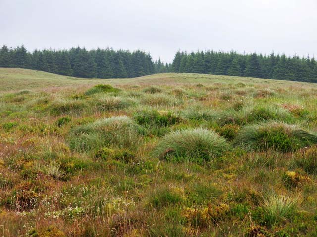
The woodland itself is predominantly made up of native Scottish trees, including oak, birch, and rowan, which are interspersed with pockets of dense undergrowth. The forest floor is carpeted with a rich variety of mosses, ferns, and wildflowers, contributing to the area's biodiversity and providing a haven for numerous species of flora and fauna.
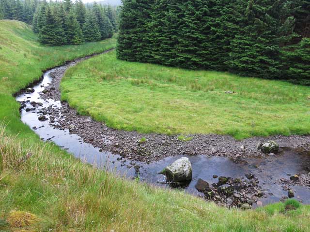
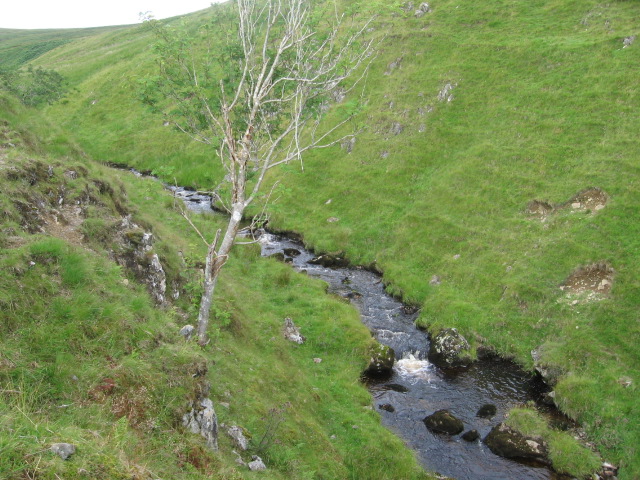
Blood Moss is a popular destination for nature enthusiasts and hikers, who are drawn to its tranquil ambiance and the opportunity to explore its well-maintained trails. The forest also boasts a small, meandering river that adds to its charm, providing a serene backdrop for those seeking a peaceful retreat.
Visitors to Blood Moss can expect to encounter an array of wildlife, including red squirrels, roe deer, and a diverse range of bird species. The forest is particularly renowned for its birdwatching opportunities, with enthusiasts often catching sight of species such as the great spotted woodpecker and the common buzzard.
Overall, Blood Moss, Ayrshire is a captivating woodland that offers a unique and enchanting experience for nature lovers, providing a tranquil escape and a chance to immerse oneself in the beauty of Scotland's natural landscapes.
If you have any feedback on the listing, please let us know in the comments section below.
Blood Moss Images
Images are sourced within 2km of 55.332417/-4.2167641 or Grid Reference NS5906. Thanks to Geograph Open Source API. All images are credited.


Blood Moss is located at Grid Ref: NS5906 (Lat: 55.332417, Lng: -4.2167641)
Unitary Authority: East Ayrshire
Police Authority: Ayrshire
What 3 Words
///cocoons.apart.addicted. Near New Cumnock, East Ayrshire
Nearby Locations
Related Wikis

Blackcraig Hill
Blackcraig Hill is a hill in the Carsphairn and Scaur Hills range, part of the Southern Uplands of Scotland. It lies southeast of the town of New Cumnock...

Windy Standard
Windy Standard is a hill in the Carsphairn and Scaur Hills range, part of the Southern Uplands of Scotland. It lies in Dumfries and Galloway, south of...

Knockshinnoch disaster
The Knockshinnoch disaster was a mining accident that occurred in September 1950 in the village of New Cumnock, Ayrshire, Scotland. A glaciated lake filled...

New Cumnock Town Hall
New Cumnock Town Hall is a municipal building in Castle, New Cumnock, East Ayrshire, Scotland. The structure, which is used as a community events venue...
Have you been to Blood Moss?
Leave your review of Blood Moss below (or comments, questions and feedback).