Queen Elizabeth Forest Park

Wood, Forest in Perthshire

Scotland

Queen Elizabeth Forest Park

Old fingerpost On the old A84, now unclassified, at Kingshouse is this well photographed fingerpost. At one time it had a third finger pointing south and an A84 plate attached to the top of the north pointing finger.  In 2015 it was newly painted but now needs some refurbishment.  It is a shame that house builders are allowed to fasten their signs onto these almost 100 year old posts.  The Kingshouse Hotel on the opposite side of the road is now the Mhor 84 Motel.

Milestone Society National ID: STL_NN5620
Old fingerpost Credit: Chris Minto

Queen Elizabeth Forest Park is a vast woodland area located in Perthshire, Scotland. It covers an expansive area of approximately 50,000 acres and is renowned for its stunning natural beauty and diverse range of flora and fauna. The park is named after Queen Elizabeth II to honor her visit in 1969.

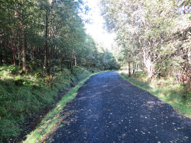
The forest park is characterized by its dense woodlands, towering trees, and tranquil atmosphere. It offers a variety of activities for visitors to enjoy, including walking, hiking, cycling, and wildlife spotting. There are numerous well-marked trails that cater to different abilities, ranging from gentle strolls to more challenging hikes, providing ample opportunities to explore the park's rich biodiversity.

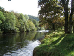
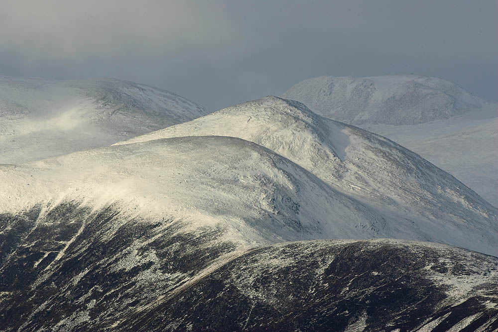
One of the highlights of the park is its stunning viewpoints that offer panoramic vistas of the surrounding countryside, including the picturesque Loch Lomond and Trossachs National Park. These viewpoints provide a perfect backdrop for nature photography enthusiasts.

Wildlife enthusiasts will be delighted by the park's abundant wildlife population. Red deer, red squirrels, pine martens, and a variety of bird species can be spotted throughout the forest. The park is also home to the Scottish Wildlife Trust's Osprey Centre, where visitors can observe these magnificent birds of prey in their natural habitat.

Additionally, Queen Elizabeth Forest Park offers a range of visitor facilities, including picnic areas, visitor centers, and a café. These amenities provide a comfortable and enjoyable experience for visitors to relax and take in the natural surroundings.

Overall, Queen Elizabeth Forest Park is a haven for nature lovers, offering a magnificent display of woodlands, wildlife, and breathtaking landscapes that make it a must-visit destination in Perthshire.

If you have any feedback on the listing, please let us know in the comments section below.

Queen Elizabeth Forest Park Images

Images are sourced within 2km of 56.353786/-4.3199633 or Grid Reference NN5620. Thanks to Geograph Open Source API. All images are credited.

Old fingerpost On the old A84, now unclassified, at Kingshouse is this well photographed fingerpost. At one time it had a third finger pointing south and an A84 plate attached to the top of the north pointing finger.  In 2015 it was newly painted but now needs some refurbishment.  It is a shame that house builders are allowed to fasten their signs onto these almost 100 year old posts.  The Kingshouse Hotel on the opposite side of the road is now the Mhor 84 Motel.

Milestone Society National ID: STL_NN5620
Old fingerpost
On the old A84, now unclassified, at Kingshouse is this well photographed fingerpost. At one time it had a third finger pointing south and an A84 plate attached to the top of the north pointing finger. In 2015 it was newly painted but now needs some refurbishment. It is a shame that house builders are allowed to fasten their signs onto these almost 100 year old posts. The Kingshouse Hotel on the opposite side of the road is now the Mhor 84 Motel. Milestone Society National ID: STL_NN5620
Old milestone For many years a red telephone box stood behind this wall with its mileage plate.   It is on the old A84 now by-passed at Kingshouse.  A rare plate with a 'nought' mileage.   Inverlochlarig is at the end of the road, the site of Rob Roy's House.   It is west of Balquhidder where Rob Roy is buried, Loch Voil and Loch Doine.
Old milestone
For many years a red telephone box stood behind this wall with its mileage plate. It is on the old A84 now by-passed at Kingshouse. A rare plate with a 'nought' mileage. Inverlochlarig is at the end of the road, the site of Rob Roy's House. It is west of Balquhidder where Rob Roy is buried, Loch Voil and Loch Doine.
Lay-by on the A84 near Kinghouse
A84 near Balquhidder Station
Forestry entrance near Balquhidder Station
Woodland track at Coille na Sròine Looking north-westward
Woodland track at Coille na Sròine
Looking north-westward
Recreational Trail beside the A84 at Kingshouse Looking north-eaastward. This is used by the Rob Roy Way path.
Recreational Trail beside the A84 at Kingshouse
Looking north-eaastward. This is used by the Rob Roy Way path.
Road (A84) at the Golden Larches Coffee Shop Looking north-eastward, The area on the right was the entrance to the former Balquhidder Railway Station.
Road (A84) at the Golden Larches Coffee Shop
Looking north-eastward, The area on the right was the entrance to the former Balquhidder Railway Station.
Ordnance Survey Flush Bracket 11991 This bracket can be found on the roadside wall of the former entrance to Balquhidder Railway Station.
The recorded details give a height of 150.373 metres above sea level.
For more detail see : <span class="nowrap"><a title="https://www.bench-marks.org.uk/bm11270" rel="nofollow ugc noopener" href="https://www.bench-marks.org.uk/bm11270">Link</a><img style="margin-left:2px;" alt="External link" title="External link - shift click to open in new window" src="https://s1.geograph.org.uk/img/external.png" width="10" height="10"/></span>
Ordnance Survey Flush Bracket 11991
This bracket can be found on the roadside wall of the former entrance to Balquhidder Railway Station. The recorded details give a height of 150.373 metres above sea level. For more detail see : LinkExternal link
A84 through Strathyre
Recently felled hillside near Stronslaney, Strathyre Looking north-westward.
Recently felled hillside near Stronslaney, Strathyre
Looking north-westward.
A84 in Strathyre
A84 in Strathyre
Forestry road above Strathyre Looking back down the road, on the Rob Roy Way between Strathyre and Balquhidder.
Forestry road above Strathyre
Looking back down the road, on the Rob Roy Way between Strathyre and Balquhidder.
Forested hillside, Strathyre Forest Looking down towards the A84.
Forested hillside, Strathyre Forest
Looking down towards the A84.
Track at Beananach in Strathyre
Road (A84) approaching Strathyre Looking southward.
Road (A84) approaching Strathyre
Looking southward.
The Balvag floodplain north of Strathyre Rough unimproved pasture viewed from beside the Callander to Killin cycleway.

This photograph was taken during the Coronavirus (COVID-19) pandemic of 2020/21.
The Balvag floodplain north of Strathyre
Rough unimproved pasture viewed from beside the Callander to Killin cycleway. This photograph was taken during the Coronavirus (COVID-19) pandemic of 2020/21.
Scene north-west of Beananach A view looking towards Stroneslaney farm house in the background. Log cabin holiday lets are very popular in the area.
Scene north-west of Beananach
A view looking towards Stroneslaney farm house in the background. Log cabin holiday lets are very popular in the area.
Show me another place!

Queen Elizabeth Forest Park is located at Grid Ref: NN5620 (Lat: 56.353786, Lng: -4.3199633)

Unitary Authority: Stirling

Police Authority: Forth Valley

What 3 Words

///down.agrees.polishing. Near Callander, Stirling

Related Wikis

Kingshouse railway station

Kingshouse was a railway station located at the hamlet of Kingshouse, Stirling where the road from Balquhidder joins the A84. The only building of note...

Balquhidder railway station

Balquhidder was a railway station around two miles south of Lochearnhead, Stirling (district). It was where the Callander and Oban Railway was joined by...

Auchtubh

Auchtubh is a hamlet in the Stirling council area of Scotland, less than 1 mile (2 kilometres) to the east of the village of Balquhidder. Auchtubh consisted...

River Balvaig

The River Balvaig (Scottish Gaelic: "Abhainn Balbhaig") is a short river, approximately 8 km (5.0 mi) long, draining from the head of Loch Voil near Balquhidder...

Breadalbane, Scotland

Breadalbane , from Scottish Gaelic Bràghaid Albann ("upper Alba" or "upland of Alba"), is a region of the southern/central Scottish Highlands. It is a...

Balquhidder

Balquhidder ( ; Scottish Gaelic: Both Chuidir [ˌpɔˈxutʲɪɾʲ] or Both Phuidir [ˌpɔˈfutʲɪɾʲ]) is a small village in Perthshire located 10 miles (16 km) north...

Strathyre

Strathyre (; from Scottish Gaelic: Srath Eadhair) is a district and settlement in the Stirling local government district of Scotland. It forms the south...

Strathyre railway station

Strathyre was a railway station located at the head of Loch Lubnaig, Stirling, in Strathyre. == History == This station opened on 1 June 1870 along with...

Nearby Amenities

Located within 500m of 56.353786,-4.3199633
Kingshouse
Created By: Potlatch 0.6b
Place: hamlet
Lat/Long: 56.354358/-4.3240271
National Cycle Network Milepost
Flickr: https://www.flickr.com/photos/22985844@N07/51979104056/
Ncn Milepost: rowe
Sustrans Ref: MP739
Lat/Long: 56.3542493/-4.3265113
Booth: K6
Removed Amenity: telephone
Source: survey
Lat/Long: 56.3537261/-4.32518
Restaurant
Mhor 84 Motel
Email: motel@mhor.net
Fax: +44 1877 38471
Internet Access: yes
Phone: +44 1877 384646
Smoking: no
Tourism: hotel
Website: https://mhor.net/mhor-84-motel/
Wheelchair: no
Lat/Long: 56.3533446/-4.3249905
Hiking: yes
Information: map
Map Size: region
Map Type: topo
Tourism: information
Lat/Long: 56.3533121/-4.3253939
Noexit: yes
Lat/Long: 56.3535084/-4.3254597
Noexit: yes
Lat/Long: 56.3535495/-4.3242724
Crossing
Crossing: unmarked
Lat/Long: 56.3539909/-4.3270207
Information: board
Tourism: information
Lat/Long: 56.353945/-4.3270266
Bus Stop
Naptan AtcoCode: 66005640001
Naptan NaptanCode: 78424795
Lat/Long: 56.3540466/-4.3255556
Bus Stop
Naptan AtcoCode: 66005640002
Naptan NaptanCode: 78424794
Lat/Long: 56.354164/-4.3258131
Power: pole
Lat/Long: 56.3530268/-4.3279682
Power: pole
Lat/Long: 56.3537038/-4.3274513
Power: pole
Lat/Long: 56.354268/-4.3271599
Power: pole
Lat/Long: 56.3548174/-4.3265803
Power: pole
Lat/Long: 56.3553902/-4.3259928
Power: pole
Lat/Long: 56.3560664/-4.3236304
Power: pole
Lat/Long: 56.3570454/-4.3213511
Power: pole
Lat/Long: 56.3576624/-4.3199098
Power: pole
Lat/Long: 56.354485/-4.3271035
Power: pole
Lat/Long: 56.3572919/-4.32481
Kingshouse
Historic Railway: station
Railway: site
Wikidata: Q6413235
Wikipedia: en:Kingshouse railway station
Lat/Long: 56.3553069/-4.3241339
Milestone
Inscription: Inverlochard 8 Kingshouse 0
Lat/Long: 56.3537013/-4.3251675
Kingshouse
Historic Railway: station
Railway: site
Wikidata: Q6413235
Wikipedia: en:Kingshouse railway station
Lat/Long: 56.3531293/-4.3278034
Bench
Lat/Long: 56.3547565/-4.3255509
The data included in this document is from www.openstreetmap.org. The data is made available under ODbL.

Have you been to Queen Elizabeth Forest Park?

Leave your review of Queen Elizabeth Forest Park below (or comments, questions and feedback).