Sheepfold Plantation

Wood, Forest in Sutherland

Scotland

Sheepfold Plantation

Road (A836) beside the woodland of Leathad na Cloiche Mòire Looking south-eastward.
Road (A836) beside the woodland of Leathad na Cloiche Mòire Credit: Peter Wood

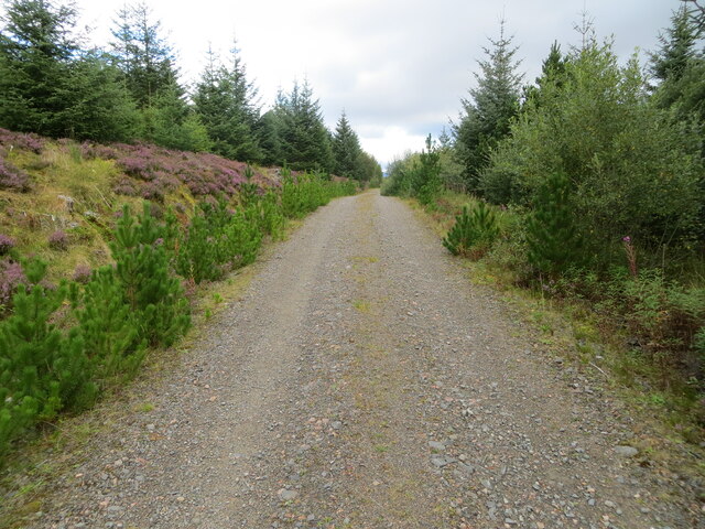
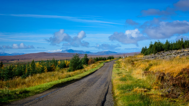
Sheepfold Plantation, located in Sutherland, is a picturesque woodland area known for its natural beauty and historical significance. The plantation spans across a vast area, comprising of dense forests and rolling hills, making it a popular destination for nature enthusiasts and history buffs alike.

The plantation earned its name from the sheepfolds that were once used to house sheep during the farming activities in the area. Today, remnants of these sheepfolds can still be seen, adding to the plantation's rustic charm. The woodlands are predominantly composed of native trees, including oak, birch, and pine, creating a diverse and rich ecosystem that supports a wide variety of flora and fauna.

Visitors to Sheepfold Plantation can enjoy a range of outdoor activities. There are well-maintained trails that wind through the forest, offering opportunities for hiking, walking, and birdwatching. The plantation is also home to a number of wildlife species, such as red deer, foxes, and various bird species, making it an ideal spot for wildlife observation.

In addition to its natural beauty, Sheepfold Plantation holds historical significance. It is believed that the area was once inhabited by ancient settlements, and archaeological artifacts have been discovered in the vicinity. The plantation's history can be explored through guided tours, which provide insights into the past communities and their way of life.

Overall, Sheepfold Plantation in Sutherland is a captivating destination that combines natural splendor with historical intrigue. Whether one seeks outdoor adventures or a journey through time, this woodland gem offers a memorable experience for all who visit.

If you have any feedback on the listing, please let us know in the comments section below.

Sheepfold Plantation Images

Images are sourced within 2km of 58.134817/-4.4504365 or Grid Reference NC5518. Thanks to Geograph Open Source API. All images are credited.

Road (A836) beside the woodland of Leathad na Cloiche Mòire Looking south-eastward.
Road (A836) beside the woodland of Leathad na Cloiche Mòire
Looking south-eastward.
Road (A836) in Strath Tirry Looking north-westward.
Road (A836) in Strath Tirry
Looking north-westward.
Road (A836) near to Tramp's Cairn Plantation Looking south-eastward.
Road (A836) near to Tramp's Cairn Plantation
Looking south-eastward.
Forest track leading to Cnoc Olasdail Looking north-westward.
Forest track leading to Cnoc Olasdail
Looking north-westward.
Road (A836) passing to the east of Cnoc Olasdail Looking south-eastward.
Road (A836) passing to the east of Cnoc Olasdail
Looking south-eastward.
Road (A836) passing to the east of Cnoc Olasdail Looking north-westward.
Road (A836) passing to the east of Cnoc Olasdail
Looking north-westward.
Forest track at North Dalchork Looking north-eastward.
Forest track at North Dalchork
Looking north-eastward.
Feith Ra'fin Valley in Dalchork Woods, Sutherland View looking southeast from the Lairg to Altnaharra road, across the large forest at Dalchork.  For the same view on a snowy day, see:

<a href="https://www.geograph.org.uk/photo/6747320">NC5518 : Feith Ra'fin Valley in Dalchork Woods, Sutherland</a>
Feith Ra'fin Valley in Dalchork Woods, Sutherland
View looking southeast from the Lairg to Altnaharra road, across the large forest at Dalchork. For the same view on a snowy day, see: NC5518 : Feith Ra'fin Valley in Dalchork Woods, Sutherland
Cnoc na Doire trig point Clearfell all around
Cnoc na Doire trig point
Clearfell all around
NE Edge of Lub Ruadh Plantation Outside the previous forest edge is long wet grass with signs of deer tracks. To the left of this is the felled forest and further left are new plantings.
NE Edge of Lub Ruadh Plantation
Outside the previous forest edge is long wet grass with signs of deer tracks. To the left of this is the felled forest and further left are new plantings.
Bridge over the Feith a' Chaoruinn Our OS 2014 map still has the word "Ford" near here, but the track has substantial bridges. Seen as the sun was setting.
Bridge over the Feith a' Chaoruinn
Our OS 2014 map still has the word "Ford" near here, but the track has substantial bridges. Seen as the sun was setting.
A836 through the cleared plantations of North Dalchork
Tree Tops and Mountains, Dalchork Woods, Sutherland
Track at North Dalchork, Sutherland, during Winter Snow Storm Snow falling on a track within Dalchork Woods.  Large parts of Dalchork Woods have been cleared by the Forestry Commission in recent years leaving only a few trees as seen here.
Track at North Dalchork, Sutherland, during Winter Snow Storm
Snow falling on a track within Dalchork Woods. Large parts of Dalchork Woods have been cleared by the Forestry Commission in recent years leaving only a few trees as seen here.
North Dalchork moorland Looking north west over damp moorland, with Ben Hee crowning the skyline. Taken from the A836; this area is now given over to forestry, so the view is quite different.
North Dalchork moorland
Looking north west over damp moorland, with Ben Hee crowning the skyline. Taken from the A836; this area is now given over to forestry, so the view is quite different.
Forestry in Strath Tirry
The A836 heading for Lairg
Forest edge, near Rhuidhean The start of a vast area of conifers.
Forest edge, near Rhuidhean
The start of a vast area of conifers.
Show me another place!

Sheepfold Plantation is located at Grid Ref: NC5518 (Lat: 58.134817, Lng: -4.4504365)

Unitary Authority: Highland

Police Authority: Highlands and Islands

What 3 Words

///village.presides.districts. Near Lairg, Highland

Related Wikis

Achnairn

Achnairn (Scottish Gaelic: Achadh an Fheàrna) is a village in the Scottish council area of Highland, situated on the east side of Loch Shin. == References ==

Loch Shin

Loch Shin (Scottish Gaelic: Loch Sìn, pronounced [l̪ˠɔx ˈʃiːn]) is a loch in the Scottish North West Highlands. To the south is the small town of Lairg...

Achfrish

Achfrish is a hamlet situated towards the southeastern part of Loch Shin on the north side of the Loch in Highland, Scotland. It is also part of the wider...

Nearby Amenities

Located within 500m of 58.134817,-4.4504365
Power: pole
Lat/Long: 58.1368598/-4.4574666
Power: pole
Lat/Long: 58.1362764/-4.4571662
Power: pole
Lat/Long: 58.1357936/-4.4562596
Power: pole
Lat/Long: 58.1352612/-4.4552538
Power: pole
Lat/Long: 58.134716/-4.4542426
Power: pole
Lat/Long: 58.1341963/-4.4532287
Power: pole
Lat/Long: 58.1336639/-4.4521934
Power: pole
Lat/Long: 58.1331329/-4.4511876
Power: pole
Lat/Long: 58.1325976/-4.4501737
Power: pole
Lat/Long: 58.1320736/-4.4491786
Power: pole
Lat/Long: 58.1315114/-4.4481352
Power: pole
Lat/Long: 58.1309818/-4.4471428
The data included in this document is from www.openstreetmap.org. The data is made available under ODbL.

Have you been to Sheepfold Plantation?

Leave your review of Sheepfold Plantation below (or comments, questions and feedback).