Arnochoile Wood

Wood, Forest in Perthshire

Scotland

Arnochoile Wood

Bridge over the River Forth Looking from the minor road bridge at Cobleland to the bridge carrying the A81 over the River Forth.
Bridge over the River Forth Credit: Richard Sutcliffe

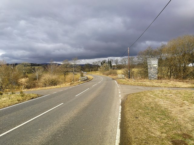
Arnochoile Wood is a picturesque forest located in Perthshire, Scotland. Covering an area of approximately 200 acres, it is nestled within the stunning Scottish Highlands, offering visitors a breathtaking natural landscape to explore. The wood is situated near the village of Comrie, just a short drive from the town of Crieff.

Arnochoile Wood is known for its diverse range of plant and animal life, making it a haven for nature enthusiasts and wildlife watchers. The wood is predominantly made up of native Scottish tree species, such as oak, birch, and pine, which provide a rich habitat for numerous bird species, including woodpeckers and owls.

The forest is crisscrossed with well-maintained trails and paths, allowing visitors to easily navigate through the wood and discover its hidden treasures. These paths lead to several viewpoints, offering stunning panoramic views of the surrounding countryside, including the majestic mountains in the distance.

Arnochoile Wood is also home to a variety of wildlife, including red squirrels, deer, and badgers. Birdwatchers will be delighted to spot a wide range of species, including the rare capercaillie and osprey. The wood's tranquil atmosphere and abundance of flora and fauna make it an ideal location for nature photography and birdwatching.

Throughout the year, the wood hosts various events and activities, including guided nature walks and educational programs for children. These initiatives aim to raise awareness about the importance of conservation and encourage visitors to appreciate and protect the natural beauty of Arnochoile Wood.

In conclusion, Arnochoile Wood is a stunning forest in Perthshire, offering visitors an opportunity to immerse themselves in the beauty of the Scottish Highlands. With its diverse plant and animal life, breathtaking views, and tranquil atmosphere, it is a must-visit destination for nature lovers and outdoor enthusiasts.

If you have any feedback on the listing, please let us know in the comments section below.

Arnochoile Wood Images

Images are sourced within 2km of 56.148297/-4.3417901 or Grid Reference NS5497. Thanks to Geograph Open Source API. All images are credited.

Bridge over the River Forth Looking from the minor road bridge at Cobleland to the bridge carrying the A81 over the River Forth.
Bridge over the River Forth
Looking from the minor road bridge at Cobleland to the bridge carrying the A81 over the River Forth.
Cobleland Campsite Campsite on the banks of the River Forth.
Cobleland Campsite
Campsite on the banks of the River Forth.
Cobleland and telephone box The road on the left leads to the A81. Straight on takes you to Gartmore.
Cobleland and telephone box
The road on the left leads to the A81. Straight on takes you to Gartmore.
Cobleland Campsite
Cobleland Campsite
Bridge at Cobleland Over the River Forth.
Bridge at Cobleland
Over the River Forth.
Cobleland Pillbox A type 22 Second World War pillbox.
Cobleland Pillbox
A type 22 Second World War pillbox.
Cycle track to Aberfoyle This section of National Cycle Route 7 follows the route of the former Strathendrick and Aberfoyle Railway, which closed in 1959.
Cycle track to Aberfoyle
This section of National Cycle Route 7 follows the route of the former Strathendrick and Aberfoyle Railway, which closed in 1959.
Cycle route to Gartmore and Drymen Part of National Cycle Route 7.
Cycle route to Gartmore and Drymen
Part of National Cycle Route 7.
Boundary, Loch Lomond and Trossachs National Park Loch Lomond and Trossachs National Park has a boundary length of 220 miles and covers an area of 720 square miles.  The boundary here is formed by the Kelty Water.
Boundary, Loch Lomond and Trossachs National Park
Loch Lomond and Trossachs National Park has a boundary length of 220 miles and covers an area of 720 square miles. The boundary here is formed by the Kelty Water.
Wester Shannochill As viewed from the footpath/cycleway, having crossed the western extent of Flanders Moss from Buchlyvie.
Wester Shannochill
As viewed from the footpath/cycleway, having crossed the western extent of Flanders Moss from Buchlyvie.
River Forth from the bridge near Gartrenich A view of the Forth looking downstream.
River Forth from the bridge near Gartrenich
A view of the Forth looking downstream.
Snoozing in the midday sun Actually, 1323 hrs, but these Tamworths aren't concerned with that!
Snoozing in the midday sun
Actually, 1323 hrs, but these Tamworths aren't concerned with that!
Old Milepost by the A81, east of Gartmore, Port of Menteith parish Glasgow curved by the A81, in parish of Port of Menteith (Stirling District), Baad near Gartmore junction, on narrow verge.

Inscription reads:-
GLASGOW
ROYAL EXCHANGE
24
{hand->}
ABERFOIL
INN
3¼
{<-hand}

Surveyed

Milestone Society National ID: ST_GWAF24
Old Milepost by the A81, east of Gartmore, Port of Menteith parish
Glasgow curved by the A81, in parish of Port of Menteith (Stirling District), Baad near Gartmore junction, on narrow verge. Inscription reads:- GLASGOW ROYAL EXCHANGE 24 {hand->} ABERFOIL INN 3¼ {<-hand} Surveyed Milestone Society National ID: ST_GWAF24
Old Milepost by the A81, Gartartan, Port of Menteith parish Glasgow curved plate by the A81, in parish of Port of Menteith (Stirling District), Gartartan, on verge.

Inscription reads:-
GLASGOW
ROYAL EXCHANGE
25
{hand-&amp;gt;}
ABERFOIL
INN
2¼
{&amp;lt;-hand}

Surveyed

Milestone Society National ID: ST_GWAF25
Old Milepost by the A81, Gartartan, Port of Menteith parish
Glasgow curved plate by the A81, in parish of Port of Menteith (Stirling District), Gartartan, on verge. Inscription reads:- GLASGOW ROYAL EXCHANGE 25 {hand->} ABERFOIL INN 2¼ {<-hand} Surveyed Milestone Society National ID: ST_GWAF25
Trossachs Holiday Park, Gartmore
Auchentroig Burn A railway line was completed in 1882 across Flanders Moss between Buchlyvie and Aberfoyle. It closed in the late 1950&amp;#039;s and is now a forestry road, here crossing a small tributary of the River Forth.
Auchentroig Burn
A railway line was completed in 1882 across Flanders Moss between Buchlyvie and Aberfoyle. It closed in the late 1950's and is now a forestry road, here crossing a small tributary of the River Forth.
Bridge over Kelty Water at Barbadoes Heading north along the course of the old railway line from Buchlyvie to Aberfoyle this is the second of three river bridge crossings.
Bridge over Kelty Water at Barbadoes
Heading north along the course of the old railway line from Buchlyvie to Aberfoyle this is the second of three river bridge crossings.
Bridge over the River Forth This is the third river bridge to crossed when heading north from Buchlyvie along the course of the old railway which terminates at Aberfoyle. The flatland beyond is the Carse of Shannochill.
Bridge over the River Forth
This is the third river bridge to crossed when heading north from Buchlyvie along the course of the old railway which terminates at Aberfoyle. The flatland beyond is the Carse of Shannochill.
Show me another place!

Arnochoile Wood is located at Grid Ref: NS5497 (Lat: 56.148297, Lng: -4.3417901)

Unitary Authority: Stirling

Police Authority: Forth Valley

What 3 Words

///frizz.kennels.slimming. Near Balfron, Stirling

Nearby Locations

Arnochoile Wood

Related Wikis

Gartmore House

Gartmore House is a country house and estate in the village of Gartmore, Stirling, Scotland. It was built in the mid-18th century for the Graham family...

Gartmore railway station

Gartmore railway station served the village of Gartmore, in the historical county of Stirlingshire, Scotland, from 1882 to 1950 on the Strathendrick and...

Cunninghame Graham Memorial

The Cunninghame Graham Memorial is a stone monument dedicated to the memory of 'Don Roberto' Robert Bontine Cunninghame Graham (1852–1936) 15th of Gartmore...

Gartmore

Gartmore (Scottish Gaelic An Gart Mòr) is a village in the Stirling council area, Scotland. It is a village with a view of the Wallace Monument in Stirling...

Nearby Amenities

Located within 500m of 56.148297,-4.3417901
The data included in this document is from www.openstreetmap.org. The data is made available under ODbL.

Have you been to Arnochoile Wood?

Leave your review of Arnochoile Wood below (or comments, questions and feedback).