Black Wood

Wood, Forest in Stirlingshire

Scotland

Black Wood

Track leading to Slackdhu above Strathblane
Track leading to Slackdhu above Strathblane Credit: Chris Upson

Black Wood is a picturesque forest located in Stirlingshire, Scotland. Covering an area of approximately 3.5 square kilometers, it is a popular destination for nature lovers and outdoor enthusiasts. The wood is situated near the town of Doune, just a short drive from the city of Stirling.

Black Wood is predominantly composed of native broadleaf trees, such as oak, birch, and hazel, which create a diverse and vibrant ecosystem. The forest floor is covered with a rich carpet of mosses, ferns, and wildflowers, adding to its natural beauty. The canopy of the wood provides a haven for a wide range of bird species, including woodpeckers, owls, and various songbirds, making it a haven for birdwatchers.

The forest is crisscrossed by a network of well-maintained walking trails, allowing visitors to explore its enchanting surroundings. The paths meander through the dense woodland, leading to hidden glades, babbling brooks, and even a small waterfall. Along the way, there are several viewpoints that offer breathtaking vistas of the surrounding countryside.

Black Wood is also steeped in history, with remnants of ancient settlements and structures scattered throughout. Archaeological evidence suggests that the area has been inhabited since prehistoric times, and it is believed to have been a significant site during the Roman occupation of Scotland.

Overall, Black Wood in Stirlingshire is a captivating destination that offers a tranquil escape from the hustle and bustle of everyday life. Its natural beauty, diverse wildlife, and rich history make it a must-visit location for anyone seeking to immerse themselves in the Scottish countryside.

If you have any feedback on the listing, please let us know in the comments section below.

Black Wood Images

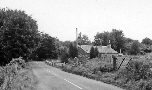
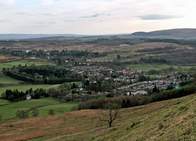
Images are sourced within 2km of 55.983121/-4.3325938 or Grid Reference NS5479. Thanks to Geograph Open Source API. All images are credited.

Track leading to Slackdhu above Strathblane
Arlehaven Located next to West Highland Way
Arlehaven
Located next to West Highland Way
View Across Strath Blane
Slump A recent and rather large landslide on the slopes beneath Slackdhu.
Slump
A recent and rather large landslide on the slopes beneath Slackdhu.
Arlehaven on the West Highland Way The path of the West Highland Way can be seen with Dumgoyne in the background.
Arlehaven on the West Highland Way
The path of the West Highland Way can be seen with Dumgoyne in the background.
Remains of Arlehaven Some mishap has befallen the house at Arlehaven, its previous, idyllic state shown in <a href="https://www.geograph.org.uk/photo/80349">NS5380 : Arlehaven</a>. The pile of stones to the right, just below halfway, seems to be all that remains, plus some abandoned electrical appliances.
Remains of Arlehaven
Some mishap has befallen the house at Arlehaven, its previous, idyllic state shown in NS5380 : Arlehaven. The pile of stones to the right, just below halfway, seems to be all that remains, plus some abandoned electrical appliances.
West Highland Way at Arlehaven The path of the West Highland Way has clearly seen many visitors in recent days, so its line is quite clear at the bottom of the picture, even if its surface currently resembles a ski piste. The distinctively shaped hill Dumgoyne lies in the distance. At top right you can still see the telephone line that served the now destroyed house at Arlehaven ( <a href="https://www.geograph.org.uk/photo/1640386">NS5380 : Remains of Arlehaven</a> ).
West Highland Way at Arlehaven
The path of the West Highland Way has clearly seen many visitors in recent days, so its line is quite clear at the bottom of the picture, even if its surface currently resembles a ski piste. The distinctively shaped hill Dumgoyne lies in the distance. At top right you can still see the telephone line that served the now destroyed house at Arlehaven ( NS5380 : Remains of Arlehaven ).
Solitary tree The tree is viewed from the West Highland Way between Arlehaven and Dumgoyach. Higher ground stands to the west as the path sinks towards the Blane Valley; hence the tree's apparent isolation, and the still-lit sky behind it in the middle of the afternoon.
Solitary tree
The tree is viewed from the West Highland Way between Arlehaven and Dumgoyach. Higher ground stands to the west as the path sinks towards the Blane Valley; hence the tree's apparent isolation, and the still-lit sky behind it in the middle of the afternoon.
Edge of the Strathblane Hills
Dumgoyach, Dumgoyne and the West Highland Way Just north of Carbeth Loch on the long distance path from Milngavie to Fort William.
Dumgoyach, Dumgoyne and the West Highland Way
Just north of Carbeth Loch on the long distance path from Milngavie to Fort William.
House by the A81 In Strath Blane.
House by the A81
In Strath Blane.
Middle Ballewan From the A81 near Blanefield.
Middle Ballewan
From the A81 near Blanefield.
Very old signpost on the A81 I'm sure no-one nowadays needs directions to the Glasgow Royal Exchange, and the only evidence I can find for Aberfoyle being spelled Aberfoil is on an 1863 map, so how old is this milepost?! Impressive.
Very old signpost on the A81
I'm sure no-one nowadays needs directions to the Glasgow Royal Exchange, and the only evidence I can find for Aberfoyle being spelled Aberfoil is on an 1863 map, so how old is this milepost?! Impressive.
Campsie Dene Road From the town/country boundary, looking towards Campsie Dene House.
Campsie Dene Road
From the town/country boundary, looking towards Campsie Dene House.
Woodland, Craigbrock A narrow strip of woodland rises from the A81.
Woodland, Craigbrock
A narrow strip of woodland rises from the A81.
Middle Ballewan Pheasant pens in Strathblane.
Middle Ballewan
Pheasant pens in Strathblane.
A81 milepost An iron milepost, one of several on the road. If not local and travelling from the north, the Glasgow 12 takes a bit of believing. Here in Strathblane there is little evidence (other than the traffic) that the centre of a great city is only 19km distant.

Note the spelling - probably an alternative now lost, chosen for brevity over Aberfoyle.
A81 milepost
An iron milepost, one of several on the road. If not local and travelling from the north, the Glasgow 12 takes a bit of believing. Here in Strathblane there is little evidence (other than the traffic) that the centre of a great city is only 19km distant. Note the spelling - probably an alternative now lost, chosen for brevity over Aberfoyle.
Scarp above East Ballewan A section of Strathblane: Lush grassland on the floor, woodland and steep craggy basalt crags.
Scarp above East Ballewan
A section of Strathblane: Lush grassland on the floor, woodland and steep craggy basalt crags.
Show me another place!

Black Wood is located at Grid Ref: NS5479 (Lat: 55.983121, Lng: -4.3325938)

Unitary Authority: Stirling

Police Authority: Forth Valley

What 3 Words

///beside.condensed.rockets. Near Strathblane, Stirling

Nearby Locations

Black Wood

Related Wikis

Blanefield railway station

Blanefield railway station served the village of Blanefield, Stirling, Scotland from 1867 to 1959 on the Blane Valley Railway. == History == The station...

Blanefield

Blanefield is a settlement in Scotland contiguous with Strathblane's northwestern fringe. To the west is the volcanic plug Dumgoyne, Glengoyne Distillery...

Strathblane

Strathblane (Scottish Gaelic: Strath Bhlàthain, pronounced [s̪t̪ɾahˈvl̪ˠaː.ɪɲ]) is a village and parish in the registration county of Stirlingshire, situated...

Strathblane railway station

Strathblane railway station served the village of Strathblane, Stirling, Scotland from 1867 to 1951 on the Blane Valley Railway. == History == The station...

Nearby Amenities

Located within 500m of 55.983121,-4.3325938
Barrier: hampshire_gate
Bicycle: yes
Foot: yes
Horse: yes
Lat/Long: 55.98265/-4.325166
Cuilt Brae
Place: locality
Lat/Long: 55.9843426/-4.3259887
Boards
Place: hamlet
Lat/Long: 55.983846/-4.3370657
Ford: yes
Lat/Long: 55.9829023/-4.3251187
Barrier: stile
Foot: yes
Lat/Long: 55.980018/-4.327524
Power: pole
Lat/Long: 55.9841855/-4.337824
Power: pole
Lat/Long: 55.9843391/-4.339318
The data included in this document is from www.openstreetmap.org. The data is made available under ODbL.

Have you been to Black Wood?

Leave your review of Black Wood below (or comments, questions and feedback).