Crookston Wood

Wood, Forest in Renfrewshire

Scotland

Crookston Wood

Bungalows on Glasgow Road (A761)
Bungalows on Glasgow Road (A761) Credit: JThomas

Crookston Wood is a charming forest located in Renfrewshire, Scotland. Spanning across a vast area, this woodland is a popular destination for nature enthusiasts and hikers. The wood is named after the nearby village of Crookston, and its natural beauty is a testament to Scotland's stunning landscapes.

The forest is characterized by a diverse range of flora and fauna, making it an ideal habitat for various wildlife species. The towering trees, predominantly oak and birch, provide a dense canopy that creates a cool and peaceful atmosphere. Moss-covered rocks and fallen leaves create a picturesque scene, adding to the wood's enchanting allure.

Several well-maintained trails wind their way through Crookston Wood, offering visitors the opportunity to explore its natural wonders. These paths cater to all levels of ability, from leisurely strolls to more challenging hikes. Along the way, hikers may encounter a host of wildlife, including deer, squirrels, and a variety of bird species.

Crookston Wood is not only a haven for nature lovers but also a valuable resource for the local community. It serves as a recreational space for families and individuals alike, providing a tranquil environment for picnics, outdoor activities, and relaxation. The forest also plays a crucial role in preserving the region's biodiversity and acts as a natural carbon sink, contributing to the fight against climate change.

Overall, Crookston Wood is a captivating woodland that showcases Scotland's natural splendor. Its diverse ecosystem, well-maintained trails, and community significance make it a must-visit destination for anyone seeking a rejuvenating and immersive experience in nature.

If you have any feedback on the listing, please let us know in the comments section below.

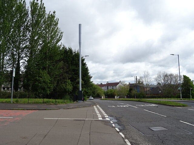
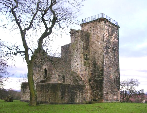
Crookston Wood Images

Images are sourced within 2km of 55.837609/-4.3497594 or Grid Reference NS5262. Thanks to Geograph Open Source API. All images are credited.

Bungalows on Glasgow Road (A761)
Bus top and shelter on Glasgow Road (A761)
Shop on Glasgow Road (A761)
Glasgow Road (A761) Towards Glasgow.
Glasgow Road (A761)
Towards Glasgow.
Blocks of flats, Kelhead Path
Block of flats, Tinwold Path
Phone mast on Sandwood Road (A736)
Leonardo's Restaurant Italian restaurant on Paisley Road West.
Leonardo's Restaurant
Italian restaurant on Paisley Road West.
Bus stop and shelter on Paisley Road West (A761)
George V postbox on Glasgow Road (A761) Postbox No. PA1 174.
George V postbox on Glasgow Road (A761)
Postbox No. PA1 174.
Cardonald railway station A night view, looking west towards Hillington East from the west bound platform.
Cardonald railway station
A night view, looking west towards Hillington East from the west bound platform.
Cardonald railway station The customer information board on the west bound platform provides information about public transport links from the station (by road).
Cardonald railway station
The customer information board on the west bound platform provides information about public transport links from the station (by road).
The M8 motorway at Cardonald Looking east from the A739 overbridge near Cardonald railway station.
The M8 motorway at Cardonald
Looking east from the A739 overbridge near Cardonald railway station.
Cardonald railway station A night view across the tracks from the west bound platform. Note the tactile paving in the foreground.
Cardonald railway station
A night view across the tracks from the west bound platform. Note the tactile paving in the foreground.
Open space, Pollok Country Park Just to the west of the car park for Pollok House.
Open space, Pollok Country Park
Just to the west of the car park for Pollok House.
Autumn colours, Pollok Country Park Birch and beech trees (and others) show off their autumn colours.
Autumn colours, Pollok Country Park
Birch and beech trees (and others) show off their autumn colours.
Silverburn Shopping centre As evening falls the car park near Tesco's at the Silverburn shopping centre is still very full.
Silverburn Shopping centre
As evening falls the car park near Tesco's at the Silverburn shopping centre is still very full.
A tree lined road A very pleasant looking suburb of Glasgow.
A tree lined road
A very pleasant looking suburb of Glasgow.
Show me another place!

Crookston Wood is located at Grid Ref: NS5262 (Lat: 55.837609, Lng: -4.3497594)

Unitary Authority: City of Glasgow

Police Authority: Greater Glasgow

What 3 Words

///grades.slowly.caller. Near Thornliebank, East Renfrewshire

Nearby Locations

Tower Crookston Wood

Related Wikis

Nearby Amenities

Located within 500m of 55.837609,-4.3497594
Mosspark
Naptan AtcoCode: 9100MSSPARK
Network: National Rail
Network Website: https://www.nationalrail.co.uk/stations/mpk/
Network Wikidata: Q26334
Operator: ScotRail
Operator Website: https://www.scotrail.co.uk/plan-your-journey/stations-and-facilities/mpk
Operator Wikidata: Q18356161
Public Transport: station
Railway: station
Ref Crs: MPK
Train: yes
Wikidata: Q1941822
Wikipedia: en:Mosspark railway station
Lat/Long: 55.8406803/-4.3474296
Traffic Calming: chicane
Lat/Long: 55.8403104/-4.354312
Traffic Calming: chicane
Lat/Long: 55.8402417/-4.3542891
Bus Stop
Bus: yes
Fixme: check if still exists plus name & ref
Public Transport: platform
Lat/Long: 55.8402225/-4.3509892
Bus Stop
Linthaugh Road / Dormanside Road
Bus: yes
Naptan AtcoCode: 60903481
Naptan Bearing: SW
Naptan CommonName: Crookston Wood
Naptan Indicator: Opp
Naptan Landmark: Dormanside Road
Naptan NaptanCode: 45234857
Naptan Street: Linthaugh Road
Public Transport: platform
Ref: 60903481
Lat/Long: 55.83982/-4.35658
Bus Stop
Linthaugh Road / Everton road
Bus: yes
Naptan AtcoCode: 60903268
Naptan Bearing: NW
Naptan CommonName: Everton Road
Naptan Indicator: after
Naptan Landmark: Everton road
Naptan NaptanCode: 45234639
Naptan Street: Linthaugh Road
Public Transport: platform
Ref: 60903268
Lat/Long: 55.83759/-4.34214
Bus Stop
Linthaugh Road / Everton road
Bus: yes
Naptan AtcoCode: 60903269
Naptan Bearing: SE
Naptan CommonName: Everton Road
Naptan Indicator: before
Naptan Landmark: Everton road
Naptan NaptanCode: 45237383
Naptan Street: Linthaugh Road
Public Transport: platform
Ref: 60903269
Lat/Long: 55.8377034/-4.3418953
Bus Stop
Linthaugh Road / Lyoncross Road
Bus: yes
Naptan AtcoCode: 60903275
Naptan Bearing: E
Naptan CommonName: Lyoncross Road
Naptan Indicator: Opp
Naptan Landmark: Lyoncross Road
Naptan NaptanCode: 45238396
Naptan Street: Linthaugh Road
Public Transport: platform
Ref: 60903275
Lat/Long: 55.8404243/-4.3509159
Bus Stop
Linthaugh Road / No 101
Bus: yes
Naptan AtcoCode: 60903270
Naptan Bearing: NW
Naptan CommonName: Linthaugh Road
Naptan Indicator: near 101
Naptan Landmark: No 101
Naptan NaptanCode: 45234394
Naptan Street: Linthaugh Road
Public Transport: platform
Ref: 60903270
Lat/Long: 55.83876/-4.34388
Bus Stop
Linthaugh Road / No 101
Bus: yes
Naptan AtcoCode: 60903271
Naptan Bearing: SE
Naptan CommonName: Linthaugh Road
Naptan Indicator: opp 101
Naptan Landmark: No 101
Naptan NaptanCode: 45235243
Naptan Street: Linthaugh Road
Public Transport: platform
Ref: 60903271
Lat/Long: 55.8390176/-4.3439831
Bus Stop
Linthaugh Road / No 147
Bus: yes
Naptan AtcoCode: 60903273
Naptan Bearing: SE
Naptan CommonName: 147 Linthaugh Road
Naptan Indicator: opp
Naptan Landmark: No 147
Naptan NaptanCode: 45235379
Naptan Street: Linthaugh Road
Public Transport: platform
Ref: 60903273
Lat/Long: 55.83984/-4.34702
Bus Stop
Linthaugh Road / No 149
Bus: yes
Naptan AtcoCode: 60903272
Naptan Bearing: NW
Naptan CommonName: 149 Linthaugh Road
Naptan Indicator: near
Naptan Landmark: No 149
Naptan NaptanCode: 45236965
Naptan Street: Linthaugh Road
Public Transport: platform
Ref: 60903272
Lat/Long: 55.83975/-4.3473
Bus Stop
Pollok, Lyoncross Road/ Barnbeth Road
Naptan AtcoCode: 60903259
Naptan Bearing: SW
Naptan CommonName: Lyoncross Nursery School
Naptan Indicator: At
Naptan Landmark: Barnbeth Road
Naptan NaptanCode: 45242592
Naptan Street: Lyoncross Road
Ref: 60903259
Lat/Long: 55.83703/-4.35392
Bus Stop
Pollok, Lyoncross Road/ Barnbeth Road
Naptan AtcoCode: 60903260
Naptan Bearing: NE
Naptan CommonName: Currie Hall
Naptan Indicator: At
Naptan Landmark: Barnbeth Road
Naptan NaptanCode: 45236472
Naptan Street: Lyoncross Road
Ref: 60903260
Lat/Long: 55.8376171/-4.3537065
Bus Stop
Lyoncross Road / Dormanside Road
Bus: yes
Naptan AtcoCode: 60903261
Naptan Bearing: NE
Naptan CommonName: Dormanside Road
Naptan Indicator: Near
Naptan Landmark: Dormanside Road
Naptan NaptanCode: 45235982
Naptan Street: Lyoncross Road
Public Transport: platform
Ref: 60903261
Lat/Long: 55.83908/-4.35221
Bus Stop
Lyoncross Road / Dormanside Road
Bus: yes
Naptan AtcoCode: 60903262
Naptan Bearing: SW
Naptan CommonName: Dormanside Road
Naptan Indicator: At
Naptan Landmark: Dormanside Road
Naptan NaptanCode: 45238263
Naptan Street: Lyoncross Road
Public Transport: platform
Ref: 60903262
Lat/Long: 55.83933/-4.35173
Bus Stop
Lyoncross Road / Meiklerig Crescent
Bus: yes
Naptan AtcoCode: 60903255
Naptan Bearing: NW
Naptan CommonName: Meiklerig Crescent
Naptan Indicator: opp
Naptan Landmark: Meiklerig Crescent
Naptan NaptanCode: 45243765
Naptan Street: Lyoncross Road
Public Transport: platform
Ref: 60903255
Lat/Long: 55.83435/-4.3493846
Bus Stop
Lyoncross Road / Meiklerig Crescent
Bus: yes
Naptan AtcoCode: 60903256
Naptan Bearing: SE
Naptan CommonName: Meiklerig Crescent
Naptan Indicator: before
Naptan Landmark: Meiklerig Crescent
Naptan NaptanCode: 45242823
Naptan Street: Lyoncross Road
Public Transport: platform
Ref: 60903256
Shelter: yes
Lat/Long: 55.834559/-4.3492862
Bus Stop
Pollok, Lyoncross Road/ Potterhill Road
Naptan AtcoCode: 60903257
Naptan Bearing: NW
Naptan CommonName: Potterhill Road
Naptan Indicator: Near
Naptan Landmark: Potterhill Road
Naptan NaptanCode: 45239564
Naptan Street: Lyoncross Road
Ref: 60903257
Lat/Long: 55.8354372/-4.352699
Bus Stop
Pollok, Lyoncross Road/ Potterhill Road
Naptan AtcoCode: 60903258
Naptan Bearing: SE
Naptan CommonName: Potterhill Road
Naptan Indicator: Opp
Naptan Landmark: Potterhill Road
Naptan NaptanCode: 45243459
Naptan Street: Lyoncross Road
Ref: 60903258
Lat/Long: 55.8355785/-4.3525696
Entrance: main
Lat/Long: 55.8344121/-4.3486364
Generator Method: photovoltaic
Generator Output Electricity: yes
Generator Source: solar
Generator Type: solar_photovoltaic_panel
Power: generator
Lat/Long: 55.8351074/-4.3454968
Generator Method: photovoltaic
Generator Output Electricity: yes
Generator Source: solar
Generator Type: solar_photovoltaic_panel
Power: generator
Lat/Long: 55.8354851/-4.3455926
Generator Method: photovoltaic
Generator Output Electricity: yes
Generator Source: solar
Generator Type: solar_photovoltaic_panel
Power: generator
Lat/Long: 55.836413/-4.3450305
The data included in this document is from www.openstreetmap.org. The data is made available under ODbL.

Have you been to Crookston Wood?

Leave your review of Crookston Wood below (or comments, questions and feedback).