Ballochanamour Wood

Wood, Forest in Kirkcudbrightshire

Scotland

Ballochanamour Wood

Cycle route through the hills National cycle route 7 in Galloway.
Cycle route through the hills Credit: Peter Mackenzie

Ballochanamour Wood is a picturesque forest located in Kirkcudbrightshire, Scotland. Covering an area of approximately 100 acres, this woodland is a haven for nature lovers and outdoor enthusiasts alike.

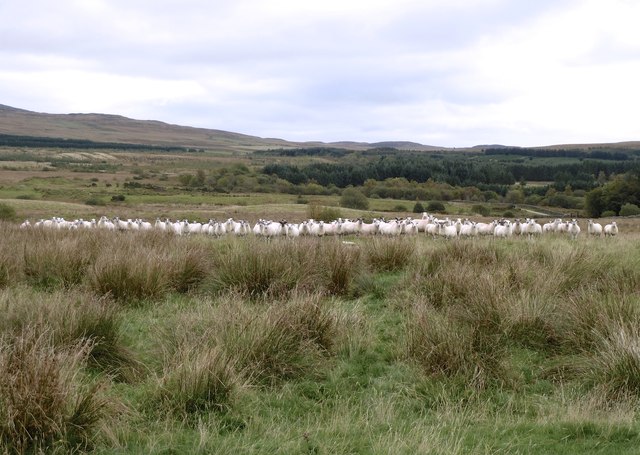
The wood is characterized by its diverse range of tree species, including oak, birch, beech, and conifers, which create a beautiful and vibrant landscape throughout the year. The trees provide a habitat for a variety of wildlife, including birds, squirrels, and deer, making it a popular spot for birdwatching and wildlife photography.

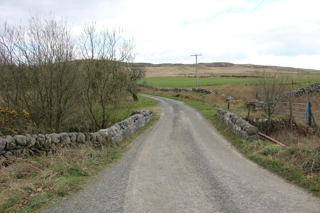
The forest is crisscrossed by a network of well-maintained walking trails, allowing visitors to explore its natural beauty at their own pace. These trails vary in difficulty, catering to both casual strollers and more experienced hikers. Along the way, visitors can enjoy breathtaking views of the surrounding countryside and the nearby River Dee.

In addition to its natural beauty, Ballochanamour Wood also has a rich history. It is believed to have been part of a larger estate dating back to the 17th century and was once owned by a prominent local family. Today, remnants of old stone walls and the foundations of former buildings can still be seen, providing a glimpse into the area's past.

Overall, Ballochanamour Wood offers a tranquil and immersive experience for nature enthusiasts and history buffs alike. Its stunning scenery, diverse wildlife, and well-maintained trails make it a must-visit destination for those seeking a peaceful retreat in the heart of Kirkcudbrightshire.

If you have any feedback on the listing, please let us know in the comments section below.

Ballochanamour Wood Images

Images are sourced within 2km of 54.902197/-4.3540456 or Grid Reference NX4958. Thanks to Geograph Open Source API. All images are credited.

Cycle route through the hills National cycle route 7 in Galloway.
Cycle route through the hills
National cycle route 7 in Galloway.
Forestry near Garrocher An open area obviously used as a loading area.
Forestry near Garrocher
An open area obviously used as a loading area.
Country road above Creetown With flourishing Bracken as part of the roadside vegetation.
Country road above Creetown
With flourishing Bracken as part of the roadside vegetation.
Garrocher Tree Farm Nursery and Christmas tree growers. Pibble Hill in the background.
Garrocher Tree Farm
Nursery and Christmas tree growers. Pibble Hill in the background.
Landscaped old sandpit A new pond dug out of an old sand and gravel pit. There is life here, a heron was hunting the margin. The banks are freshly dug, with new track marks on the road up to the pool.
Landscaped old sandpit
A new pond dug out of an old sand and gravel pit. There is life here, a heron was hunting the margin. The banks are freshly dug, with new track marks on the road up to the pool.
Billy Diamond's Bridge Narrow bridge over the Englishman's Burn. Cambret Hill on the skyline with the masts.
Billy Diamond's Bridge
Narrow bridge over the Englishman's Burn. Cambret Hill on the skyline with the masts.
Glenquicken Moor Prospect over Glenquicken Moor from the Creetown-Mark lane. In mid distance is Glenquicken Quarry and Farm; beyond are the Cambret Hill masts under approaching rain clouds.
Glenquicken Moor
Prospect over Glenquicken Moor from the Creetown-Mark lane. In mid distance is Glenquicken Quarry and Farm; beyond are the Cambret Hill masts under approaching rain clouds.
Stone Circle south of Old Military Road A circle of 28 stones 50ft in diameter with the centre stone 6ft high. A gap in the SW suggests the possibility of an additional stone, now missing.
Stone Circle south of Old Military Road
A circle of 28 stones 50ft in diameter with the centre stone 6ft high. A gap in the SW suggests the possibility of an additional stone, now missing.
Cist south of Old Military Road
Unclassified road just to the east of Billy Diamond's Bridge
Glenquicken Stone Circle This stone circle is on the remote Glenquicken Moor. It is a ring of 28 low boulders set close together.  Just one stone, in the south west, appears to be missing.  The central standing stone is 1.6m high. It is granite and weighs over 4 tons.  The circle is 15.5m in diameter.
Glenquicken Stone Circle
This stone circle is on the remote Glenquicken Moor. It is a ring of 28 low boulders set close together. Just one stone, in the south west, appears to be missing. The central standing stone is 1.6m high. It is granite and weighs over 4 tons. The circle is 15.5m in diameter.
Rough grazing land at Glenquicken Stone Circle Sheep often graze in this field.
Rough grazing land at Glenquicken Stone Circle
Sheep often graze in this field.
Road to Creetown From Mark Bridge
Road to Creetown
From Mark Bridge
A chorus line The victory of curiosity over panic: sheep alongside the road at Mark Farm.
A chorus line
The victory of curiosity over panic: sheep alongside the road at Mark Farm.
The Pied Pipers Sheep near Balloch Wood, Creetown, following hill walkers along the track towards Mark Farm.
The Pied Pipers
Sheep near Balloch Wood, Creetown, following hill walkers along the track towards Mark Farm.
Billy Diamond's Bridge
Englishman's Burn
Englishman's Burn
Englishman's Burn
Englishman's Burn
Show me another place!

Ballochanamour Wood is located at Grid Ref: NX4958 (Lat: 54.902197, Lng: -4.3540456)

Unitary Authority: Dumfries and Galloway

Police Authority: Dumfries and Galloway

What 3 Words

///stung.ounce.register. Near Newton Stewart, Dumfries & Galloway

Nearby Locations

Ballochanamour Wood

Related Wikis

Kirkmabreck

Kirkmabreck is a civil parish in the historic county of Kirkcudbrightshire in the Dumfries and Galloway council area, Scotland. Situated in the historic...

Creetown

Creetown (/ˈkri:tən/, sometimes /'kri:taʊn/) is a small seaside town in the Stewartry of Kirkcudbright, in Galloway in the Dumfries and Galloway council...

Creetown railway station

Creetown railway station served the town of Creetown, Dumfries and Galloway, Scotland from 1861 to 1965 on the Portpatrick and Wigtownshire Joint Railway...

Glenquicken stone circle

Glenquicken stone circle or Billy Diamond's Bridge stone circle (grid reference NX50965821) is an oval stone circle with a central pillar, two miles east...

Creetown F.C.

Creetown Football Club are a football club based in Creetown in the Dumfries and Galloway area of Scotland. Formed in 1905 as Creetown Rifle Volunteers...

River Bladnoch

The Bladnoch is a river in Wigtownshire in the Machars of Galloway in southwest Scotland. One of the earliest descriptions of it is given by Sir Andrew...

Palnure

Palnure (Scottish Gaelic: Poll an Iùbhair) is a small village in the historical county of Kirkcudbrightshire in Dumfries and Galloway, Scotland, on the...

Cairnholy

Cairnholy (or Cairn Holy) is the site of two Neolithic chambered tombs of the Clyde type. It is located 4 kilometres east of the village of Carsluith in...

Nearby Amenities

Located within 500m of 54.902197,-4.3540456
Power: pole
Lat/Long: 54.8997731/-4.3479302
Power: pole
Lat/Long: 54.9003474/-4.3474529
Power: pole
Lat/Long: 54.906522/-4.3533822
Power: pole
Lat/Long: 54.9061417/-4.3523091
Power: pole
Lat/Long: 54.9058722/-4.3515614
Power: pole
Lat/Long: 54.9055013/-4.3505362
Power: pole
Lat/Long: 54.9051513/-4.3495447
Power: pole
Lat/Long: 54.904816/-4.3485988
Power: pole
Lat/Long: 54.9044726/-4.3476295
The data included in this document is from www.openstreetmap.org. The data is made available under ODbL.

Have you been to Ballochanamour Wood?

Leave your review of Ballochanamour Wood below (or comments, questions and feedback).