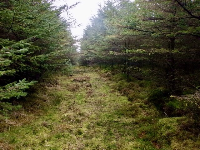
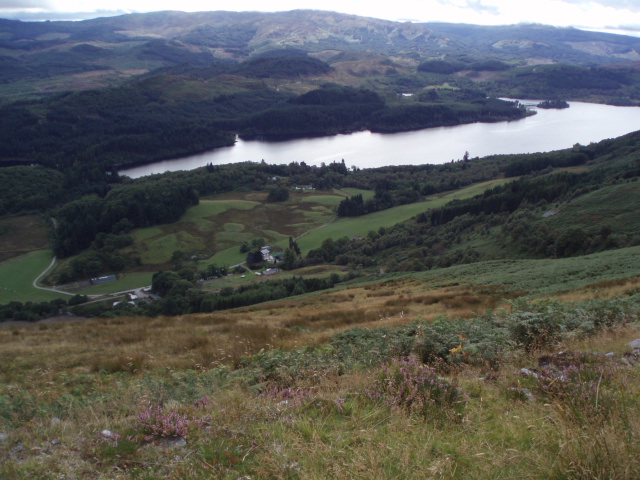
Drumore Wood

Wood, Forest in Stirlingshire

Scotland

Drumore Wood

Track to Aberfoyle The forest track that follows the Bofrishlie Burn NE to Aberfoyle.
Track to Aberfoyle Credit: Jim Barton

The requested URL returned error: 429 Too Many Requests

If you have any feedback on the listing, please let us know in the comments section below.

Drumore Wood Images

Images are sourced within 2km of 56.160869/-4.4371119 or Grid Reference NS4899. Thanks to Geograph Open Source API. All images are credited.

Track to Aberfoyle The forest track that follows the Bofrishlie Burn NE to Aberfoyle.
Track to Aberfoyle
The forest track that follows the Bofrishlie Burn NE to Aberfoyle.
Trackside Verge , near Garbeg Hill
Track near Garbeg Hill
Clashmore Loch A small lochan, set in wetland within Loch Ard Forest.
Clashmore Loch
A small lochan, set in wetland within Loch Ard Forest.
Logging road, Loch Ard Forest A road passing Clashmore Loch. As usual in Loch Ard the forest is varied with wetlands, carrs and areas of native trees breaking up the dominant commercial conifer blocks.
Logging road, Loch Ard Forest
A road passing Clashmore Loch. As usual in Loch Ard the forest is varied with wetlands, carrs and areas of native trees breaking up the dominant commercial conifer blocks.
Forest Road Forest Road with Ben Lomond in the distance. The road is part of the "Lomond" and "Aqueduct" signposted routes intended for the trendy 'new' sport of gravel biking.
Forest Road
Forest Road with Ben Lomond in the distance. The road is part of the "Lomond" and "Aqueduct" signposted routes intended for the trendy 'new' sport of gravel biking.
Logging road, Loch Ard Forest High on Uamh Mhòr one of the many rocky ridges under the trees.
Logging road, Loch Ard Forest
High on Uamh Mhòr one of the many rocky ridges under the trees.
Old extraction track, Uamh Mhòr A now overgrown and rotting track made up of small logs. It would have been used for timber extraction. As the slope overlooks Loch Ard, it was not clear felled for scenery preservation reasons and there are now some large trees growing here, trees which would not have survived were this deeper in the forest.
Old extraction track, Uamh Mhòr
A now overgrown and rotting track made up of small logs. It would have been used for timber extraction. As the slope overlooks Loch Ard, it was not clear felled for scenery preservation reasons and there are now some large trees growing here, trees which would not have survived were this deeper in the forest.
Summit, Uamh Mhòr A small clearing on a steep sided ridge.
Summit, Uamh Mhòr
A small clearing on a steep sided ridge.
Statute Labour Road Loch Ard Forest.  It appears that the code letters at junctions has been abandoned, this was a useful tool for navigating the track network, but there are signposts. The white posts with what appears to be a sign forbidding Norway, are marking an electricity cable. The sign is no digging.
Statute Labour Road
Loch Ard Forest. It appears that the code letters at junctions has been abandoned, this was a useful tool for navigating the track network, but there are signposts. The white posts with what appears to be a sign forbidding Norway, are marking an electricity cable. The sign is no digging.
Lochan a' Ghleannain
Clear felled area, Dalzell Wood Loch Ard Forest.
Clear felled area, Dalzell Wood
Loch Ard Forest.
Mature Sitka spruce, Loch Ard Forest Southeast of Drum of Clashmore
Mature Sitka spruce, Loch Ard Forest
Southeast of Drum of Clashmore
Summit area, Drum of Clashmore A wet ride runs along the ridge which is on the Highland Boundary Fault. The highest point is in the trees on the right.
Summit area, Drum of Clashmore
A wet ride runs along the ridge which is on the Highland Boundary Fault. The highest point is in the trees on the right.
Road, Garbeg Hill Loch Ard Forest.
Road, Garbeg Hill
Loch Ard Forest.
Loch Ard Forest, Garbeg Hill
Summit, Garbeg Hill A rocky rib in a clearing. There had been a fire here in the recent past and the subsequent growth of self seeded Sitka spruce gives a bit of a struggle.  The high point is marked by either a cairn or anthill, both about the same height.
Summit, Garbeg Hill
A rocky rib in a clearing. There had been a fire here in the recent past and the subsequent growth of self seeded Sitka spruce gives a bit of a struggle. The high point is marked by either a cairn or anthill, both about the same height.
Clashmore Loch, Loch Ard Forest
Show me another place!

Drumore Wood is located at Grid Ref: NS4899 (Lat: 56.160869, Lng: -4.4371119)

Unitary Authority: Stirling

Police Authority: Forth Valley

What 3 Words

///desire.promising.milk. Near Balfron, Stirling

Nearby Locations

Drumore Wood

Related Wikis

Queen Elizabeth Forest Park

Queen Elizabeth Forest Park is a 19,665-hectare (48,590-acre) forest park in the Scottish Highlands which extends from the eastern shores of Loch Lomond...

Duchray Water

Duchray Water, also called Dachray Water, is a 14-mile-long (23 km) headstream of the River Forth in the Trossachs region of Scotland. == Location == Duchray...

Milton, Stirling

Milton is a hamlet in Stirling, Scotland near Aberfoyle situated above the River Forth. In 1961 it had a population of 98. Most pupils attend Aberfoyle...

Loch Ard

Loch Ard (Scottish Gaelic: Loch na h-Àirde) is a loch, located in Loch Lomond and the Trossachs National Park, Stirling council area, Scotland. == Overview... ==

Have you been to Drumore Wood?

Leave your review of Drumore Wood below (or comments, questions and feedback).