Achnasoul Wood

Wood, Forest in Ross-shire

Scotland

Achnasoul Wood

Weir, above the Falls of Orrin A weir across the River Orrin. A sluice gate on the right, taking water to the hydro scheme.
Weir, above the Falls of Orrin Credit: Craig Wallace

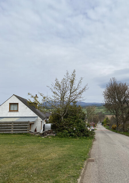
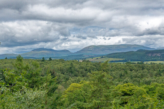
Achnasoul Wood is a picturesque woodland located in Ross-shire, Scotland. Covering an area of approximately 100 acres, it is a popular destination for nature enthusiasts, hikers, and birdwatchers alike. The wood is situated on the southern slopes of Achnasoul Hill, providing stunning views of the surrounding countryside.

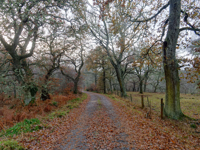
The wood is predominantly composed of native broadleaf trees such as oak, birch, and rowan, creating a diverse and rich habitat for a wide range of wildlife. The forest floor is covered in a blanket of lush green vegetation, including ferns, mosses, and wildflowers, adding to the enchanting atmosphere of the wood.

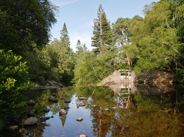
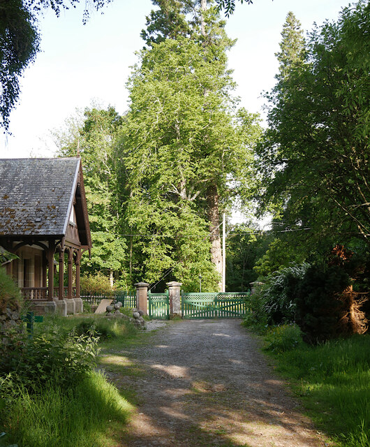
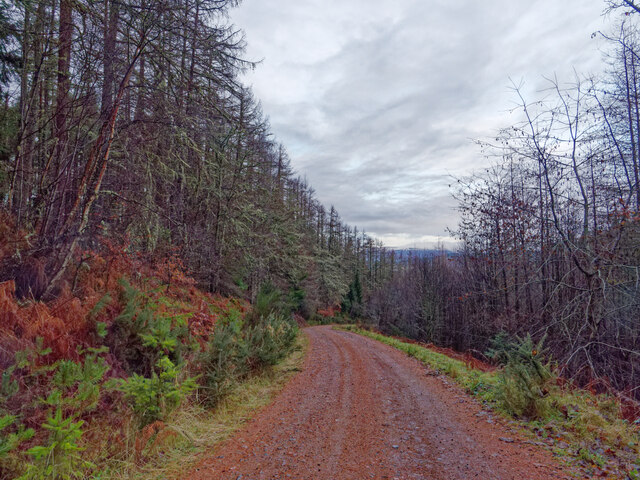
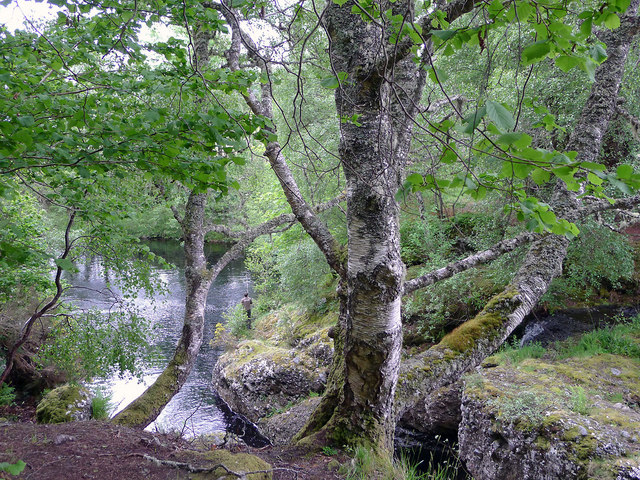
Visitors to Achnasoul Wood can enjoy a network of well-maintained trails, allowing them to explore the woodland at their own pace. The paths wind through the trees, leading visitors to hidden glens, babbling brooks, and tranquil ponds. These water features attract various species of birds, making it a paradise for birdwatchers. Common sightings include woodpeckers, redstarts, and treecreepers.

In addition to its natural beauty, Achnasoul Wood also has a rich history. It is believed to have been used as a hunting ground for the local lairds in the past. Remnants of old stone walls and ruins can still be found scattered throughout the wood, adding an air of mystery and intrigue.

Overall, Achnasoul Wood is a captivating destination that offers visitors a chance to immerse themselves in the tranquility of nature while experiencing the rich history and diverse wildlife of Ross-shire.

If you have any feedback on the listing, please let us know in the comments section below.

Achnasoul Wood Images

Images are sourced within 2km of 57.531544/-4.5358844 or Grid Reference NH4851. Thanks to Geograph Open Source API. All images are credited.

Weir, above the Falls of Orrin A weir across the River Orrin. A sluice gate on the right, taking water to the hydro scheme.
Weir, above the Falls of Orrin
A weir across the River Orrin. A sluice gate on the right, taking water to the hydro scheme.
Track by Fairburn The estate road along the north side of the River Orrin, passing by a mixture of trees.
Track by Fairburn
The estate road along the north side of the River Orrin, passing by a mixture of trees.
Track by Aultgowrie Lodge A track into the Fairburn Estate, on the north side of the River Orrin.
The lodge, gate piers and gates are Category B listed. <span class="nowrap"><a title="https://portal.historicenvironment.scot/designation/LB14032" rel="nofollow ugc noopener" href="https://portal.historicenvironment.scot/designation/LB14032">Link</a><img style="margin-left:2px;" alt="External link" title="External link - shift click to open in new window" src="https://s1.geograph.org.uk/img/external.png" width="10" height="10"/></span>
Track by Aultgowrie Lodge
A track into the Fairburn Estate, on the north side of the River Orrin. The lodge, gate piers and gates are Category B listed. LinkExternal link
The Brae, Marybank
The Brae, Marybank
Flush Bracket OSBM G1718 - Marybank, former Post Office <span class="nowrap"><a title="https://www.bench-marks.org.uk/bm404" rel="nofollow ugc noopener" href="https://www.bench-marks.org.uk/bm404">Link</a><img style="margin-left:2px;" alt="External link" title="External link - shift click to open in new window" src="https://s1.geograph.org.uk/img/external.png" width="10" height="10"/></span>
Flush Bracket OSBM G1718 - Marybank, former Post Office
Location of Flush Bracket OSBM G1718 - Marybank, former Post Office
Mini roundabout, Marybank
Dustbin day at Marybank
A long straight road, A832
Ben Wyvis and the woodland of Strathconon A view from a vantage point in Clash Wood.  The view has become more restricted over the years by the growth of trees.  See <a href="https://www.geograph.org.uk/photo/5808608">NH4951 : Outlook from Clash Wood towards Ben Wyvis</a> in 2018 and <a href="https://www.geograph.org.uk/photo/5808608">NH4951 : Outlook from Clash Wood towards Ben Wyvis</a> in 2019.
Ben Wyvis and the woodland of Strathconon
A view from a vantage point in Clash Wood. The view has become more restricted over the years by the growth of trees. See NH4951 : Outlook from Clash Wood towards Ben Wyvis in 2018 and NH4951 : Outlook from Clash Wood towards Ben Wyvis in 2019.
River Orrin at Aultgowrie The river looking upstream from the bridge carrying a minor road over its flow.
Cùl Mòr is the mountain on the left side of the image. Beinn an Rubha Riabhach is more distant.
River Orrin at Aultgowrie
The river looking upstream from the bridge carrying a minor road over its flow. Cùl Mòr is the mountain on the left side of the image. Beinn an Rubha Riabhach is more distant.
Forestry road to Faebait Cottage This wide track continues to the minor road at Faebait Cottage.  The track is a Core Path of the Highland Core Path Network, RC 32.03
Forestry road to Faebait Cottage
This wide track continues to the minor road at Faebait Cottage. The track is a Core Path of the Highland Core Path Network, RC 32.03
Faebait Cottage by Clash Wood The cottage viewed from the Forestry Road through Clash Wood.
Faebait Cottage by Clash Wood
The cottage viewed from the Forestry Road through Clash Wood.
Forestry Road from Faebait to Clash Wood A wide road that is a footpath of the Highland Core Path Network,  RC 32.03
Forestry Road from Faebait to Clash Wood
A wide road that is a footpath of the Highland Core Path Network, RC 32.03
Tying Raspberry Canes At Balvraid Fruit Farm.
Tying Raspberry Canes
At Balvraid Fruit Farm.
The End Rig Next to Balvraid Fruit Farms and northwest of Muir of Ord.
The End Rig
Next to Balvraid Fruit Farms and northwest of Muir of Ord.
Looking upstream the River Orrin from the bridge at Aultgowrie Plenty of water in the Orrin after a poor week of weather.
Looking upstream the River Orrin from the bridge at Aultgowrie
Plenty of water in the Orrin after a poor week of weather.
Fisherman below the Falls of Orrin We saw the man struggle with a fish on his line, and having caught it, returned it carefully to the river.  From our distance it was clear that the fish was of a dark hue, but what species it was we could not tell. Despite the hectic pace of the water in the falls just below our feet, the pool below was remarkably placid.
Fisherman below the Falls of Orrin
We saw the man struggle with a fish on his line, and having caught it, returned it carefully to the river. From our distance it was clear that the fish was of a dark hue, but what species it was we could not tell. Despite the hectic pace of the water in the falls just below our feet, the pool below was remarkably placid.
Show me another place!

Achnasoul Wood is located at Grid Ref: NH4851 (Lat: 57.531544, Lng: -4.5358844)

Unitary Authority: Highland

Police Authority: Highlands and Islands

What 3 Words

///warp.sapping.mammals. Near Muir of Ord, Highland

Nearby Locations

Achnasoul Wood

Related Wikis

Fairburn Tower

Fairburn Tower is a recently restored Scottish castle near Inverness and Muir of Ord in the parish of Urray. The tower house on a hill above the River...

Falls of Orrin

Falls of Orrin is a waterfall on the River Orrin, in the Highlands of Scotland. == See also == Waterfalls of Scotland == References ==

Marybank

Marybank is a small village in Ross-shire, Scottish Highlands and is in the Scottish council area of Highland. The village of Muir of Ord lies 3 miles...

Urray

Urray (Scottish Gaelic: Urrath) is a scattered village and coastal parish, consisting of Easter, Old and Wester Urray and is located in the county of Ross...

Nearby Amenities

Located within 500m of 57.531544,-4.5358844
Created By: Merkaartor 0.12
Lat/Long: 57.5286937/-4.53405
Orrinside
Place: hamlet
Source: survey
Lat/Long: 57.5294733/-4.5323483
Historic Power: tower
Lat/Long: 57.5297914/-4.5296827
Historic Power: tower
Lat/Long: 57.5299498/-4.528783
Historic Power: tower
Lat/Long: 57.5315413/-4.5309068
Historic Power: tower
Lat/Long: 57.5319688/-4.5301399
Power: tower
Lat/Long: 57.5344751/-4.5366213
Power: tower
Lat/Long: 57.5334125/-4.5324531
Power: tower
Lat/Long: 57.5316674/-4.5312837
Power: tower
Lat/Long: 57.5297379/-4.5299694
Power: pole
Lat/Long: 57.5350699/-4.5313143
Power: pole
Lat/Long: 57.5350734/-4.5320161
Power: pole
Lat/Long: 57.5351447/-4.532782
Power: pole
Lat/Long: 57.5352136/-4.5335391
Power: pole
Lat/Long: 57.5352837/-4.5343493
Power: pole
Lat/Long: 57.5350223/-4.5353277
Power: pole
Lat/Long: 57.5342696/-4.537071
Power: pole
Lat/Long: 57.5339368/-4.5371396
Power: pole
Lat/Long: 57.5332773/-4.5372813
Power: pole
Lat/Long: 57.5326249/-4.537434
Power: pole
Lat/Long: 57.532045/-4.5375646
Power: pole
Lat/Long: 57.5313819/-4.5377151
Power: pole
Lat/Long: 57.5307295/-4.5378568
Power: pole
Lat/Long: 57.5301008/-4.5380029
Power: pole
Lat/Long: 57.5298465/-4.5380582
Power: pole
Lat/Long: 57.5296718/-4.5392802
Power: pole
Lat/Long: 57.5294852/-4.5404601
Power: pole
Lat/Long: 57.5292262/-4.5415935
Power: pole
Lat/Long: 57.5290015/-4.5426781
Power: pole
Lat/Long: 57.5292998/-4.5375779
Power: pole
Lat/Long: 57.5293165/-4.5368319
Power: pole
Lat/Long: 57.5293272/-4.5358778
Power: pole
Lat/Long: 57.5293284/-4.5348396
Power: pole
Lat/Long: 57.5293385/-4.5337903
Power: pole
Lat/Long: 57.5293563/-4.5325396
Power: pole
Lat/Long: 57.5292458/-4.5313929
Power: pole
Lat/Long: 57.52914/-4.530202
Power: pole
Lat/Long: 57.5287026/-4.5294538
The data included in this document is from www.openstreetmap.org. The data is made available under ODbL.

Have you been to Achnasoul Wood?

Leave your review of Achnasoul Wood below (or comments, questions and feedback).