Bargaly Wood

Wood, Forest in Kirkcudbrightshire

Scotland

Bargaly Wood

Walkers on forest road on slope of Ardwell Hill Ardwell Hill is part of a western spur of the hill Cairnsmore of Fleet, it rises to the right out of the image.
Walkers on forest road on slope of Ardwell Hill Credit: Trevor Littlewood

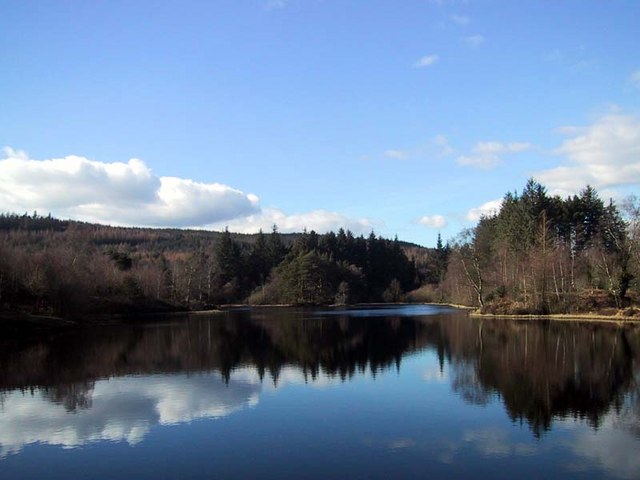
Bargaly Wood, located in Kirkcudbrightshire, Scotland, is a breathtaking forest that is renowned for its natural beauty and rich biodiversity. The wood covers an area of approximately 200 hectares, making it a significant natural landmark in the region.

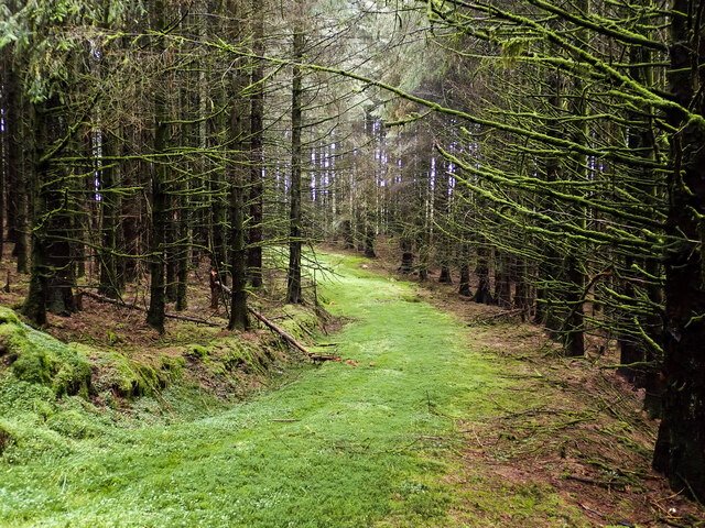
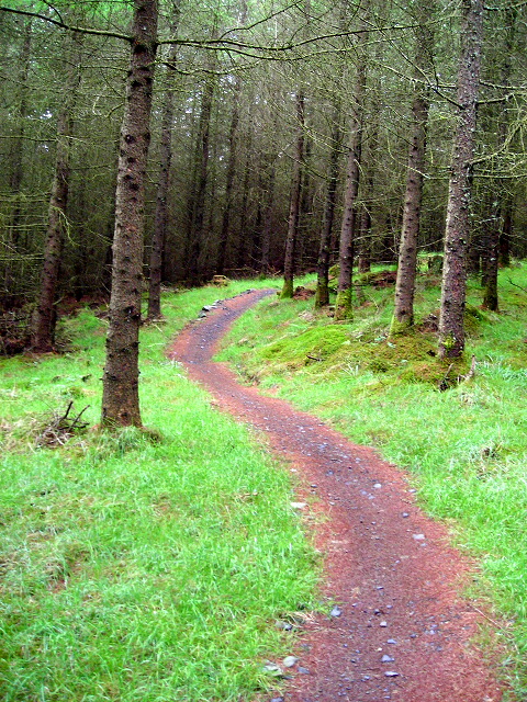
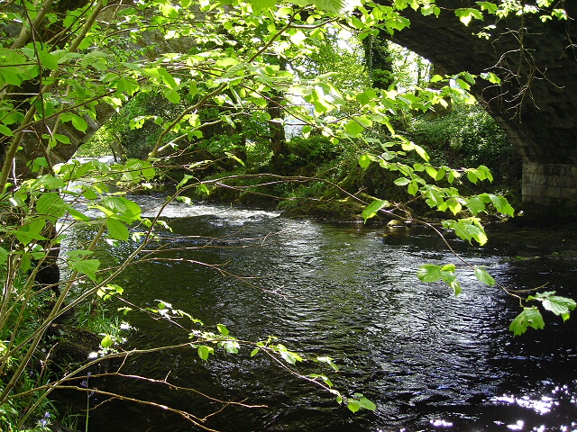
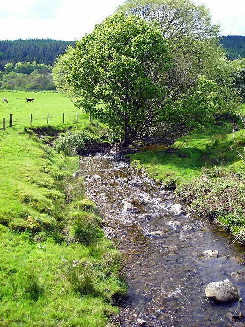
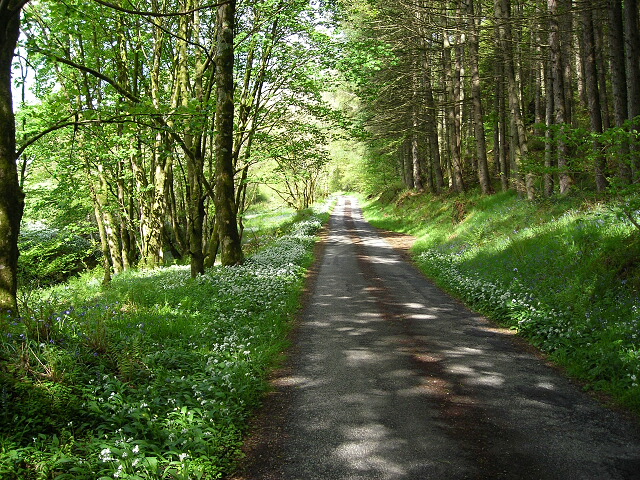
The forest is primarily composed of native broadleaf trees, including oak, birch, and rowan. These trees, with their towering canopies and vibrant foliage, create a picturesque landscape that attracts nature enthusiasts, photographers, and hikers alike.

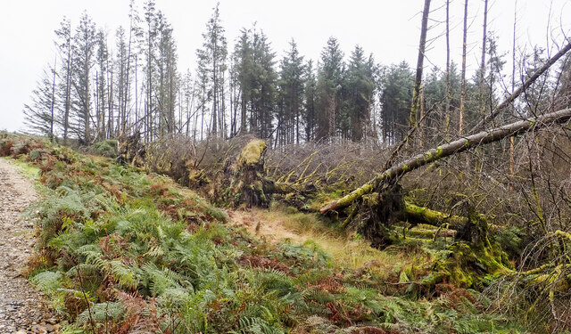
Bargaly Wood is not only visually stunning but also serves as a vital habitat for numerous animal species. The diverse ecosystem supports a variety of wildlife, including red squirrels, badgers, roe deer, and a wide range of bird species. Birdwatchers can spot woodpeckers, cuckoos, and even the elusive capercaillie within the wood's boundaries.

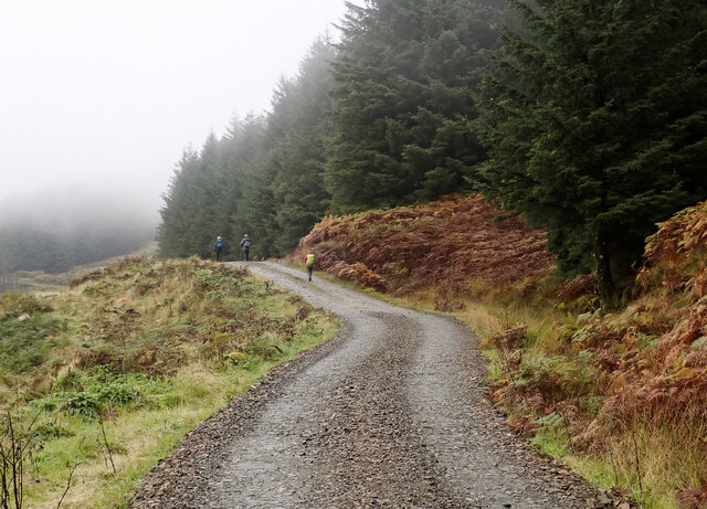
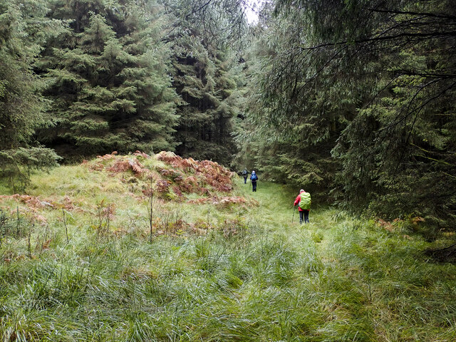
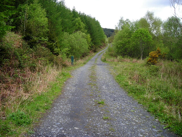
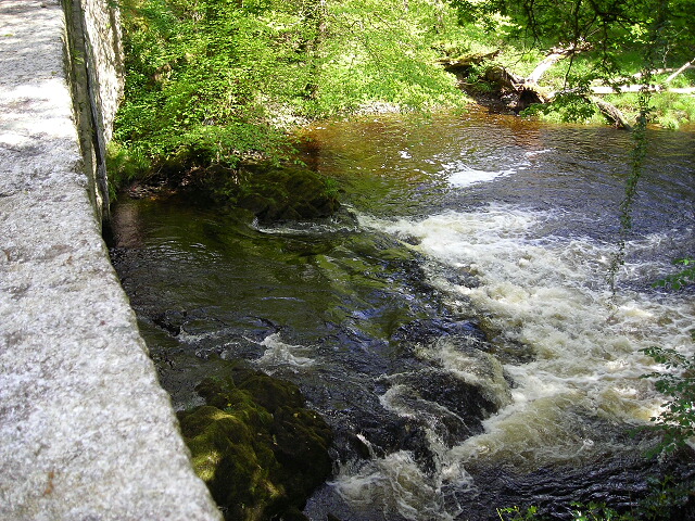
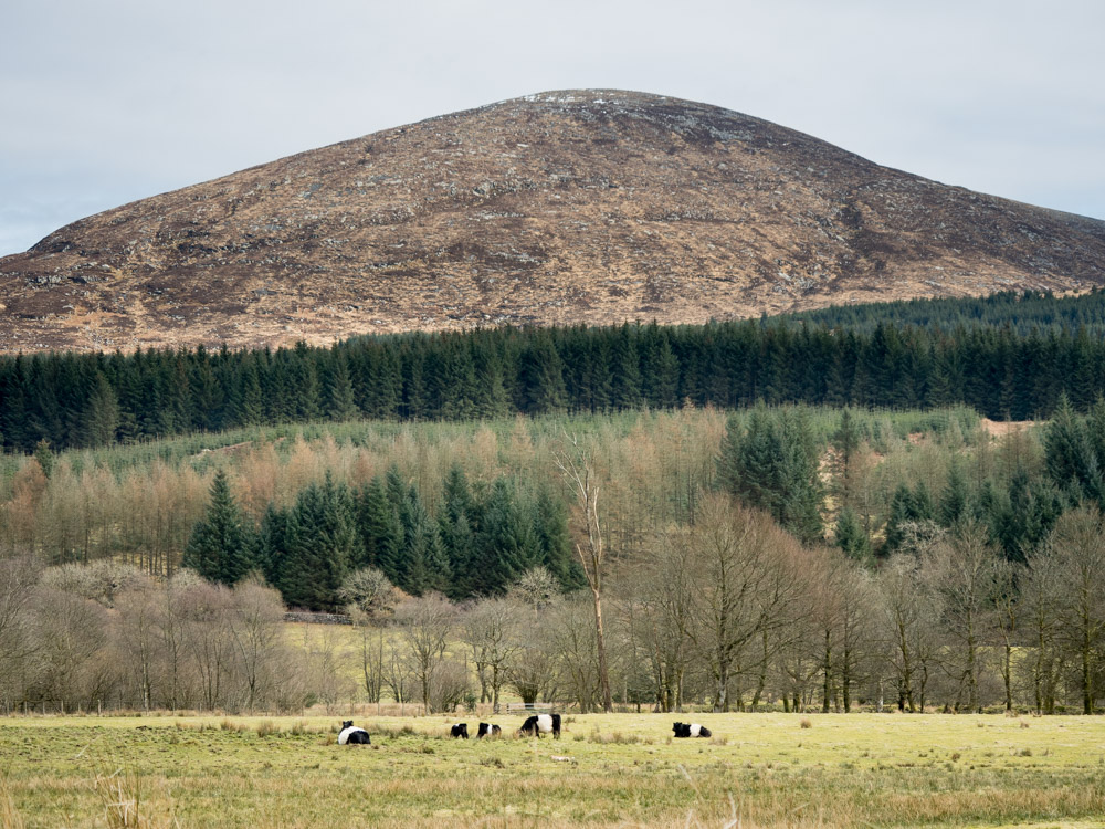
The wood is crisscrossed by a network of well-maintained trails, allowing visitors to explore its natural wonders at their own pace. These trails offer panoramic views of the surrounding countryside, with glimpses of rolling hills, meandering rivers, and distant mountains.

Bargaly Wood is not only a haven for nature enthusiasts but also a site of historical importance. The wood has remnants of ancient settlements, including stone circles and burial mounds, providing a glimpse into the area's rich past.

Overall, Bargaly Wood is a treasure trove of natural beauty, biodiversity, and historical significance. Its stunning scenery, abundant wildlife, and well-preserved trails make it a must-visit destination for anyone seeking a peaceful escape into nature.

If you have any feedback on the listing, please let us know in the comments section below.

Bargaly Wood Images

Images are sourced within 2km of 54.96544/-4.4024119 or Grid Reference NX4666. Thanks to Geograph Open Source API. All images are credited.

Walkers on forest road on slope of Ardwell Hill Ardwell Hill is part of a western spur of the hill Cairnsmore of Fleet, it rises to the right out of the image.
Walkers on forest road on slope of Ardwell Hill
Ardwell Hill is part of a western spur of the hill Cairnsmore of Fleet, it rises to the right out of the image.
Forest road on Ardwell Hill Ardwell Hill is a forested, western spur of Cairnsmore of Fleet. Here, the forest road more or less contours around it then continues towards a crossing of the Mill Burn.
Forest road on Ardwell Hill
Ardwell Hill is a forested, western spur of Cairnsmore of Fleet. Here, the forest road more or less contours around it then continues towards a crossing of the Mill Burn.
Windthrown trees on west side of forest road The road and trees are on the west side of the hill, Cairnsmore of Fleet. A good number of trees have been brought down both in view in the image and further along the road.
Windthrown trees on west side of forest road
The road and trees are on the west side of the hill, Cairnsmore of Fleet. A good number of trees have been brought down both in view in the image and further along the road.
Vague path through coniferous plantation Coniferous plantings occupy much of the eastern side of the Bargaly Glen as the slope rises towards Cairnsmore of Fleet. A virtually disused, vegetated forest road heads south into the trees to reach and cross the Knock Burn by a bridge; from there the road gradually looses its identity becoming the path being followed by the walking party in the image.
Vague path through coniferous plantation
Coniferous plantings occupy much of the eastern side of the Bargaly Glen as the slope rises towards Cairnsmore of Fleet. A virtually disused, vegetated forest road heads south into the trees to reach and cross the Knock Burn by a bridge; from there the road gradually looses its identity becoming the path being followed by the walking party in the image.
Route through trees in Bargaly Glen The way is through trees to the east of the Palnure Burn and properties such as Bargaly Farm House. Further north the route it's a little used or even disused forest road until it reaches the Knock Burn which is crossed by a sort of bridge. South from there it becomes more of a path, fading progressively and becoming very wet in places. From this location however the way is absolutely clear between coniferous trees.
Route through trees in Bargaly Glen
The way is through trees to the east of the Palnure Burn and properties such as Bargaly Farm House. Further north the route it's a little used or even disused forest road until it reaches the Knock Burn which is crossed by a sort of bridge. South from there it becomes more of a path, fading progressively and becoming very wet in places. From this location however the way is absolutely clear between coniferous trees.
Trees alongside the Palnure Burn The burn can just be detected beside the middle distance trees.
Trees alongside the Palnure Burn
The burn can just be detected beside the middle distance trees.
Bungalow beside Mill Burn The burn flows just below the slope to the right, it then passes beneath the Woodend Bridge from which the image was made.
Bungalow beside Mill Burn
The burn flows just below the slope to the right, it then passes beneath the Woodend Bridge from which the image was made.
Sunlit field east of Little Park Shadowed trees beyond and shadowed bracken before but a luminously-lit grassed field in between.
Sunlit field east of Little Park
Shadowed trees beyond and shadowed bracken before but a luminously-lit grassed field in between.
Road heading north in valley of Palnure Burn The road is on the eastern side of the burn approaching Bardrochwood and other properties at Bargaly where it terminates, at least for public, motorised use.
Road heading north in valley of Palnure Burn
The road is on the eastern side of the burn approaching Bardrochwood and other properties at Bargaly where it terminates, at least for public, motorised use.
Farmhouse at Craignine The farmhouse seen over a field from the west side of Craignine Bridge which carries a minor road over the Palnure Burn.
Farmhouse at Craignine
The farmhouse seen over a field from the west side of Craignine Bridge which carries a minor road over the Palnure Burn.
Galloway Forest Park monument Monument and view point at the start of the Kirroughtree Mountain bike black trail.
Galloway Forest Park monument
Monument and view point at the start of the Kirroughtree Mountain bike black trail.
Bruntis Loch
Bruntis Loch
Cycle Trail at Kirroughtree
Forest Track in Bargaly Glen
Falls on Palnure Burn at Craignine Bridge
Palnure Burn at Craignine Bridge
Burn at Woodend Bridge
Minor Road Flanked by Wild Garlic and Bluebells
Show me another place!

Bargaly Wood is located at Grid Ref: NX4666 (Lat: 54.96544, Lng: -4.4024119)

Unitary Authority: Dumfries and Galloway

Police Authority: Dumfries and Galloway

What 3 Words

///truckload.dreaming.bracelet. Near Newton Stewart, Dumfries & Galloway

Nearby Locations

Bargaly Wood

Related Wikis

Kirroughtree

Kirroughtree Forest is located near Newton Stewart in Dumfries and Galloway, southwest Scotland and overlooks the Irish Sea. It is managed by Forestry...

Palnure railway station

Palnure railway station (NX450634) was a railway station on the Portpatrick and Wigtownshire Joint Railway close to Newton Stewart and the junction for...

Palnure

Palnure (Scottish Gaelic: Poll an Iùbhair) is a small village in the historical county of Kirkcudbrightshire in Dumfries and Galloway, Scotland, on the...

Cairnsmore of Fleet

Cairnsmore of Fleet is an isolated mountain in the Southern Uplands of Scotland. The mountain forms an unafforested granite massif, whose highest point...

Kirroughtree House

Kirroughtree House is the heritage-listed mansion house (Category B listing.) of the Kirroughtree estate. It occupies a prominent position 1 mile (1.6...

Minnigaff

Minnigaff is a village and civil parish in the historic county of Kirkcudbrightshire in Dumfries and Galloway, Scotland. Lead was discovered there in...

McMillan Hall, Newton Stewart

The McMillan Hall is a municipal building in Dashwood Square in Newton Stewart, Dumfries and Galloway, Scotland. The structure, which is used as a community...

Penninghame

Penninghame in Wigtownshire, Dumfries and Galloway, Scotland, is a civil parish area, 8 miles (N. W.) from Wigtown. The area is approx 16 miles in length...

Nearby Amenities

Located within 500m of 54.96544,-4.4024119
Ford: yes
Lat/Long: 54.9648214/-4.3963961
Power: pole
Lat/Long: 54.9691464/-4.4063348
Power: pole
Lat/Long: 54.968576/-4.406722
Power: pole
Lat/Long: 54.967881/-4.4073635
Power: pole
Lat/Long: 54.9673935/-4.4078138
Power: pole
Lat/Long: 54.9669048/-4.408327
Power: pole
Lat/Long: 54.9663852/-4.4087912
Power: pole
Lat/Long: 54.9658374/-4.4092974
Power: pole
Lat/Long: 54.9652522/-4.4098363
The data included in this document is from www.openstreetmap.org. The data is made available under ODbL.

Have you been to Bargaly Wood?

Leave your review of Bargaly Wood below (or comments, questions and feedback).