California Plantation

Wood, Forest in Wigtownshire

Scotland

California Plantation

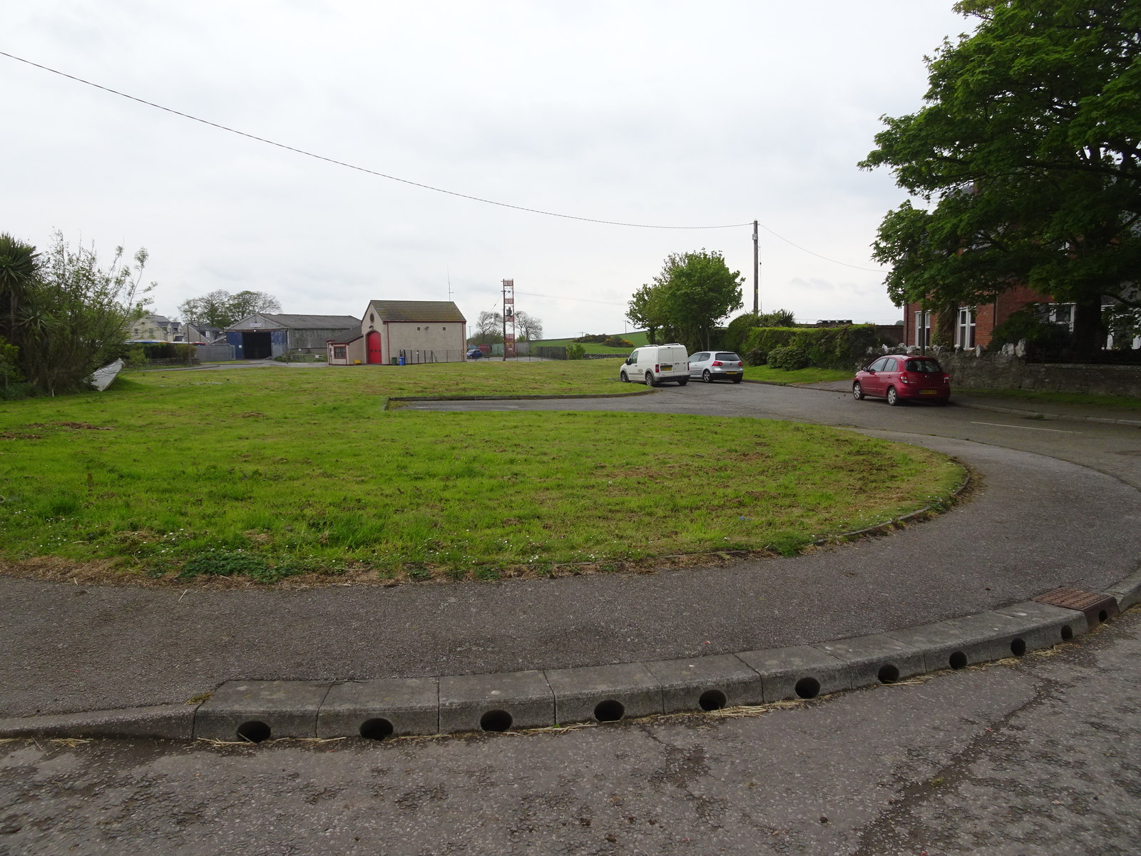
A747, Glasserton
A747, Glasserton Credit: Richard Webb

California Plantation is a picturesque woodland located in the Wigtownshire region of Scotland. Covering an extensive area, it is renowned for its lush vegetation, diverse wildlife, and tranquil atmosphere. The plantation primarily consists of dense forested areas, predominantly composed of native tree species such as oak, beech, and birch.

The woodland boasts a rich biodiversity, serving as a habitat for a wide range of flora and fauna. Visitors to California Plantation can expect to encounter an array of plant life, including vibrant wildflowers, ferns, and mosses. The varied terrain, with its gentle slopes and meandering paths, offers an ideal setting for leisurely walks, nature trails, and outdoor activities.

The plantation is also home to numerous bird species, making it a paradise for birdwatchers and nature enthusiasts. Birdsong can be heard throughout the year, providing a soothing backdrop to the serene surroundings. Woodpeckers, owls, and various songbirds are frequently spotted within the woodland, adding to its charm.

California Plantation offers a peaceful retreat from the hustle and bustle of everyday life. Its natural beauty and idyllic setting make it a popular destination for those seeking solace and tranquility. The plantation's management ensures the preservation of its ecological balance, making it an exemplary model of sustainable forestry practices.

In conclusion, California Plantation is a captivating woodland in Wigtownshire, Scotland. With its verdant forest, diverse wildlife, and peaceful ambiance, it invites visitors to immerse themselves in the beauty of nature and enjoy a respite from the outside world.

If you have any feedback on the listing, please let us know in the comments section below.

California Plantation Images

Images are sourced within 2km of 54.740085/-4.4579535 or Grid Reference NX4141. Thanks to Geograph Open Source API. All images are credited.

A747, Glasserton
A747, Glasserton
A field between roads After taking a silage cut.
A field between roads
After taking a silage cut.
Rispain settlement Ancient defended homestead with a surprisingly deep rectangular ditch.  It was thought to be a Roman Camp until radio carbon dating put its age at around 60BC.
Rispain settlement
Ancient defended homestead with a surprisingly deep rectangular ditch. It was thought to be a Roman Camp until radio carbon dating put its age at around 60BC.
Farm buildings Farm buildings at Rispain.  A car park is provided by the farm for visitors to the Rispain Settlement.
Farm buildings
Farm buildings at Rispain. A car park is provided by the farm for visitors to the Rispain Settlement.
Road junction between Glasserton and Craiglemine
The old barn at Rispain farm This view of the old barn is taken from the track to Rispain Settlement.
The old barn at Rispain farm
This view of the old barn is taken from the track to Rispain Settlement.
A farm track at Rispain The track to the left leads to Rispain Settlement - - straight on into the fields.
A farm track at Rispain
The track to the left leads to Rispain Settlement - - straight on into the fields.
Entrance into a ploughed field This open gateway into a ploughed field is at Rispain farm.  Old tyres piled up in the farmyard can be seen to the right of the picture.
Entrance into a ploughed field
This open gateway into a ploughed field is at Rispain farm. Old tyres piled up in the farmyard can be seen to the right of the picture.
Track at Rispain This track leads from Rispain farmyard to the settlement.
Track at Rispain
This track leads from Rispain farmyard to the settlement.
The entrance gate into Rispain Settlement
The massage defensive ditch at Rispain Settlement looking south east The Rispain Settlement was originally thought to be Roman because of its square construction but archaeological excavations in 1978-81 proved it to be from 100BC to 200AD. It had been built by local Celtic farmers.
The massage defensive ditch at Rispain Settlement looking south east
The Rispain Settlement was originally thought to be Roman because of its square construction but archaeological excavations in 1978-81 proved it to be from 100BC to 200AD. It had been built by local Celtic farmers.
Massage defensive ditch at Rispain Settlement This view of the massive ditch at Rispain is looking south, along the ditch. Looking at the nearby trees gives an idea of just how big the ditch is.
Massage defensive ditch at Rispain Settlement
This view of the massive ditch at Rispain is looking south, along the ditch. Looking at the nearby trees gives an idea of just how big the ditch is.
The ditch at Rispain, looking north east The word "Rispain" is thought to have come from the Old Welsh word " rhwospen" meaning "the chief of the cultivated country" which would have been appropriate for this prestigious iron age farm.
The ditch at Rispain, looking north east
The word "Rispain" is thought to have come from the Old Welsh word " rhwospen" meaning "the chief of the cultivated country" which would have been appropriate for this prestigious iron age farm.
The ditch at Rispain, looking south west This iron age settlement was thought to contain many large roundhouses and its heyday was thought to be around the time of Christ.
The ditch at Rispain, looking south west
This iron age settlement was thought to contain many large roundhouses and its heyday was thought to be around the time of Christ.
Car park at Rispain farm This is the car park for those wishing to visit Rispain Settlement. The way to the settlement is through the gate on the left.
Car park at Rispain farm
This is the car park for those wishing to visit Rispain Settlement. The way to the settlement is through the gate on the left.
A747 Junction View of this junction where the road from Ravenstone joins the main A747 which runs between Port William and the two Whithorns (Isle of Whithorn and Whithorn).
A747 Junction
View of this junction where the road from Ravenstone joins the main A747 which runs between Port William and the two Whithorns (Isle of Whithorn and Whithorn).
A747 Junction View of this junction where the Ravenstone road left of picture joins the A747. Direction is towards Glasserton.
A747 Junction
View of this junction where the Ravenstone road left of picture joins the A747. Direction is towards Glasserton.
Road to Ravenstone This small unnamed road runs from the A747 across the B7021 and ends at Ravenstone Mains.
Road to Ravenstone
This small unnamed road runs from the A747 across the B7021 and ends at Ravenstone Mains.
Show me another place!

California Plantation is located at Grid Ref: NX4141 (Lat: 54.740085, Lng: -4.4579535)

Unitary Authority: Dumfries and Galloway

Police Authority: Dumfries and Galloway

What 3 Words

///downward.crows.daunting. Near Whithorn, Dumfries & Galloway

Related Wikis

Rispain Camp

Rispain Camp is the remains of a fortified farmstead 1 mile west of Whithorn, Dumfries and Galloway, Scotland. It is one of the major Iron Age archaeological...

Glasserton

Glasserton is a civil parish in Dumfries and Galloway, south-west Scotland. It is on the Machars peninsula, in the traditional county of Wigtownshire....

Whithorn Priory

Whithorn Priory was a medieval Scottish monastery that also served as a cathedral, located at 6 Bruce Street in Whithorn, Wigtownshire, Dumfries and Galloway...

Whithorn railway station

Whithorn is the closed terminus of the Wigtownshire Railway branch, from Newton Stewart, of the Portpatrick and Wigtownshire Joint Railway. It served...

Nearby Amenities

Located within 500m of 54.740085,-4.4579535
California Farm
Place: farm
Lat/Long: 54.7405506/-4.4550528
Power: pole
Lat/Long: 54.7406628/-4.46556
Power: pole
Lat/Long: 54.7414802/-4.4649577
Power: pole
Lat/Long: 54.7423659/-4.464311
Power: pole
Lat/Long: 54.7413875/-4.4640957
Power: pole
Lat/Long: 54.7412677/-4.4628258
Power: pole
Lat/Long: 54.7411502/-4.4618306
Power: pole
Lat/Long: 54.741036/-4.4607912
Power: pole
Lat/Long: 54.7409417/-4.4598057
Power: pole
Lat/Long: 54.740833/-4.4587259
Power: pole
Lat/Long: 54.7407165/-4.4576885
Power: pole
Lat/Long: 54.7405979/-4.4565992
Power: pole
Lat/Long: 54.7405025/-4.4556155
The data included in this document is from www.openstreetmap.org. The data is made available under ODbL.

Have you been to California Plantation?

Leave your review of California Plantation below (or comments, questions and feedback).