Culag Plantation

Wood, Forest in Dunbartonshire

Scotland

Culag Plantation

Village shop and Post Office Luss
Village shop and Post Office Luss Credit: John Ferguson

Culag Plantation is a sprawling wood and forest area located in Dunbartonshire, Scotland. Nestled amidst the picturesque countryside, this plantation covers an extensive area of approximately 500 acres. The plantation is known for its diverse range of tree species, providing a habitat for various wildlife species and offering a serene environment for visitors.

The woodlands of Culag Plantation are predominantly composed of native species such as oak, birch, and Scots pine. The tall, majestic trees create a dense canopy, allowing for filtered sunlight to penetrate the forest floor and nurture a vibrant undergrowth of ferns, mosses, and wildflowers. This rich biodiversity attracts a wide array of birds, including woodpeckers, owls, and songbirds, making it a haven for birdwatching enthusiasts.

Visitors to Culag Plantation can explore the numerous walking trails that wind through the woodland, offering scenic views of the surrounding landscape. These trails are well-maintained and suitable for both leisurely strolls and more challenging hikes. The plantation also features picnic areas and benches, providing opportunities for visitors to relax and soak in the tranquil atmosphere.

Culag Plantation is managed by local conservation organizations and forestry authorities, ensuring the preservation of its natural beauty and ecological importance. Regular maintenance activities, such as tree thinning and invasive species control, are undertaken to maintain the health and balance of the woodland ecosystem.

Whether it is for a peaceful walk, birdwatching, or simply immersing oneself in nature, Culag Plantation offers a serene and captivating experience for visitors, showcasing the beauty and biodiversity of Dunbartonshire's woodlands.

If you have any feedback on the listing, please let us know in the comments section below.

Culag Plantation Images

Images are sourced within 2km of 56.117935/-4.6533592 or Grid Reference NS3594. Thanks to Geograph Open Source API. All images are credited.

Village shop and Post Office Luss
Foxglove among bracken Bracken low down on the Glen Luss hillside has died down and been flattened by winter. The ground is covered in dry, brittle bracken except where new foxgloves have sprouted.
Foxglove among bracken
Bracken low down on the Glen Luss hillside has died down and been flattened by winter. The ground is covered in dry, brittle bracken except where new foxgloves have sprouted.
Gate onto the hill
Gate onto the hill
Fell runners descending from Beinn Dubh The runners are following the popular path that takes walkers to and from Luss village. Loch Lomond with Inchlonaig island lies beyond.
Fell runners descending from Beinn Dubh
The runners are following the popular path that takes walkers to and from Luss village. Loch Lomond with Inchlonaig island lies beyond.
Looking towards Loch Lomond from Creag an t-Seilich The featureless hillside in the foreground typifies the terrain of the Luss Hills. An indistinct path leads walkers over Creag an t-Seilich towards the top of Beinn Dubh. Islands of Loch Lomond lie behind: Fraoch Eilean small in the foreground, Inchtavannach and Inchconnachan behind it, Inchmoan and Inchruin behind them at the left.
Looking towards Loch Lomond from Creag an t-Seilich
The featureless hillside in the foreground typifies the terrain of the Luss Hills. An indistinct path leads walkers over Creag an t-Seilich towards the top of Beinn Dubh. Islands of Loch Lomond lie behind: Fraoch Eilean small in the foreground, Inchtavannach and Inchconnachan behind it, Inchmoan and Inchruin behind them at the left.
Boggy terrain on Beinn Dubh On the same path, looking in the same direction as <a href="https://www.geograph.org.uk/photo/934033">NS3494 : Path to Beinn Dubh</a>, the picture here shows how much damper the ground generally is in early Spring.
Boggy terrain on Beinn Dubh
On the same path, looking in the same direction as NS3494 : Path to Beinn Dubh, the picture here shows how much damper the ground generally is in early Spring.
Peat hags on Beinn Dubh The peat hags lie on the north side of the very broad, flat ridge that runs north-west from the summit of Beinn Dubh. Although the day was hazy, Loch Lomond and Ben Lomond can be seen behind.
Peat hags on Beinn Dubh
The peat hags lie on the north side of the very broad, flat ridge that runs north-west from the summit of Beinn Dubh. Although the day was hazy, Loch Lomond and Ben Lomond can be seen behind.
Hillside above Glen Luss The picture looks roughly east along the side of the hill above Glen Luss. Loch Lomond lies in the distance.
Hillside above Glen Luss
The picture looks roughly east along the side of the hill above Glen Luss. Loch Lomond lies in the distance.
Eagle Sculpture outside Luss Visitor centre
Luss Visitor Centre in the rain By car park in Luss
Luss Visitor Centre in the rain
By car park in Luss
Headland at Rhu wood across Luss Bay Taken just north of Pier. Ben Lomond in background
Headland at Rhu wood across Luss Bay
Taken just north of Pier. Ben Lomond in background
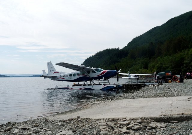
Loch Lomond Seaplane base G-MDJE ready for takeoff
Loch Lomond Seaplane base
G-MDJE ready for takeoff
Luss beach, looking towards the jetty
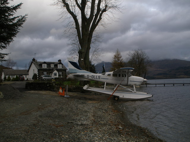
Sea-plane on the banks of Loch Lomond at Culag
Rhu Wood Woodland on the west side of Loch Lomond, seen from the old alignment of the A82.
Rhu Wood
Woodland on the west side of Loch Lomond, seen from the old alignment of the A82.
Rhu Wood A path leaves a car park rather steeply. A possible route onto Mid Hill?
Rhu Wood
A path leaves a car park rather steeply. A possible route onto Mid Hill?
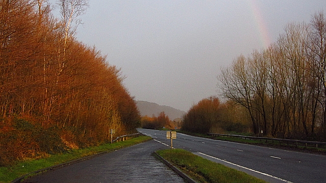
A82 The improved bit of the A82 on Loch Lomond. Things go worse north of Tarbet.
A82
The improved bit of the A82 on Loch Lomond. Things go worse north of Tarbet.
Bridge over the A82 The A82 is a trunk road in Scotland. It is the principal route from Lowland Scotland to the western Scottish Highlands, running from Glasgow to Inverness, going by Loch Lomond, Glen Coe, Fort William and the Great Glen. It is 167 miles long.
<span class="nowrap"><a title="https://www.sabre-roads.org.uk/wiki/index.php?title=A82" rel="nofollow ugc noopener" href="https://www.sabre-roads.org.uk/wiki/index.php?title=A82">Link</a><img style="margin-left:2px;" alt="External link" title="External link - shift click to open in new window" src="https://s1.geograph.org.uk/img/external.png" width="10" height="10"/></span>
Bridge over the A82
The A82 is a trunk road in Scotland. It is the principal route from Lowland Scotland to the western Scottish Highlands, running from Glasgow to Inverness, going by Loch Lomond, Glen Coe, Fort William and the Great Glen. It is 167 miles long. LinkExternal link
Show me another place!

Culag Plantation is located at Grid Ref: NS3594 (Lat: 56.117935, Lng: -4.6533592)

Unitary Authority: Argyll and Bute

Police Authority: Argyll and West Dunbartonshire

What 3 Words

///asserts.acre.purifier. Near Garelochhead, Argyll & Bute

Nearby Locations

Culag Plantation

Related Wikis

West Loch Lomond Cycle Path

The West Loch Lomond Cycle Path is a cycle path that runs from Arrochar and Tarbet railway station, at the upper end of Loch Lomond in Scotland, to Balloch...

Ross Isles

The Ross Isles are two small islands in Loch Lomond, in west central Scotland. They lie opposite Luss, and are named after the promontory on the east shore...

Luss

Luss (Lus, 'herb' in Gaelic) is a village in Argyll and Bute, Scotland, on the west bank of Loch Lomond. The village is within the Loch Lomond and The...

Thistle Cottage

Thistle Cottage is a building in Luss, Argyll and Bute, Scotland. A Category C listed cottage dating to the late 19th century, it overlooks the western...

Nearby Amenities

Located within 500m of 56.117935,-4.6533592
Luss Seaplane Terminal
Aerodrome Type: seaplane
Aeroway: aerodrome
Lat/Long: 56.1209321/-4.650184
The data included in this document is from www.openstreetmap.org. The data is made available under ODbL.

Have you been to Culag Plantation?

Leave your review of Culag Plantation below (or comments, questions and feedback).