Hole Wood

Wood, Forest in Dunbartonshire

Scotland

Hole Wood

Gates to Rossdhu House
Gates to Rossdhu House Credit: Eirian Evans

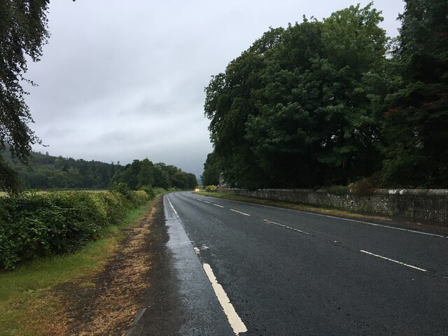
Hole Wood is a picturesque forest located in Dunbartonshire, Scotland. Covering an area of approximately 200 acres, this woodland is a haven of natural beauty and tranquility.

The wood is predominantly composed of native tree species such as oak, birch, and beech, which create a dense canopy overhead. The forest floor is carpeted with a variety of wildflowers, ferns, and mosses, providing a rich and diverse ecosystem.

Hole Wood boasts an extensive network of well-maintained trails, making it a popular destination for outdoor enthusiasts. These trails meander through the forest, offering visitors the opportunity to explore and immerse themselves in the stunning surroundings.

The wood is also home to a wide range of wildlife, including deer, foxes, and various bird species. Nature lovers will appreciate the abundance of birdwatching opportunities, with species such as woodpeckers, owls, and thrushes commonly spotted within the wood.

In addition to its natural beauty, Hole Wood has a rich history and is dotted with remnants of its past. There are ancient ruins of a chapel, believed to date back to the 12th century, which add an air of mystery and intrigue to the woodland.

Hole Wood is easily accessible, with parking facilities and well-marked entrances. It offers a peaceful retreat from the hustle and bustle of everyday life, inviting visitors to connect with nature and enjoy the serenity of this enchanting forest.

If you have any feedback on the listing, please let us know in the comments section below.

Hole Wood Images

Images are sourced within 2km of 56.031474/-4.6480788 or Grid Reference NS3585. Thanks to Geograph Open Source API. All images are credited.

Gates to Rossdhu House
Old bridge crossing Fruin Water
Lay-by on the A82 near Loch Lomond
A82 near Arden
A82 near Arden
A82 north of Arden
A82 north of Arden
Carrick Bee Garden 1 Ornamental Bee Garden located about 10 metres south of the Carrick Golf Course access road. 1 of 9
Carrick Bee Garden 1
Ornamental Bee Garden located about 10 metres south of the Carrick Golf Course access road. 1 of 9
Carrick Bee Garden 2 Ornamental Bee Garden located about 10 metres south of the Carrick Golf Course access road.  2 of 9
Carrick Bee Garden 2
Ornamental Bee Garden located about 10 metres south of the Carrick Golf Course access road. 2 of 9
Carrick Bee Garden 3 Ornamental Bee Garden located about 10 metres south of the Carrick Golf Course access road.  3 of 9
Carrick Bee Garden 3
Ornamental Bee Garden located about 10 metres south of the Carrick Golf Course access road. 3 of 9
Carrick Bee Garden 4 Ornamental Bee Garden located about 10 metres south of the Carrick Golf Course access road.  4 of 9
Carrick Bee Garden 4
Ornamental Bee Garden located about 10 metres south of the Carrick Golf Course access road. 4 of 9
Carrick Bee Garden 5 Ornamental Bee Garden located about 10 metres south of the Carrick Golf Course access road. 5 of 9
Carrick Bee Garden 5
Ornamental Bee Garden located about 10 metres south of the Carrick Golf Course access road. 5 of 9
Carrick Bee Garden 6 Ornamental Bee Garden located about 10 metres south of the Carrick Golf Course access road.   6 of 9
Carrick Bee Garden 6
Ornamental Bee Garden located about 10 metres south of the Carrick Golf Course access road. 6 of 9
Carrick Bee Garden 7 Ornamental Bee Garden located about 10 metres south of the Carrick Golf Course access road  7 of 9
Carrick Bee Garden 7
Ornamental Bee Garden located about 10 metres south of the Carrick Golf Course access road 7 of 9
Carrick Bee Garden 8 Ornamental Bee Garden located about 10 metres south of the Carrick Golf Course access road   8 of 9
Carrick Bee Garden 8
Ornamental Bee Garden located about 10 metres south of the Carrick Golf Course access road 8 of 9
Carrick Bee Garden 9 Ornamental Bee Garden located about 10 metres south of the Carrick Golf Course access road.   9 of 9
Carrick Bee Garden 9
Ornamental Bee Garden located about 10 metres south of the Carrick Golf Course access road. 9 of 9
A hazardous hole on the Carrick Golf Course Carrick Golf Course 14th Hole.  This a Par 3 hole; indicating that with one stroke the golfer ought to land his/her ball on the green and the ball should not then roll across and off the green. This requires a lofted club so that the ball lands as near vertically as possible.
The distance from tee to green is 199 yards but it has an elevated tee which is approximately 90 feet higher than the green.
It is rated with a stroke index of 17 which means that it is the second hardest hole of the course on which to achieve ‘Par’.
The view from the tee is magnificent even on a winter’s day. An unlucky golfer, who loses their ball in the intervening bracken and undergrowth, might use the excuse that they were distracted by the wonderful views of Loch Lomond and the slopes of Ben Lomond.
A public footpath and cycle track runs low down, half way between the tee and the green. The golfers cannot see the footpath. The walkers and cyclists can see the green but cannot see the tee. They are, however, able to hear the crack of the club on the ball. 
The Course opened in 2007. I have not yet heard of any fatalities.
A hazardous hole on the Carrick Golf Course
Carrick Golf Course 14th Hole. This a Par 3 hole; indicating that with one stroke the golfer ought to land his/her ball on the green and the ball should not then roll across and off the green. This requires a lofted club so that the ball lands as near vertically as possible. The distance from tee to green is 199 yards but it has an elevated tee which is approximately 90 feet higher than the green. It is rated with a stroke index of 17 which means that it is the second hardest hole of the course on which to achieve ‘Par’. The view from the tee is magnificent even on a winter’s day. An unlucky golfer, who loses their ball in the intervening bracken and undergrowth, might use the excuse that they were distracted by the wonderful views of Loch Lomond and the slopes of Ben Lomond. A public footpath and cycle track runs low down, half way between the tee and the green. The golfers cannot see the footpath. The walkers and cyclists can see the green but cannot see the tee. They are, however, able to hear the crack of the club on the ball. The Course opened in 2007. I have not yet heard of any fatalities.
Carrick Cottage 16 years later Carrick/ Forester’s/ Boiden/ Borden Cottage,   

This is the same cottage as in the 2007 photo <a href="https://www.geograph.org.uk/photo/423142">NS3585 : Cottage</a>. The cottage is now considerably worse for wear.
Six inch 1st Edition Ordnance Survey map Dumbartonshire, Sheet XIII,
Survey date: 1860,  Publication date: 1864,  shows a building on this location and marks it as “BORDEN”
A bonus is that in the centre of the garden of this old cottage, an 80 foot tall monkey puzzle tree flourishes, (Araucaria araucana), also known as Chile pine. The tree’s branches invade the top left hand corner of this picture. A full photo of it show at <a href="https://www.geograph.org.uk/photo/7366695">NS3585 : Awesome Araucaria araucana</a>.
Carrick Cottage 16 years later
Carrick/ Forester’s/ Boiden/ Borden Cottage, This is the same cottage as in the 2007 photo NS3585 : Cottage. The cottage is now considerably worse for wear. Six inch 1st Edition Ordnance Survey map Dumbartonshire, Sheet XIII, Survey date: 1860, Publication date: 1864, shows a building on this location and marks it as “BORDEN” A bonus is that in the centre of the garden of this old cottage, an 80 foot tall monkey puzzle tree flourishes, (Araucaria araucana), also known as Chile pine. The tree’s branches invade the top left hand corner of this picture. A full photo of it show at NS3585 : Awesome Araucaria araucana.
Awesome Araucaria araucana This 80 foot Monkey Puzzle Tree flourishes in the garden of the old Carrick Cottage photo <a href="https://www.geograph.org.uk/photo/7366683">NS3585 : Carrick Cottage 16 years later</a>. After you leave the A82, it is visible on the left hand side, 100 metres past the entrance to the Carrick Golf Course.
Awesome Araucaria araucana
This 80 foot Monkey Puzzle Tree flourishes in the garden of the old Carrick Cottage photo NS3585 : Carrick Cottage 16 years later. After you leave the A82, it is visible on the left hand side, 100 metres past the entrance to the Carrick Golf Course.
Shalom, Muirlands, near Arden Shalom is the name of the private house which was formerly Muirlands Primary School. It was the school for the surrounding rural area. The hamlet of Muirlands, even today, consists only of eight dwellings. There are no markings to indicate that you are entering or leaving Muirlands other than a couple of "Reduce Speed Now" signs. 

The school was built in 1869 by the Laird of Luss to provide education for the local community and was also used as a church and Sunday school. 

The Old School House, built in 1880, is not a listed building and is approximately 50 metres north of Shalom. It was presumably the teacher's accommodation.  

The Gothic style "Shalom" is Category B listed. Among its external features are the gabled porch and the small candle snuffer spire with fish-scale slating, which originally housed the church bell. A new village school in Luss was built in 1970.
Shalom, Muirlands, near Arden
Shalom is the name of the private house which was formerly Muirlands Primary School. It was the school for the surrounding rural area. The hamlet of Muirlands, even today, consists only of eight dwellings. There are no markings to indicate that you are entering or leaving Muirlands other than a couple of "Reduce Speed Now" signs. The school was built in 1869 by the Laird of Luss to provide education for the local community and was also used as a church and Sunday school. The Old School House, built in 1880, is not a listed building and is approximately 50 metres north of Shalom. It was presumably the teacher's accommodation. The Gothic style "Shalom" is Category B listed. Among its external features are the gabled porch and the small candle snuffer spire with fish-scale slating, which originally housed the church bell. A new village school in Luss was built in 1970.
Show me another place!

Hole Wood is located at Grid Ref: NS3585 (Lat: 56.031474, Lng: -4.6480788)

Unitary Authority: Argyll and Bute

Police Authority: Argyll and West Dunbartonshire

What 3 Words

///sprinter.isolating.scorch. Near Balloch, West Dunbartonshire

Nearby Locations

Hole Wood Mungo's Hill

Related Wikis

Arden, Argyll

Arden is a village on the southwest shore of Loch Lomond in Argyll and Bute, Scotland. == References ==

Dumbarton (district)

Dumbarton (Scottish Gaelic: Dùn Breatainn) was, from 1975 to 1996, one of nineteen local government districts in the Strathclyde region of Scotland, covering...

River Leven, Dunbartonshire

The River Leven (Uisge Leamhna in Gaelic) is a stretch of water in West Dunbartonshire, Scotland, flowing from Loch Lomond in the North to the River Clyde...

Cameron House

Cameron House, located on Loch Lomond near Balloch, Scotland, was first built in the mid-1700s, and later purchased by Sir James Smollett. The modern...

Nearby Amenities

Located within 500m of 56.031474,-4.6480788
Power: pole
Lat/Long: 56.0288413/-4.6542217
Power: pole
Lat/Long: 56.0288248/-4.6526874
Power: pole
Lat/Long: 56.028791/-4.6509962
Power: pole
Lat/Long: 56.0287673/-4.6493752
Power: pole
Lat/Long: 56.0287417/-4.6476856
Power: pole
Lat/Long: 56.0287217/-4.6459716
Power: pole
Lat/Long: 56.0287034/-4.6444078
Power: pole
Lat/Long: 56.0286723/-4.6428081
Power: pole
Lat/Long: 56.0292476/-4.6414224
Power: pole
Lat/Long: 56.030608/-4.6552936
Power: pole
Lat/Long: 56.0312982/-4.6543639
Power: pole
Lat/Long: 56.0319866/-4.6534554
Power: pole
Lat/Long: 56.0326366/-4.6525844
Power: pole
Lat/Long: 56.0333277/-4.6516743
Power: pole
Lat/Long: 56.0339768/-4.650805
Power: pole
Lat/Long: 56.0346433/-4.6499259
Power: pole
Lat/Long: 56.0353088/-4.6490451
Power: pole
Lat/Long: 56.0305568/-4.6550208
Power: pole
Lat/Long: 56.031395/-4.6539129
Power: pole
Lat/Long: 56.0321966/-4.6528671
Power: pole
Lat/Long: 56.0329945/-4.6517821
Power: pole
Lat/Long: 56.0337796/-4.6507266
Power: pole
Lat/Long: 56.0345867/-4.6496742
Power: pole
Lat/Long: 56.0352476/-4.6488213
Rossbank
Place: isolated_dwelling
Lat/Long: 56.0283571/-4.6427642
The data included in this document is from www.openstreetmap.org. The data is made available under ODbL.

Have you been to Hole Wood?

Leave your review of Hole Wood below (or comments, questions and feedback).