Todglen Wood

Wood, Forest in Ayrshire

Scotland

Todglen Wood

Road with copious tree canopy
Road with copious tree canopy Credit: Gordon Brown

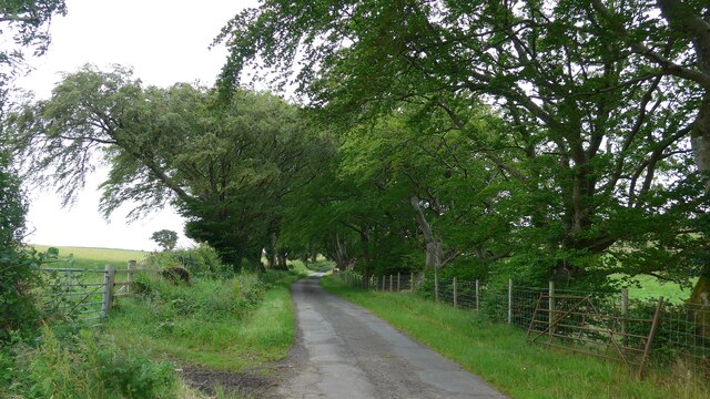
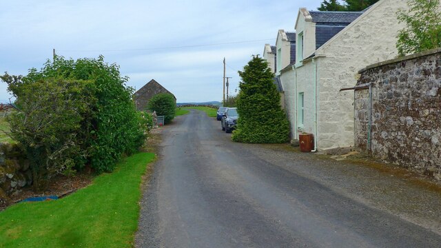
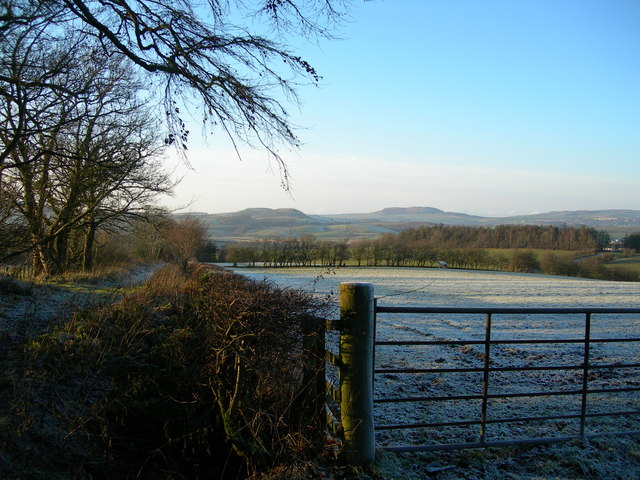
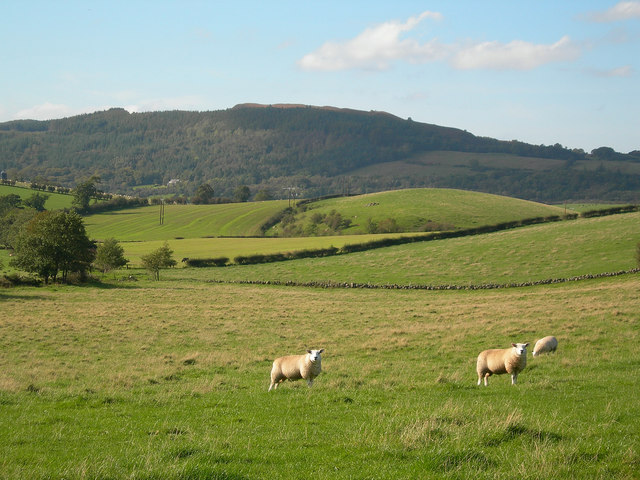
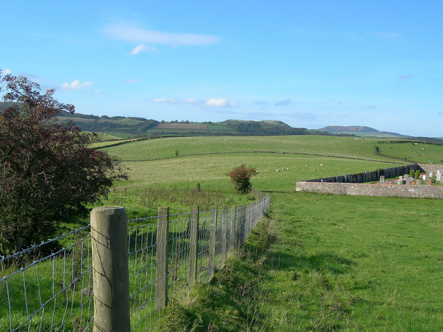
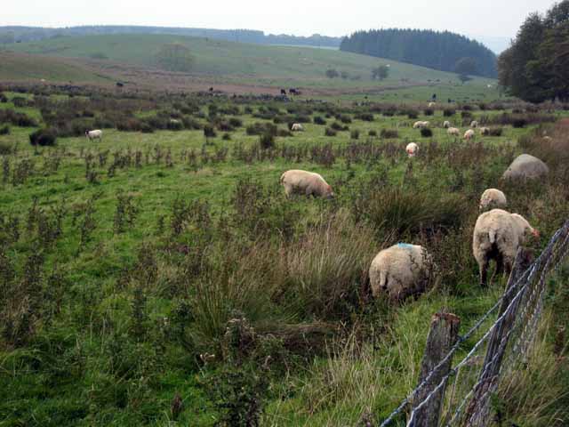
Todglen Wood is a picturesque woodland located in Ayrshire, Scotland. Spanning over an area of approximately 100 acres, it is a haven for nature enthusiasts and outdoor lovers. The woodland is situated on the outskirts of the village of Coylton, offering a tranquil escape from the bustling city life.

Todglen Wood is predominantly composed of native broadleaf trees, including oak, ash, and birch, which create a dense and vibrant canopy. The rich biodiversity of the wood attracts a variety of wildlife, including birds, small mammals, and insects. It is a popular spot for birdwatching, with species such as woodpeckers, owls, and thrushes frequently spotted among the trees.

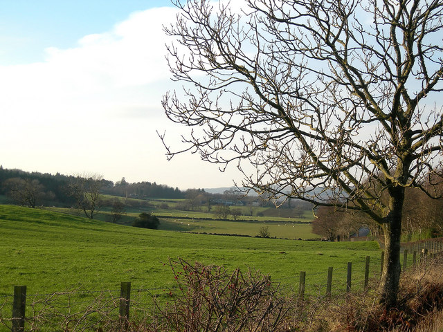
The woodland is crisscrossed by a network of well-maintained trails, allowing visitors to explore its beauty at their own pace. These paths wind through the trees, offering glimpses of hidden glens, babbling brooks, and wildflower meadows. The diverse topography of the wood provides opportunities for both leisurely strolls and challenging hikes.

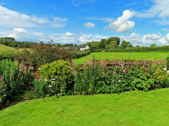
Todglen Wood is also home to an array of plant species, with bluebells carpeting the forest floor in spring, and ferns and mosses adorning the tree trunks. The wood is particularly stunning during autumn, when the foliage turns into a vibrant palette of reds, oranges, and yellows.

With its natural beauty and peaceful ambiance, Todglen Wood is a popular destination for nature walks, picnics, and family outings. It offers a sanctuary for those seeking solace in nature, providing a refreshing escape from the daily grind.

If you have any feedback on the listing, please let us know in the comments section below.

Todglen Wood Images

Images are sourced within 2km of 55.310868/-4.6132289 or Grid Reference NS3404. Thanks to Geograph Open Source API. All images are credited.

Road with copious tree canopy
Houses at Knockgardner
Scotland’s Gardens Scheme at Dalhowan Farm The garden at Dalhowan Farm was open to visitors on 29 July, the first time it had featured in the national garden scheme. The sun shone for most of the afternoon, the garden looked beautiful, the home baking in the tea room was delicious, all in all a very pleasant afternoon visit.
Scotland’s Gardens Scheme at Dalhowan Farm
The garden at Dalhowan Farm was open to visitors on 29 July, the first time it had featured in the national garden scheme. The sun shone for most of the afternoon, the garden looked beautiful, the home baking in the tea room was delicious, all in all a very pleasant afternoon visit.
Visiting Dalhowan Farm garden The garden at Dalhowan Farm was open to visitors on 29 July, the first time it had featured in the national garden scheme. The sun shone for most of the afternoon, the garden looked beautiful, the home baking in the tea room was delicious, all in all a very pleasant afternoon visit.
Visiting Dalhowan Farm garden
The garden at Dalhowan Farm was open to visitors on 29 July, the first time it had featured in the national garden scheme. The sun shone for most of the afternoon, the garden looked beautiful, the home baking in the tea room was delicious, all in all a very pleasant afternoon visit.
The Old Road at Dalhowan Viewed looking towards Crosshill village, this track was the old road to Straiton before the current one was built. It's in good condition between Crosshill and the Dalhowan farmstead but becomes challenging beyond it.  Viewed in autumn colours.
The Old Road at Dalhowan
Viewed looking towards Crosshill village, this track was the old road to Straiton before the current one was built. It's in good condition between Crosshill and the Dalhowan farmstead but becomes challenging beyond it. Viewed in autumn colours.
Autumn tones at Auchalton A simple roadside shot of tall beech trees near Auchalton Meadow.
Autumn tones at Auchalton
A simple roadside shot of tall beech trees near Auchalton Meadow.
The Old Road Looking WNW from the point where the Old Road, now only a path, crosses the minor road.
The Old Road
Looking WNW from the point where the Old Road, now only a path, crosses the minor road.
Winter view from Drumfairn Winter view of South Ayrshire farmland, showing edge of Crosshill and the minor road to Kirkmichael, with Kildoon Hill in the distance on the right.
Winter view from Drumfairn
Winter view of South Ayrshire farmland, showing edge of Crosshill and the minor road to Kirkmichael, with Kildoon Hill in the distance on the right.
Farmland near Crosshill Sheep grazing behind Crosshill Cemetery, with Craigfin Hill in the background
Farmland near Crosshill
Sheep grazing behind Crosshill Cemetery, with Craigfin Hill in the background
Behind the Cemetery View of farmland behind Crosshill cemetery, with Kildoon Hill in the background and Mochrum Hill in the far distance
Behind the Cemetery
View of farmland behind Crosshill cemetery, with Kildoon Hill in the background and Mochrum Hill in the far distance
Threave View Looking towards Threave Farm from Crosshill, with Barskelly in the distance.  This area's landscape comes from deposition during the last Ice Age.
Threave View
Looking towards Threave Farm from Crosshill, with Barskelly in the distance. This area's landscape comes from deposition during the last Ice Age.
Auchalton Toll Cottage On the old toll road from Ayr to Newton Stewart.
Auchalton Toll Cottage
On the old toll road from Ayr to Newton Stewart.
Auchalton Meadow A wildlife reserve managed by the Scottish Wildlife Trust.
Auchalton Meadow
A wildlife reserve managed by the Scottish Wildlife Trust.
Fields near Auchalton
Rough grazing near Kirkbride
Knockgardner An isolated farm near Straiton.
Knockgardner
An isolated farm near Straiton.
Cattle at Tranew Beef cattle at Tranew on a fine December afternoon.
Cattle at Tranew
Beef cattle at Tranew on a fine December afternoon.
Towards Ashfield Looking west along the B741 with Ashfield Farm showing in the distance.
Towards Ashfield
Looking west along the B741 with Ashfield Farm showing in the distance.
Show me another place!

Todglen Wood is located at Grid Ref: NS3404 (Lat: 55.310868, Lng: -4.6132289)

Unitary Authority: South Ayrshire

Police Authority: Ayrshire

What 3 Words

///driveway.departure.proud. Near Maybole, South Ayrshire

Related Wikis

Ayr, Carrick and Cumnock (UK Parliament constituency)

Ayr, Carrick, and Cumnock is a county constituency represented in the House of Commons of the Parliament of the United Kingdom. It was created for the...

Crosshill, South Ayrshire

Crosshill is a small village in South Ayrshire, Scotland.Crosshill has a primary school. == References ==
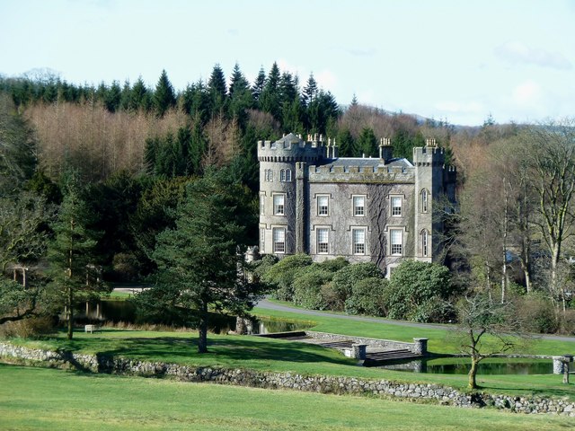
Blairquhan Castle

Blairquhan ( blair-WHAHN, Scots: Blairwhan) is a Regency era castle near Maybole in South Ayrshire, Scotland. It was the historic home of the Hunter-Blair...

Cloncaird Castle

Cloncaird Castle is located near the small village of Kirkmichael, around 6 kilometres (3.7 mi) east of Maybole in South Ayrshire, Scotland. The castle...

Straiton

Straiton is a village on the River Girvan in South Ayrshire in Scotland. It lies in the hills between Kirkmichael, Dalmellington, Crosshill, and Maybole...

Kirkmichael, South Ayrshire

Kirkmichael (Gaelic: Cille Mhìcheil, "the church of St Michael") is a village in South Ayrshire, Scotland, located between Patna, Maybole and Straiton...

Crosshill railway station (Ayr)

Crosshill railway station served the village of Crosshill, South Ayrshire, Scotland, from 1860 to 1862 on the Maybole and Girvan Railway. == History... ==

Kilkerran House

Kilkerran House is an 18th-century private house near Maybole, Ayrshire, Scotland. It is a category A listed building set within grounds included in the...

Nearby Amenities

Located within 500m of 55.310868,-4.6132289
Power: pole
Lat/Long: 55.3151923/-4.6149244
Power: pole
Lat/Long: 55.3146213/-4.6148276
Power: pole
Lat/Long: 55.3140624/-4.6147474
Power: pole
Lat/Long: 55.3135062/-4.6146742
Power: pole
Lat/Long: 55.3128613/-4.6151345
Power: pole
Lat/Long: 55.3122205/-4.6156114
Power: pole
Lat/Long: 55.3116427/-4.6160364
Power: pole
Lat/Long: 55.3109185/-4.6165558
Power: pole
Lat/Long: 55.3104281/-4.6169052
Power: pole
Lat/Long: 55.3099014/-4.6172923
Power: pole
Lat/Long: 55.3093465/-4.6177149
Power: pole
Lat/Long: 55.3086908/-4.6177645
Power: pole
Lat/Long: 55.3080378/-4.6178094
Power: pole
Lat/Long: 55.3073713/-4.6178495
Power: pole
Lat/Long: 55.3119343/-4.6173254
Power: pole
Lat/Long: 55.3121157/-4.6179935
The data included in this document is from www.openstreetmap.org. The data is made available under ODbL.

Have you been to Todglen Wood?

Leave your review of Todglen Wood below (or comments, questions and feedback).