Crosherie Plantation

Wood, Forest in Wigtownshire

Scotland

Crosherie Plantation

Old milestone In May 2008 this milestone was almost hidden from view but using the milometer on my bike I knew just where to search.  In April 2023 not quite hidden.  It is just south of the Kirkchrist Lodge.   Glenluce still 11 miles away.
Old milestone Credit: Chris Minto

Crosherie Plantation, located in Wigtownshire, Scotland, is a picturesque woodland area renowned for its natural beauty and rich biodiversity. Spanning approximately 200 acres, this enchanting forest is a haven for nature enthusiasts and offers a tranquil escape from the hustle and bustle of city life.

The plantation is predominantly composed of native broadleaf trees, including oak, beech, and birch, which create a lush and vibrant canopy overhead. As visitors traverse the well-maintained walking trails, they are treated to the soothing sounds of birdsong and the gentle rustling of leaves, providing a serene atmosphere that is conducive to relaxation and contemplation.

Crosherie Plantation is home to a diverse range of plant and animal species, making it a significant ecological site. Rare and protected species, such as red squirrels, badgers, and various woodland birds, can often be spotted among the trees. Additionally, the forest floor is adorned with a vibrant array of wildflowers, ferns, and mosses, adding to the visual appeal of the woodland.

Visitors to Crosherie Plantation can partake in a range of activities, including walking, jogging, and birdwatching. The trails are well-signposted, ensuring easy navigation, and benches are strategically placed throughout the forest to provide resting spots and opportunities to soak in the surroundings.

Managed by the local forestry commission, Crosherie Plantation offers a balance between conservation and recreational use. It serves as a valuable educational resource, with guided nature walks and workshops organized periodically to promote awareness and appreciation for the natural environment. Whether seeking solitude in nature or seeking to learn more about Scotland's woodland habitats, Crosherie Plantation is a destination worth exploring.

If you have any feedback on the listing, please let us know in the comments section below.

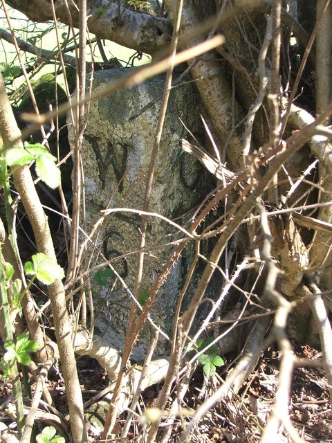
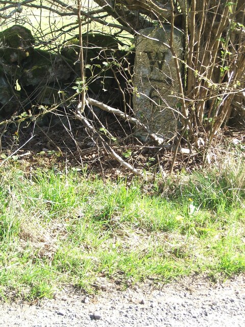
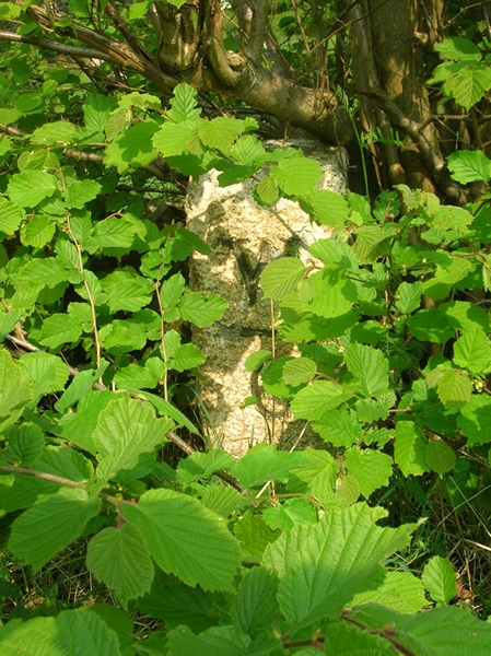
Crosherie Plantation Images

Images are sourced within 2km of 54.90922/-4.5973003 or Grid Reference NX3360. Thanks to Geograph Open Source API. All images are credited.

Old milestone In May 2008 this milestone was almost hidden from view but using the milometer on my bike I knew just where to search.  In April 2023 not quite hidden.  It is just south of the Kirkchrist Lodge.   Glenluce still 11 miles away.
Old milestone
In May 2008 this milestone was almost hidden from view but using the milometer on my bike I knew just where to search. In April 2023 not quite hidden. It is just south of the Kirkchrist Lodge. Glenluce still 11 miles away.
Old milestone Another view of the milestone hidden under the bush/tree just south of Kirkchrist Lodge. G/arrow to left/11 on the unseen face.
Old milestone
Another view of the milestone hidden under the bush/tree just south of Kirkchrist Lodge. G/arrow to left/11 on the unseen face.
Old Milestone by the B733, south of Kirkchrist Lodge, Kirkcowan parish Stone post by the B733, in parish of Kirkcowan (Wigtownshire District), South of lodge to Kirkchrist House, hidden under hazel tree.

Inscription reads:-
: W / {arrow->} / 6 : : G / {<-arrow} / 11 :
(To Wigtown and Glenluce) 

Surveyed

Milestone Society National ID: DG_WGGL06
Old Milestone by the B733, south of Kirkchrist Lodge, Kirkcowan parish
Stone post by the B733, in parish of Kirkcowan (Wigtownshire District), South of lodge to Kirkchrist House, hidden under hazel tree. Inscription reads:- : W / {arrow->} / 6 : : G / {<-arrow} / 11 : (To Wigtown and Glenluce) Surveyed Milestone Society National ID: DG_WGGL06
Main Street, Kirkcowan At the junction with St. Couan&amp;#039;s Crescent. Building on the right is the Village Hall.
Main Street, Kirkcowan
At the junction with St. Couan's Crescent. Building on the right is the Village Hall.
Village Hall, Kirkcowan On the corner of Main Street and St. Couan&amp;#039;s Crescent.
Village Hall, Kirkcowan
On the corner of Main Street and St. Couan's Crescent.
St. Couan's Crescent, Kirkcowan Viewed from the Main Street with the Village Hall on the left.
St. Couan's Crescent, Kirkcowan
Viewed from the Main Street with the Village Hall on the left.
Kirkcowan Graveyard Old Tombstone, part of the Exterior wall to the right of the Entrance Gate.
Kirkcowan Graveyard
Old Tombstone, part of the Exterior wall to the right of the Entrance Gate.
Main Street, Kirkcowan Viewed from the Old Graveyard.
Main Street, Kirkcowan
Viewed from the Old Graveyard.
Old Graveyard, Kirkcowan Just off the Main Street.
Old Graveyard, Kirkcowan
Just off the Main Street.
Old Graveyard, Kirkcowan Enterened in from the Main Street.
Old Graveyard, Kirkcowan
Enterened in from the Main Street.
Old Graveyard, Kirkcowan
Old Graveyard, Kirkcowan Looking over towards the New Graveyard.
Old Graveyard, Kirkcowan
Looking over towards the New Graveyard.
New Graveyard, Kirkcowan
OldGraveyard, Kirkcowan
New Graveyard, Kirkcowan
Show me another place!

Crosherie Plantation is located at Grid Ref: NX3360 (Lat: 54.90922, Lng: -4.5973003)

Unitary Authority: Dumfries and Galloway

Police Authority: Dumfries and Galloway

What 3 Words

///captions.pose.waistcoat. Near Newton Stewart, Dumfries & Galloway

Nearby Locations

Crosherie Plantation

Related Wikis

Kirkcowan

Kirkcowan is an area about 15 miles in length, and from nearly two to nearly seven miles in breadth, comprising 30,580 acres, of which 7000 are arable...

Kirkcowan railway station

Kirkcowan railway station served the village of Kirkcowan, Dumfries and Galloway, Scotland from 1861 to 1965 on the Portpatrick and Wigtownshire Joint...

Torhouse

The Standing Stones of Torhouse (also Torhousekie) are a stone circle of nineteen granite boulders on the land of Torhouse, three miles west of Wigtown...

Mains of Penninghame Platform railway station

Mains of Penninghame Platform railway station (NX410617) was a halt on the Wigtownshire Railway branch line, from Newton Stewart to Whithorn, of the Portpatrick...

Nearby Amenities

Located within 500m of 54.90922,-4.5973003
Power: pole
Lat/Long: 54.9076335/-4.603509
Power: pole
Lat/Long: 54.9072966/-4.60179
Power: pole
Lat/Long: 54.907619/-4.6007442
Power: pole
Lat/Long: 54.9079324/-4.5997547
Power: pole
Lat/Long: 54.9082681/-4.5986799
Power: pole
Lat/Long: 54.9068982/-4.5918747
Power: pole
Lat/Long: 54.9071594/-4.5933531
Power: pole
Lat/Long: 54.9074215/-4.5948141
Power: pole
Lat/Long: 54.9076803/-4.5962964
Power: pole
Lat/Long: 54.9079447/-4.5978
Power: pole
Lat/Long: 54.9086295/-4.5996752
Power: pole
Lat/Long: 54.9095017/-4.5993434
Power: pole
Lat/Long: 54.9099628/-4.6004666
Power: pole
Lat/Long: 54.9102345/-4.6011284
Power: pole
Lat/Long: 54.9109349/-4.6017628
Power: pole
Lat/Long: 54.9113744/-4.602147
Power: pole
Lat/Long: 54.9119956/-4.6027077
Power: pole
Lat/Long: 54.909445/-4.6015598
Power: pole
Lat/Long: 54.9109873/-4.5982433
Power: pole
Lat/Long: 54.9113186/-4.5996946
Power: pole
Lat/Long: 54.9116019/-4.6009324
Power: pole
Lat/Long: 54.9117982/-4.601823
Power: pole
Lat/Long: 54.9074427/-4.5917583
Power: pole
Lat/Long: 54.9082626/-4.5916186
Power: pole
Lat/Long: 54.9090043/-4.5915158
Power: pole
Lat/Long: 54.9095575/-4.5913955
Power: pole
Lat/Long: 54.9095564/-4.5905612
The data included in this document is from www.openstreetmap.org. The data is made available under ODbL.

Have you been to Crosherie Plantation?

Leave your review of Crosherie Plantation below (or comments, questions and feedback).