Blairbowie Wood

Wood, Forest in Ayrshire

Scotland

Blairbowie Wood

By the Low Road Rich farmland beside the B7045, known locally as "the Low Road".
By the Low Road Credit: Mary and Angus Hogg

Blairbowie Wood is a sprawling forest located in Ayrshire, Scotland. Covering an area of approximately 400 acres, this woodland is a prominent natural landmark in the region. The wood is situated near the village of Ochiltree, just a few miles southeast of the town of Mauchline.

Blairbowie Wood is characterized by its diverse ecosystem and abundant wildlife. The forest is predominantly composed of broadleaf trees such as oak, beech, and birch, which create a lush and vibrant environment. The wood is also home to a variety of plant species, including bluebells, wild garlic, and ferns, which contribute to its natural beauty.

Aside from its scenic appeal, Blairbowie Wood is a beloved destination for outdoor enthusiasts. The forest features numerous walking trails and paths, making it an ideal location for leisurely strolls and hikes. Visitors can explore the wood's tranquil surroundings, taking in the sights and sounds of nature.

The woodland is also a habitat for a wide range of wildlife. It is common to spot deer, rabbits, and a variety of bird species within the forest. Blairbowie Wood is a haven for birdwatchers, as it provides opportunities to observe species such as woodpeckers, owls, and various songbirds.

Overall, Blairbowie Wood offers a serene and picturesque escape from the hustle and bustle of everyday life. With its diverse flora and fauna, well-maintained trails, and peaceful ambiance, it is a perfect destination for nature lovers and those seeking a tranquil retreat in Ayrshire.

If you have any feedback on the listing, please let us know in the comments section below.

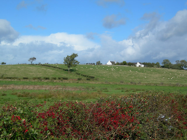
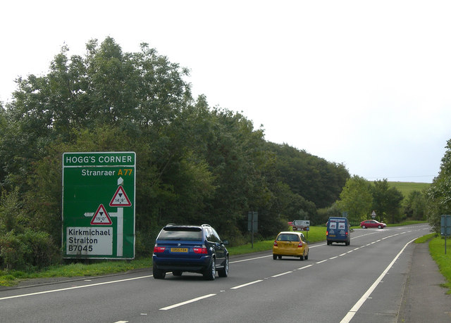
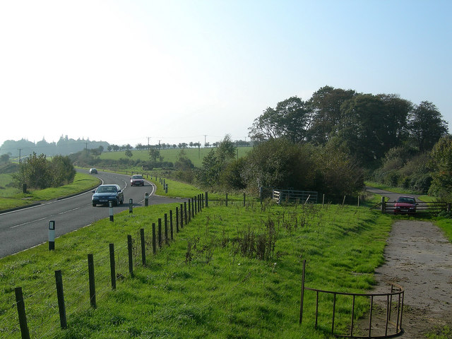
Blairbowie Wood Images

Images are sourced within 2km of 55.374157/-4.6308825 or Grid Reference NS3312. Thanks to Geograph Open Source API. All images are credited.

By the Low Road Rich farmland beside the B7045, known locally as "the Low Road".
By the Low Road
Rich farmland beside the B7045, known locally as "the Low Road".
Blairbowie Flash A semi-permanent wet flash in one of Blairbowie Farm's fields, the standing water is partly due to the low land here having once been the bed of the Rivers Doon and Girvan prior to the final stage of the last Ice Age
Blairbowie Flash
A semi-permanent wet flash in one of Blairbowie Farm's fields, the standing water is partly due to the low land here having once been the bed of the Rivers Doon and Girvan prior to the final stage of the last Ice Age
Burnmouth Farm Typical lowland Ayrshire farmland, a mix of grazing, silage and cereals (mostly barley).
Burnmouth Farm
Typical lowland Ayrshire farmland, a mix of grazing, silage and cereals (mostly barley).
Laigh Woodston The damp land in the foreground lies next to Blairbowie flash
Laigh Woodston
The damp land in the foreground lies next to Blairbowie flash
Hogg's Corner, Minishant The original dangerous corner was removed when the A77 was realigned in the early 1970s, but the name has been retained for the junction.
Hogg's Corner, Minishant
The original dangerous corner was removed when the A77 was realigned in the early 1970s, but the name has been retained for the junction.
Myremill Farm Myremill viewed from the B7045 at Grimmet, with Maybole and Mochrum Hill in the far distance.
Myremill Farm
Myremill viewed from the B7045 at Grimmet, with Maybole and Mochrum Hill in the far distance.
Field Edge Looking WNW from the B742 on the way to Maybole
Field Edge
Looking WNW from the B742 on the way to Maybole
Pastureland Looking NE across the B7045.  South Ayrshire's rolling countryside was formed by drumlins, deposited during the last Ice Age.
Pastureland
Looking NE across the B7045. South Ayrshire's rolling countryside was formed by drumlins, deposited during the last Ice Age.
Fingerpost Old fingerpost at the intersection of the B742 and the B7045 near Maybole.  It shows the old spelling of Minishant and gives distances in quarter miles.
Fingerpost
Old fingerpost at the intersection of the B742 and the B7045 near Maybole. It shows the old spelling of Minishant and gives distances in quarter miles.
Nether Culzean Farm Entrance The realignment of the A77(T) road gave safer access to this farm
Nether Culzean Farm Entrance
The realignment of the A77(T) road gave safer access to this farm
Nether Culzean Farm Sign
Dalrymple Wood and Woodland Farm Looking NW across the River Doon, with Brown Carrick Hill in the distance.
Dalrymple Wood and Woodland Farm
Looking NW across the River Doon, with Brown Carrick Hill in the distance.
Cassillis House Located close to the River Doon, near Dalrymple, Cassillis House is the setting for the famous ballad "Johnnie Faa" - <span class="nowrap"><a title="http://books.google.co.uk/books?id=2XACAAAAQAAJ&printsec=frontcover&dq=Miscellany+by+Allan+Ramsay#PPA427,M1" rel="nofollow ugc noopener" href="http://books.google.co.uk/books?id=2XACAAAAQAAJ&printsec=frontcover&dq=Miscellany+by+Allan+Ramsay#PPA427,M1">Link</a><img style="margin-left:2px;" alt="External link" title="External link - shift click to open in new window" src="https://s1.geograph.org.uk/img/external.png" width="10" height="10"/></span>
Before her marriage to the powerful chief of the Kennedys, the countess had loved a young knight, Sir John Fall.  She eloped with him, disguised as the gypsy, "Johnnie Faa".  The Earl brought them back and made her watch the gypsy band and her disguised lover being hanged from the Dule Tree in front of Cassillis House.  The Earl imprisoned the Countess for life in his town house, Maybole Castle <a href="https://www.geograph.org.uk/photo/241392">NS3010 : The Countess's Window</a>. He then divorced her and remarried.  No human rights in those days!
Cassillis House
Located close to the River Doon, near Dalrymple, Cassillis House is the setting for the famous ballad "Johnnie Faa" - LinkExternal link Before her marriage to the powerful chief of the Kennedys, the countess had loved a young knight, Sir John Fall. She eloped with him, disguised as the gypsy, "Johnnie Faa". The Earl brought them back and made her watch the gypsy band and her disguised lover being hanged from the Dule Tree in front of Cassillis House. The Earl imprisoned the Countess for life in his town house, Maybole Castle NS3010 : The Countess's Window. He then divorced her and remarried. No human rights in those days!
Roadside Woodland. Near Barwheys House entrance.
Roadside Woodland.
Near Barwheys House entrance.
New Fencing Old wall and old fence.
New Fencing
Old wall and old fence.
Moss Covered Wall
Moss Covered Wall
Golden Gorse The spring flowering gorse makes a splash of colour along the hedgerows.  The gorse flowers smell of coconut.
Golden Gorse
The spring flowering gorse makes a splash of colour along the hedgerows. The gorse flowers smell of coconut.
Spring Hedge This hedge contains 3 plants.  The blackthorn produces its white flowers before growing its leaves.  The hawthorn grows bright green leaves first, then flowers in May.  The beech holds last year's leaves right through the winter.
Spring Hedge
This hedge contains 3 plants. The blackthorn produces its white flowers before growing its leaves. The hawthorn grows bright green leaves first, then flowers in May. The beech holds last year's leaves right through the winter.
Show me another place!

Blairbowie Wood is located at Grid Ref: NS3312 (Lat: 55.374157, Lng: -4.6308825)

Unitary Authority: South Ayrshire

Police Authority: Ayrshire

What 3 Words

///curly.waxes.waxing. Near Dalrymple, East Ayrshire

Nearby Locations

Blairbowie Wood

Related Wikis

Cassillis railway station

Cassillis railway station was a railway station serving the village of Minishant, South Ayrshire, Scotland. The station was originally part of the Ayr...

Minishant

Minishant is a village bordering the A77 in the old county of Carrick, South Ayrshire, Scotland. It is located in Maybole Parish, 3+1⁄2 miles (5.5 kilometres...

Maybole (old) railway station

Maybole railway station was a railway station serving the village of Maybole, South Ayrshire, Scotland. The station was originally part of the Ayr and...

Kirkmichael, South Ayrshire

Kirkmichael (Gaelic: Cille Mhìcheil, "the church of St Michael") is a village in South Ayrshire, Scotland, located between Patna, Maybole and Straiton...

Nearby Amenities

Located within 500m of 55.374157,-4.6308825
Power: pole
Lat/Long: 55.3725357/-4.6237823
Power: pole
Lat/Long: 55.373228/-4.6243137
Power: pole
Lat/Long: 55.3739585/-4.624873
Power: pole
Lat/Long: 55.3743383/-4.6263883
Power: pole
Lat/Long: 55.3748657/-4.6273978
Power: pole
Lat/Long: 55.3753813/-4.6283307
Power: pole
Lat/Long: 55.3759074/-4.6293053
Power: pole
Lat/Long: 55.3764256/-4.6302985
Power: pole
Lat/Long: 55.3759219/-4.6307928
Power: pole
Lat/Long: 55.3754327/-4.6312732
Power: pole
Lat/Long: 55.3768409/-4.6304679
Power: pole
Lat/Long: 55.3775305/-4.6299179
Power: pole
Lat/Long: 55.3782213/-4.6293772
The data included in this document is from www.openstreetmap.org. The data is made available under ODbL.

Have you been to Blairbowie Wood?

Leave your review of Blairbowie Wood below (or comments, questions and feedback).