Barr Plantation

Wood, Forest in Wigtownshire

Scotland

Barr Plantation

Old milestone On the 14 miles of the A747 north of Port William towards Glenluce on the A75 are about 9 of the typical Wigtownshire milestones.   This one is leaning considerably.   The ground around has been cleared and the legend repainted black.
Old milestone Credit: Jacqueline Crowther

Barr Plantation, located in Wigtownshire, is a magnificent woodland area that spans across a vast expanse of approximately 900 acres. Situated in the southwest of Scotland, this woodland paradise is a haven for nature enthusiasts and those seeking tranquility amidst beautiful surroundings.

The plantation is predominantly composed of a diverse range of tree species, including oak, beech, birch, and pine, which contribute to the area's rich biodiversity. The trees, some of which are several centuries old, create a dense canopy that provides shade and shelter for an array of wildlife.

Barr Plantation offers a network of well-maintained paths and trails that wind their way through the woods, providing ample opportunity for visitors to explore the area on foot or by bike. Along these paths, visitors may encounter various species of birds, such as woodpeckers, jays, and tawny owls, as well as small mammals like red squirrels and badgers.

The plantation is also home to a number of picturesque streams and ponds, which further enhance the natural beauty of the area. These water features attract a diverse range of aquatic life, including frogs, newts, and dragonflies.

With its stunning scenery and abundance of wildlife, Barr Plantation offers a peaceful retreat for those seeking solace in nature. Whether it be a leisurely stroll through the woods, birdwatching, or simply enjoying a picnic amidst the tranquil surroundings, this woodland gem is sure to captivate visitors with its beauty and serenity.

If you have any feedback on the listing, please let us know in the comments section below.

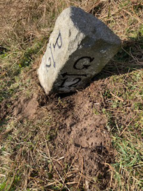
Barr Plantation Images

Images are sourced within 2km of 54.790359/-4.6011822 or Grid Reference NX3247. Thanks to Geograph Open Source API. All images are credited.

Old milestone On the 14 miles of the A747 north of Port William towards Glenluce on the A75 are about 9 of the typical Wigtownshire milestones.   This one is leaning considerably.   The ground around has been cleared and the legend repainted black.
Old milestone
On the 14 miles of the A747 north of Port William towards Glenluce on the A75 are about 9 of the typical Wigtownshire milestones. This one is leaning considerably. The ground around has been cleared and the legend repainted black.
Bale store, Port William Silage bales stored on an old alignment of the coast road.
Bale store, Port William
Silage bales stored on an old alignment of the coast road.
Sheep on coastal pasture Here the strip of land below the steep bank is wide enough for fields.
Sheep on coastal pasture
Here the strip of land below the steep bank is wide enough for fields.
Links, Killantrae A stony strip with dense vegetation beside the sea.
Links, Killantrae
A stony strip with dense vegetation beside the sea.
Bank, Killantrae The road runs along a narrow strip between the sea and a steep bank.
Bank, Killantrae
The road runs along a narrow strip between the sea and a steep bank.
A747, Barr The road keeps to a narrow coastal strip with a steep vegetated bank to landward.
A747, Barr
The road keeps to a narrow coastal strip with a steep vegetated bank to landward.
Overgrown bank, Milton The steep slopes above the road and raised beach are covered with dense vegetation.
Overgrown bank, Milton
The steep slopes above the road and raised beach are covered with dense vegetation.
A747, Milton The road runs along a narrow strip between sea and steep vegetated slopes, probably a raised beach.
A747, Milton
The road runs along a narrow strip between sea and steep vegetated slopes, probably a raised beach.
Rough Sea Looking towards Philip and Mary across the waves.
Rough Sea
Looking towards Philip and Mary across the waves.
Sand hoppers A very windy day and a very high tide have driven a multitude of sand hoppers to shelter in a handy footprint.
Sand hoppers
A very windy day and a very high tide have driven a multitude of sand hoppers to shelter in a handy footprint.
Old milestone Once leaning, this milestone has been cleared of vegetation, set upright and painted by a Milestone Society member.
Old milestone
Once leaning, this milestone has been cleared of vegetation, set upright and painted by a Milestone Society member.
Old milestone The position of this milestone at the back of the grassy verge sees it almost surrounded by yellow gorse on the hillside.   The rough back of the stone can also be seen.  Only the two front faces of these milestones were worked flat to have the legends inscribed.
Old milestone
The position of this milestone at the back of the grassy verge sees it almost surrounded by yellow gorse on the hillside. The rough back of the stone can also be seen. Only the two front faces of these milestones were worked flat to have the legends inscribed.
Old milestone Another of the milestones north of Port William that has had the vegetation cleared by a Milestone Society member and then repainted.   Most of the Wigtownshire milestones are of the same shape with just a single letter on each face and an arrow indicating the places to and from.   On this road the G is for Glenluce.
Old milestone
Another of the milestones north of Port William that has had the vegetation cleared by a Milestone Society member and then repainted. Most of the Wigtownshire milestones are of the same shape with just a single letter on each face and an arrow indicating the places to and from. On this road the G is for Glenluce.
Old milestone A view from the milestone along this lovely coastal road on a fine day.
Old milestone
A view from the milestone along this lovely coastal road on a fine day.
Silage Bales Stored on the layby created from an old section of the A747.
Silage Bales
Stored on the layby created from an old section of the A747.
Abandoned Machinery An old slurry sprayer or a water bowser abandoned in the corner of the field.
Abandoned Machinery
An old slurry sprayer or a water bowser abandoned in the corner of the field.
Manse View Picture of this 'deceptively spacious end terraced Category C listed property, situated in the rural village of Mochrum two miles from Port William' still on the market for £150k. It is opposite the kirk on main street.
Manse View
Picture of this 'deceptively spacious end terraced Category C listed property, situated in the rural village of Mochrum two miles from Port William' still on the market for £150k. It is opposite the kirk on main street.
Road to Auchenmalg Passing West Barr Caravan Park.
Road to Auchenmalg
Passing West Barr Caravan Park.
Show me another place!

Barr Plantation is located at Grid Ref: NX3247 (Lat: 54.790359, Lng: -4.6011822)

Unitary Authority: Dumfries and Galloway

Police Authority: Dumfries and Galloway

What 3 Words

///mammal.movements.flicks. Near Whithorn, Dumfries & Galloway

Related Wikis

Elrig

Elrig (Scottish Gaelic: An Eileirg, meaning "the deer run") is a clachan or hamlet in the historical county of Wigtownshire in Dumfries and Galloway...

Mochrum

Mochrum () is a coastal civil and Church of Scotland parish situated to the east of Luce Bay on the Machars peninsula and 8 miles (13 km) southwest of...

Port William, Dumfries and Galloway

Port William (Scottish Gaelic: Cill na Tràghad) is a fishing village in the parish of Mochrum in the historical county of Wigtownshire, Dumfries and Galloway...

Machars

The Machars (Scottish Gaelic: Machair Ghallghaidhealaibh) is a peninsula in the historical county of Wigtownshire in Galloway in the south-west of Scotland...

Drumtroddan standing stones

The Drumtroddan standing stones (grid reference NX 36449 44300) are a small Neolithic or Bronze Age stone alignment in the parish of Mochrum, Wigtownshire...

Monreith House

Monreith House is a category A listed Georgian mansion located 1.5 kilometres (0.93 mi) east of the village of Port William in Mochrum parish in the historical...

Doon of May

The Doon of May is a conifer plantation associated with an Iron Age hill fort in Dumfries and Galloway, south-west Scotland. Located around 14 kilometres...

Wren's Egg

The Wren's Egg (grid reference NX 3610 4199) is the name given to a set of late Neolithic or Bronze Age stone monuments in the parish of Glasserton, Wigtownshire...

Nearby Amenities

Located within 500m of 54.790359,-4.6011822
Power: pole
Lat/Long: 54.7916887/-4.5940825
Power: pole
Lat/Long: 54.7922655/-4.5955427
Power: pole
Lat/Long: 54.7927279/-4.5967115
Power: pole
Lat/Long: 54.7931916/-4.5978874
Power: pole
Lat/Long: 54.7934803/-4.5986
Power: pole
Lat/Long: 54.7935034/-4.5999993
Power: pole
Lat/Long: 54.7935129/-4.6008694
Power: pole
Lat/Long: 54.7935292/-4.6017607
Power: pole
Lat/Long: 54.7935522/-4.6033505
Power: pole
Lat/Long: 54.7935875/-4.6047803
Power: pole
Lat/Long: 54.7935997/-4.6060902
Power: pole
Lat/Long: 54.7911089/-4.5947878
Power: pole
Lat/Long: 54.7904649/-4.5955968
Power: pole
Lat/Long: 54.7897964/-4.596434
Power: pole
Lat/Long: 54.7891442/-4.5972477
Power: pole
Lat/Long: 54.7884757/-4.5980897
Power: pole
Lat/Long: 54.7929868/-4.5979956
Power: pole
Lat/Long: 54.7925841/-4.5982378
Power: pole
Lat/Long: 54.7922126/-4.5984589
Power: pole
Lat/Long: 54.7938741/-4.5973516
The data included in this document is from www.openstreetmap.org. The data is made available under ODbL.

Have you been to Barr Plantation?

Leave your review of Barr Plantation below (or comments, questions and feedback).