Barneight Plantation

Wood, Forest in Wigtownshire

Scotland

Barneight Plantation

Field near Shennanton House Gorse (or furze) seems to be a major problem in south-west Scotland, having invaded large areas of farmland
Field near Shennanton House Credit: Oliver Dixon

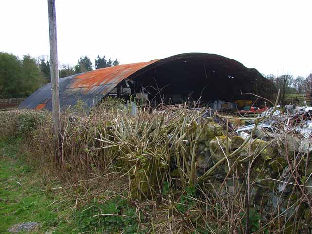
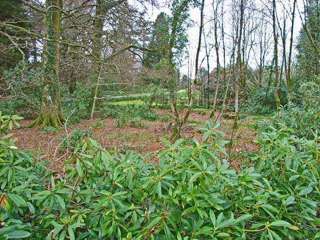
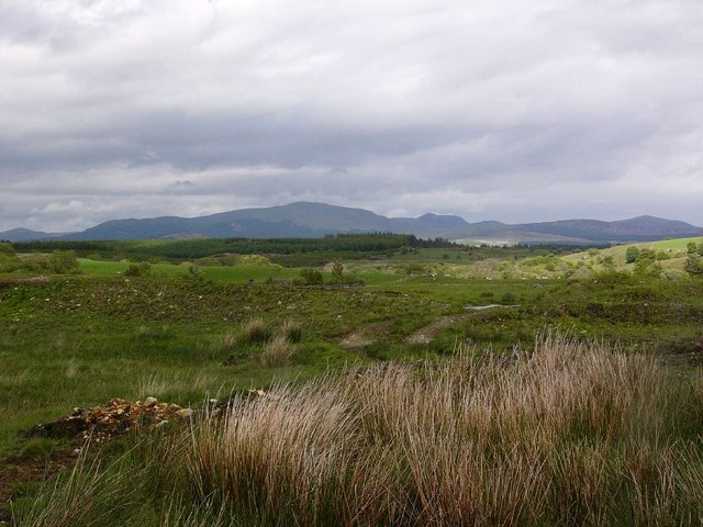
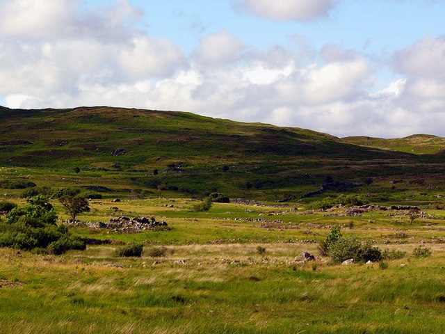
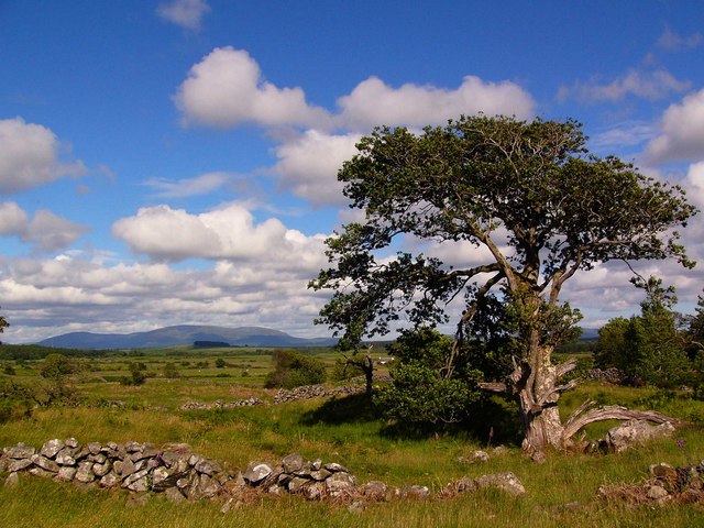
Barneight Plantation is a sprawling woodland located in Wigtownshire, a picturesque region in southwestern Scotland. Nestled amidst the rolling hills, this dense forest is a haven for nature enthusiasts and outdoor adventurers alike.

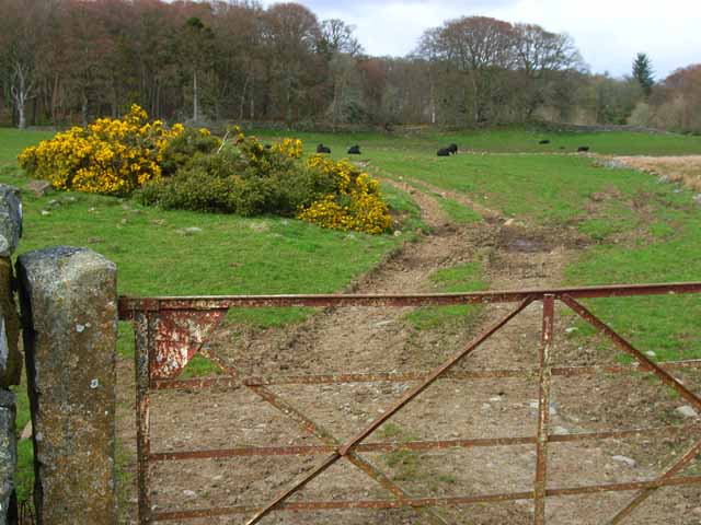
Covering a vast area of approximately 500 acres, Barneight Plantation boasts a diverse range of tree species, including oak, beech, birch, and Scots pine. The woodland's lush greenery provides a habitat for various wildlife, making it a popular destination for birdwatchers and nature photographers. Visitors can frequently spot species such as red squirrels, roe deer, and a wide array of birdlife within the plantation.

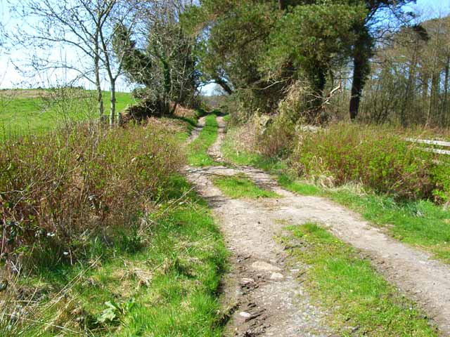
The plantation offers several well-maintained walking trails, allowing visitors to explore the woodland's tranquil beauty at their own pace. These trails cater to different levels of difficulty, making it suitable for both casual walkers and seasoned hikers. Along the way, visitors can immerse themselves in the peaceful surroundings, taking in the fresh scent of pine and the soothing sound of rustling leaves.

In addition to its natural offerings, Barneight Plantation also features a picnic area, providing a perfect spot for families and friends to enjoy a leisurely outdoor meal. The plantation's visitor center offers information about the local flora and fauna, as well as guided tours for those seeking a more immersive experience.

Barneight Plantation, with its stunning woodland, abundant wildlife, and recreational facilities, is a cherished gem in Wigtownshire, inviting visitors to reconnect with nature and bask in its serene ambiance.

If you have any feedback on the listing, please let us know in the comments section below.

Barneight Plantation Images

Images are sourced within 2km of 54.941133/-4.6144581 or Grid Reference NX3263. Thanks to Geograph Open Source API. All images are credited.

Field near Shennanton House Gorse (or furze) seems to be a major problem in south-west Scotland, having invaded large areas of farmland
Field near Shennanton House
Gorse (or furze) seems to be a major problem in south-west Scotland, having invaded large areas of farmland
Old Pack Horse bridge over the River Bladnoch This bridge lies on the course of the old Military  Road, built in the 18th century to enable rapid transport of troops to Ireland via Portpatrick. Curiously, one arch remains, covered in gorse bushes; whilst the abutment on the opposite bank has been reduced to rubble.
Old Pack Horse bridge over the River Bladnoch
This bridge lies on the course of the old Military Road, built in the 18th century to enable rapid transport of troops to Ireland via Portpatrick. Curiously, one arch remains, covered in gorse bushes; whilst the abutment on the opposite bank has been reduced to rubble.
Barn at Mark of Shennanton This colossal barn stands close to Shennanton House.
Barn at Mark of Shennanton
This colossal barn stands close to Shennanton House.
Mrs Johnston's tree near Culvennan Fell The tree is known as Mrs Johnston's as she died in a snowstorm at this point. There is some question as to when, it was not the '47 storm but possibly '37 or '38.  Mrs Johnnston lived in the ruined cottage at the end of the Culvennan farm road (information kindly supplied by John Hannay). Cairnsmore of Fleet in the background.
Mrs Johnston's tree near Culvennan Fell
The tree is known as Mrs Johnston's as she died in a snowstorm at this point. There is some question as to when, it was not the '47 storm but possibly '37 or '38. Mrs Johnnston lived in the ruined cottage at the end of the Culvennan farm road (information kindly supplied by John Hannay). Cairnsmore of Fleet in the background.
Layby next to A75 Used for the storage of agricultural materials
Layby next to A75
Used for the storage of agricultural materials
Moorland track near Culvennan Fell Hills behind Glentrool in the distance
Moorland track near Culvennan Fell
Hills behind Glentrool in the distance
Old Military Road at Ardachie The Old Military Road was built possibly in the 16th century to link Dumfries with Portpatrick. In addition to its military function, it was much used by drovers en route to and from Ireland. The Old Military Road is indicated clearly on the Landranger maps, but over much of the way the road is now scarcely traceable, although at this point it is being used as a farm road.
Old Military Road at Ardachie
The Old Military Road was built possibly in the 16th century to link Dumfries with Portpatrick. In addition to its military function, it was much used by drovers en route to and from Ireland. The Old Military Road is indicated clearly on the Landranger maps, but over much of the way the road is now scarcely traceable, although at this point it is being used as a farm road.
The old Dumfries to Stranraer railway Now used as a farm road. The line was closed in the 1960s. Viewed from the bridge on the B735
The old Dumfries to Stranraer railway
Now used as a farm road. The line was closed in the 1960s. Viewed from the bridge on the B735
River Bladnoch from the A75 The A75 has been realigned to cross the River Bladnoch on the line of the old Dumfries to Stranraer railway (closed in the 1960s)
River Bladnoch from the A75
The A75 has been realigned to cross the River Bladnoch on the line of the old Dumfries to Stranraer railway (closed in the 1960s)
Shennanton House Lodge It is difficult to get a clear sight of Shennanton House, a large Tudor style house built in 1908 set in 30 acres of garden. The house must be the ultimate holiday home - normally let as three separate properties, but can be let together to house at least 30 people! The Lodge seen here is also available as a holiday let.
Shennanton House Lodge
It is difficult to get a clear sight of Shennanton House, a large Tudor style house built in 1908 set in 30 acres of garden. The house must be the ultimate holiday home - normally let as three separate properties, but can be let together to house at least 30 people! The Lodge seen here is also available as a holiday let.
Shennanton House Gardens It is difficult to get a clear sight of Shennanton House, a large Tudor style house built in 1908 set in 30 acres of woodland garden. The house must be the ultimate holiday home - normally let as three separate properties, but can be let together to house at least 30 people!
Shennanton House Gardens
It is difficult to get a clear sight of Shennanton House, a large Tudor style house built in 1908 set in 30 acres of woodland garden. The house must be the ultimate holiday home - normally let as three separate properties, but can be let together to house at least 30 people!
Bridge over the River Bladnoch A bridge over the River Bladnoch a short way upstream from Shennanton House. Presumably the current bridge replaces a much older structure.
Bridge over the River Bladnoch
A bridge over the River Bladnoch a short way upstream from Shennanton House. Presumably the current bridge replaces a much older structure.
Culvennan Fell Looking NNE to Culvennan Fell with the Galloway Hills in the far distance.
Culvennan Fell
Looking NNE to Culvennan Fell with the Galloway Hills in the far distance.
Mrs Johnstons Tree During the "Big Sna'" of 1947, Mrs Johnston walked from her cottage at West Culvennan <a href="https://www.geograph.org.uk/photo/526687">NX2965 : Ruined house at West Culvennan</a> <a href="https://www.geograph.org.uk/photo/526703">NX2964 : West Culvennan from the Gargrie</a> 3½ miles to Kirkcowan village to get groceries. She never returned home and was found lying dead in the snow at the foot of this tree.
For same view, different season, see
<a href="https://www.geograph.org.uk/photo/163206">NX3162 : Mrs Johnston's tree near Culvennan Fell</a>
Mrs Johnstons Tree
During the "Big Sna'" of 1947, Mrs Johnston walked from her cottage at West Culvennan NX2965 : Ruined house at West Culvennan NX2964 : West Culvennan from the Gargrie 3½ miles to Kirkcowan village to get groceries. She never returned home and was found lying dead in the snow at the foot of this tree. For same view, different season, see NX3162 : Mrs Johnston's tree near Culvennan Fell
Gravel pit near Shennanton
Rough grazing near Carsebuie Looking over to the Minnigaff Hills.
Rough grazing near Carsebuie
Looking over to the Minnigaff Hills.
Remains of old settlement, Ardachie These ruins lie on the moor to the north of Ardachie (Ard achadh - high field) and are the remains of the original settlement called "Urdachy" on early maps. The hill in the background is Crunlae Fell.
Remains of old settlement, Ardachie
These ruins lie on the moor to the north of Ardachie (Ard achadh - high field) and are the remains of the original settlement called "Urdachy" on early maps. The hill in the background is Crunlae Fell.
Old walls and oak tree near Drumbuie. These ruined walls were part of the field system of the farm of Drumbuie on the old military road near Ardachie. The view is west towards Cairnsmore of Fleet.
Old walls and oak tree near Drumbuie.
These ruined walls were part of the field system of the farm of Drumbuie on the old military road near Ardachie. The view is west towards Cairnsmore of Fleet.
Show me another place!

Barneight Plantation is located at Grid Ref: NX3263 (Lat: 54.941133, Lng: -4.6144581)

Unitary Authority: Dumfries and Galloway

Police Authority: Dumfries and Galloway

What 3 Words

///calculating.skinning.firmer. Near Newton Stewart, Dumfries & Galloway

Related Wikis

Kirkcowan railway station

Kirkcowan railway station served the village of Kirkcowan, Dumfries and Galloway, Scotland from 1861 to 1965 on the Portpatrick and Wigtownshire Joint...

Kirkcowan

Kirkcowan is an area about 15 miles in length, and from nearly two to nearly seven miles in breadth, comprising 30,580 acres, of which 7000 are arable...

Tarf Water, Wigtownshire

The Tarf Water is a river in the former county of Wigtownshire in south-west Scotland. It rises on the Ayrshire border (55.0048°N 4.7815°W / 55.0048;...

Newton Stewart F.C.

Newton Stewart Football Club are a football club from the town of Newton Stewart in the Dumfries and Galloway area of Scotland. Formed in 1880, as Newton...

Nearby Amenities

Located within 500m of 54.941133,-4.6144581
Power: tower
Lat/Long: 54.9399429/-4.6131314
Power: tower
Lat/Long: 54.9416528/-4.6086518
Power: tower
Lat/Long: 54.9382897/-4.6174623
Power: pole
Lat/Long: 54.9389738/-4.6090543
Power: pole
Lat/Long: 54.9390293/-4.6106717
Power: pole
Lat/Long: 54.9390786/-4.6123454
Power: pole
Lat/Long: 54.9387211/-4.6133137
Power: pole
Lat/Long: 54.9383529/-4.6143383
Power: pole
Lat/Long: 54.9379738/-4.6153468
Power: pole
Lat/Long: 54.9374823/-4.6167442
Power: pole
Lat/Long: 54.9439084/-4.6094838
Power: pole
Lat/Long: 54.9434348/-4.6104674
Power: pole
Lat/Long: 54.9430258/-4.6116121
Power: pole
Lat/Long: 54.9426781/-4.6125939
Power: pole
Lat/Long: 54.9422858/-4.6137192
Power: pole
Lat/Long: 54.9416784/-4.6141576
Power: pole
Lat/Long: 54.9408704/-4.6147746
Power: pole
Lat/Long: 54.9402474/-4.6152267
Power: pole
Lat/Long: 54.9394171/-4.6158553
Power: pole
Lat/Long: 54.9388442/-4.6166353
Power: pole
Lat/Long: 54.9380864/-4.6168506
Power: pole
Lat/Long: 54.9375703/-4.6172406
The data included in this document is from www.openstreetmap.org. The data is made available under ODbL.

Have you been to Barneight Plantation?

Leave your review of Barneight Plantation below (or comments, questions and feedback).