Barlennan Plantation

Wood, Forest in Wigtownshire

Scotland

Barlennan Plantation

Wall and fence-lined minor road between High Mindork and Barnearnie Looking north-eastward.
Wall and fence-lined minor road between High Mindork and Barnearnie Credit: Peter Wood

Barlennan Plantation is a picturesque woodland located in Wigtownshire, a historic county in southwest Scotland. Spanning over a vast area, this plantation is renowned for its rich biodiversity and stunning natural beauty. The plantation is predominantly composed of a diverse mix of deciduous and coniferous trees, creating a captivating landscape that changes throughout the seasons.

The woodland boasts a variety of tree species, including oak, beech, birch, and fir. These towering trees provide a home to a wide array of wildlife, from small mammals like red squirrels and rabbits to numerous bird species such as woodpeckers and owls. The plantation's ecosystem is carefully managed to maintain a balanced environment, ensuring the preservation of its flora and fauna.

Visitors to Barlennan Plantation can enjoy a network of well-maintained walking trails that meander through the woodland, offering opportunities for leisurely strolls or more challenging hikes. The paths lead visitors through enchanting groves, past babbling brooks, and up gentle slopes, all while surrounded by the tranquility and beauty of nature.

Barlennan Plantation is a popular destination for nature enthusiasts, photographers, and those seeking a peaceful escape from the hustle and bustle of everyday life. The woodland's serene atmosphere and breathtaking scenery make it an ideal spot for picnics, wildlife spotting, or simply immersing oneself in the wonders of the natural world.

In conclusion, Barlennan Plantation is a captivating woodland in Wigtownshire, Scotland, offering a diverse range of tree species, a thriving wildlife population, and tranquil walking trails. It is a cherished natural haven that provides visitors with an opportunity to connect with nature in a truly captivating setting.

If you have any feedback on the listing, please let us know in the comments section below.

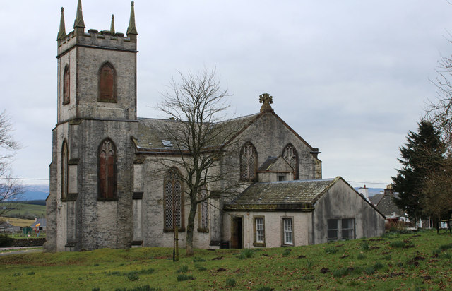
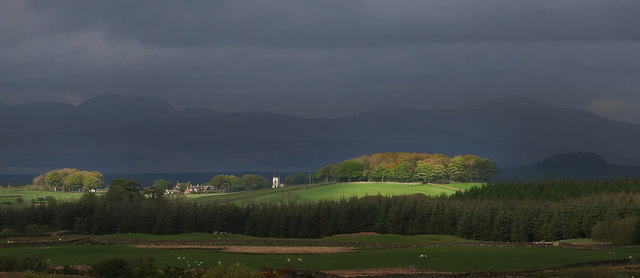
Barlennan Plantation Images

Images are sourced within 2km of 54.907759/-4.620141 or Grid Reference NX3260. Thanks to Geograph Open Source API. All images are credited.

Wall and fence-lined minor road between High Mindork and Barnearnie Looking north-eastward.
Wall and fence-lined minor road between High Mindork and Barnearnie
Looking north-eastward.
Old milestone Travelling towards Kirkcowan the B733 crosses the River Tarff by Johnston's Bridge.   The Tarff then soon runs into the River Bladnoch a short distance to the east.   The milestone is at the northern end of the bridge.
Old milestone
Travelling towards Kirkcowan the B733 crosses the River Tarff by Johnston's Bridge. The Tarff then soon runs into the River Bladnoch a short distance to the east. The milestone is at the northern end of the bridge.
Old milestone The bridge over the river then sharp left to continue towards Wigtown.
Old milestone
The bridge over the river then sharp left to continue towards Wigtown.
Old milestone Looking towards Kirkcowan.   This milestone was spotted by a Milestone Society member from Dumfries in 2017.   It wasn't seen in 2008.   The dyke (wall) in front of Oldland Farm may have been rebuilt at some time and the repainted milestone set within it.
Old milestone
Looking towards Kirkcowan. This milestone was spotted by a Milestone Society member from Dumfries in 2017. It wasn't seen in 2008. The dyke (wall) in front of Oldland Farm may have been rebuilt at some time and the repainted milestone set within it.
Old milestone A short distance from this milestone can be seen the road sign for the A75 and the Give Way sign.   This is the last of a complete set of 10 milestones on the B733 from Wigtown 0.   It is now 8 miles of A75, new and old sections, into Glenluce.
Old milestone
A short distance from this milestone can be seen the road sign for the A75 and the Give Way sign. This is the last of a complete set of 10 milestones on the B733 from Wigtown 0. It is now 8 miles of A75, new and old sections, into Glenluce.
Old milestone From this photograph it can be seen that the milestone has, at some time, been reset with the W face to the road.  And it has been painted since 2008 when first recorded for the Milestone Society.
Old milestone
From this photograph it can be seen that the milestone has, at some time, been reset with the W face to the road. And it has been painted since 2008 when first recorded for the Milestone Society.
Kirkcowan Parish Church Viewed in early April (6th).
Kirkcowan Parish Church
Viewed in early April (6th).
Main Street, Kirkcowan Viewed in early April (6th).
Main Street, Kirkcowan
Viewed in early April (6th).
Streets in Kirkcowan
Outdoor Seating Area, Kirkcowan
Playing Field, Kirkcowan
Stagecoach Bus, Kirkcowan
Stagecoach Bus, Kirkcowan Passing the Parish Church.
Stagecoach Bus, Kirkcowan
Passing the Parish Church.
Path to Tarff Bridge
Kirkcowan Parish Church
Kirkcowan Parish Church At the west end of the village, built in 1834 to replace a former church, of which only an ivy-clad east gable remains in its kirkyard (east end of village). The present church is a harled T-plan building with external stairs at the east and west gables leading to two galleries. A tower at the north side. Inside, three galleries in all, supported by marbled cast-iron columns. Tall pulpit of 1834 and a late 19th-century chamber organ by J & A Mirrlees, brought here in 1966.
Kirkcowan Parish Church
At the west end of the village, built in 1834 to replace a former church, of which only an ivy-clad east gable remains in its kirkyard (east end of village). The present church is a harled T-plan building with external stairs at the east and west gables leading to two galleries. A tower at the north side. Inside, three galleries in all, supported by marbled cast-iron columns. Tall pulpit of 1834 and a late 19th-century chamber organ by J & A Mirrlees, brought here in 1966.
Show me another place!

Barlennan Plantation is located at Grid Ref: NX3260 (Lat: 54.907759, Lng: -4.620141)

Unitary Authority: Dumfries and Galloway

Police Authority: Dumfries and Galloway

What 3 Words

///dusts.shielding.performed. Near Newton Stewart, Dumfries & Galloway

Related Wikis

Kirkcowan railway station

Kirkcowan railway station served the village of Kirkcowan, Dumfries and Galloway, Scotland from 1861 to 1965 on the Portpatrick and Wigtownshire Joint...

Kirkcowan

Kirkcowan is an area about 15 miles in length, and from nearly two to nearly seven miles in breadth, comprising 30,580 acres, of which 7000 are arable...

Barhapple Loch

Barhapple Loch is a small semicircular freshwater loch located in Wigtownshire, Dumfries and Galloway in Scotland. Barhapple Loch is principally known...

Torhouse

The Standing Stones of Torhouse (also Torhousekie) are a stone circle of nineteen granite boulders on the land of Torhouse, three miles west of Wigtown...

Nearby Amenities

Located within 500m of 54.907759,-4.620141
Power: pole
Lat/Long: 54.91139/-4.6229884
Power: pole
Lat/Long: 54.9108691/-4.6220435
Power: pole
Lat/Long: 54.9103204/-4.621023
Power: pole
Lat/Long: 54.9098241/-4.6201247
Power: pole
Lat/Long: 54.9091917/-4.6189586
Power: pole
Lat/Long: 54.9090745/-4.6176257
Power: pole
Lat/Long: 54.908915/-4.616124
Power: pole
Lat/Long: 54.9087712/-4.6145738
Power: pole
Lat/Long: 54.9086306/-4.6130702
Power: pole
Lat/Long: 54.9097649/-4.6194087
Power: pole
Lat/Long: 54.9097058/-4.6186773
Power: pole
Lat/Long: 54.9053468/-4.6261046
Power: pole
Lat/Long: 54.9058827/-4.625112
Power: pole
Lat/Long: 54.906428/-4.6240543
Power: pole
Lat/Long: 54.9069787/-4.6230663
Power: pole
Lat/Long: 54.9075213/-4.6220714
Power: pole
Lat/Long: 54.9080679/-4.6210253
Power: pole
Lat/Long: 54.9086211/-4.6200047
The data included in this document is from www.openstreetmap.org. The data is made available under ODbL.

Have you been to Barlennan Plantation?

Leave your review of Barlennan Plantation below (or comments, questions and feedback).