Camrose

Settlement in Pembrokeshire

Wales

Camrose

Robleston Hall Farm
Robleston Hall Farm Credit: Alan Hughes

Camrose is a small village located in the county of Pembrokeshire, Wales. Situated in the southwestern part of the country, it lies approximately 8 miles west of the county town of Haverfordwest. Surrounded by rolling hills and picturesque countryside, Camrose offers a tranquil and rural setting.

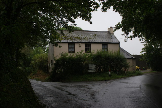
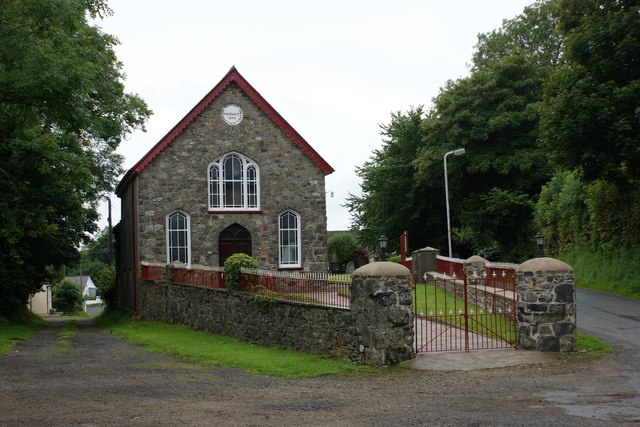
The village is characterized by its traditional Welsh charm, with a scattering of stone cottages and farmhouses throughout. It has a population of around 400 residents, making it a close-knit community. The village center consists of a few amenities, including a local pub, a small convenience store, and a village hall.

Camrose is well-positioned for exploring the natural beauty of Pembrokeshire. Just a short drive away, visitors can access the stunning Pembrokeshire Coast National Park, renowned for its rugged cliffs, sandy beaches, and diverse wildlife. Popular destinations such as St. Davids, the UK's smallest city, and the picturesque town of Tenby are also within easy reach.

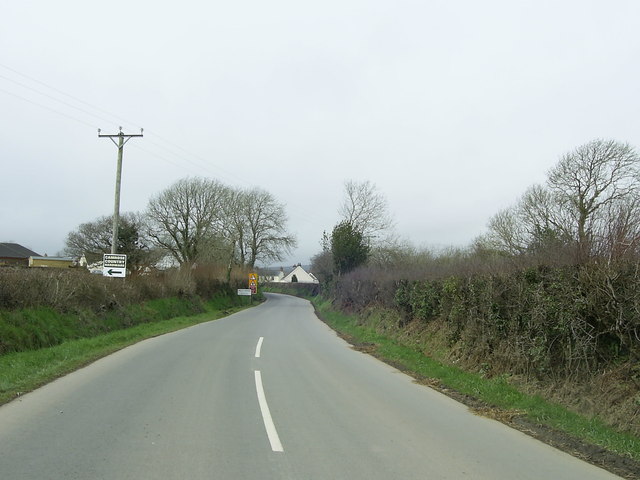
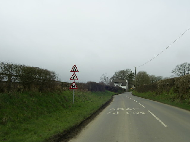
The village is well-connected by road, with the A40 passing nearby, providing convenient access to surrounding areas. Public transportation is limited, with bus services operating on a less frequent schedule.

Camrose offers a peaceful and idyllic lifestyle, perfect for those seeking a quiet retreat surrounded by nature. Its location provides ample opportunities for outdoor activities such as hiking, cycling, and birdwatching, making it a haven for nature enthusiasts.

If you have any feedback on the listing, please let us know in the comments section below.
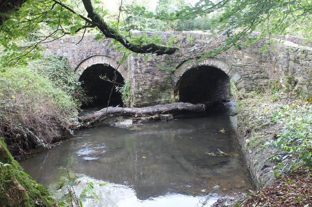
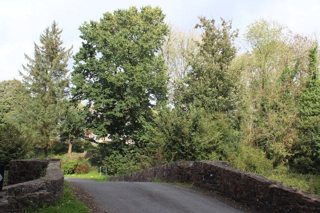
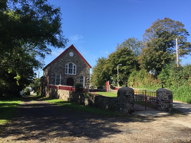
Camrose Images

Images are sourced within 2km of 51.843418/-5.010133 or Grid Reference SM9220. Thanks to Geograph Open Source API. All images are credited.

Robleston Hall Farm
Robleston Hall Farm
Pond at Robleston Hall
Country lane towards Camrose
St Ishmael’s Church, Camrose
Road junction near Haysford Road junction of the B4330 and the minor road to Wolfsdale, near Haysford.
Road junction near Haysford
Road junction of the B4330 and the minor road to Wolfsdale, near Haysford.
Bend in the B4330, Folly Cross The view of the bend in the B4330 approaching Folly Cross near Camrose.
Bend in the B4330, Folly Cross
The view of the bend in the B4330 approaching Folly Cross near Camrose.
Approaching Kilns Cross near Camrose The B4330 ahead narrows as it heads for Kilns Cross and the road junction near Camrose.
Approaching Kilns Cross near Camrose
The B4330 ahead narrows as it heads for Kilns Cross and the road junction near Camrose.
Cottage at Kilns Cross, Camrose
Cutty Bridge, Knock Brook The historic stone bridge carries the B4330 over a tributary of the Western Cleddau.
Cutty Bridge, Knock Brook
The historic stone bridge carries the B4330 over a tributary of the Western Cleddau.
B4330 at Cutty Bridge The stone bridge <a href="https://www.geograph.org.uk/photo/7616525">SM9318 : Cutty Bridge, Knock Brook</a> carries the road  from Haverfordwest over Knock Brook.
B4330 at Cutty Bridge
The stone bridge SM9318 : Cutty Bridge, Knock Brook carries the road from Haverfordwest over Knock Brook.
Ordnance Survey Cut Mark This OS cut mark can be found on the east face of St Ishmael's Church. It marks a point 38.027m above mean sea level.
Ordnance Survey Cut Mark
This OS cut mark can be found on the east face of St Ishmael's Church. It marks a point 38.027m above mean sea level.
Ordnance Survey Cut Mark This OS cut mark can be found on the north face of St Ishmael's Church. It marks a point 123.6ft above mean sea level.
Ordnance Survey Cut Mark
This OS cut mark can be found on the north face of St Ishmael's Church. It marks a point 123.6ft above mean sea level.
Ordnance Survey Cut Mark This OS cut mark can be found on the gatepost of Whitehorn Cottage. It marks a point 45.202m above mean sea level.
Ordnance Survey Cut Mark
This OS cut mark can be found on the gatepost of Whitehorn Cottage. It marks a point 45.202m above mean sea level.
Ordnance Survey Cut Mark This OS inverted cut mark can be found on the north face of the Baptist Chapel. It marks a point 41.941m above mean sea level.
Ordnance Survey Cut Mark
This OS inverted cut mark can be found on the north face of the Baptist Chapel. It marks a point 41.941m above mean sea level.
Ordnance Survey Cut Mark This OS cut mark can be found on the barn at Upper House Farm. It marks a point 70.384m above mean sea level.
Ordnance Survey Cut Mark
This OS cut mark can be found on the barn at Upper House Farm. It marks a point 70.384m above mean sea level.
Ordnance Survey Cut Mark This OS cut mark can be found on the barn at Causeway Farm. It marks a point 92.205m above mean sea level.
Ordnance Survey Cut Mark
This OS cut mark can be found on the barn at Causeway Farm. It marks a point 92.205m above mean sea level.
Camrose Baptist Chapel
Camrose Baptist Church Lebanon Baptist Church, Camrose.  Built in 1838 and rebuilt in 1876.
Camrose Baptist Church
Lebanon Baptist Church, Camrose. Built in 1838 and rebuilt in 1876.
Show me another place!

Camrose is located at Grid Ref: SM9220 (Lat: 51.843418, Lng: -5.010133)

Unitary Authority: Pembrokeshire

Police Authority: Dyfed Powys

Also known as: Camros

What 3 Words

///tightest.river.dome. Near Camrose, Pembrokeshire

Nearby Locations

Folly Camrose Camros

Related Wikis

Camrose, Pembrokeshire

Camrose (Welsh: Camros) is a village, parish and community in the historic cantref of Roose (Welsh: Rhos) in Pembrokeshire, Wales. The community includes...

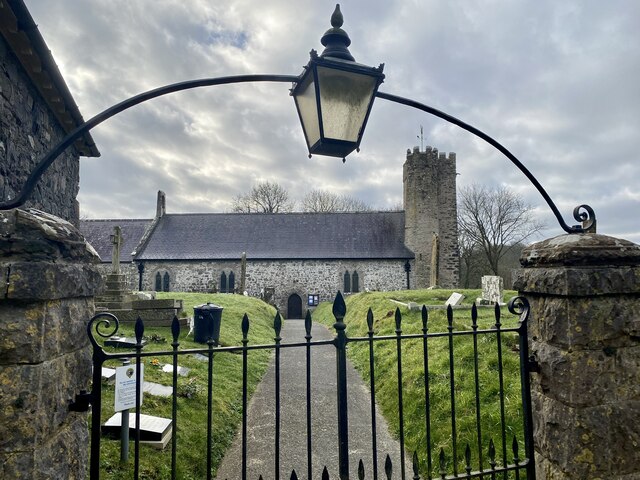
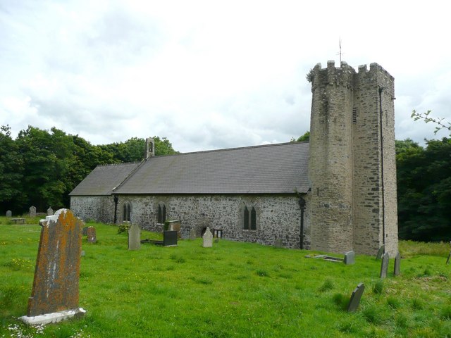
St Michael's Church, Rudbaxton

St Michael's Church is a Grade I listed building and parish church in the community and parish of Rudbaxton in Pembrokeshire, Wales. The building dates...

Rudbaxton

Rudbaxton is a village, parish and a local government community in the county of Pembrokeshire, Wales. It is 81 miles (130 km) from Cardiff and 208 miles...

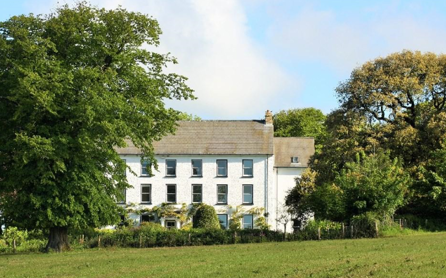
Cuffern Manor, Pembrokeshire

Cuffern Manor in Roch, Pembrokeshire is a house of historical significance and is listed on the Wales Heritage Register. It was built in 1770 by John Rees...

Nearby Amenities

Located within 500m of 51.843418,-5.010133
Folly
Place: hamlet
Lat/Long: 51.8468619/-5.0100984
Give Way
Direction: backward
Lat/Long: 51.8465377/-5.0100496
Give Way
Direction: backward
Lat/Long: 51.8466435/-5.0100543
Camrose
Name Cy: Camros
Place: village
Source: Bing
Lat/Long: 51.8432973/-5.0095975
Direction: S
Generator Method: photovoltaic
Generator Output Electricity: yes
Generator Solar Modules: 16
Generator Source: solar
Generator Type: solar_photovoltaic_panel
Location: roof
Power: generator
Lat/Long: 51.8447605/-5.0092506
Direction: E
Generator Method: photovoltaic
Generator Output Electricity: yes
Generator Solar Modules: 10
Generator Source: solar
Generator Type: solar_photovoltaic_panel
Location: roof
Power: generator
Lat/Long: 51.8457083/-5.0102068
Direction: E
Generator Method: photovoltaic
Generator Output Electricity: yes
Generator Solar Modules: 10
Generator Source: solar
Generator Type: solar_photovoltaic_panel
Location: roof
Power: generator
Lat/Long: 51.8457638/-5.0102055
Direction: E
Generator Method: photovoltaic
Generator Output Electricity: yes
Generator Solar Modules: 10
Generator Source: solar
Generator Type: solar_photovoltaic_panel
Location: roof
Power: generator
Lat/Long: 51.8458682/-5.0102042
Direction: E
Generator Method: photovoltaic
Generator Output Electricity: yes
Generator Solar Modules: 10
Generator Source: solar
Generator Type: solar_photovoltaic_panel
Location: roof
Power: generator
Lat/Long: 51.8459237/-5.0102028
Direction: E
Generator Method: photovoltaic
Generator Output Electricity: yes
Generator Solar Modules: 14
Generator Source: solar
Generator Type: solar_photovoltaic_panel
Location: roof
Power: generator
Lat/Long: 51.8457539/-5.0108425
Direction: W
Generator Method: photovoltaic
Generator Output Electricity: yes
Generator Solar Modules: 13
Generator Source: solar
Generator Type: solar_photovoltaic_panel
Location: roof
Power: generator
Lat/Long: 51.845739/-5.0109123
Direction: S
Generator Method: photovoltaic
Generator Output Electricity: yes
Generator Solar Modules: 5
Generator Source: solar
Generator Type: solar_photovoltaic_panel
Location: roof
Power: generator
Lat/Long: 51.8453728/-5.0107862
Direction: 190
Generator Method: photovoltaic
Generator Output Electricity: yes
Generator Solar Modules: 12
Generator Source: solar
Generator Type: solar_photovoltaic_panel
Location: roof
Power: generator
Lat/Long: 51.8476088/-5.0096657
Man Made: utility_pole
Lat/Long: 51.8429174/-5.0040185
The data included in this document is from www.openstreetmap.org. The data is made available under ODbL.

Have you been to Camrose?

Leave your review of Camrose below (or comments, questions and feedback).