Camptown

Settlement in Roxburghshire

Scotland

Camptown

Ordnance Survey 1GL Bolt This OS Bolt can be found on the north face of Edgerston Church. It marks a point 235.165m above mean sea level.
Ordnance Survey 1GL Bolt Credit: Adrian Dust

Camptown is a small village located in the Scottish Borders region of Scotland, specifically in Roxburghshire. Situated approximately 4 miles south of the town of Jedburgh, Camptown is nestled in a picturesque rural setting.

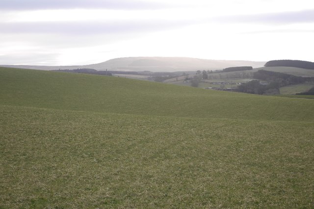
The village is characterized by its charming stone cottages and tranquil atmosphere. Surrounded by rolling hills and lush green fields, it offers residents and visitors a peaceful and idyllic environment. The nearby Jed Water, a river that flows through the area, adds to the scenic beauty of the village.

Despite its small size, Camptown has a close-knit community that takes pride in its local heritage. The village is home to a number of historic landmarks, including the Camptown Parish Church, which dates back to the 18th century. The church is known for its striking architecture and beautiful stained glass windows.

Although Camptown does not have many amenities of its own, the nearby town of Jedburgh provides residents with easy access to essential services such as shops, schools, and healthcare facilities. Additionally, the village benefits from its proximity to the A68 road, which connects it to larger towns and cities in the region.

Nature enthusiasts will find plenty to explore in the surrounding area. The nearby Jedburgh Abbey and Harestanes Visitor Centre offer opportunities for historical and cultural exploration, while the Cheviot Hills and Northumberland National Park provide ample opportunities for outdoor activities such as hiking and wildlife spotting.

In conclusion, Camptown is a charming and peaceful village in Roxburghshire, offering residents and visitors a tranquil rural setting, a rich history, and easy access to nearby amenities and natural attractions.

If you have any feedback on the listing, please let us know in the comments section below.
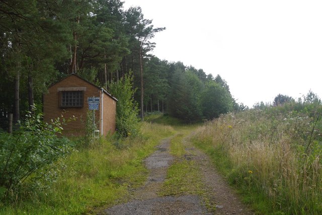
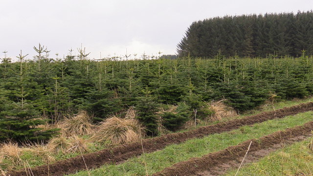
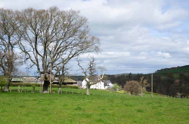
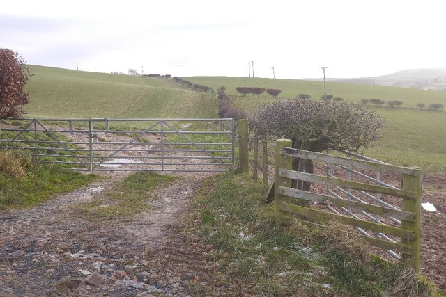
Camptown Images

Images are sourced within 2km of 55.414706/-2.5077542 or Grid Reference NT6713. Thanks to Geograph Open Source API. All images are credited.

Ordnance Survey 1GL Bolt This OS Bolt can be found on the north face of Edgerston Church. It marks a point 235.165m above mean sea level.
Ordnance Survey 1GL Bolt
This OS Bolt can be found on the north face of Edgerston Church. It marks a point 235.165m above mean sea level.
Small Reservoir Compound with Triangulation Pillar at Dolphinston Looking southward.
Small Reservoir Compound with Triangulation Pillar at Dolphinston
Looking southward.
A68, Edgerston Towards Jedburgh
A68, Edgerston
Towards Jedburgh
Track beside the Shaw Burn A track passes a somewhat overgrown looking pumping station building.
Track beside the Shaw Burn
A track passes a somewhat overgrown looking pumping station building.
Forest 'plantation' 7 years on near Mervinslaw, Jedburgh I think it was a nursery plantation perhaps now producing a crop of Xmas trees in the season. Many farms in the surrounding area have similar strips of very closely planted seedlings which makes sense when there is, I presume, so much demand locally for re-planting material. However these specimens are well past the transplanting stage.Perhaps a planning error or maybe I've got it all wrong!
Forest 'plantation' 7 years on near Mervinslaw, Jedburgh
I think it was a nursery plantation perhaps now producing a crop of Xmas trees in the season. Many farms in the surrounding area have similar strips of very closely planted seedlings which makes sense when there is, I presume, so much demand locally for re-planting material. However these specimens are well past the transplanting stage.Perhaps a planning error or maybe I've got it all wrong!
Entering Camptown
Entering Camptown
Tree house near to Old Jeddart The tree house is close to the buildings at Old Jeddart which are seen in the distance.
Tree house near to Old Jeddart
The tree house is close to the buildings at Old Jeddart which are seen in the distance.
Camptown from the air Viewed from an Edinburgh bound flight from Prague.
Camptown from the air
Viewed from an Edinburgh bound flight from Prague.
Fields above the Jed Water
Field above the Jed Water Looking over grass slopes towards Carter Fell on the Border.
Field above the Jed Water
Looking over grass slopes towards Carter Fell on the Border.
Pasture, Dolphinston Grass with a young forestry plantation on Birkenside in the background.
Pasture, Dolphinston
Grass with a young forestry plantation on Birkenside in the background.
Dolphinston Moor Big grass fields, grazed by sheep on the northern edge of the Cheviot Hills.
Dolphinston Moor
Big grass fields, grazed by sheep on the northern edge of the Cheviot Hills.
View from the trig Looking away from the triangulation pillar near Dolphinston.
View from the trig
Looking away from the triangulation pillar near Dolphinston.
Road to Dolphinston Above the Jed Water.
Road to Dolphinston
Above the Jed Water.
Road from Dolphinston Very quiet road on the north side of the Cheviot hills.
Road from Dolphinston
Very quiet road on the north side of the Cheviot hills.
Dolphinston to Falla road Above a crossroads amongst frozen grass fields.
Dolphinston to Falla road
Above a crossroads amongst frozen grass fields.
Road to Falla A dead end to motorised traffic on the north side of the Cheviot Hills.
Road to Falla
A dead end to motorised traffic on the north side of the Cheviot Hills.
Fields, Falla Frosty slopes of Dod Hill.
Fields, Falla
Frosty slopes of Dod Hill.
Show me another place!

Camptown is located at Grid Ref: NT6713 (Lat: 55.414706, Lng: -2.5077542)

Unitary Authority: The Scottish Borders

Police Authority: The Lothians and Scottish Borders

What 3 Words

///repay.developed.bricks. Near Jedburgh, Scottish Borders

Nearby Locations

Camptown Roaring Linn

Related Wikis

Camptown, Scottish Borders

Camptown is a small settlement on the A68, in the Scottish Borders area of Scotland, 5m (8 km) south of Jedburgh, and the same distance south to Carter...

Edgerston

Edgerston is a village and an estate about 4 miles (6.4 km) north of the Anglo-Scottish border, and 8 miles (13 km) south of Jedburgh in the Scottish Borders...

Bairnkine

Bairnkine is a hamlet on the Jed Water in the Scottish Borders area of Scotland, on the A68, south of Jedburgh. Other places nearby include Abbotrule,...

Ferniehirst Castle

Ferniehirst Castle (sometimes spelled Ferniehurst) is an L-shaped construction on the east bank of the Jed Water, about a mile and a half south of Jedburgh...

Nearby Amenities

Located within 500m of 55.414706,-2.5077542
Bus Stop
Camptown Cottages
Bus: yes
Naptan AtcoCode: 6900175
Naptan Bearing: S
Naptan CommonName: Cottages
Naptan Indicator: at
Naptan Landmark: Telephone Box
Naptan NaptanCode: 72723242
Naptan Street: A68
Operator: Scottish Borders Council
Public Transport: platform
Ref: 6900175
Source: NaPTAN
Lat/Long: 55.4133625/-2.5077236
Bus Stop
Telephone Box
Naptan AtcoCode: 6900177
Naptan Bearing: N
Naptan CommonName: Telephone Box
Naptan Indicator: adj Lay-by
Naptan Landmark: Telephone Box
Naptan NaptanCode: 72723239
Naptan Street: A68
Naptan Verified: no
Shelter: no
Source: naptan_import
Lat/Long: 55.4130772/-2.5078954
Natural: peak
Lat/Long: 55.4167079/-2.5012541
Speed Camera
Source: survey
Lat/Long: 55.4124522/-2.5077304
Post Box
Brand: Royal Mail
Brand Wikidata: Q638098
Operator: Royal Mail
Operator Wikidata: Q638098
Post Box Design: hovis
Post Box Mounting: wooden_post
Post Box Type: lamp
Ref: TD8 89
Royal Cypher: GR
Royal Cypher Wikidata: Q33102273
Source: drive-by survey
Lat/Long: 55.4134972/-2.5076915
Bench
Backrest: yes
Lat/Long: 55.4145903/-2.507844
Telephone
Booth: KX100
Covered: booth
Lat/Long: 55.4133939/-2.5076902
Power: pole
Lat/Long: 55.4146892/-2.5153461
Power: pole
Lat/Long: 55.4139158/-2.5148928
Generator Method: photovoltaic
Generator Output Electricity: yes
Generator Source: solar
Generator Type: solar_photovoltaic_panel
Power: generator
Lat/Long: 55.4140033/-2.5072539
Give Way
Direction: forward
Lat/Long: 55.4146641/-2.5079592
Power: pole
Lat/Long: 55.4132623/-2.5145147
Power: pole
Lat/Long: 55.4123853/-2.5140023
Power: pole
Lat/Long: 55.4127507/-2.5129955
Power: pole
Lat/Long: 55.4130855/-2.5120531
Power: pole
Lat/Long: 55.4137476/-2.51023
Material: wood
Power: pole
Lat/Long: 55.4143206/-2.5084945
Power: pole
Lat/Long: 55.4144156/-2.5082241
Material: wood
Power: pole
Lat/Long: 55.4155791/-2.5089502
Material: wood
Power: pole
Lat/Long: 55.4147664/-2.5083915
Material: wood
Power: pole
Lat/Long: 55.4137637/-2.5084404
Material: wood
Power: pole
Lat/Long: 55.4131001/-2.5083322
Material: wood
Power: pole
Lat/Long: 55.412416/-2.5082215
Material: wood
Power: pole
Lat/Long: 55.4117217/-2.5080928
Power: pole
Lat/Long: 55.4110391/-2.5079846
Power: pole
Lat/Long: 55.4189063/-2.5063656
The data included in this document is from www.openstreetmap.org. The data is made available under ODbL.

Have you been to Camptown?

Leave your review of Camptown below (or comments, questions and feedback).