Arnsheen Woodlands

Wood, Forest in Ayrshire

Scotland

Arnsheen Woodlands

Horse Chestnut flowers All going well, there should be a good crop of conkers here in the autumn.
Horse Chestnut flowers Credit: Mary and Angus Hogg

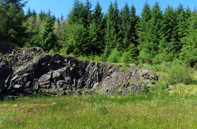
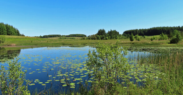
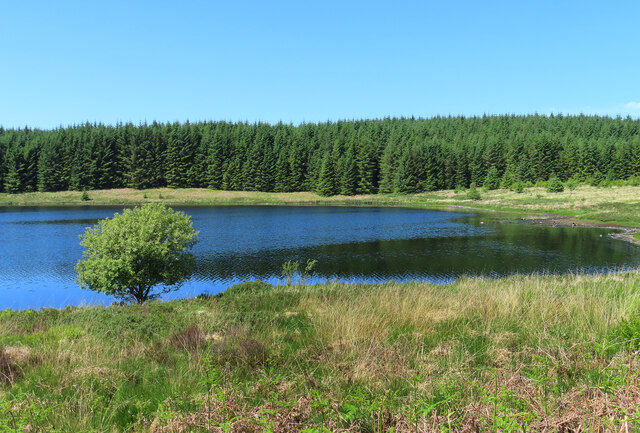
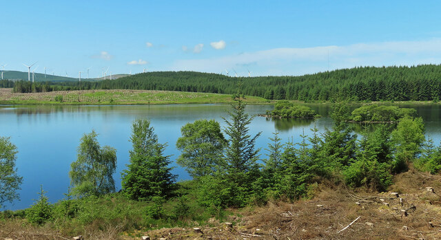
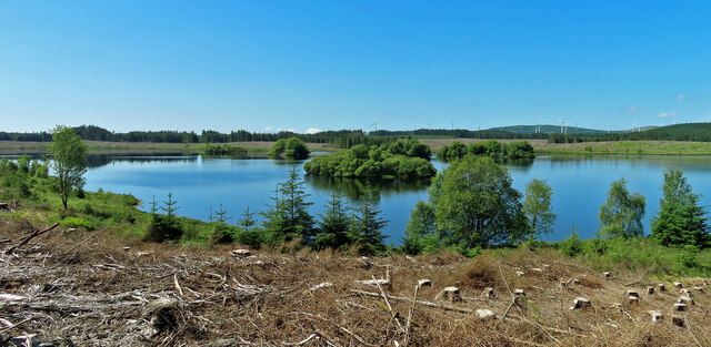
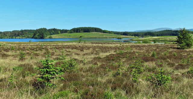
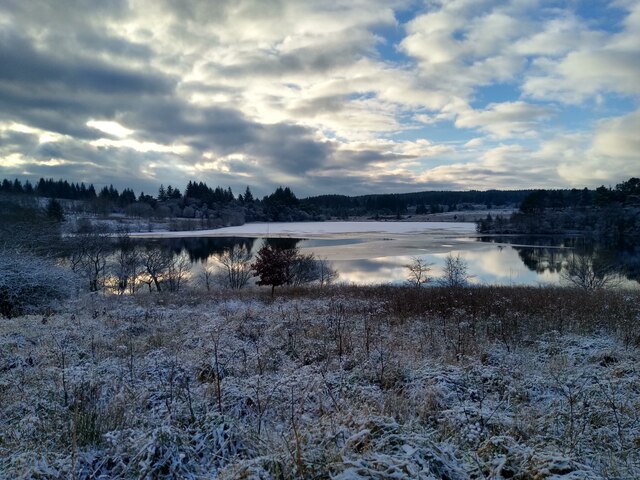
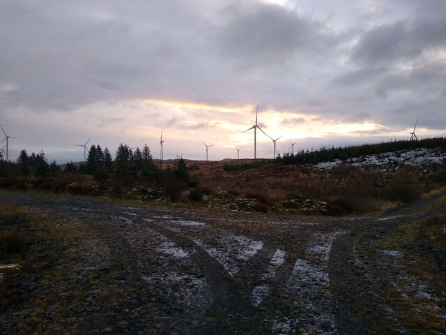
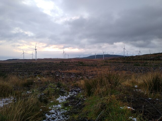
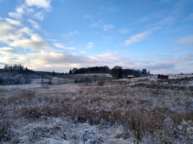
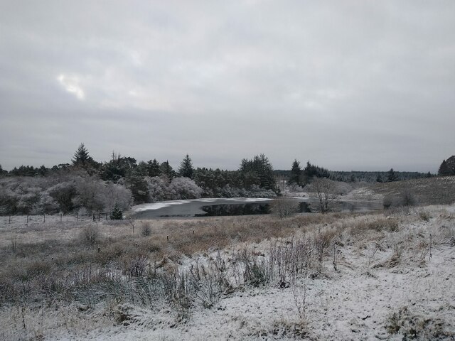
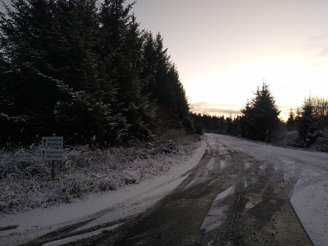
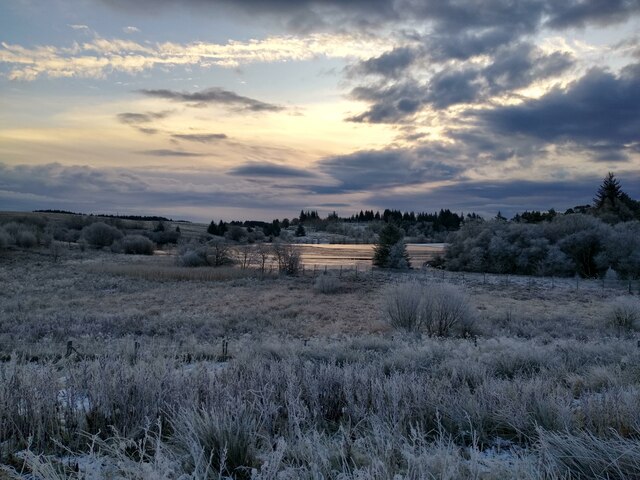
Arnsheen Woodlands is a beautiful forest located in Ayrshire, Scotland. Covering an area of approximately 200 acres, it is a haven for nature lovers and outdoor enthusiasts. The woodlands are situated on the southern slopes of the Galloway Hills, providing stunning panoramic views of the surrounding countryside.

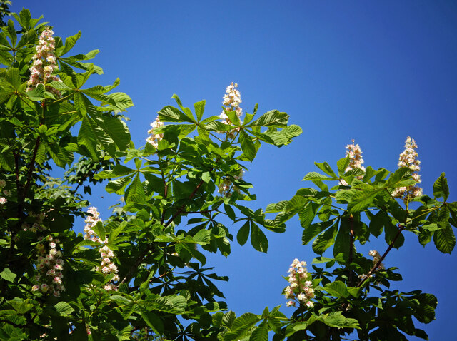
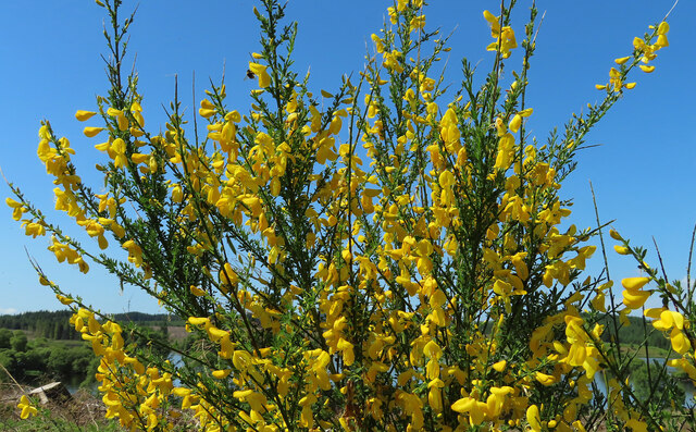
Arnsheen Woodlands is primarily composed of native broadleaf trees such as oak, birch, and rowan, creating a diverse and vibrant ecosystem. The forest floor is covered in a rich carpet of mosses, ferns, and wildflowers, adding to the enchanting atmosphere of the woodlands.

The area is home to a wide variety of wildlife, including red squirrels, badgers, and a plethora of bird species. Nature enthusiasts can witness the magical sight of red deer grazing in the early mornings or evenings. The woodlands also provide an excellent habitat for many species of butterflies and insects.

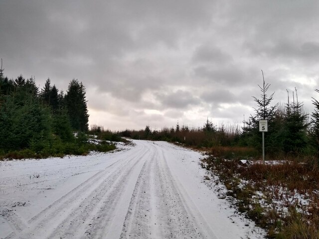
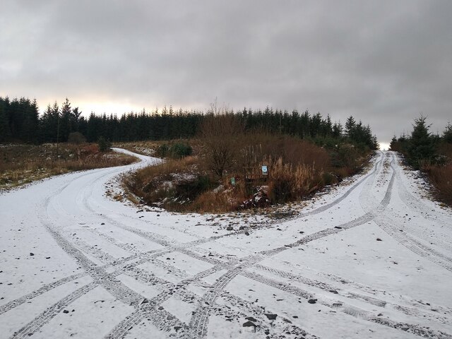
Visitors to Arnsheen Woodlands can enjoy a network of well-maintained trails that wind through the forest, allowing them to explore the woodland's beauty at their own pace. These trails are suitable for walkers of all abilities and offer glimpses of the breathtaking scenery and wildlife that inhabit the area.

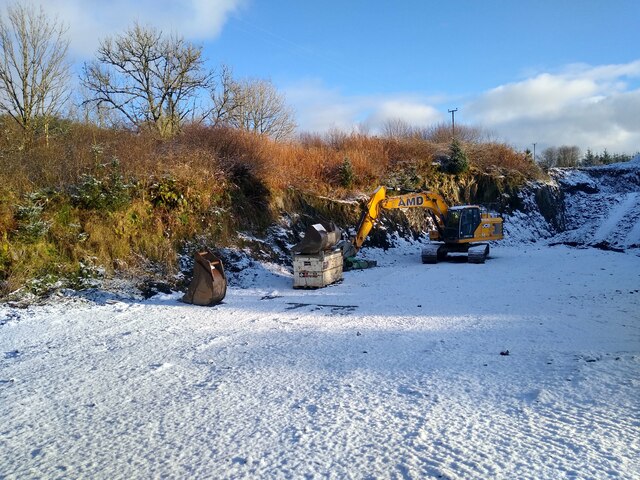
Arnsheen Woodlands is a popular destination for outdoor activities such as hiking, picnicking, and birdwatching. It offers a peaceful and tranquil escape from the hustle and bustle of everyday life, allowing visitors to reconnect with nature and enjoy the serenity of the woodlands.

Overall, Arnsheen Woodlands in Ayrshire is a truly captivating forest, offering a blend of natural beauty, diverse wildlife, and recreational opportunities for all who visit.

If you have any feedback on the listing, please let us know in the comments section below.

Arnsheen Woodlands Images

Images are sourced within 2km of 55.054562/-4.7016334 or Grid Reference NX2776. Thanks to Geograph Open Source API. All images are credited.

Horse Chestnut flowers All going well, there should be a good crop of conkers here in the autumn.
Horse Chestnut flowers
All going well, there should be a good crop of conkers here in the autumn.
An old quarry Beside the B7027, this overgrown site holds a shallow pool of water with marshy edges. Even after a long spell of dry weather, the pool was still there.
An old quarry
Beside the B7027, this overgrown site holds a shallow pool of water with marshy edges. Even after a long spell of dry weather, the pool was still there.
Loch Nahinie revisited This tiny roadside loch has become more overgrown since my previous visit <a href="https://www.geograph.org.uk/photo/476093">NX2777 : Loch Nahinie</a> with water lilies now in abundance. Roadside views have also become more obscured. I had to scramble down a banking to get clear of the foliage.
Loch Nahinie revisited
This tiny roadside loch has become more overgrown since my previous visit NX2777 : Loch Nahinie with water lilies now in abundance. Roadside views have also become more obscured. I had to scramble down a banking to get clear of the foliage.
Loch Maberry The road follows the shoreline here, giving lovely views and good access to the loch. This end of the loch lies in South Ayrshire. The other end is in Dumfries & Galloway.
Loch Maberry
The road follows the shoreline here, giving lovely views and good access to the loch. This end of the loch lies in South Ayrshire. The other end is in Dumfries & Galloway.
From Barloch Wood The lovely view to Loch Maberry has been reopened by recent timber operations.
From Barloch Wood
The lovely view to Loch Maberry has been reopened by recent timber operations.
Loch Maberry view The view has changed since my previous visit in 2007 <a href="https://www.geograph.org.uk/photo/476123">NX2875 : Loch Maberry</a>. The trees on the islands are a lot bigger.
Loch Maberry view
The view has changed since my previous visit in 2007 NX2875 : Loch Maberry. The trees on the islands are a lot bigger.
A golden show of Common Broom The Broom (Cytisus scoparius) has grown well here since the trees were cut down. The flowers smell of coconut.
A golden show of Common Broom
The Broom (Cytisus scoparius) has grown well here since the trees were cut down. The flowers smell of coconut.
Towards Loch Dornal The loch is shared by South Ayrshire and Dumfries & Galloway.
Towards Loch Dornal
The loch is shared by South Ayrshire and Dumfries & Galloway.
Drumlamford Loch Slight snowcover, on a frosty winter morning. The loch itself is owned by the Drumlamford Estate. A track leads from Laigh Drumlamford around the east side of the loch, but it is blocked by a padlocked gate.
Drumlamford Loch
Slight snowcover, on a frosty winter morning. The loch itself is owned by the Drumlamford Estate. A track leads from Laigh Drumlamford around the east side of the loch, but it is blocked by a padlocked gate.
Small quarry at High Drumlamford High Drumlamford is just a building site at the moment. The small quarry is below the building, and clearly still in use, sometimes.
Small quarry at High Drumlamford
High Drumlamford is just a building site at the moment. The small quarry is below the building, and clearly still in use, sometimes.
Road to Killgallioch This comfortable road was built to access the site of Killgallioch windfarm. A forestry road branches off to the left.
Road to Killgallioch
This comfortable road was built to access the site of Killgallioch windfarm. A forestry road branches off to the left.
Crossroads west of Arnsheen The right track leads onto a long loop that eventually leads back to this spot. A network of forestry tracks leads to the plantations around Arnsheen.
Crossroads west of Arnsheen
The right track leads onto a long loop that eventually leads back to this spot. A network of forestry tracks leads to the plantations around Arnsheen.
Road junction with wind turbines A few forestry tracks meet at this point. The view is towards the open moorland with the wind turbines.
Road junction with wind turbines
A few forestry tracks meet at this point. The view is towards the open moorland with the wind turbines.
View over the wind farm From the forestry track, the view opens towards an open stretch of just harvested trees, and beyond the wind turbines.
View over the wind farm
From the forestry track, the view opens towards an open stretch of just harvested trees, and beyond the wind turbines.
Pods at the loch The northside of Drumlamford Loch is home to three 'off grid' glamping pods.
Pods at the loch
The northside of Drumlamford Loch is home to three 'off grid' glamping pods.
Drumlamford Loch This part of the loch is separated from the larger body of water by a peninsula that is connected to the east side of the loch, and extends almost entirely to the north shore. Drumlamford Loch is a quite beautiful area of wildlife protection, in the midst of miles of forestry plantations.
Drumlamford Loch
This part of the loch is separated from the larger body of water by a peninsula that is connected to the east side of the loch, and extends almost entirely to the north shore. Drumlamford Loch is a quite beautiful area of wildlife protection, in the midst of miles of forestry plantations.
Road to the windfarms A new road has been built, solely for access to the windfarms Arecleoch and Killgallioch. It makes use of a former forestry track, but is a lot wider and smoother than a typical forestry road.
Road to the windfarms
A new road has been built, solely for access to the windfarms Arecleoch and Killgallioch. It makes use of a former forestry track, but is a lot wider and smoother than a typical forestry road.
Another view across Drumlamford Loch This is on a frosty winter morning, with the first glimpses of the Sun.
Another view across Drumlamford Loch
This is on a frosty winter morning, with the first glimpses of the Sun.
Show me another place!

Arnsheen Woodlands is located at Grid Ref: NX2776 (Lat: 55.054562, Lng: -4.7016334)

Unitary Authority: South Ayrshire

Police Authority: Ayrshire

What 3 Words

///added.countries.manuals. Near Newton Stewart, Dumfries & Galloway

Nearby Locations

Arnsheen Woodlands

Related Wikis

Loch Dornal

Loch Dornal is an irregular shaped, shallow, freshwater loch in south Ayrshire, in the Southern Uplands of Scotland. It lies approximately eight miles...

Kilgallioch

Kilgallioch Wind Farm is a 96 turbine wind farm in South Ayrshire, Scotland with a total capacity of up to 239 megawatts (MW). Consent granted by the Scottish...

Cairnderry chambered cairn

Cairnderry chambered cairn is a chambered cairn in Dumfries and Galloway. It is a Bargrennan cairn, a type of Neolithic or early Bronze Age monument only...

Barrhill, South Ayrshire

Barrhill (Scots: Baurhill) is a village in South Ayrshire, Scotland with a population of approximately 400 in 2001.While the surrounding area is predominantly...

Nearby Amenities

Located within 500m of 55.054562,-4.7016334
Power: pole
Lat/Long: 55.0585386/-4.7008569
Power: pole
Lat/Long: 55.0573816/-4.698865
Power: pole
Lat/Long: 55.0568832/-4.6980066
Power: pole
Lat/Long: 55.056432/-4.6972282
Power: pole
Lat/Long: 55.0559592/-4.6964239
Power: pole
Lat/Long: 55.0555025/-4.6956455
Power: pole
Lat/Long: 55.0550526/-4.6948412
Power: pole
Lat/Long: 55.0582773/-4.7058801
Power: pole
Lat/Long: 55.0577183/-4.7067267
Power: pole
Lat/Long: 55.0571149/-4.7076462
Power: pole
Lat/Long: 55.0565438/-4.7084928
The data included in this document is from www.openstreetmap.org. The data is made available under ODbL.

Have you been to Arnsheen Woodlands?

Leave your review of Arnsheen Woodlands below (or comments, questions and feedback).