Dailly Plantation

Wood, Forest in Ayrshire

Scotland

Dailly Plantation

Small wooded valley near Dailly
Small wooded valley near Dailly Credit: Oliver Dixon

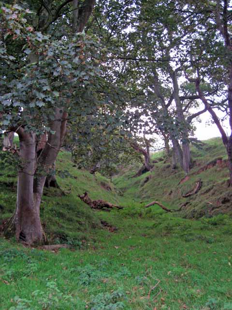
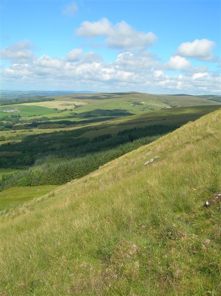
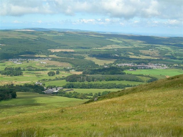
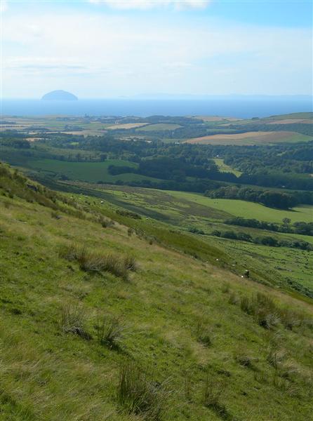
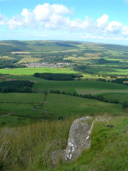
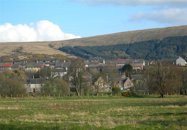
Dailly Plantation is a picturesque woodland located in Ayrshire, Scotland. With its lush greenery and towering trees, it provides a serene and tranquil atmosphere for visitors to escape the hustle and bustle of everyday life. The plantation covers an area of approximately 200 acres, making it a haven for nature lovers and outdoor enthusiasts.

The wood is predominantly composed of native tree species such as oak, beech, and birch, creating a diverse and vibrant ecosystem. The mature trees provide a canopy that filters the sunlight, casting dappled shadows on the forest floor. This creates an enchanting ambiance and allows for the growth of a variety of understory plants and wildflowers.

Dailly Plantation is crisscrossed by a network of well-maintained paths and trails, making it easily accessible for walkers, joggers, and cyclists. These paths lead visitors through the heart of the woodland, offering glimpses of wildlife such as deer, squirrels, and a wide array of bird species.

The plantation is also home to a small pond, which serves as a watering hole for the local wildlife. It is a popular spot for birdwatchers, who can observe waterfowl and other water-loving birds nesting and feeding in the area.

Dailly Plantation is managed and maintained by the local council, ensuring that it remains a pristine and natural environment for all to enjoy. It is a place where visitors can immerse themselves in the beauty of nature, taking in the sights, sounds, and scents of the woodland.

If you have any feedback on the listing, please let us know in the comments section below.

Dailly Plantation Images

Images are sourced within 2km of 55.272613/-4.7297004 or Grid Reference NS2601. Thanks to Geograph Open Source API. All images are credited.

Small wooded valley near Dailly
Hadyard Hill (Summit) 360 Panorama This photo was taken back in Feb.2004 before the Windfarm was constructed in the same area, Centre of picture is due North, Penwhapple Reservoir can be seen to the left of the picture.
Hadyard Hill (Summit) 360 Panorama
This photo was taken back in Feb.2004 before the Windfarm was constructed in the same area, Centre of picture is due North, Penwhapple Reservoir can be seen to the left of the picture.
View From Maxwellston Hill Looking across the lower Girvan Valley, towards the Firth of Clyde and Arran, on a fine July afternoon.
View From Maxwellston Hill
Looking across the lower Girvan Valley, towards the Firth of Clyde and Arran, on a fine July afternoon.
The Start of the Southern Uplands Looking along the hilltop between Maxwellston and Hadyard Hills. These hills mark the edge of Central Lowlands and the Southern Uplands of Scotland. The Southern Uplands Boundary Fault lies roughly between Girvan and Dunbar. For an updated view, see <a href="https://www.geograph.org.uk/photo/6545968">NX2699 : Heading for Hadyard Hill</a>
The Start of the Southern Uplands
Looking along the hilltop between Maxwellston and Hadyard Hills. These hills mark the edge of Central Lowlands and the Southern Uplands of Scotland. The Southern Uplands Boundary Fault lies roughly between Girvan and Dunbar. For an updated view, see NX2699 : Heading for Hadyard Hill
The Edge of Hadyard Hill Hadyard Hill marks the edge of the Central Lowlands and the Southern Uplands of Scotland along the lower section of the Girvan Valley.  The Southern Uplands Boundary Fault lies roughly between Girvan and Dunbar.  This view shows the upper part of the hill edge, above the very steep lower part close to the valley.
The Edge of Hadyard Hill
Hadyard Hill marks the edge of the Central Lowlands and the Southern Uplands of Scotland along the lower section of the Girvan Valley. The Southern Uplands Boundary Fault lies roughly between Girvan and Dunbar. This view shows the upper part of the hill edge, above the very steep lower part close to the valley.
Girvan Valley View Looking north across the Girvan Valley from the saddle between Maxwellston and Hadyard Hills.  In the background, from the left - Brunstane Castle Golf Course, Maxwellston Farm, and the village of Dailly. For an updated view, see <a href="https://www.geograph.org.uk/photo/6545963">NX2699 : The Girvan Valley viewed again</a>
Girvan Valley View
Looking north across the Girvan Valley from the saddle between Maxwellston and Hadyard Hills. In the background, from the left - Brunstane Castle Golf Course, Maxwellston Farm, and the village of Dailly. For an updated view, see NX2699 : The Girvan Valley viewed again
Hadyard Hill Slope The steep slope of Hadyard Hill, overlooking the Girvan Valley.  In the background - the Firth of Clyde, Ailsa Craig and Arran. For an updated view taken from the shoulder of the hill, see <a href="https://www.geograph.org.uk/photo/6545979">NX2799 : Hadyard Hill view</a>
Hadyard Hill Slope
The steep slope of Hadyard Hill, overlooking the Girvan Valley. In the background - the Firth of Clyde, Ailsa Craig and Arran. For an updated view taken from the shoulder of the hill, see NX2799 : Hadyard Hill view
From Hadyard Hill Looking down towards Dailly and the Girvan Valley.
From Hadyard Hill
Looking down towards Dailly and the Girvan Valley.
Field entrances on both sides of the road To the left and right, almost opposite each other are the field entrances.
Field entrances on both sides of the road
To the left and right, almost opposite each other are the field entrances.
The Girvan Valley viewed again The Girvan Valley viewed from Maxwellston Hill on the edge of the Southern Uplands. From the left, there’s the Holiday Village, then Maxwellston Farm tucked away at the foot of the steep slope and then the village of Dailly.
The Girvan Valley viewed again
The Girvan Valley viewed from Maxwellston Hill on the edge of the Southern Uplands. From the left, there’s the Holiday Village, then Maxwellston Farm tucked away at the foot of the steep slope and then the village of Dailly.
Heading for Hadyard Hill Heading for Hadyard Hill on the edge of the Southern Uplands, showing a marked difference in landscape from the farmland of the Central Lowlands.
Heading for Hadyard Hill
Heading for Hadyard Hill on the edge of the Southern Uplands, showing a marked difference in landscape from the farmland of the Central Lowlands.
Towards the Firth of Clyde from Maxwellston Hill Looking towards the Firth of Clyde from the edge of Maxwellston Hill showing Grangestone Industrial Estate and, on the far right, Killochan Castle. Ailsa Craig and the island of Arran provide an attractive background.
Towards the Firth of Clyde from Maxwellston Hill
Looking towards the Firth of Clyde from the edge of Maxwellston Hill showing Grangestone Industrial Estate and, on the far right, Killochan Castle. Ailsa Craig and the island of Arran provide an attractive background.
From the slopes of Maxwellston Hill Looking towards the Firth of Clyde from the edge of Maxwellston Hill. From the left, it’s some of the turbines of the Hadyard Hill wind farm, then a more distant Brae Hill with its comms masts, then the northern edge of Girvan, followed by Grangestone Industrial Estate and Killochan Castle on the far right. Ailsa Craig  provides an attractive background.
From the slopes of Maxwellston Hill
Looking towards the Firth of Clyde from the edge of Maxwellston Hill. From the left, it’s some of the turbines of the Hadyard Hill wind farm, then a more distant Brae Hill with its comms masts, then the northern edge of Girvan, followed by Grangestone Industrial Estate and Killochan Castle on the far right. Ailsa Craig provides an attractive background.
Hadyard Hill view Looking towards the Firth of Clyde from Hadyard Hill on the edge of the Southern Uplands. This viewpoint is available from the shoulder of the hills, not from the footpath which runs at a higher level. This is where the valley opens out to show the arable fields that take advantage of Girvan’s good sunshine record in an otherwise wet part of Carrick.
Hadyard Hill view
Looking towards the Firth of Clyde from Hadyard Hill on the edge of the Southern Uplands. This viewpoint is available from the shoulder of the hills, not from the footpath which runs at a higher level. This is where the valley opens out to show the arable fields that take advantage of Girvan’s good sunshine record in an otherwise wet part of Carrick.
Towards Dailly Looking from Hadyard Hill on the edge of the Southern Uplands towards the village of Dailly, in the Central Lowlands. Hadyard Hill makes a prominent feature, rising sharply from the valley. The Southern Uplands Boundary Fault lies roughly between Girvan and Dunbar.
Towards Dailly
Looking from Hadyard Hill on the edge of the Southern Uplands towards the village of Dailly, in the Central Lowlands. Hadyard Hill makes a prominent feature, rising sharply from the valley. The Southern Uplands Boundary Fault lies roughly between Girvan and Dunbar.
Dailly Parish Church and War Memorial
Dalquharran Castle
Dalquharran Castle
Dailly bridge This remarkable bridge in the village of Dailly in south Ayrshire spans the Water of Girvan, and lies at the very heart of the remarkable Dailly Community Paths and Sculptures Project. The bridge was opened in April, 2002 and reconnects the village to the north side of the river for the first time in 50 years. The delicate tracery of the balustrades and arches perfectly complements the woodland setting. <span class="nowrap"><a title="http://www.rsa.org.uk/afanew/snapshots/Region/Details.asp?SnapShotID=1" rel="nofollow ugc noopener" href="http://www.rsa.org.uk/afanew/snapshots/Region/Details.asp?SnapShotID=1">Link</a><img style="margin-left:2px;" alt="External link" title="External link - shift click to open in new window" src="https://s1.geograph.org.uk/img/external.png" width="10" height="10"/></span> <span class="nowrap"><a title="http://www.lunemillenniumbridge.info/Dailly.html" rel="nofollow ugc noopener" href="http://www.lunemillenniumbridge.info/Dailly.html">Link</a><img style="margin-left:2px;" alt="External link" title="External link - shift click to open in new window" src="https://s1.geograph.org.uk/img/external.png" width="10" height="10"/></span>
Dailly bridge
This remarkable bridge in the village of Dailly in south Ayrshire spans the Water of Girvan, and lies at the very heart of the remarkable Dailly Community Paths and Sculptures Project. The bridge was opened in April, 2002 and reconnects the village to the north side of the river for the first time in 50 years. The delicate tracery of the balustrades and arches perfectly complements the woodland setting. LinkExternal link LinkExternal link
Show me another place!

Dailly Plantation is located at Grid Ref: NS2601 (Lat: 55.272613, Lng: -4.7297004)

Unitary Authority: South Ayrshire

Police Authority: Ayrshire

What 3 Words

///fixated.marinated.purse. Near Girvan, South Ayrshire

Related Wikis

Dailly

Dailly (Scottish Gaelic: Dail Mhaol Chiarain) is a village in South Ayrshire, Scotland. It is located on the Water of Girvan, five miles (eight kilometres...

Dalquharran Castle

Dalquharran Castle is a category A listed building in South Ayrshire, Scotland, designed by Robert Adam and completed around 1790. The first recorded lord...

Dailly railway station

Dailly railway station served the village of Dailly, South Ayrshire, Scotland, from 1860 to 1965 on the Maybole and Girvan Railway. == History == The station...

South Ayrshire

South Ayrshire (Scots: Sooth Ayrshire; Scottish Gaelic: Siorrachd Àir a Deas, pronounced [ˈʃirˠəxk aːɾʲ ə ˈtʲes̪]) is one of thirty-two council areas of...

Nearby Amenities

Located within 500m of 55.272613,-4.7297004
Pub
Mid Pub
Designation: Public House
Lat/Long: 55.2765819/-4.7284101
Atm
Brand: The Co-operative Bank
Brand Wikidata: Q3520318
Fee: no
Operator: The Co-operative Bank
Operator Wikidata: Q3520318
Lat/Long: 55.2760452/-4.7291
Post Box
Lat/Long: 55.2755994/-4.7285212
Power: pole
Lat/Long: 55.2692281/-4.7338524
Power: pole
Lat/Long: 55.2694632/-4.7328237
Power: pole
Lat/Long: 55.2697085/-4.7317771
Power: pole
Lat/Long: 55.2699538/-4.7307244
Power: pole
Lat/Long: 55.2702639/-4.7293608
Power: pole
Lat/Long: 55.2718483/-4.7226144
Power: pole
Lat/Long: 55.2715825/-4.7237448
Power: pole
Lat/Long: 55.2712793/-4.7250366
Power: pole
Lat/Long: 55.2710135/-4.7261311
Power: pole
Lat/Long: 55.2707852/-4.7271479
Power: pole
Lat/Long: 55.2705671/-4.728057
Carrah Wood
Lat/Long: 55.2694929/-4.7298161
Power: pole
Lat/Long: 55.2716741/-4.7265289
Power: pole
Lat/Long: 55.2723116/-4.726883
Give Way
Direction: backward
Lat/Long: 55.2739731/-4.7261909
Generator Method: photovoltaic
Generator Output Electricity: yes
Generator Source: solar
Generator Type: solar_photovoltaic_panel
Power: generator
Lat/Long: 55.2754906/-4.7281673
Generator Method: photovoltaic
Generator Output Electricity: yes
Generator Source: solar
Generator Type: solar_photovoltaic_panel
Power: generator
Lat/Long: 55.2756443/-4.7240466
The data included in this document is from www.openstreetmap.org. The data is made available under ODbL.

Have you been to Dailly Plantation?

Leave your review of Dailly Plantation below (or comments, questions and feedback).