Lagganhooly Wood

Wood, Forest in Ayrshire

Scotland

Lagganhooly Wood

Old Arch On the way into Culzean Country Park. Taken from the new road bridge over this burn at the park entrance.
Old Arch Credit: wfmillar

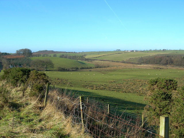
Lagganhooly Wood is a picturesque woodland located in Ayrshire, Scotland. This natural gem covers an expansive area of approximately 100 acres, making it an ideal destination for nature enthusiasts and outdoor lovers.

The wood is characterized by its diverse range of trees, including oak, beech, and birch, which create a stunning canopy of greenery. These trees provide shelter and a habitat for a variety of wildlife, such as red squirrels, roe deer, and numerous species of birds.

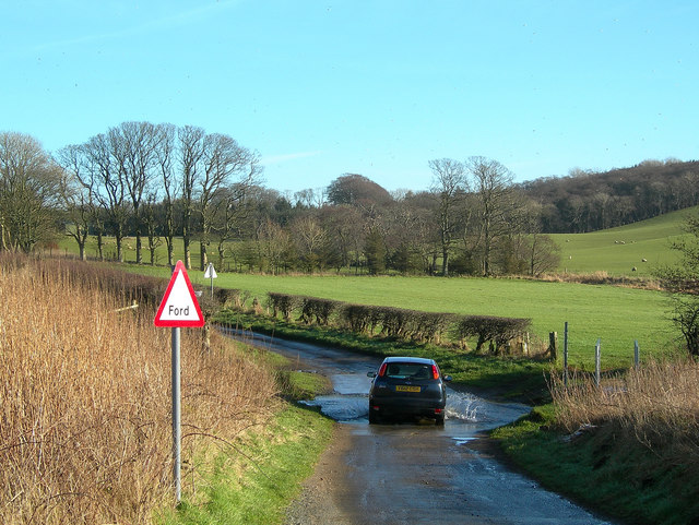
Lagganhooly Wood offers a network of well-maintained trails, allowing visitors to explore the beauty of the woodland at their own pace. These paths wind through the peaceful forest, offering glimpses of babbling brooks and enchanting clearings. The forest floor is covered in a lush carpet of ferns and wildflowers, adding to the area's natural charm.

The wood is also known for its historical significance. It is believed to have been part of the ancient Caledonian Forest, which once covered a large area of Scotland. The forest has witnessed centuries of human activity, with evidence of former settlements and agricultural practices still visible today.

Visitors to Lagganhooly Wood can enjoy a range of activities, including walking, birdwatching, and photography. The tranquil atmosphere and breathtaking scenery make it an ideal spot for relaxation and contemplation.

Overall, Lagganhooly Wood is a stunning natural treasure in Ayrshire, offering visitors a chance to immerse themselves in the beauty of Scotland's woodlands and appreciate the rich biodiversity that thrives within its boundaries.

If you have any feedback on the listing, please let us know in the comments section below.

Lagganhooly Wood Images

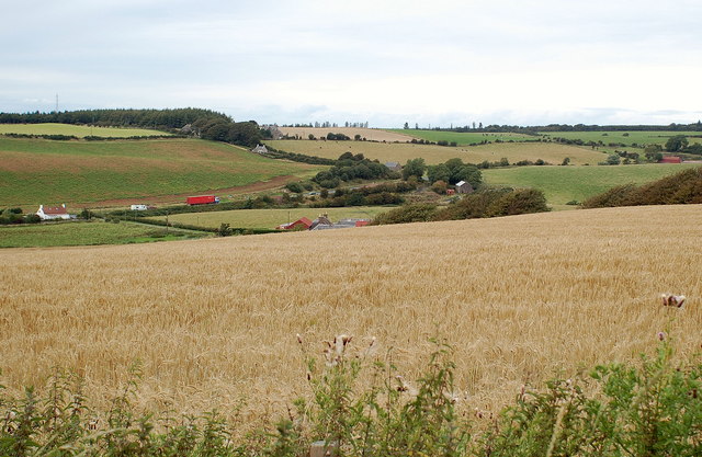
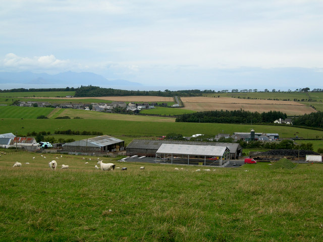
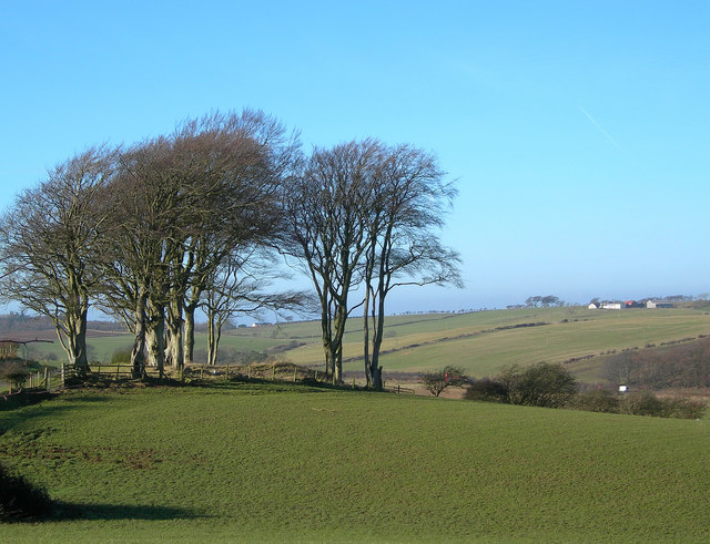
Images are sourced within 2km of 55.336179/-4.7754233 or Grid Reference NS2408. Thanks to Geograph Open Source API. All images are credited.

Old Arch On the way into Culzean Country Park. Taken from the new road bridge over this burn at the park entrance.
Old Arch
On the way into Culzean Country Park. Taken from the new road bridge over this burn at the park entrance.
Welcome To Culzean Culzean, the home of the Kennedy family, was given to the National Trust For Scotland in 1945.  The grounds became Scotland's first Country Park in 1969. (Source:  NTS information leaflet).
Welcome To Culzean
Culzean, the home of the Kennedy family, was given to the National Trust For Scotland in 1945. The grounds became Scotland's first Country Park in 1969. (Source: NTS information leaflet).
Crossing Glenside Burn The entrance road for Culzean Country Park crosses Glenside Burn on this bridge, which is on the very edge of the square.
Crossing Glenside Burn
The entrance road for Culzean Country Park crosses Glenside Burn on this bridge, which is on the very edge of the square.
Going Into Culzean Country Park This footpath runs alongside the access road for traffic leaving the park.  It was looking lovely at the end of March, with lots of daffodils in bloom.
Going Into Culzean Country Park
This footpath runs alongside the access road for traffic leaving the park. It was looking lovely at the end of March, with lots of daffodils in bloom.
The Kennedy Family Graveyard At Culzean The inscription on the large cross tells that it is in the memory of Archibald Kennedy, 2nd Marquess of Ailsa, K.T. and Lord Lieutenant of Ayrshire.  He died in 1870.  He was also the 13th Earl of Cassillis.
The Kennedy Family Graveyard At Culzean
The inscription on the large cross tells that it is in the memory of Archibald Kennedy, 2nd Marquess of Ailsa, K.T. and Lord Lieutenant of Ayrshire. He died in 1870. He was also the 13th Earl of Cassillis.
Culzean Castle - camellia house The camellia house at Culzean Castle is a gothic conservatory originally designed as an orangery by architect James Donaldson in 1818. A furnace at the back of the building supplied under-floor heating. In 1995, the National Trust for Scotland restored the camellia house.
Culzean Castle - camellia house
The camellia house at Culzean Castle is a gothic conservatory originally designed as an orangery by architect James Donaldson in 1818. A furnace at the back of the building supplied under-floor heating. In 1995, the National Trust for Scotland restored the camellia house.
Culzean Castle Walled Garden
Within the walled gardens.
Just one of the stunning specimens in the walled garden
Souter Johnnie's Cottage The figures in the garden of the cottage commemorate Tam o'Shanter and his drinking companion, Souter Johnnie, hi 'ancient, trusty, drouthy (thirsty) crony.
Souter Johnnie's Cottage
The figures in the garden of the cottage commemorate Tam o'Shanter and his drinking companion, Souter Johnnie, hi 'ancient, trusty, drouthy (thirsty) crony.
Herbaceous border, Culzean walled garden
Minnybae Farm Looking towards Minnybae and A77
Minnybae Farm
Looking towards Minnybae and A77
Broadshean Looking NNW over Broadshean Farm towards Kirkoswald, with Arran in the distance
Broadshean
Looking NNW over Broadshean Farm towards Kirkoswald, with Arran in the distance
Winter View Looking through a stand of beech trees on a fine February day.  Birniehill Farm is on the skyline, on the right.
Winter View
Looking through a stand of beech trees on a fine February day. Birniehill Farm is on the skyline, on the right.
Farmland View Looking down the fields towards marshy ground.  Birniehill Farm is visible on the skyline.
Farmland View
Looking down the fields towards marshy ground. Birniehill Farm is visible on the skyline.
Crossing the Ford
Crossing the Ford
Glenluie Looking across boggy ground towards Glenluie Farm, visible behind the trees.
Glenluie
Looking across boggy ground towards Glenluie Farm, visible behind the trees.
Show me another place!

Lagganhooly Wood is located at Grid Ref: NS2408 (Lat: 55.336179, Lng: -4.7754233)

Unitary Authority: South Ayrshire

Police Authority: Ayrshire

What 3 Words

///device.unpainted.richer. Near Maybole, South Ayrshire

Nearby Locations

Lagganhooly Wood

Related Wikis

Kirkoswald Parish Church

Kirkoswald Parish Church is located in the small village of Kirkoswald (on the A77 road), South Ayrshire, Scotland. It is a parish church in the Church...

Kirkoswald, South Ayrshire

Kirkoswald (Scots: Kirkossald) is a village and parish in the Carrick district of Ayrshire, Scotland, 1+3⁄4 miles (3 kilometres) from the coast and four...

Thomaston Castle

Thomaston Castle is a medieval castle located west of Maybole, South Ayrshire, Scotland. It looks much as it did hundreds of years ago. Little has changed...

Glenside railway station

Glenside railway station was a railway station near Culzean Castle, South Ayrshire, Scotland. The station was part of the Maidens and Dunure Light Railway...

Nearby Amenities

Located within 500m of 55.336179,-4.7754233
Building: yes
Lat/Long: 55.3345615/-4.7765585
Power: pole
Lat/Long: 55.3349818/-4.7824026
Power: pole
Lat/Long: 55.3343135/-4.7818396
Power: pole
Lat/Long: 55.3334973/-4.7810161
Power: pole
Lat/Long: 55.3327741/-4.7803214
Power: pole
Lat/Long: 55.331935/-4.776518
Power: pole
Lat/Long: 55.3322569/-4.7753271
Power: pole
Lat/Long: 55.3329564/-4.7701089
Power: pole
Lat/Long: 55.3325621/-4.7741872
Power: pole
Lat/Long: 55.332858/-4.7730875
Power: pole
Lat/Long: 55.333154/-4.7719824
Power: pole
Lat/Long: 55.3338741/-4.781228
Power: pole
Lat/Long: 55.334341/-4.7790286
Power: pole
Lat/Long: 55.3345439/-4.7780013
Power: pole
Lat/Long: 55.3347574/-4.7769526
Power: pole
Lat/Long: 55.3357079/-4.7722855
Power: pole
Lat/Long: 55.3359413/-4.7711214
Power: pole
Lat/Long: 55.3361854/-4.7699037
Power: pole
Lat/Long: 55.3364432/-4.7686619
Power: pole
Lat/Long: 55.333987/-4.7688657
Power: pole
Lat/Long: 55.3337155/-4.7698715
Power: pole
Lat/Long: 55.3334439/-4.7709015
Power: pole
Lat/Long: 55.3341043/-4.7801434
Power: pole
Lat/Long: 55.3350087/-4.7757185
Power: pole
Lat/Long: 55.3352346/-4.7746095
Power: pole
Lat/Long: 55.3354667/-4.7734698
The data included in this document is from www.openstreetmap.org. The data is made available under ODbL.

Have you been to Lagganhooly Wood?

Leave your review of Lagganhooly Wood below (or comments, questions and feedback).