Coille Ghormaig

Wood, Forest in Inverness-shire

Scotland

Coille Ghormaig

Ceannacroc Bridge
Ceannacroc Bridge Credit: Steven Brown

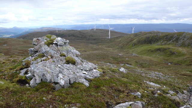
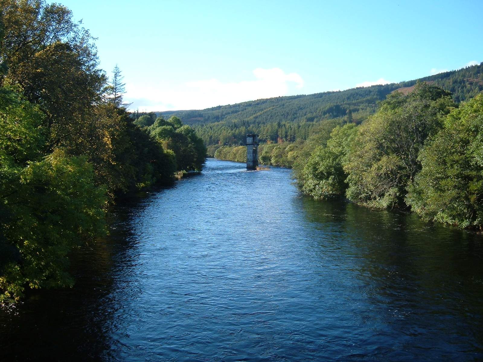
Coille Ghormaig, located in Inverness-shire, Scotland, is a picturesque woodland area known for its natural beauty and diverse wildlife. Spanning approximately 200 acres, this enchanting forest is a haven for nature enthusiasts and outdoor adventurers.

The forest is characterized by its dense canopy of trees, predominantly consisting of native Scottish species such as Scots pine, birch, and oak. These towering trees create a serene and tranquil atmosphere, providing a perfect escape from the hustle and bustle of city life.

Coille Ghormaig offers a range of walking trails that wind through the forest, allowing visitors to explore its hidden wonders. These trails cater to all levels of fitness and provide opportunities to witness the stunning flora and fauna that call this woodland home. From vibrant wildflowers to elusive woodland creatures like red squirrels and deer, there is always something to discover.

The forest is also renowned for its rich history and cultural significance. Ruins of ancient settlements and burial sites dot the landscape, offering a glimpse into the region's past. Additionally, the forest has played a crucial role in local folklore and legends, adding an element of mystique to the area.

Coille Ghormaig is not only a remarkable natural treasure but also a vital ecosystem that supports a wide range of wildlife. Conservation efforts are in place to protect the forest and ensure its preservation for future generations to enjoy.

Whether you seek solitude in nature, a chance to immerse yourself in history, or a close encounter with wildlife, Coille Ghormaig in Inverness-shire is a destination that promises to captivate and inspire all who visit.

If you have any feedback on the listing, please let us know in the comments section below.

Coille Ghormaig Images

Images are sourced within 2km of 57.152334/-4.9239655 or Grid Reference NH2310. Thanks to Geograph Open Source API. All images are credited.

Ceannacroc Bridge
Ceannacroc Bridge
Road over Ceannacroc Bridge This was the route of an old military road.
Road over Ceannacroc Bridge
This was the route of an old military road.
A887 in Glen Moriston
Touring Caravan on the A887 in Glen Moriston The A887 is essentially a link road through Glen Moriston from the A82 to the A87 for traffic travelling between Inverness and Kyle of Lochalsh and the Isle of Skye. Although a trunk route, traffic volumes are relatively low.

The A887 runs for 14½ miles from a turning off the A82 at the small village of Invermoriston near the shore of Loch Ness to the A87 junction at Bunloyne. Traffic for Skye continues along the A87.
Touring Caravan on the A887 in Glen Moriston
The A887 is essentially a link road through Glen Moriston from the A82 to the A87 for traffic travelling between Inverness and Kyle of Lochalsh and the Isle of Skye. Although a trunk route, traffic volumes are relatively low. The A887 runs for 14½ miles from a turning off the A82 at the small village of Invermoriston near the shore of Loch Ness to the A87 junction at Bunloyne. Traffic for Skye continues along the A87.
Layby on the A887 near MacKenzie's Cairn The A887 is essentially a link road through Glen Moriston from the A82 to the A87 for traffic travelling between Inverness and Kyle of Lochalsh and the Isle of Skye. Although a trunk route, traffic volumes are relatively low.

The A887 runs for 14½ miles from a turning off the A82 at the small village of Invermoriston near the shore of Loch Ness to the A87 junction at Bunloyne. Traffic for Skye continues along the A87.
Layby on the A887 near MacKenzie's Cairn
The A887 is essentially a link road through Glen Moriston from the A82 to the A87 for traffic travelling between Inverness and Kyle of Lochalsh and the Isle of Skye. Although a trunk route, traffic volumes are relatively low. The A887 runs for 14½ miles from a turning off the A82 at the small village of Invermoriston near the shore of Loch Ness to the A87 junction at Bunloyne. Traffic for Skye continues along the A87.
A887 Bridge across River Moriston, Ceannacroc The A887 is essentially a link road through Glen Moriston from the A82 to the A87 for traffic travelling between Inverness and Kyle of Lochalsh and the Isle of Skye. Although a trunk route, traffic volumes are relatively low.

The A887 runs for 14½ miles from a turning off the A82 at the small village of Invermoriston near the shore of Loch Ness to the A87 junction at Bunloyne. Traffic for Skye continues along the A87.
A887 Bridge across River Moriston, Ceannacroc
The A887 is essentially a link road through Glen Moriston from the A82 to the A87 for traffic travelling between Inverness and Kyle of Lochalsh and the Isle of Skye. Although a trunk route, traffic volumes are relatively low. The A887 runs for 14½ miles from a turning off the A82 at the small village of Invermoriston near the shore of Loch Ness to the A87 junction at Bunloyne. Traffic for Skye continues along the A87.
A887 Westbound near Bun Loyn The A887 is essentially a link road through Glen Moriston from the A82 to the A87 for traffic travelling between Inverness and Kyle of Lochalsh and the Isle of Skye. Although a trunk route, traffic volumes are relatively low.

The A887 runs for 14½ miles from a turning off the A82 at the small village of Invermoriston near the shore of Loch Ness to the A87 junction at Bunloyne. Traffic for Skye continues along the A87.
A887 Westbound near Bun Loyn
The A887 is essentially a link road through Glen Moriston from the A82 to the A87 for traffic travelling between Inverness and Kyle of Lochalsh and the Isle of Skye. Although a trunk route, traffic volumes are relatively low. The A887 runs for 14½ miles from a turning off the A82 at the small village of Invermoriston near the shore of Loch Ness to the A87 junction at Bunloyne. Traffic for Skye continues along the A87.
A887 at Mackenzie’s Cairn
New Forestry track by old Bridge over the Allt an Eoin
River Moriston passing Roderck Mackenzie's Grave
Estate and forest track at Coille Ghormaig
Estate and forest track below Beinn an Eoin
Ceannacroc Bridge from the A887
Electricity sub station
Roderick MacKenzie's Grave Mackenzie's Grave is associated with Roderick Mackenzie, a fugitive from the battle of Glenshiel, 1719, who, pretending to be Prince Charles, was executed and his head taken to London.
Roderick MacKenzie's Grave
Mackenzie's Grave is associated with Roderick Mackenzie, a fugitive from the battle of Glenshiel, 1719, who, pretending to be Prince Charles, was executed and his head taken to London.
Mackenzie's Cairn The memorial cairn to the Jacobite officer killed in 1746 - his grave lies down the embankment on the N side of the road, accessible by a short path.
Mackenzie's Cairn
The memorial cairn to the Jacobite officer killed in 1746 - his grave lies down the embankment on the N side of the road, accessible by a short path.
Mackenzie's grave A closer view of the grave near the River Moriston shown in <a href="https://www.geograph.org.uk/photo/4331042">NH2311 : Roderick MacKenzie's Grave</a>, marked RM for Roderick Mackenzie and with a faded tartan ribbon.
Mackenzie's grave
A closer view of the grave near the River Moriston shown in NH2311 : Roderick MacKenzie's Grave, marked RM for Roderick Mackenzie and with a faded tartan ribbon.
Show me another place!

Coille Ghormaig is located at Grid Ref: NH2310 (Lat: 57.152334, Lng: -4.9239655)

Unitary Authority: Highland

Police Authority: Highlands and Islands

What 3 Words

///than.duties.conjured. Near Cannich, Highland

Nearby Locations

Coille Ghormaig

Related Wikis

Meall Dubh

Meall Dubh (789 m) is a mountain in the Northwest Highlands, Scotland. Lying near the village of Fort Augustus, it is the highest peak between the valleys...

Tomchrasky

Tomchrasky is a village in Glen Moriston, in Inverness-shire, Scottish Highlands and is in the Scottish council area of Highland. The village lies on the...

River Oich

The River Oich is a short river that flows through the Great Glen in Scotland. It carries water from Loch Oich (to the SW) to Loch Ness (to the NE) and...

Achlain

Achlain is a house in Glenmoriston in the Highland council area of Scotland. It is about 15 km west of Invermoriston, next to the A887 road and the River...

Nearby Amenities

Located within 500m of 57.152334,-4.9239655
Power: tower
Lat/Long: 57.1555368/-4.9279758
Power: tower
Lat/Long: 57.1561793/-4.9230024
Power: pole
Lat/Long: 57.1549295/-4.9300409
Power: pole
Lat/Long: 57.1565128/-4.9219473
Power: pole
Lat/Long: 57.1564958/-4.9221105
Power: pole
Lat/Long: 57.1561385/-4.9248548
Power: pole
Lat/Long: 57.1559607/-4.9262232
Power: pole
Lat/Long: 57.1558064/-4.9276095
Power: pole
Lat/Long: 57.1557244/-4.9286052
The data included in this document is from www.openstreetmap.org. The data is made available under ODbL.

Have you been to Coille Ghormaig?

Leave your review of Coille Ghormaig below (or comments, questions and feedback).