South Fernicarry Wood

Wood, Forest in Dunbartonshire

Scotland

South Fernicarry Wood

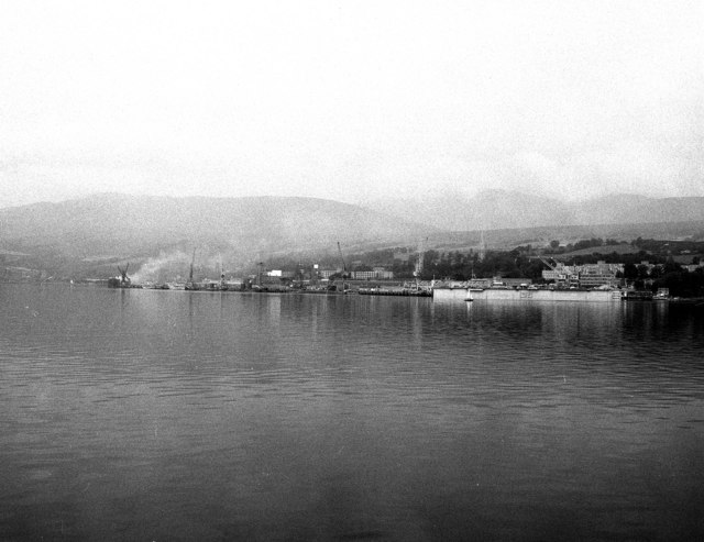
Greenfield Way, Garelochhead Viewed from a north bound train on the West Highland Line.
Greenfield Way, Garelochhead Credit: Thomas Nugent

South Fernicarry Wood is a dense forest located in Dunbartonshire, Scotland. Covering a vast area, the wood is known for its stunning natural beauty and diverse ecosystem. The forest is situated in a rural setting, surrounded by rolling hills and picturesque landscapes.

The wood is predominantly composed of native tree species, including oak, birch, and Scots pine. These trees provide a rich habitat for a variety of wildlife, such as red squirrels, roe deer, and a wide array of bird species. The forest also boasts a vibrant undergrowth of ferns, wildflowers, and mosses, adding to its enchanting appeal.

The wood is crisscrossed with numerous walking trails, allowing visitors to explore its beauty at their own pace. These paths meander through the forest, leading to hidden clearings, babbling brooks, and stunning viewpoints. This makes South Fernicarry Wood a popular destination for hikers, nature enthusiasts, and photographers.

The wood is managed by local conservation authorities, who ensure its preservation and protection. Efforts have been made to maintain the natural balance of the ecosystem and promote biodiversity. This includes the creation of bird nesting boxes, monitoring of animal populations, and controlled logging practices.

South Fernicarry Wood is not only a haven for flora and fauna but also serves as a recreational spot for the local community. It offers a peaceful retreat from the hustle and bustle of city life, where visitors can immerse themselves in the tranquility of nature.

If you have any feedback on the listing, please let us know in the comments section below.

South Fernicarry Wood Images

Images are sourced within 2km of 56.07068/-4.8423836 or Grid Reference NS2390. Thanks to Geograph Open Source API. All images are credited.

Greenfield Way, Garelochhead Viewed from a north bound train on the West Highland Line.
Greenfield Way, Garelochhead
Viewed from a north bound train on the West Highland Line.
A817 to Balloch From roundabout on A814 at Garelochhead
A817 to Balloch
From roundabout on A814 at Garelochhead
Foreshore and grounded fishing boat at Garelochhead
Garelochhead Railway Station Station opened in 1894 is of a standard West Highland island-platform station design. The station is unmanned but still in use
Garelochhead Railway Station
Station opened in 1894 is of a standard West Highland island-platform station design. The station is unmanned but still in use
Subway Entrance for Garelochhead station Typical of many of the Stations on the West Highland Line entrance to the station is through a subway to stairs which allows passengers up onto the island platform.
Subway Entrance for Garelochhead station
Typical of many of the Stations on the West Highland Line entrance to the station is through a subway to stairs which allows passengers up onto the island platform.
A814, Garelochhead The A814 runs for 40 miles from the A8 in central Glasgow, less than half a mile from Glasgow Cross, to Arrochar. The section in Glasgow is a high-speed inner-city dual carriageway, part of which is designated “The Clydeside Expressway” which was opened in 1973. Further west, the A814 continues as a single carriageway road passing through the village of Old Kilparick before bypassing the centre of Dumbarton. After leaving Dumbarton, it passes alongside the Clyde, at Helensburgh, and the Gare Loch.
A814, Garelochhead
The A814 runs for 40 miles from the A8 in central Glasgow, less than half a mile from Glasgow Cross, to Arrochar. The section in Glasgow is a high-speed inner-city dual carriageway, part of which is designated “The Clydeside Expressway” which was opened in 1973. Further west, the A814 continues as a single carriageway road passing through the village of Old Kilparick before bypassing the centre of Dumbarton. After leaving Dumbarton, it passes alongside the Clyde, at Helensburgh, and the Gare Loch.
A814 Garelochhead The A814 runs for 40 miles from the A8 in central Glasgow, less than half a mile from Glasgow Cross, to Arrochar. The section in Glasgow is a high-speed inner-city dual carriageway, part of which is designated “The Clydeside Expressway” which was opened in 1973. Further west, the A814 continues as a single carriageway road passing through the village of Old Kilparick before bypassing the centre of Dumbarton. After leaving Dumbarton, it passes alongside the Clyde, at Helensburgh, and the Gare Loch.
A814 Garelochhead
The A814 runs for 40 miles from the A8 in central Glasgow, less than half a mile from Glasgow Cross, to Arrochar. The section in Glasgow is a high-speed inner-city dual carriageway, part of which is designated “The Clydeside Expressway” which was opened in 1973. Further west, the A814 continues as a single carriageway road passing through the village of Old Kilparick before bypassing the centre of Dumbarton. After leaving Dumbarton, it passes alongside the Clyde, at Helensburgh, and the Gare Loch.
A814/A817 Junction The traffic island at the junction of the A814 and A817 above Faslane.
A814/A817 Junction
The traffic island at the junction of the A814 and A817 above Faslane.
View Towards Gare Loch A view from the parking area above the northern end of Gare Loch, a 10Km-long sea loch which opens into the Firth of Clyde. 

Much of the eastern shore at this end of the loch is dominated by the Faslane Naval Base <a href="https://www.geograph.org.uk/gridref/NS2589">NS2589</a>,  home of the UK's Trident nuclear submarines. The loch was the site of a major naval base during World War II and was used to store decommissioned naval vessels in the 1950s. A shipbreakers yard ceased trading in the 1980s and has been absorbed into the naval base (<span class="nowrap"><a title="http://en.wikipedia.org/wiki/Gare_Loch" rel="nofollow ugc noopener" href="http://en.wikipedia.org/wiki/Gare_Loch">Link</a><img style="margin-left:2px;" alt="External link" title="External link - shift click to open in new window" src="https://s1.geograph.org.uk/img/external.png" width="10" height="10"/></span> Wikipedia).

On the opposite shore is the Rosneath Peninsula, a body of land separating the Gare Loch from Loch Long, another large sea loch to the west.
View Towards Gare Loch
A view from the parking area above the northern end of Gare Loch, a 10Km-long sea loch which opens into the Firth of Clyde. Much of the eastern shore at this end of the loch is dominated by the Faslane Naval Base NS2589, home of the UK's Trident nuclear submarines. The loch was the site of a major naval base during World War II and was used to store decommissioned naval vessels in the 1950s. A shipbreakers yard ceased trading in the 1980s and has been absorbed into the naval base (LinkExternal link Wikipedia). On the opposite shore is the Rosneath Peninsula, a body of land separating the Gare Loch from Loch Long, another large sea loch to the west.
South to Snow Gate roundabout This is the junction of the A814 and A817
South to Snow Gate roundabout
This is the junction of the A814 and A817
On The West Highland Line : Garelochhead Station A view back along the platform at Garelochhead from the front of the 12.20 Glasgow Queen Street to Oban and Mallaig service.
On The West Highland Line : Garelochhead Station
A view back along the platform at Garelochhead from the front of the 12.20 Glasgow Queen Street to Oban and Mallaig service.
On The West Highland Line : Fancy Wheels at Garelochhead
Garelochhead station
Garelochhead Station A quick stop on the West Highland Line.
Garelochhead Station
A quick stop on the West Highland Line.
B872 runs alongside heavily secured fencing
B872 at Garelochhead
MoD road west of Garelochead
A817 viewpoint towards Faslane and Gare Loch
Show me another place!

South Fernicarry Wood is located at Grid Ref: NS2390 (Lat: 56.07068, Lng: -4.8423836)

Unitary Authority: Argyll and Bute

Police Authority: Argyll and West Dunbartonshire

What 3 Words

///cared.acting.initiates. Near Garelochhead, Argyll & Bute

Nearby Locations

South Fernicarry Wood

Related Wikis

Garelochhead Training Area

Garelochhead Training Camp is a military training camp located near Garelochhead in Scotland. == History == The camp was originally built in 1940 during...

Garelochhead

Garelochhead (Scots: Garelochheid, Scottish Gaelic: Ceann a' Gheàrr-loch, "Headland of the Short Lake") is a small town on the Gare Loch in Argyll and...

Faslane (bay)

Faslane (Gaelic: Am Fas Leathann) on Gare Loch is the name of a bay near the village of Garelochhead, and is now the main part of HM Naval Base Clyde in...

Garelochhead railway station

Garelochhead railway station (Scottish Gaelic: Ceann a' Gheàrrloch) is a railway station serving the village of Garelochhead, on the Gare Loch, in Scotland...

Nearby Amenities

Located within 500m of 56.07068,-4.8423836
Wikidata: Q17774914
Lat/Long: 56.0720727/-4.8386042
The data included in this document is from www.openstreetmap.org. The data is made available under ODbL.

Have you been to South Fernicarry Wood?

Leave your review of South Fernicarry Wood below (or comments, questions and feedback).