Ballochniel Wood

Wood, Forest in Ayrshire

Scotland

Ballochniel Wood

Souter Johnnie's Cottage The figures in the garden of the cottage commemorate Tam o'Shanter and his drinking companion, Souter Johnnie, hi 'ancient, trusty, drouthy (thirsty) crony.
Souter Johnnie's Cottage Credit: Anne Burgess

Ballochniel Wood is a picturesque woodland located in Ayrshire, Scotland. Stretching across an area of approximately 100 acres, this forest is nestled in the heart of the countryside, just a few miles away from the town of Ayr. It is easily accessible by both car and foot, making it a popular destination for nature enthusiasts and locals alike.

The wood boasts a diverse range of tree species, including oak, beech, and pine, creating a rich tapestry of colors throughout the seasons. The forest floor is adorned with a variety of wildflowers, adding to its natural beauty. The dense foliage provides a habitat for numerous wildlife species, such as deer, squirrels, and various bird species, making it a haven for birdwatchers and animal lovers.

Visitors to Ballochniel Wood can enjoy a network of well-maintained walking trails that meander through the forest, offering stunning views and peaceful surroundings. These trails cater to different skill levels, from leisurely strolls to more challenging hikes. Along the way, there are several picnic areas and benches strategically placed, allowing visitors to rest and appreciate the tranquility of the woodland.

Ballochniel Wood also offers educational opportunities, with informative signposts providing details about the flora and fauna found within the forest. It is a great place for families, as children can learn about the natural environment while enjoying the great outdoors.

Overall, Ballochniel Wood is a hidden gem in Ayrshire, offering a serene escape from the hustle and bustle of everyday life. It is a place where visitors can immerse themselves in nature, explore walking trails, and appreciate the beauty of the Scottish countryside.

If you have any feedback on the listing, please let us know in the comments section below.

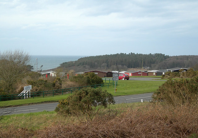
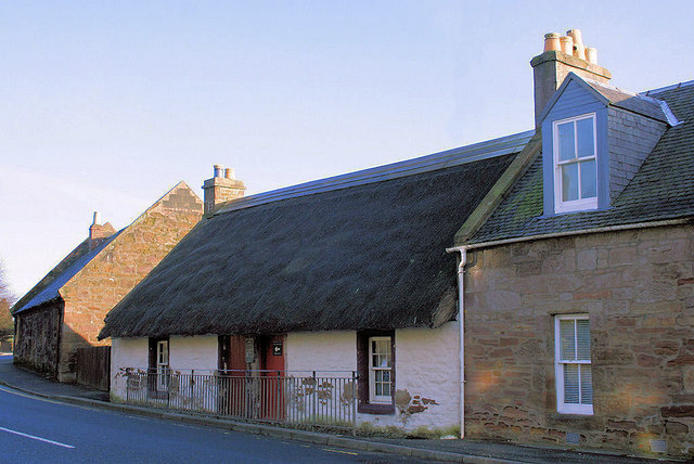
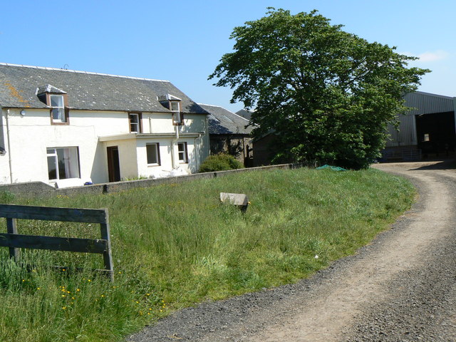
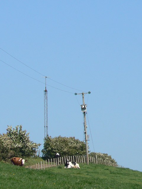
Ballochniel Wood Images

Images are sourced within 2km of 55.320721/-4.8000704 or Grid Reference NS2206. Thanks to Geograph Open Source API. All images are credited.

Souter Johnnie's Cottage The figures in the garden of the cottage commemorate Tam o'Shanter and his drinking companion, Souter Johnnie, hi 'ancient, trusty, drouthy (thirsty) crony.
Souter Johnnie's Cottage
The figures in the garden of the cottage commemorate Tam o'Shanter and his drinking companion, Souter Johnnie, hi 'ancient, trusty, drouthy (thirsty) crony.
From Glenhead Farm towards the beacon The beacon is part of the civil aircraft navigation system.
From Glenhead Farm towards the beacon
The beacon is part of the civil aircraft navigation system.
From the Glenhead Road Farmland in South Ayrshire, Arran in the far distance
From the Glenhead Road
Farmland in South Ayrshire, Arran in the far distance
Minnybae Farm Looking towards Minnybae and A77
Minnybae Farm
Looking towards Minnybae and A77
Turnberry Golf Course Looking South West across one of the three golf courses at Turnberry with the Southern Upland Boundary Fault hills in the background
Turnberry Golf Course
Looking South West across one of the three golf courses at Turnberry with the Southern Upland Boundary Fault hills in the background
Towards Barsloan Wood
Dalquat Farm
Dalquat Farm
From Low Dalquat South Ayrshire's typical rolling countryside, created from deposits laid down during the last Ice Age.
From Low Dalquat
South Ayrshire's typical rolling countryside, created from deposits laid down during the last Ice Age.
Picnic Area by the A77 The new parking and picnic area on the A77, with excellent views across the Firth of Clyde.
Picnic Area by the A77
The new parking and picnic area on the A77, with excellent views across the Firth of Clyde.
Coming Up The A77 Traffic climbing up from Turnberry on the A77.  This group included some vehicles coming from the Irish ferries on Loch Ryan.
Coming Up The A77
Traffic climbing up from Turnberry on the A77. This group included some vehicles coming from the Irish ferries on Loch Ryan.
Tradesmen's View The view across the Firth of Clyde showing the back of Turnberry Hotel, with  Ailsa Craig on the skyline.
Tradesmen's View
The view across the Firth of Clyde showing the back of Turnberry Hotel, with Ailsa Craig on the skyline.
Maidens Village A horse rider enjoys the early spring sunshine at Maidens.
Maidens Village
A horse rider enjoys the early spring sunshine at Maidens.
Maidens Maidenhead Bay, Barwhin Point and Culzean Country Park are visible in the background.
Maidens
Maidenhead Bay, Barwhin Point and Culzean Country Park are visible in the background.
Chalets at Maidens Holiday chalets at Maidens, built on a site using the old railway line.  This was called "The Tattie Line", taking its name from Ayrshire's famous early potato crop. Culzean Country Park is in the background of this photograph.
Chalets at Maidens
Holiday chalets at Maidens, built on a site using the old railway line. This was called "The Tattie Line", taking its name from Ayrshire's famous early potato crop. Culzean Country Park is in the background of this photograph.
Hedge and Field Farm machinery yard in the distance.
Hedge and Field
Farm machinery yard in the distance.
Souter Johnnies Cottage, Kirkoswald The cottage on the A77 through Kirkoswald, Ayrshire built in 1785 by John Davidson a shoemaker or souter, one of two characters depicted in the poem Tam O'Shanter written by Robert Burns.
Souter Johnnies Cottage, Kirkoswald
The cottage on the A77 through Kirkoswald, Ayrshire built in 1785 by John Davidson a shoemaker or souter, one of two characters depicted in the poem Tam O'Shanter written by Robert Burns.
Craigenton Farm
Craigenton Farm
Cattle and masts Cows below the telecom mast near Craigenton beacon.
Cattle and masts
Cows below the telecom mast near Craigenton beacon.
Show me another place!

Ballochniel Wood is located at Grid Ref: NS2206 (Lat: 55.320721, Lng: -4.8000704)

Unitary Authority: South Ayrshire

Police Authority: Ayrshire

What 3 Words

///tangling.hood.cabinet. Near Maybole, South Ayrshire

Nearby Locations

Ballochniel Wood

Related Wikis

Maidens railway station

Maidens railway station was a railway station serving the village of Maidens, South Ayrshire, Scotland. The station was part of the Maidens and Dunure...

Kirkoswald Parish Church

Kirkoswald Parish Church is located in the small village of Kirkoswald (on the A77 road), South Ayrshire, Scotland. It is a parish church in the Church...

Maidens, South Ayrshire

Maidens is a village in the Kirkoswald parish of Ayrshire, Scotland. Situated on the coast of the Firth of Clyde at the southern end of Maidenhead Bay...

Battle of Turnberry

The Battle of Turnberry was a battle fought in February 1307 during the Scottish Wars of Independence near Turnberry, Ayrshire, Scotland. King Robert I...

Nearby Amenities

Located within 500m of 55.320721,-4.8000704
Parking
Source: survey
Lat/Long: 55.3210562/-4.8012615
Power: pole
Lat/Long: 55.3205013/-4.807342
Power: pole
Lat/Long: 55.3209134/-4.8064193
Power: pole
Lat/Long: 55.3213407/-4.8054698
Power: pole
Lat/Long: 55.3217512/-4.8045257
Power: pole
Lat/Long: 55.3221617/-4.8036352
Power: pole
Lat/Long: 55.3223708/-4.8027769
Power: pole
Lat/Long: 55.3226119/-4.8018703
Power: pole
Lat/Long: 55.3229019/-4.8007411
Power: pole
Lat/Long: 55.3232269/-4.7995126
Power: pole
Lat/Long: 55.3235641/-4.7981527
Power: pole
Lat/Long: 55.3239334/-4.7967821
Power: pole
Lat/Long: 55.3242875/-4.7953686
Power: pole
Lat/Long: 55.3243227/-4.8034104
Power: pole
Lat/Long: 55.3237855/-4.8030468
Power: pole
Lat/Long: 55.3232455/-4.8027116
Power: pole
Lat/Long: 55.3227378/-4.8019986
Power: pole
Lat/Long: 55.3191916/-4.8059317
Power: pole
Lat/Long: 55.3185186/-4.8052235
Power: pole
Lat/Long: 55.3179638/-4.804664
Power: pole
Lat/Long: 55.317421/-4.8040832
Power: pole
Lat/Long: 55.31701/-4.8034245
Power: pole
Lat/Long: 55.316709/-4.8026289
Power: pole
Lat/Long: 55.3168125/-4.8036842
Power: pole
Lat/Long: 55.317245/-4.8027753
Power: pole
Lat/Long: 55.3174425/-4.8022347
Power: pole
Lat/Long: 55.3176346/-4.8016964
The data included in this document is from www.openstreetmap.org. The data is made available under ODbL.

Have you been to Ballochniel Wood?

Leave your review of Ballochniel Wood below (or comments, questions and feedback).